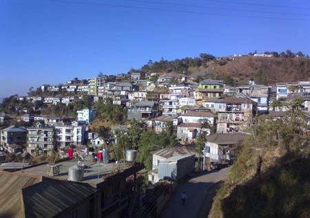
Serchhip
    How To Reach    |    Where to stay    |    Weather and Temperature    |    Share Your Experience    |   

<

>

 
                                                  Serchhip

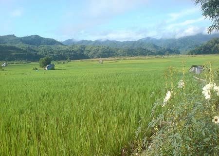
There are numerous small and big towns and villages situated around Serchhip. The Serchhip is the largest town; Thenzawl being the second largest. The terrain of the place is not undulated; it is plain. The area is cored with meadows covered in plush green grass. One of the main attractions of the place is the majestic waterfall named the Vantawng Khawhthla. The name of the waterfall means “Heaven’s reaching fall”. The waterfall is located close to the town of Thenzawl. 

                                TOURIST PLACES IN SERCHHIP

Vantawng Khawhthla: The Vantawng Falls is the most renowned waterfall in the Indian state of Mizoram. It is located in the south direction of the sub-division of Thenzawl, on the river named Lau. The altitude of the waterfall is 220 meters. 

The structure of the waterfall is very appealing; it is like a seven floored cliff. The name of the waterfall has been derived from the name of Vantawnga, who was an illustrious swimmer. His death occurred in the waterfall itself, when he was hit by a huge log carried down by the water of the waterfall. 

The sub-clan named Mualthuam used to dwell in Mizoram at one point of time. The spirit of the waterfall was worshipped by this community named Mualthuam. This location is considered as one of the most appealing locations in the entire state of Mizoram. Numerous people come here to visit this place. The distance between Serchhip and this place is 24 Kms.

Zoluti Hriatrengna Lung: As per the many historians, the inhabitants and many writers, this place is believed to contain a strong historical plan. No solid historical proof supports the information about at which place the British people were given the Zoluti. 

Chhingpuii Thla: In order to give tribute to the memory of Nl. Chhingpuii, a stone has been erected by the Chhingchhip Branch YMA. The distance between this monument and Chhingchhip is a mere 4 Kms and it is located in the north direction of Chhingchhip. Nl. Chhingpuii belonged to the sub village named Ruanzawl. She was renowned because of her appearance and beauty. There is an intriguing story related to her.

                                    HOW TO REACH SERCHHIP

By air: The nearest air terminal is the Lengpui Airport. The distance between the town of Serchhip and the airport is 154 Kms.

By Rail: The station at Bairabi is the best option for people coming via rail. 

By Road: The NH 54, NH 40 and the NH 150 link the town of Serchhip with Silchar, Agartala and Imphal respectively. 


29 °C

Humidity: 84%
Wind : From South at 18 kph

Forecast for Next 3 days

Friday                    

tstorms
29°C |25°C
Saturday                    

tstorms
28°C |25°C
Sunday                    

chancetstorms
31°C |25°C

Best Time To Visit : NOV DEC JAN FEB
   
 
Theme: Waterfall

SightSeeings in Serchhip

Near By Other Tourist Places


Serchhip   0 KM near     
Lunglei   51 KM near     
Aizawl   56 KM near     
Champhai   58 KM near     
Mamit   88 KM near     

Near By major Cities


Aizawl  56 KM near     
Imphal  224 KM near     
Kolkata  521 KM near     

Near By Air Ports


Aizawl Airport   70 KM near     
Singerbhil Airport   197 KM near     
Kumbhirgram Airport   200 KM near     
Imphal Municipal Airport   216 KM near     

Near By Local Cities


Udaipur  158 KM near     
Guwahati  379 KM near     
Gopalpur  488 KM near     
Naihati  509 KM near     

Near By Districts


Serchhip   0 KM near     
Lunglei   52 KM near     
Aizawl   56 KM near     
Champhai   57 KM near     

Near By RailWay Station


Monu Rail Way Station   128 KM near     
Ambasa Rail Way Station   136 KM near     
Pencharthal Rail Way Station   139 KM near     
Kumar Ghat Rail Way Station   139 KM near     
 

Reviews

_______________________________________________________________

Write Review
  • Underline
  • Italic
  • Undo
  • Redo


Serchhip Tourism
Lunglei Tourism
Aizawl Tourism
Champhai Tourism
Mamit Tourism

Lunglei City
Aizawl City
Champhai City
Saiha City

Serchhip District
Lunglei District
Aizawl District
Champhai District

Monu Rail Way Station
Ambasa Rail Way Station
Pencharthal Rail Way Station
Kumar Ghat Rail Way Station

Aizawl Airport AirPort     
Singerbhil Airport AirPort     
Kumbhirgram Airport AirPort     
Imphal Municipal Airport AirPort     

Know your village
Know your school
Know your college
Locate your Home Town
Tourist Destinations in India
Cities in India
Temples in India
States of India
Railway stations in India
Trains
Bus, Rail, Road and Air Directions
Distance calculator
City Bus Routes
Distance calculator
Pin codes of India
Banks and Ifsc Codes of India
Know todays weather
Trace missed calls
Trace missed calls
List your house
List your school
List your college
Write about your home town
All Rights Reserved © 2010 onefivenine.com             Contact Us             About Us             Privacy Policy