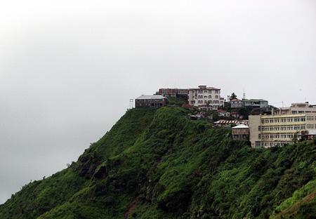
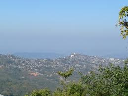
Lunglei
    How To Reach    |    Where to stay    |    Weather and Temperature    |    Share Your Experience    |   

<

>

 
                                                     Lunglei

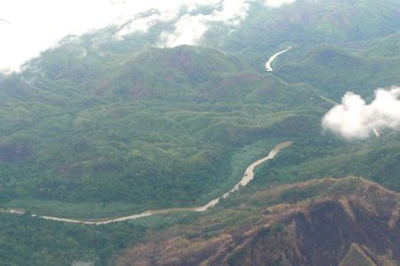
The southern part of the Indian state of Mizoram contains the tiny town named Lunglei. Along the banks of the river named Nghashih, this town has been formed. This river is a branch of the river named Tlwang. The river Tlwang is present in quite a big portion of the eastern India. 

The word ‘Lunglei’ stands for the phrase, “A bridge made of rock”. The reason for the name is the fact that a large rock is present right in the heart of the river and thus, the rocks functions as a bridge. 

Among all the places of India, Lunglei has the record of having the maximum amount of precipitation. Lunglei contains spectacular meadows and also some breathtaking hilly landscapes. The population of this place is also one of the highest in the entire Mizoram region. One can witness some unique cultures in this place. Most of the dwellers of the town follow Buddhism. Numerous people from Nepal and Bangladesh have migrated here in the past years for living a good life.

                                      HOW TO REACH LUNGLEI

By air: People, who prefer to travel by flight, can opt for the Aizwal Airport, which is situated at a distance of 116 Kms. 

By road: Many people travel to this place via buses. One can also opt for private cars, taxis and jeeps.


26 °C

Humidity: 89%
Wind : From ESE at 9 kph

Forecast for Next 3 days

Wednesday                    

tstorms
29°C |25°C
Thursday                    

tstorms
28°C |25°C
Friday                    

chancetstorms
30°C |25°C

Best Time To Visit : NOV DEC JAN FEB
   
 
Theme: Scenic beauty
Must Visit Places : Tamdil, Champhai

SightSeeings in Lunglei

Near By Other Tourist Places


Mayapur   503 KM near     

Near By major Cities


Aizawl  104 KM near     
Imphal  272 KM near     
Kolkata  504 KM near     

Near By Air Ports


Aizawl Airport   116 KM near     
Singerbhil Airport   211 KM near     
Kumbhirgram Airport   251 KM near     
Imphal Municipal Airport   265 KM near     

Near By Local Cities


Udaipur  164 KM near     
Guwahati  423 KM near     
Gopalpur  479 KM near     
Naihati  496 KM near     

Near By Districts


Lunglei   1 KM near     
Lawngtlai   47 KM near     
Serchhip   50 KM near     
Saiha   57 KM near     

Near By RailWay Station


Monu Rail Way Station   159 KM near     
Ambasa Rail Way Station   162 KM near     
Kumar Ghat Rail Way Station   174 KM near     
Teliamura Rail Way Station   175 KM near     
 

Reviews

_______________________________________________________________

Write Review
  • Underline
  • Italic
  • Undo
  • Redo


Mayapur Tourism

Lunglei City
Saiha City
Champhai City
Aizawl City

Lunglei District
Lawngtlai District
Serchhip District
Saiha District

Monu Rail Way Station
Ambasa Rail Way Station
Kumar Ghat Rail Way Station
Teliamura Rail Way Station

Aizawl Airport AirPort     
Singerbhil Airport AirPort     
Kumbhirgram Airport AirPort     
Imphal Municipal Airport AirPort     

Know your village
Know your school
Know your college
Locate your Home Town
Tourist Destinations in India
Cities in India
Temples in India
States of India
Railway stations in India
Trains
Bus, Rail, Road and Air Directions
Distance calculator
City Bus Routes
Distance calculator
Pin codes of India
Banks and Ifsc Codes of India
Know todays weather
Trace missed calls
Trace missed calls
List your house
List your school
List your college
Write about your home town
All Rights Reserved © 2010 onefivenine.com             Contact Us             About Us             Privacy Policy