| Home | City Bus | Maps | Villages | Cities | Rail | Tourist Places | School | College | Pin Codes | Corona Cases Count |
| Distance Calculator Bus Services IFSC Codes Trace Mobile Number Weather Search Place Trace IP Available Cash ATM/Banks Locate Polling Booth Report an Error contact People |
Head Quarters : Lawngtlai
Language : Mizo
Area: 2557 sq. km
Population : 117444
Sex Ratio : 945
Density : 46/ sq. km
Literacy : 66.41
Elevation / Altitude: - meters. Above Seal level
Current Time 12:41 PM
Date: Saturday , Jan 03,2026 (IST)
Time zone: IST (UTC+5:30)
District Pin code Index: 796XXX
Vehicle Registration Number: MZ-07
RTO Office: Lawngtlai
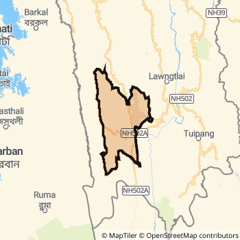
Lawngtlai District Map
Current Corona Virus Infected Patients Count in Lawngtlai District
| City Name | District Name | Total Covid cases |
|---|
Temples in Lawngtlai
Historical Daily Max Temperatures (Next 7 Days)
| Years | 03 Jan | 04 Jan | 05 Jan | 06 Jan | 07 Jan | 08 Jan | 09 Jan |
|---|---|---|---|---|---|---|---|
| 2025 | |||||||
| 2024 | |||||||
| 2023 |
About Lawngtlai District
Lawngtlai District is one among 8 Districts of Mizoram State ,India. Lawngtlai District Administrative head quarter is Lawngtlai. It is is Located 154 KM North towards State capital Aizawl . Lawngtlai District population is 117444. It is 4 th Largest District in the State by population.Geography and Climate Lawngtlai District
It is Located at Latitude-22.5, Longitude-92.9. Lawngtlai District is sharing border with Lunglei District to the North , Saiha District to the East . Lawngtlai District occupies an area of approximately 2557 square kilometres. . Its in the meters to meters elevation range.This District belongs to Eastern India .DemoGraphics of Lawngtlai District
Mizo is the Local Language here. Lawngtlai District is divided into 4 Blocks , 134 Panchayats , 161 Villages. Chawngte Block is the Smallest Block by population with 220 population. Lawngtlai Block is the Biggest Block by population with 554 population.Census 2011 of Lawngtlai District
Lawngtlai district Total population is 117444 according to census 2011.Males are 60383 and Females are 57061 .Literate people are 77701 among total.Its total area is 2557 sq.km. It is the 4 th largest district in the state by Population . But 5 th Largest District in the state By Area. 594 th Largest District in the Country By Population. 8 th highest District in the State By literacy rate. 461 st highest District in the Country By literacy rate.its literacy Rate is 66.41Politics in Lawngtlai District
Mizo National Front , INC are the major political parties in Lawngtlai District.Assembly constituencies in Lawngtlai District
Total 3 Assembly constituencies in Lawngtlai District.| Constituency name | MLA name | Party |
|---|---|---|
| Tuichawng | Rasik Mohan Chakma | |
| Lawngtlai West | C. Ngunlianchunga | |
| Lawngtlai East | Dr. Lorrain Lalpekliana Chinzah |
Parliament constituencies in Lawngtlai District
Total 1 Parliament constituencies in Lawngtlai District.| Constituency name | MP name | Party |
|---|---|---|
| Mizoram | C LALROSANGA | Mizo National Front |
Lawngtlai District Political Map
Lawngtlai Commerce
Total Registered Comapnies with Ministry of Corporate Affairs (MCA) in Lawngtlai areCompany Name : ARJYOMITRO CONSTRUCTION PRIVATE LIMITED
Type Of Business : Construction
Capital : 1.0 Lakhs
Company Name : MIZO ORGANIC LAWNGTLAI PRODUCTS PRODUCER COMPANY LIMITED
Type Of Business : Agriculture and Allied Activities
Capital : 0
More Lawngtlai Registered Companies
Lawngtlai District Tourism
Lawngtlai Transport
Road Transport
District Headquarters Lawngtlai is well connected by road . Lawngtlai is about 154 KM by road to Aizawl( Capital of Mizoram )Rail Transport
Bus Transport
Mizoram State Road Transportation ( MST) runs Busses from Major cities to Towns and Villages in this District.
Pin Codes in Lawngtlai District
796772
( Kamalanagar (Lawngtlai)) ,
796810
( Sangau ) ,
796891
( Lawngtlai ) ,
more PinCodes
Hotels in Lawngtlai
Near Cities
Saiha 10 KM near
Lunglei 48 KM near
Champhai 123 KM near
Aizawl 149 KM near
Near By Air Ports
Aizawl Airport 162 KM near
Singerbhil Airport 253 KM near
Kumbhirgram Airport 293 KM near
Imphal Municipal Airport 296 KM near
Near By Districts
Lawngtlai 0 KM near
Saiha 10 KM near
Lunglei 46 KM near
Serchhip 92 KM near