| Home | City Bus | Maps | Villages | Cities | Rail | Tourist Places | School | College | Pin Codes | Corona Cases Count |
| Distance Calculator Bus Services IFSC Codes Trace Mobile Number Weather Search Place Trace IP Available Cash ATM/Banks Locate Polling Booth Report an Error contact People |
Tehri Garhwal District.
Currently In:
India >>
Uttarakhand
Head Quarters : Tehri
Language : Hindi and Urdu
Area: 4080 sq. km
Population : 616409
Sex Ratio : 1078
Density : 169/ sq. km
Literacy : 75.1
Elevation / Altitude: 372 - 355 meters. Above Seal level
Current Time 02:37 AM
Date: Saturday , Jan 03,2026 (IST)
Time zone: IST (UTC+5:30)
District Pin code Index: 249XXX
Vehicle Registration Number: UK-09
RTO Office: Tehri
Tourist Places near Tehri Garhwal
Chamba Garhwal Dhanaulti (Dhanolti) Devprayag Uttarkashi Mussoorie
Chamba Garhwal Dhanaulti (Dhanolti) Devprayag Uttarkashi Mussoorie
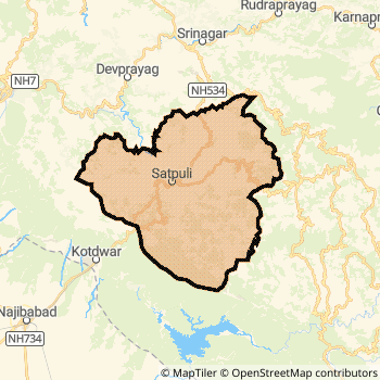
Tehri Garhwal District Map
Current Corona Virus Infected Patients Count in Tehri Garhwal District
| City Name | District Name | Total Covid cases |
|---|
Tehri Garhwal Live Weather
Temperature: 6.3 °C
clear sky
Humidity: 50%
Wind : 2.22 mt/sec towards N
StationName : "Tehri"
observed on 20 Mins Back
Temperature: 6.3 °C
clear sky
Humidity: 50%
Wind : 2.22 mt/sec towards N
StationName : "Tehri"
observed on 20 Mins Back
Tehri Garhwal Weather Forecast for Next 5 days
03-01-2026
7.5°C to 7.5°C
clear sky
7.5°C to 7.5°C
clear sky
04-01-2026
7.0°C to 18.5°C
clear sky, few clouds, scattered clouds, overcast clouds, broken clouds
7.0°C to 18.5°C
clear sky, few clouds, scattered clouds, overcast clouds, broken clouds
05-01-2026
6.7°C to 19.1°C
clear sky
6.7°C to 19.1°C
clear sky
06-01-2026
6.6°C to 19.4°C
clear sky
6.6°C to 19.4°C
clear sky
07-01-2026
6.7°C to 19.9°C
clear sky
6.7°C to 19.9°C
clear sky
Historical Daily Max Temperatures (Next 7 Days)
| Years | 02 Jan | 03 Jan | 04 Jan | 05 Jan | 06 Jan | 07 Jan | 08 Jan |
|---|---|---|---|---|---|---|---|
| 2025 | |||||||
| 2024 | |||||||
| 2023 |
About Tehri Garhwal District
Tehri Garhwal District is one among 13 Districts of Uttarakhand State ,India. Tehri Garhwal District Administrative head quarter is Tehri. It is is Located 49 KM west towards State capital Dehradun . Tehri Garhwal District population is 616409. It is 7 th Largest District in the State by population.Geography and Climate Tehri Garhwal District
It is Located at Latitude-30.3, Longitude-78.4. Tehri Garhwal District is sharing border with Chamoli District to the East , Dehradun District to the west , Pauri Garhwal District to the East , Rudra Prayag District to the East , Uttar Kashi District to the North . Tehri Garhwal District occupies an area of approximately 4080 square kilometres. . Its in the 372 meters to 355 meters elevation range.This District belongs to Hindi Belt India .DemoGraphics of Tehri Garhwal District
Hindi is the Local Language here. Also People Speaks Urdu . Tehri Garhwal District is divided into 11 Blocks , Panchayats , 1983 Villages.Census 2011 of Tehri Garhwal District
Tehri Garhwal district Total population is 616409 according to census 2011.Males are 296636 and Females are 319773 .Literate people are 407816 among total.Its total area is 4080 sq.km. It is the 7 th largest district in the state by Population . But 5 th Largest District in the state By Area. 512 nd Largest District in the Country By Population. 11 th highest District in the State By literacy rate. 259 th highest District in the Country By literacy rate.its literacy Rate is 75.1Politics in Tehri Garhwal District
BJP , BJP , INC are the major political parties in Tehri Garhwal District.Assembly constituencies in Tehri Garhwal District
Total 8 Assembly constituencies in Tehri Garhwal District.| Constituency name | MLA name | Party |
|---|---|---|
| Deoprayag | Vinod Kandari | IND |
| Narendranagar | Subodh Uniyal | BJP |
| Pratapnagar | Vikram Singh Negi | BJP |
| Tehri | Kishore Upadhyay | IND |
| Dhanolti | Pritam Singh Panwar | BJP |
| Mussoorie | Ganesh Joshi | BJP |
Parliament constituencies in Tehri Garhwal District
Total 3 Parliament constituencies in Tehri Garhwal District.| Constituency name | MP name | Party |
|---|---|---|
| Garhwal | Tirath Singh Rawat | Bharatiya Janata Party |
| Hardwar | Ramesh Pokhriyal 'Nishank' | Bharatiya Janata Party |
| Tehri Garhwal | MALA RAJYA LAXMI SHAH | Bharatiya Janata Party |
Tehri Garhwal District Political Map
Tehri Garhwal Commerce
Total Registered Comapnies with Ministry of Corporate Affairs (MCA) in Tehri Garhwal are 63Company Name : THDC INDIA LIMITED
Type Of Business : Construction
Capital : 3627.43 Crores
Company Name : MAHANANDA SPA AND RESORTS PRIVATE LIMITED
Type Of Business : Trading
Capital : 13.156 Crores
Company Name : RISHI GANGA NIDHI LIMITED
Type Of Business : Finance
Capital : 1.3309 Crores
Company Name : A.M.V. PHARMACY (INDIA) PRIVATE LIMITED
Type Of Business : Manufacturing (Metals & Chemicals, and products thereof)
Capital : 80.9686 Lakhs
More Tehri Garhwal Registered Companies
Tehri Garhwal District Tourism
Chamba , Devprayag , Dhanaulti , Har Ki Doon , are the Tourist destinations to Visit.
Temples in Tehri Garhwal District
Surkanda Devi, , Chandrabadni , Nag Raja Temple are the famous temple in Tehri Garhwal DistrictTehri Garhwal Transport
Road Transport
District Headquarters Tehri is well connected by road . Tehri , Chamba , Rishikesh are the Cities in this district having road connectivity to major towns and remote villages. Tehri is about 49 KM by road to Dehradun( Capital of Uttarakhand )Rail Transport
Some of the rail way stations in district are Rishikesh , Virbhadra .... which connects most of the towns and villages in the District.Bus Transport
Uttaranchal transport ( UTC) runs Busses from Major cities to Towns and Villages in this District.
Pin Codes in Tehri Garhwal District
249137
( Munikireti ) ,
249301
( Devprayag ) ,
249132
( Chham ) ,
249145
( Chamma ) ,
249180
( Thatyur ) ,
249181
( Pilkhi ) ,
249199
( Ranichauri ) ,
249146
( Gajja ) ,
249161
( Kirtinagar ) ,
249131
( Bhladiana ) ,
249165
( Lambgaon ) ,
249155
( Ghansali ) ,
249175
( Narendra Nagar (Tehri Garhwal)) ,
249123
( Jakhnidhar ) ,
249186
( Sigunisera ) ,
249126
( Bhallegaon ) ,
249121
( Anjanisain ) ,
249124
( Bhagirathipuram ) ,
249001
( Tehri ) ,
249130
( V.K.Puram ) ,
more PinCodes
Hotels in Tehri Garhwal
Hemkund Basera Hotel
Tapovan , Opp Laxman Temple , P P Shivananda Ngr , T G, Rishikesh Uttranchal, Rishikesh - 249409
Rishikesh
Contact No: (91)-(135)-2442156
Price Range : Rs. 400 - Rs. 1200
Hill Top Swiss Cottage
High Bank, Bhirkhet, Tapovan, Rishikesh - 249192, India
Rishikesh
Contact No: 01352442896, 8006551415
Email: nishantchauhan@live.com
Price Range : Rs. 800 - Rs. 1500
Green Valley Cottage
Post Tapovan; Via Shivananda Nagar;; Rishikesh; Uttaranchal; Pin code- 249192
Rishikesh
Price Range : Rs. 400 - Rs. 750
Classic Hill Top
Mussoorie Chamba rd; Chamba; Himachal Pradesh; Pin code- 249001
Chamba
Price Range : Rs. 6600 - Rs. 7600
Near Cities
Tehri 1 KM near
Chamba 8 KM near
Mussoorie 42 KM near
Pauri 44 KM near
Near By Air Ports
Dehra Dun Airport 47 KM near
Muzaffarnagar Airport 147 KM near
Simla Airport 167 KM near
Chandigarh Airport 182 KM near
Near By Districts
Tehri Garhwal 0 KM near
Uttar Kashi 42 KM near
Pauri Garhwal 44 KM near
Dehradun 48 KM near