| Home | City Bus | Maps | Villages | Cities | Rail | Tourist Places | School | College | Pin Codes | Corona Cases Count |
| Distance Calculator Bus Services IFSC Codes Trace Mobile Number Weather Search Place Trace IP Available Cash ATM/Banks Locate Polling Booth Report an Error contact People |
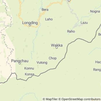
Wakka Tehsil
List Of Villages in Wakka
Language : English
Current Time
Date:
Time zone: IST (UTC+5:30)
Telephone Code / Std Code: 03786
Vehicle Registration Number:AR-13
RTO Office : Khonsa
Assembly constituency : Pongchou-wakka assembly constituency
Assembly MLA : HONCHUN NGANDAM
Lok Sabha constituency : Arunachal East parliamentary constituency
Parliament MP :
Wakka Tehsil MAP
Current Corona Virus Infected Patients Count in Tirap District
| City Name | District Name | Total Covid cases |
|---|
Rivers Near Wakka
Disang in Distance 20.6
Chengo in Distance 0.7
Dikhu in Distance 58.4
Tissa River in Distance 7.7
Tirap in Distance 23.7
Tirap in Distance 23.7
Tirap in Distance 23.7
Tewai in Distance 25.2
Sumhāk in Distance 11.2
Disang in Distance 20.6
Chengo in Distance 0.7
Dikhu in Distance 58.4
Tissa River in Distance 7.7
Tirap in Distance 23.7
Tirap in Distance 23.7
Tirap in Distance 23.7
Tewai in Distance 25.2
Sumhāk in Distance 11.2
About Wakka Tehsil
Wakka is a Tehsil in Tirap District of Arunachal Pradesh State, India. Wakka Tehsil Head Quarters is Wakka town .Margherita City , Duliajan Oil Town City , Digboi City , Tinsukia City are the nearby Cities to Wakka.
Wakka consist of 4 Villages and 4 Panchayats .
Khonsa , Mon (Mon) , Changlang , Tirap , Tinsukia are the near by Important tourist destinations to see.
Demographics of Wakka Tehsil
English is the Local Language here. Total population of Wakka Tehsil is 9,246 living in 1,605 Houses, Spread across total 4 villages and 4 panchayats . Males are 4,730 and Females are 4,516Politics in Wakka Tehsil
N.A , PPA , Bharatiya Janata Party , NCP , INC are the major political parties in this area.Wakka Tehsil comes under Pongchao Wakka assembly constituency ,current sitting MLA is HONCHUN NGANDAM contested and won from Bharatiya Janata Party party
Wakka Tehsil Political Map
HOW TO REACH Wakka Tehsil
By Rail
There is no railway station near to Wakka Tehsil in less than 10 km.Pin codes of Wakka Tehsil
786631 ( Wakka )Banks in Wakka
Colleges in Wakka
Wangcha Rajkumar Government College
Address : Ntc Colony Road, Deomali, Arunachal Pradesh
Hotels Near by Wakka
Raj Hotel
Tirap District Khonsa - 786182, India
Khonsa
Contact No: 9436046051
Price Range : Rs. 400 - Rs. 400
Registered Companies in Wakka Tehsil
More Wakka Registered CompaniesBusStation in Wakka
ATMs in Wakka
Cinema Theaters in Wakka
Temples in Wakka
Hotels and Lodges in Wakka
Hospitals in Wakka
Petrol Bunks in Wakka
Colleges in Wakka
Schools in Wakka
St. Francis School; Moktowa
St.Francis English Medium School; India; Moktowa - I; Arunachal Pradesh; India
084729 11029 Detail
BusStops in Wakka Lakes in Wakka Temples in Wakka Shops in Wakka Wakka Hospitals Hotel/Restaurants in Wakka Wakka RailwayStations Wakka BusStops ATM in Wakka
Near By Cities
Margherita 69 KM near
Duliajan Oil Town 73 KM near
Digboi 76 KM near
Tinsukia 88 KM near
Margherita 69 KM near
Duliajan Oil Town 73 KM near
Digboi 76 KM near
Tinsukia 88 KM near
Near By Taluks
Wakka 0 KM near
Kapu 10 KM near
Khakham 12 KM near
Longding 14 KM near
Wakka 0 KM near
Kapu 10 KM near
Khakham 12 KM near
Longding 14 KM near
Near By Air Ports
Chabua Airport 98 KM near
Rowriah Airport 137 KM near
Lilabari Airport 160 KM near
Dimapur Airport 215 KM near
Chabua Airport 98 KM near
Rowriah Airport 137 KM near
Lilabari Airport 160 KM near
Dimapur Airport 215 KM near
Near By Districts
Tirap 28 KM near
Mon 45 KM near
Changlang 56 KM near
Longleng 63 KM near
Tirap 28 KM near
Mon 45 KM near
Changlang 56 KM near
Longleng 63 KM near
Near By RailWay Station
Naharkatiya Rail Way Station 64 KM near
Moranhat Rail Way Station 74 KM near
Naharkatiya Rail Way Station 64 KM near
Moranhat Rail Way Station 74 KM near
Near By Bus Station