| Home | City Bus | Maps | Villages | Cities | Rail | Tourist Places | School | College | Pin Codes | Corona Cases Count |
| Distance Calculator Bus Services IFSC Codes Trace Mobile Number Weather Search Place Trace IP Available Cash ATM/Banks Locate Polling Booth Report an Error contact People |
Papum Pare District.
Currently In:
India >>
Arunachal Pradesh
Head Quarters : Yupia
Language : English
Area: 2875 sq. km
Population : 176385
Sex Ratio : 950
Density : 51/ sq. km
Literacy : 82.14
Elevation / Altitude: 162 - meters. Above Seal level
Current Time 08:25 AM
Date: Friday , Jan 02,2026 (IST)
Time zone: IST (UTC+5:30)
District Pin code Index: 791XXX
Vehicle Registration Number: AR-01,AR-02
RTO Office: Itanagar
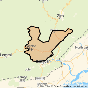
Papum Pare District Map
Current Corona Virus Infected Patients Count in Papum Pare District
| City Name | District Name | Total Covid cases |
|---|
Temples in Papum Pare
Historical Daily Max Temperatures (Next 7 Days)
| Years | 01 Jan | 02 Jan | 03 Jan | 04 Jan | 05 Jan | 06 Jan | 07 Jan |
|---|---|---|---|---|---|---|---|
| 2025 | |||||||
| 2024 | |||||||
| 2023 |
About Papum Pare District
Papum Pare District is one among 16 Districts of Arunachal Pradesh State ,India. Papum Pare District Administrative head quarter is Yupia. It is is Located 25 KM South towards State capital Itanagar . Papum Pare District population is 176385. It is Biggest district in Arunachal Pradesh State by population.Geography and Climate Papum Pare District
It is Located at Latitude-27.3, Longitude-93.7. Papum Pare District is sharing border with Lower Subansiri District to the North , Lakhimpur District to the East . It is sharing Border with Assam State to the South . Papum Pare District occupies an area of approximately 2875 square kilometres. . Its in the 162 meters to meters elevation range.This District belongs to Eastern India .DemoGraphics of Papum Pare District
English is the Local Language here. Papum Pare District is divided into 11 Tehsils , 63 Panchayats , 83 Villages. Leporiang Tehsil is the Smallest Tehsil by population with 2103 population. Lower Balijan Tehsil is the Biggest Tehsil by population with 11589 population.Census 2011 of Papum Pare District
Papum Pare district Total population is 176385 according to census 2011.Males are 90454 and Females are 85931 .Literate people are 116696 among total.Its total area is 2875 sq.km. It is the 1 st largest district in the state by Population . But 10 th Largest District in the state By Area. 579 th Largest District in the Country By Population. 1 st highest District in the State By literacy rate. 134 th highest District in the Country By literacy rate.its literacy Rate is 82.14Politics in Papum Pare District
N.A , Bharatiya Janata Party , Indian National Congress , AITC , Janata Dal (United) , INC are the major political parties in Papum Pare District.Assembly constituencies in Papum Pare District
Total 4 Assembly constituencies in Papum Pare District.| Constituency name | MLA name | Party |
|---|---|---|
| Itanagar | Techi Kaso | Janata Dal (United) |
| Doimukh | TANA HALI TARA | Bharatiya Janata Party |
| Sagalee | NABAM TUKI | Indian National Congress |
| Yachuli | TABA TEDIR | Bharatiya Janata Party |
Parliament constituencies in Papum Pare District
Papum Pare District Political Map
Papum Pare Commerce
Total Registered Comapnies with Ministry of Corporate Affairs (MCA) in Papum Pare are 228Company Name : T. K. ENGINEERING CONSORTIUM PRIVATE LIMITED
Type Of Business : Electricity, Gas & Water companies
Capital : 79.2124 Crores
Company Name : EVEREST INFRA ENERGY LIMITED
Type Of Business : Construction
Capital : 26.011 Crores
Company Name : NEFA BREWERIES PRIVATE LIMITED
Type Of Business : Manufacturing (Food stuffs)
Capital : 24.199 Crores
Company Name : SATYAM ISPAT (NORTH EAST) LIMITED
Type Of Business : Manufacturing (Metals & Chemicals, and products thereof)
Capital : 22.0098 Crores
More Papum Pare Registered Companies
Papum Pare District Tourism
Itanagar , Yupia , Buddha Temple,Ita Fort , are the Tourist destinations to Visit.
Papum Pare Transport
Road Transport
District Headquarters Yupia is well connected by road . Naharlagun , Itanagar are the Cities in this district having road connectivity to major towns and remote villages. Yupia is about 25 KM by road to Itanagar( Capital of Arunachal Pradesh )Rail Transport
Some of the rail way stations in district are Siajuli .... which connects most of the towns and villages in the District.Bus Transport
Arunachal pradesh state transport services ( APSTS) runs Busses from Major cities to Towns and Villages in this District.
Pin Codes in Papum Pare District
791112
( Doimukh ) ,
791113
( Ram Krishna Mission ) ,
791123
( Banderdewa ) ,
791110
( Naharlagun ) ,
791121
( Kimin ) ,
791111
( Itanagar ) ,
791109
( Nirjuli ) ,
more PinCodes
Hotels in Papum Pare
Donyi Polo Ashok, Hotel
Sector - C Itanagar - 791111, India
Itanagar
Contact No: 0360 - 2212626
Price Range : Rs. 3000 - Rs. 3800
Alpine, Hotel
Ganga Market Itanagar - 791111, India
Itanagar
Contact No: 0360 - 2214298
Price Range : Rs. 400 - Rs. 600
Blue Pine Hotel
Ganga Market Itanagar - 791111, India
Itanagar
Contact No: 0360 - 2211118
Price Range : Rs. 400 - Rs. 800
Bomdila Hotel
Itanagar Itanagar - 791111, India
Itanagar
Contact No: 0360 - 2203537
Price Range : Rs. 400 - Rs. 400
BusStops in Papum Pare Lakes in Papum Pare Temples in Papum Pare Shops in Papum Pare Papum Pare Hospitals Hotel/Restaurants in Papum Pare Papum Pare RailwayStations Papum Pare BusStops ATM in Papum Pare
Near Cities
Naharlagun 23 KM near
Itanagar 29 KM near
Jorhat 86 KM near
Golaghat 102 KM near
Near By Air Ports
Lilabari Airport 41 KM near
Rowriah Airport 87 KM near
Salonibari Airport 125 KM near
Chabua Airport 146 KM near
Near By Districts
Papum Pare 0 KM near
Lower Subansiri 32 KM near
Lakhimpur 44 KM near
East Kameng 74 KM near