| Home | City Bus | Maps | Villages | Cities | Rail | Tourist Places | School | College | Pin Codes | Corona Cases Count |
| Distance Calculator Bus Services IFSC Codes Trace Mobile Number Weather Search Place Trace IP Available Cash ATM/Banks Locate Polling Booth Report an Error contact People |
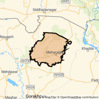
Maharajganj District.
Currently In:
India >>
Uttar Pradesh
Division : Gorakhpur
Head Quarters : Mahrajganj,
Language : Hindi and Urdu
Area: 2934.1 sq. km
Population : 2665292
Sex Ratio : 938
Density : 903/ sq. km
Literacy : 64.3
Elevation / Altitude: 96 - 100 meters. Above Seal level
Current Time 04:51 AM
Date: Tuesday , Jan 13,2026 (IST)
Time zone: IST (UTC+5:30)
District Pin code Index: 273XXX
Vehicle Registration Number: UP-56
RTO Office: Mahrajganj
Tourist Places near Maharajganj
Gorakhpur Kushinagar (Kusinagar) Kapilvastu (Kapilbastu) Lauria Nandangarh Basti Ayodhya
Gorakhpur Kushinagar (Kusinagar) Kapilvastu (Kapilbastu) Lauria Nandangarh Basti Ayodhya
Maharajganj District Map
Current Corona Virus Infected Patients Count in Maharajganj District
| City Name | District Name | Total Covid cases |
|---|
Maharajganj Live Weather
Temperature: 9.6 °C
clear sky
Humidity: 59%
Wind : 2.95 mt/sec towards W
StationName : "MahÄ\u0081rÄ\u0081ganj"
observed on Now
Temperature: 9.6 °C
clear sky
Humidity: 59%
Wind : 2.95 mt/sec towards W
StationName : "MahÄ\u0081rÄ\u0081ganj"
observed on Now
Maharajganj Weather Forecast for Next 5 days
14-01-2026
9.4°C to 21.9°C
clear sky
9.4°C to 21.9°C
clear sky
15-01-2026
8.3°C to 21.3°C
clear sky
8.3°C to 21.3°C
clear sky
16-01-2026
8.3°C to 21.5°C
clear sky
8.3°C to 21.5°C
clear sky
17-01-2026
8.9°C to 21.9°C
clear sky
8.9°C to 21.9°C
clear sky
Temples in Maharajganj
Historical Daily Min/Max Temperatures (Next 7 Days)
| Years | 12 Jan | 13 Jan | 14 Jan | 15 Jan | 16 Jan | 17 Jan | 18 Jan |
|---|---|---|---|---|---|---|---|
| 2025 | 25.0°C/ 15.0°C | 22.0°C/ 11.0°C | 23.0°C/ 10.0°C | 14.0°C/ 10.0°C | 22.0°C/ 12.0°C | 25.0°C/ 11.0°C | 18.0°C/ 10.0°C |
| 2024 | 20.0°C/ 9.0°C | 12.0°C/ 9.0°C | 22.0°C/ 8.0°C | 13.0°C/ 9.0°C | 22.0°C/ 9.0°C | 22.0°C/ 2.0°C | |
| 2023 | 23.0°C/ 14.0°C | 23.0°C/ 14.0°C | 19.0°C/ 19.0°C | 21.0°C/ 8.0°C | 20.0°C/ 10.0°C | 19.0°C/ 7.0°C | 14.0°C/ 8.0°C |
About Maharajganj District
Maharajganj District is one among 71 Districts of Uttar Pradesh State ,India. Maharajganj District Administrative head quarter is Mahrajganj,. It is is Located 305 KM west towards State capital Lucknow . Maharajganj District population is 2665292. It is 34 th Largest District in the State by population.Geography and Climate Maharajganj District
It is Located at Latitude-27.1, Longitude-83.5. Maharajganj District is sharing border with Gorakhpur District to the South , Kushi Nagar District to the South , Siddharth Nagar District to the west . Maharajganj District occupies an area of approximately 2934.1 square kilometres. . Its in the 96 meters to 100 meters elevation range.This District belongs to Hindi Belt India .DemoGraphics of Maharajganj District
Hindi is the Local Language here. Also People Speaks Urdu . Maharajganj District is divided into 13 Blocks , Panchayats , 4066 Villages.Census 2011 of Maharajganj District
Maharajganj district Total population is 2665292 according to census 2011.Males are 1375280 and Females are 1290012 .Literate people are 1763357 among total.Its total area is 2934.1 sq.km. It is the 34 th largest district in the state by Population . But 41 st Largest District in the state By Area. 150 th Largest District in the Country By Population. 53 rd highest District in the State By literacy rate. 501 st highest District in the Country By literacy rate.its literacy Rate is 64.3Politics in Maharajganj District
BJP , NCP , SP , BSP , INC are the major political parties in Maharajganj District.Assembly constituencies in Maharajganj District
Total 7 Assembly constituencies in Maharajganj District.| Constituency name | MLA name | Party |
|---|---|---|
| Kapilvastu | Shyamdhani Rahi | SP |
| Pharenda | Virendra Chaudhary | BJP |
| Nautanwa | Rishi | INC |
| Siswa | Premsagar Patel | SP |
| Maharajganj | Jay Mangal | SP |
| Paniyara | Gyanendra Singh | BSP |
Parliament constituencies in Maharajganj District
Total 3 Parliament constituencies in Maharajganj District.| Constituency name | MP name | Party |
|---|---|---|
| Domariyaganj | JAGDAMBIKA PAL | Bharatiya Janata Party |
| Maharajganj | PANKAJ CHOUDHARY | Bharatiya Janata Party |
| Gorakhpur | Ravindra Shyamnarayan Shukla alias Ravi Kishan | Bharatiya Janata Party |
Maharajganj District Political Map
Maharajganj Commerce
Total Registered Comapnies with Ministry of Corporate Affairs (MCA) in Maharajganj are 89Company Name : OM AGROENERGY PRIVATE LIMITED
Type Of Business : Manufacturing (Food stuffs)
Capital : 5.0 Crores
Company Name : GANESH AGROUDYOG PRIVATE LIMITED
Type Of Business : Business Services
Capital : 4.43737 Crores
Company Name : BAJRANGKRIPA AGRO INDUSTRIES PRIVATE LIMITED
Type Of Business : Manufacturing (Food stuffs)
Capital : 4.1978 Crores
Company Name : JAISWAL AGRO INDUSTRIES PRIVATE LIMITED
Type Of Business : Agriculture and Allied Activities
Capital : 2.755 Crores
More Maharajganj Registered Companies
Maharajganj District Tourism
Maharajganj Transport
Road Transport
District Headquarters Mahrajganj, is well connected by road . Mahrajganj, is about 305 KM by road to Lucknow( Capital of Uttar Pradesh )Rail Transport
Some of the rail way stations in district are Anand Nagar Junction , Nautanwa , Ghughuli , Lachmipur , Lehra , Purandarpur , Naikot , Lokvidyapith Nagar .... which connects most of the towns and villages in the District.Bus Transport
Uttar Pradesh State Road Transport ( UPSRTC) runs Busses from Major cities to Towns and Villages in this District.
Pin Codes in Maharajganj District
273151
( Ghughli R.S. ) ,
273162
( Laxmipur (Maharajganj) ) ,
273304
( Nichlaul ) ,
273303
( Maharajganj ) ,
273157
( Bribgemanganj ) ,
273164
( Nautanwa Bazar ) ,
273302
( Bhitauli Bazar ) ,
273305
( Thuthibari ) ,
273155
( Anandnagar (Maharajganj)) ,
273161
( Dhani Bazar ) ,
273301
( Partawal Bazar MDg ) ,
273307
( Sonbarsa) ,
more PinCodes
Hotels in Maharajganj
Near Cities
Nautanwa 38 KM near
Gorakhpur 51 KM near
Bagaha 52 KM near
Padrauna 55 KM near
Near By Air Ports
Gorakhpur Airport 50 KM near
Varanasi Airport 224 KM near
Patna Airport 257 KM near
Bamrauli Airport 293 KM near
Near By Districts
Maharajganj 0 KM near
Gorakhpur 51 KM near
Siddharth Nagar 55 KM near
Kushi Nagar 62 KM near