| Home | City Bus | Maps | Villages | Cities | Rail | Tourist Places | School | College | Pin Codes | Corona Cases Count |
| Distance Calculator Bus Services IFSC Codes Trace Mobile Number Weather Search Place Trace IP Available Cash ATM/Banks Locate Polling Booth Report an Error contact People |
Division : Bangalore
Head Quarters : Chitradurga
Language : Kannada
Area: 8440 sq. km
Population : 1660378
Sex Ratio : 969
Density : 197/ sq. km
Literacy : 73.82
Elevation / Altitude: 765 - 590 meters. Above Seal level
Current Time 09:15 PM
Date: Wednesday , Jan 07,2026 (IST)
Time zone: IST (UTC+5:30)
District Pin code Index: 577XXX
Vehicle Registration Number: KA-16
RTO Office: Chitradurga
Tourist Places near Chitradurga
Chitradurga Shivgiri Shimoga Kemmanagundi Kudremukh (Kuduremukha) Hospet (Hosapete)
Chitradurga Shivgiri Shimoga Kemmanagundi Kudremukh (Kuduremukha) Hospet (Hosapete)
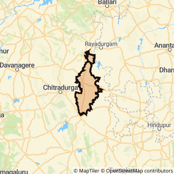
Chitradurga District Map
Current Corona Virus Infected Patients Count in Chitradurga District
| City Name | District Name | Total Covid cases |
|---|
Chitradurga Live Weather
Temperature: 22.3 °C
clear sky
Humidity: 40%
Wind : 5.64 mt/sec towards NE
StationName : "Chitradurga"
observed on 2 Hours Back
Temperature: 22.3 °C
clear sky
Humidity: 40%
Wind : 5.64 mt/sec towards NE
StationName : "Chitradurga"
observed on 2 Hours Back
Chitradurga Weather Forecast for Next 5 days
08-01-2026
16.9°C to 23.8°C
clear sky
16.9°C to 23.8°C
clear sky
09-01-2026
15.1°C to 25.6°C
scattered clouds, clear sky, few clouds, overcast clouds, broken clouds
15.1°C to 25.6°C
scattered clouds, clear sky, few clouds, overcast clouds, broken clouds
10-01-2026
15.0°C to 26.6°C
broken clouds, overcast clouds, few clouds
15.0°C to 26.6°C
broken clouds, overcast clouds, few clouds
11-01-2026
15.0°C to 27.0°C
broken clouds, overcast clouds, few clouds
15.0°C to 27.0°C
broken clouds, overcast clouds, few clouds
12-01-2026
17.3°C to 27.6°C
overcast clouds, broken clouds
17.3°C to 27.6°C
overcast clouds, broken clouds
Temples in Chitradurga
Historical Daily Min/Max Temperatures (Next 7 Days)
| Years | 07 Jan | 08 Jan | 09 Jan | 10 Jan | 11 Jan | 12 Jan | 13 Jan |
|---|---|---|---|---|---|---|---|
| 2025 | 27.0°C/ 18.0°C | 29.0°C/ 18.0°C | 29.0°C/ 19.0°C | 30.0°C/ 19.0°C | |||
| 2024 | 29.0°C/ 19.0°C | 29.0°C/ 18.0°C | 30.0°C/ 19.0°C | 28.0°C/ 21.0°C | |||
| 2023 | 27.0°C/ 14.0°C | 28.0°C/ 16.0°C | 28.0°C/ 17.0°C | 28.0°C/ 20.0°C |
About Chitradurga District
Chitradurga District is one among 30 Districts of Karnataka State ,India. Chitradurga District Administrative head quarter is Chitradurga. It is is Located 222 KM South towards State capital Bangalore . Chitradurga District population is 1660378. It is 17 th Largest District in the State by population.Geography and Climate Chitradurga District
It is Located at Latitude-14.2, Longitude-76.3. Chitradurga District is sharing border with Anantapur District to the East , Davangere District to the west . It is sharing Border with Andhra Pradesh State to the East . Chitradurga District occupies an area of approximately 8440 square kilometres. . Its in the 765 meters to 590 meters elevation range.This District belongs to Southern India .DemoGraphics of Chitradurga District
Kannada is the Local Language here. Chitradurga District is divided into 6 Taluks , 205 Panchayats , 1816 Villages. Molakalmuru Taluk is the Smallest Taluk by population with 126742 population. Chitradurga Taluk is the Biggest Taluk by population with 376506 population.Major producing Items,Crops,Industries and Exports from Chitradurga District
Arecanut, Beedi, Blankets, Bricks, Candles, Cement, Coconut, Coir, Cotton, Foodgrains, Gold, Grate, Groundnut, GroundnutOil, Jowar, Kerosene, Keroseneoil, Limestone, Maize, Medicine, Milk, Oilseeds, O are the major producing Items and Exports from here.Census 2011 of Chitradurga District
Chitradurga district Total population is 1660378 according to census 2011.Males are 843260 and Females are 817118 .Literate people are 1098506 among total.Its total area is 8440 sq.km. It is the 17 th largest district in the state by Population . But 7 th Largest District in the state By Area. 295 th Largest District in the Country By Population. 17 th highest District in the State By literacy rate. 288 th highest District in the Country By literacy rate.its literacy Rate is 73.82Politics in Chitradurga District
Bharatiya Janata Party , BJP , Indian National Congress (INC) , Bharatiya Janata Party (BJP) , INC are the major political parties in Chitradurga District.Assembly constituencies in Chitradurga District
Total 6 Assembly constituencies in Chitradurga District.| Constituency name | MLA name | Party |
|---|---|---|
| Hiriyur | D.Sudhakar | Bharatiya Janata Party (BJP) |
| Hosadurga | B. G. Govindappa | Bharatiya Janata Party (BJP) |
| Holalkere | M.Chandrappa | Bharatiya Janata Party (BJP) |
| Molakalmuru | N.Y.Gopalakrishna | Bharatiya Janata Party (BJP) |
| Challakere | T. Raghumurthy | Indian National Congress (INC) |
| Chitradurga | K.C.Veerendra Puppy | Bharatiya Janata Party (BJP) |
Parliament constituencies in Chitradurga District
Total 1 Parliament constituencies in Chitradurga District.| Constituency name | MP name | Party |
|---|---|---|
| Chitradurga | A NARAYANASWAMY | Bharatiya Janata Party |
Chitradurga District Political Map
Chitradurga Commerce
Total Registered Comapnies with Ministry of Corporate Affairs (MCA) in Chitradurga are 77Company Name : KAMADENU BRICKS AND SOLAR PRIVATE LIMITED
Type Of Business : Business Services
Capital : 2.0 Crores
Company Name : ANANTHA SPINNING MILLS PRIVATE LIMITED
Type Of Business : Electricity, Gas & Water companies
Capital : 1.98 Crores
Company Name : ANANTHA REFINERY PRIVATE LIMITED
Type Of Business : Community, personal & Social Services
Capital : 1.35088 Crores
Company Name : VIJAYESWARI COTTON MILLS PRIVATE LIMITED
Type Of Business : Manufacturing (Textiles)
Capital : 1.0 Crores
More Chitradurga Registered Companies
Chitradurga District Tourism
Chitradurga , Holalkere , Jogimatti Hill Station , Doddahottrangappa Hill , Chitradurga Fort , Ashoka Siddapura , Aadumalleshwara , Brahmagiri , are the Tourist destinations to Visit.
Chitradurga Transport
Road Transport
District Headquarters Chitradurga is well connected by road . Chitradurga is about 222 KM by road to Bangalore( Capital of Karnataka )Rail Transport
Some of the rail way stations in district are Chikjajur Junction , Shivani , Chitradurga , Hosdurga Road , Ramagiri , Holalkere , Sasalu , Amritapura .... which connects most of the towns and villages in the District.Bus Transport
Karnataka State Road Transport Corporation ( KSRTC) runs Busses from Major cities to Towns and Villages in this District.
Pin Codes in Chitradurga District
577511
( Adivala ) ,
577540
( Rampura (Chitradurga)) ,
577502
( Station Road-chitradurga ) ,
577523
( Chickjajur ) ,
577524
( Doddasiddavvanahalli ) ,
577555
( Godabanahal ) ,
577546
( Hariyabbe ) ,
577522
( Challakere ) ,
577537
( Obalapura ) ,
577521
( Bidarakere ) ,
577526
( Holalkere ) ,
577527
( Hosadurga ) ,
577558
( Aimangala ) ,
577554
( Mallappanahalli ) ,
577536
( Nayakanahatti ) ,
577532
( Maradihalli ) ,
577535
( Molakalmuru ) ,
577539
( Ramagiri (Chitradurga)) ,
577543
( Thallak ) ,
577529
( Kondlahalli ) ,
more PinCodes
Hotels in Chitradurga
Aishwarya Fort Hotel
No.7184, Near RTO Office, Turuvanur Chitradurga - 577517, India
Chitradurga
Contact No: 08194 - 231824
Price Range : Rs. 750 - Rs. 1700
Veda Comforts Hotel
Opposite Vidyanagar Extn., MH Gate, NH 4 Chitradurga - 577502, India
Chitradurga
Contact No: 08194 - 227393
Price Range : Rs. 600 - Rs. 1100
Yatri Nivas Hotel
Vidya Nagar Chitradurga - 577502, India
Chitradurga
Contact No: 08194 - 228366
Price Range : Rs. 400 - Rs. 500
Janatha Deluxe Hotel
Opp: KSRTC Bus Stand;; Pune-Bangalore rd;; Davangere;; Karnataka; Pin code- 577502
Davangere
Price Range : Rs. 600 - Rs. 1100
BusStops in Chitradurga Lakes in Chitradurga Temples in Chitradurga Shops in Chitradurga Chitradurga Hospitals Hotel/Restaurants in Chitradurga Chitradurga RailwayStations Chitradurga BusStops ATM in Chitradurga
Tourist Places Around Chitradurga
Near Cities
Chitradurga 0 KM near
Davanagere 65 KM near
Rayadurg 81 KM near
Sira 83 KM near
Near By Air Ports
Bengaluru International Airport 202 KM near
Hubli Airport 212 KM near
Bajpe Airport 240 KM near
Mysore Airport 241 KM near
Near By Districts
Chitradurga 0 KM near
Davangere 66 KM near
Shimoga 106 KM near
Bellary 131 KM near