| Home | City Bus | Maps | Villages | Cities | Rail | Tourist Places | School | College | Pin Codes | Corona Cases Count |
| Distance Calculator Bus Services IFSC Codes Trace Mobile Number Weather Search Place Trace IP Available Cash ATM/Banks Locate Polling Booth Report an Error contact People Surnames |
Mandla District.
Currently In:
India >>
Madhya Pradesh
Division : Jabalpur
Head Quarters : Mandla
Language : Hindi and Devanagari ,dravidian,bagheli
Area: 8771 sq. km
Population : 1053522
Sex Ratio : 1005
Density : 182/ sq. km
Literacy : 68.28
Elevation / Altitude: 456 - 416 meters. Above Seal level
Current Time 07:41 PM
Date: Tuesday , Apr 28,2026 (IST)
Time zone: IST (UTC+5:30)
District Pin code Index: 481XXX
Vehicle Registration Number: MP-51
RTO Office: Mandla
Tourist Places near Mandla
Kanha National park Jabalpur (Sanskaardhaani) Bhedaghat Seoni (Siv-nee) Pench National Park Kawardha
Kanha National park Jabalpur (Sanskaardhaani) Bhedaghat Seoni (Siv-nee) Pench National Park Kawardha
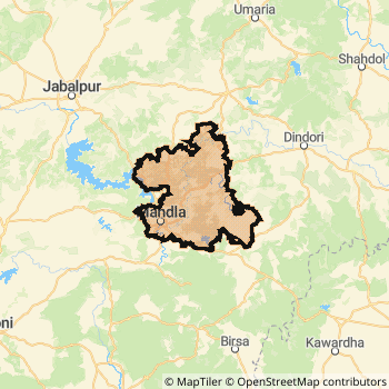
Mandla District Map
Current Corona Virus Infected Patients Count in Mandla District
| City Name | District Name | Total Covid cases |
|---|
Temples in Mandla
Historical Daily Min/Max Temperatures (Next 7 Days)
| Years | 28 Apr | 29 Apr | 30 Apr | 01 May | 02 May | 03 May | 04 May |
|---|---|---|---|---|---|---|---|
| 2025 | 40.0°C/ 25.0°C | 38.0°C/ 26.0°C | 40.0°C/ 25.0°C | ||||
| 2024 | 39.0°C/ 26.0°C | 41.0°C/ 28.0°C | 41.0°C/ 29.0°C | ||||
| 2023 | 36.0°C/ 24.0°C | 34.0°C/ 21.0°C | 24.0°C/ 20.0°C |
About Mandla District
Mandla District is one among 50 Districts of Madhya Pradesh State ,India. Mandla District Administrative head quarter is Mandla. It is is Located 364 KM west towards State capital Bhopal . Mandla District population is 1053522. It is 37 th Largest District in the State by population.Geography and Climate Mandla District
It is Located at Latitude-22.5, Longitude-80.3. Mandla District is sharing border with Kabirdham District to the East , Balaghat District to the South , Dindori District to the East , Jabalpur District to the North . It is sharing Border with Chattisgarh State to the South . Mandla District occupies an area of approximately 8771 square kilometres. . Its in the 456 meters to 416 meters elevation range.This District belongs to Hindi Belt India .DemoGraphics of Mandla District
Hindi is the Local Language here. Also People Speaks Devanagari ,dravidian,bagheli . Mandla District is divided into 9 Tehsils , 278 Panchayats , 1241 Villages. Nainpur Tehsil is the Smallest Tehsil by population with 136171 population. Mandla Tehsil is the Biggest Tehsil by population with 344172 population.Census 2011 of Mandla District
Mandla district Total population is 1053522 according to census 2011.Males are 525447 and Females are 528075 .Literate people are 697010 among total.Its total area is 8771 sq.km. It is the 37 th largest district in the state by Population . But 9 th Largest District in the state By Area. 428 th Largest District in the Country By Population. 30 th highest District in the State By literacy rate. 432 nd highest District in the Country By literacy rate.its literacy Rate is 68.28Politics in Mandla District
Bharatiya Janata Party , CPI(ML)(L) , BJP , INC are the major political parties in Mandla District.Assembly constituencies in Mandla District
Total 4 Assembly constituencies in Mandla District.| Constituency name | MLA name | Party |
|---|---|---|
| Dindori | Omkar Singh Markam | INC |
| Bichhiya | Narayan Singh Patta | INC |
| Niwas | Chainsingh Warkade | INC |
| Mandla | Sampatiya Uikey | BJP |
Parliament constituencies in Mandla District
Total 1 Parliament constituencies in Mandla District.| Constituency name | MP name | Party |
|---|---|---|
| Mandla | FAGGAN SINGH KULASTE | Bharatiya Janata Party |
Mandla District Political Map
Mandla Commerce
Total Registered Comapnies with Ministry of Corporate Affairs (MCA) in Mandla are 39Company Name : AMARKANTAK FOODS PRIVATE LIMITED
Type Of Business : Manufacturing (Food stuffs)
Capital : 3.35 Crores
Company Name : VARDHMAN GLOBAL INFRASTRUCTURES PRIVATE LIMITED
Type Of Business : Construction
Capital : 83.62 Lakhs
Company Name : MANDLA BUSINESS (INDIA) PRIVATE LIMITED
Type Of Business : Business Services
Capital : 46.25 Lakhs
Company Name : SWASTIK KHANDSARI PRIVATE LIMITED
Type Of Business : Manufacturing (Food stuffs)
Capital : 25.0 Lakhs
More Mandla Registered Companies
Mandla District Tourism
Kanha National park , Kanha National park are the Tourist destinations to Visit.
Mandla Transport
Road Transport
District Headquarters Mandla is well connected by road . Maharajpur , Nainpur , Mandla are the Cities in this district having road connectivity to major towns and remote villages. Mandla is about 364 KM by road to Bhopal( Capital of Madhya Pradesh )Rail Transport
Some of the rail way stations in district are Nainpur Junction , Chiraidongri , Pindrai , Tuiya Pani , Mandla Fort , Limarua , Padriganj , Bamhani Banjar .... which connects most of the towns and villages in the District.Bus Transport
Pin Codes in Mandla District
481668
( Pindrai ) ,
481995
( Bhuabichhia ) ,
481768
( Chiraidongri ) ,
481664
( Ghughri ) ,
481776
( Nainpur ) ,
481885
( Niwas ) ,
481663
( Mohgaon ) ,
481996
( Sijhora ) ,
481661
( Mandla ) ,
481771
( Bamni ) ,
481666
( Beejadandi ) ,
481665
( Maharajpur (Mandla)) ,
481672
( Chabi ) ,
481662
( Padariyanarayan Ganj ) ,
481998
( Anjania ) ,
more PinCodes
Hotels in Mandla
Motel Chandan
Kahatiya Village; Kanha National Park; Mandla Dist.; Madhya Pradesh; Pin code- 481661
Kanha
Price Range : Rs. 2400 - Rs. 3000
BusStops in Mandla Lakes in Mandla Temples in Mandla Shops in Mandla Mandla Hospitals Hotel/Restaurants in Mandla Mandla RailwayStations Mandla BusStops ATM in Mandla
Near Cities
Maharajpur 0 KM near
Mandla 0 KM near
Nainpur 36 KM near
Malajkhand 84 KM near
Near By Air Ports
Jabalpur Airport 51 KM near
Raipur Airport 236 KM near
Sonegaon Airport 241 KM near
Khajuraho Airport 281 KM near
Near By Districts
Mandla 0 KM near
Jabalpur 85 KM near
Dindori 92 KM near
Balaghat 99 KM near