| Home | City Bus | Maps | Villages | Cities | Rail | Tourist Places | School | College | Pin Codes | Corona Cases Count |
| Distance Calculator Bus Services IFSC Codes Trace Mobile Number Weather Search Place Trace IP Available Cash ATM/Banks Locate Polling Booth Report an Error contact People Surnames |
Bilaspur District.
Currently In:
India >>
Chattisgarh
Head Quarters : Bilaspur
Language : Chhattisgarhi and Hindi, Agariya, Bagheli
Area: 6377 sq. km
Population : 2662077
Sex Ratio : 972
Density : 322/ sq. km
Literacy : 71.59
Elevation / Altitude: 620 - 268 meters. Above Seal level
Current Time 05:02 PM
Date: Saturday , May 02,2026 (IST)
Time zone: IST (UTC+5:30)
District Pin code Index: 495XXX
Vehicle Registration Number: CG-10
RTO Office: Bilaspur
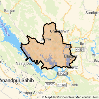
Bilaspur District Map
Current Corona Virus Infected Patients Count in Bilaspur District
| City Name | District Name | Total Covid cases |
|---|
Bilaspur Live Weather
Temperature: 39.6 °C
scattered clouds
Humidity: 14%
Wind : 5.01 mt/sec towards NE
StationName : "BilÄ\u0081spur"
observed on 1 Hours Back
Temperature: 39.6 °C
scattered clouds
Humidity: 14%
Wind : 5.01 mt/sec towards NE
StationName : "BilÄ\u0081spur"
observed on 1 Hours Back
Bilaspur Weather Forecast for Next 5 days
03-05-2026
29.4°C to 38.3°C
broken clouds
29.4°C to 38.3°C
broken clouds
04-05-2026
27.6°C to 42.1°C
broken clouds, overcast clouds, scattered clouds, few clouds, clear sky
27.6°C to 42.1°C
broken clouds, overcast clouds, scattered clouds, few clouds, clear sky
05-05-2026
28.0°C to 42.6°C
scattered clouds, few clouds, broken clouds, light rain
28.0°C to 42.6°C
scattered clouds, few clouds, broken clouds, light rain
06-05-2026
26.4°C to 43.0°C
broken clouds, clear sky, few clouds, light rain, overcast clouds, scattered clouds
26.4°C to 43.0°C
broken clouds, clear sky, few clouds, light rain, overcast clouds, scattered clouds
07-05-2026
26.7°C to 39.4°C
broken clouds, scattered clouds, light rain
26.7°C to 39.4°C
broken clouds, scattered clouds, light rain
Historical Daily Min/Max Temperatures (Next 7 Days)
| Years | 02 May | 03 May | 04 May | 05 May | 06 May | 07 May | 08 May |
|---|---|---|---|---|---|---|---|
| 2025 | |||||||
| 2024 | |||||||
| 2023 |
About Bilaspur District
Bilaspur District is one among 18 Districts of Chattisgarh State ,India. Bilaspur District Administrative head quarter is Bilaspur. It is is Located 123 KM South towards State capital Raipur . Bilaspur District population is 2662077. It is 3 rd Largest District in the State by population.Geography and Climate Bilaspur District
It is Located at Latitude-22.0, Longitude-82.1. Bilaspur District is sharing border with Durg District to the South , Janjgir-Champa District to the East , Korea District to the North , Kabirdham District to the west , Raipur District to the South . Bilaspur District occupies an area of approximately 6377 square kilometres. . Its in the 620 meters to 268 meters elevation range.This District belongs to Hindi Belt India .DemoGraphics of Bilaspur District
Chhattisgarhi is the Local Language here. Also People Speaks Hindi, Agariya, Bagheli . Bilaspur District is divided into 11 Tehsils , 554 Panchayats , 2204 Villages. Kota Tehsil is the Smallest Tehsil by population with 182567 population. Bilaspur Tehsil is the Biggest Tehsil by population with 501409 population.Census 2011 of Bilaspur District
Bilaspur district Total population is 2662077 according to census 2011.Males are 1349938 and Females are 1312139 .Literate people are 1761230 among total.Its total area is 6377 sq.km. It is the 3 rd largest district in the state by Population . But 10 th Largest District in the state By Area. 151 st Largest District in the Country By Population. 8 th highest District in the State By literacy rate. 348 th highest District in the Country By literacy rate.its literacy Rate is 71.59Politics in Bilaspur District
Bharatiya Janata Party , Indian National Congress , BJP , INC are the major political parties in Bilaspur District.Assembly constituencies in Bilaspur District
Total 10 Assembly constituencies in Bilaspur District.| Constituency name | MLA name | Party |
|---|---|---|
| Marwahi | Pranav Kumar Marpachi | INC |
| Kota | Atal Shrivastava | INC |
| Lormi | Arun Sao | BJP |
| Mungeli | Punnulal Mohle | BJP |
| Takhatpur | Dharmjeet Singh | BJP |
| Bilha | Dharam Lal Kaushik | INC |
Parliament constituencies in Bilaspur District
Total 3 Parliament constituencies in Bilaspur District.| Constituency name | MP name | Party |
|---|---|---|
| Korba | JYOTSNA CHARANDAS MAHANT | Indian National Congress |
| Rajnandgaon | SANTOSH PANDEY | Bharatiya Janata Party |
| Bilaspur | ARUN SAO | Bharatiya Janata Party |
Bilaspur District Political Map
Bilaspur Commerce
Total Registered Comapnies with Ministry of Corporate Affairs (MCA) in Bilaspur areMore Bilaspur Registered Companies
Bilaspur District Tourism
Bilaspur , Bahadurpur fort , Bhakra dam , Deotsidh temple , Nainda devi temple , Sariun fort , Tiun fort , Markandeya , are the Tourist destinations to Visit.
Temples in Bilaspur District
Naina Devi Temple, , Mahamaya Temple are the famous temple in Bilaspur DistrictBilaspur Transport
Road Transport
District Headquarters Bilaspur is well connected by road . Bilaspur , Bilaspur , Mungeli are the Cities in this district having road connectivity to major towns and remote villages. Bilaspur is about 123 KM by road to Raipur( Capital of Chattisgarh )Rail Transport
Some of the rail way stations in district are Bilaspur Junction , Pendra Road , Belha , Uslapur , Jairamnagar , Gatora , Kargi Road , Belgahna .... which connects most of the towns and villages in the District.Bus Transport
Hotels in Bilaspur
Sagar View Hotel
NH 21; Mandi rd; Bilaspur; Himachal Pradesh
Himachal Pradesh
Price Range : Rs. 850 - Rs. 1900
Akash Ganga Hotel
Main Market; Near Petrol Bunk; Bilaspur; Himachal Pradesh
Himachal Pradesh
Price Range : Rs. 200 - Rs. 300
Dholra Hotel
NH 21; Near Dholra Temple; Bilaspur; Himachal Pradesh
Himachal Pradesh
Price Range : Rs. 600 - Rs. 1600
Pal Hotel
NH 21; Diara Sector; Bilaspur; Himachal Pradesh
Himachal Pradesh
Price Range : Rs. 200 - Rs. 200
BusStops in Bilaspur Lakes in Bilaspur Temples in Bilaspur Shops in Bilaspur Bilaspur Hospitals Hotel/Restaurants in Bilaspur Bilaspur RailwayStations Bilaspur BusStops ATM in Bilaspur
Near Cities
Bilaspur 2 KM near
Bilaspur 5 KM near
Akaltara 29 KM near
Naila Janjgir 47 KM near
Near By Air Ports
Raipur Airport 120 KM near
Jabalpur Airport 267 KM near
Sonegaon Airport 379 KM near
Ranchi Airport 395 KM near
Near By Districts
Bilaspur 0 KM near
Korba 71 KM near
Janjgir-Champa 75 KM near
Kabirdham 107 KM near