Kanker
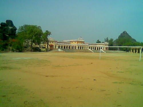
An intriguing location, Kanker is situated in the southern portion of the Indian state of Chhattisgarh. The history of the town of Kanker can be traced back to a huge amount of years, containing many an interesting and exciting incidents. Dandakaranya, an area of plush forests with luxurious green trees, was present in this region as per Ramayana and Mahabharata. Buddhism prevailed over this area during the time period of 6th century BC. The terrain of Kanker is dotted with mesmerizing topography including the picturesque majestic hills, sparkling waterfalls and luxurious vegetation and the fascinating inhabitants consisting of tribal group of people.
PLACES TO SEE IN KANKER
The Gadiya Mountain: The Gadhiya Mountain was made the capital. It is a natural structure made into a fort. A tank, which never runs out of water, is present on the mountain. Sonai is the name given to one portion of the tank, while Rupai is the name given to the other remaining segment of the tank. The names of the two portions of the tank have been derived from the name of the daughters of Kandra King Dharma Dev named Sonai and Rupai. Churi Pagar is the name of the cave that is located on the southern portion of the tank. In this very cave, the King along with his family members used to dwell in the cave for safety reasons. The cave at most can accommodate 500 people. One the west direction of the cave there is an outlet point. One more cave named Jogi cave is located on the south eastern part of the Gadhiya Mountain. 50 meters is the length of the cave. The river named Doodh passes at the base of the Gadhiya Mountain. The celebrations of the Maha Shivratri are carried out on the mountain. Hundreds and hundreds of people come here during this time.
Malanjhkudum Water fall: Neele Gondi is located on a small mountain, which is again set at a distance of 15 Kms from Kanker, in its south direction. From this point of Neele Gondi, the Doodh River originates. Once the river travels a lengthy undulating path of 10 Kms, it creates 3 waterfalls at the location named Malanjhkudum. The three waterfalls are set at an altitude of 10 meters, 15 meters and 9 meters respectively. One can get mesmerized by the swishing sloshing waves of the waterfall, which are very appealing indeed. This location is also perfect for carrying out an enjoyable and relaxing picnic.
Charre-Marre Waterfall: The distance of the spectacular Charre-Marre Waterfall and Antagarh is 17 Kms. Antagarh is a block of the district of Kanker. In the between the two places namely Antagarh and Aamabera, there is a location called Charre-Marre. The Jogidahara River, which pours into the valley of Matla, is the source from which this waterfall is created. 16 meters is the altitude of the waterfall. This location is a must visit for tourists travelling to Kanker District.
Shivani Temple: Another of the tourist places to visit is the Shivani Temple of the Kanker city. This temple is also known by the name of Shivani Maa Temple. The Goddess that is housed in the temple is a mixture of two Goddesses namely Kali Maa and Durga Maa, as per legends, and the sculpture of the Goddess is considered to be spectacular. The statue is divided into two halves in a vertical direction – one half of it being Goddess Kali and another half of it being Goddess Durga. All over the globe there are only two such statue. Kolkata has one and the second one is situated in the city of Kanker. The celebrations of Navratri are carried out in a grand manner.
HOW TO REACH IN KANKER
By Air: The closest air terminal located to Kanker is the Raipur Airport, situated at a distance of 127 Kms from Kanker.
By Rail: The Kanker Railway Station is the nearest railway station, situated at a distance of 127 Kms from Kanker.
By Road: On the National Highway 43, Kanker is located. It is well connected to other major locations via well maintained road routes.