| Home | City Bus | Maps | Villages | Cities | Rail | Tourist Places | School | College | Pin Codes | Corona Cases Count |
| Distance Calculator Bus Services IFSC Codes Trace Mobile Number Weather Search Place Trace IP Available Cash ATM/Banks Locate Polling Booth Report an Error contact People |
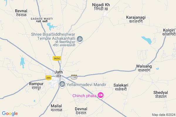
Vithalwadi (n.v.)
Vithalwadi (n.v.) Map
EDIT Map
Add Your House
 ..
..
Current Corona Virus Infected Patients Count in Sangli District
| City Name | District Name | Total Covid cases |
|---|---|---|
| Sangli District | Sangli | 20 |
| Sangli | Sangli | 9 |
Locality Name :
Vithalwadi (n.v.)
( विठ्ठलवाडी (n.v.) )
Taluka Name : Jath
District : Sangli
State : Maharashtra
Region : Desh or Paschim Maharashtra
Division : Pune
Language : Marathi and Kannada
Current Time 01:20 PM
Date: Saturday , May 03,2025 (IST)
Time zone: IST (UTC+5:30)
Elevation / Altitude: 567 meters. Above Seal level
Telephone Code / Std Code: 02344
Assembly constituency : Jat assembly constituency
Assembly MLA : Jagtap Vilasrao Narayan
Lok Sabha constituency : Sangli parliamentary constituency
Parliament MP : Sanjaykaka Patil
Serpanch Name :
Commodities Prices : Sangola Market / Mandi
Vithalwadi (n.v.) Live Weather
Temperature: 37.3 °C
clear sky
Humidity: 11%
Wind : 4.3 mt/sec towards N
StationName : "SÄ\u0081ngola"
observed on 39 Mins Back
Temperature: 37.3 °C
clear sky
Humidity: 11%
Wind : 4.3 mt/sec towards N
StationName : "SÄ\u0081ngola"
observed on 39 Mins Back
Vithalwadi (n.v.) Weather Forecast for Next 5 days
04-05-2025
28.5°C to 38.2°C
clear sky, few clouds, scattered clouds, broken clouds
28.5°C to 38.2°C
clear sky, few clouds, scattered clouds, broken clouds
05-05-2025
26.0°C to 37.3°C
broken clouds, scattered clouds, few clouds, clear sky
26.0°C to 37.3°C
broken clouds, scattered clouds, few clouds, clear sky
06-05-2025
25.4°C to 37.6°C
clear sky, broken clouds, scattered clouds
25.4°C to 37.6°C
clear sky, broken clouds, scattered clouds
07-05-2025
26.0°C to 35.5°C
few clouds, broken clouds, overcast clouds, clear sky
26.0°C to 35.5°C
few clouds, broken clouds, overcast clouds, clear sky
08-05-2025
24.8°C to 36.3°C
clear sky, broken clouds, scattered clouds, few clouds
24.8°C to 36.3°C
clear sky, broken clouds, scattered clouds, few clouds
Rivers Near Vithalwadi (n.v.)
Agrani
Agrani
About Vithalwadi (n.v.)
Correct below Info and add more info about Vithalwadi (n.v.)Vithalwadi (n.v.) is a Village in Jath Taluka in Sangli District of Maharashtra State, India. It belongs to Desh or Paschim Maharashtra region . It belongs to Pune Division . It is located 88 KM towards East from District head quarters Sangli. 389 KM from State capital Mumbai
Vithalwadi (n.v.) is surrounded by Sangola Taluka towards North , Kavathemahankal Taluka towards west , Athni Taluka towards South , Mangalvedhe Taluka towards North .
Sangole , Mangalvedhe , Bijapur , Terdal are the near by Cities to Vithalwadi (n.v.).
Demographics of Vithalwadi (n.v.)
Marathi is the Local Language here.Politics in Vithalwadi (n.v.)
Bharatiya Janata Party , BJP , NCP , INC are the major political parties in this area.Polling Stations /Booths near Vithalwadi (n.v.)
1)Zila Parishad Primary Kendra School Eastern Facing North Room No.3 Slab Building2)Zilla Parishad.primary Marathi School. R.c.c. Buliding Facing East
3)Z.p.primary Marathi
4)Zilla Parishad.primary Kannad
5)Zilla Parishad.primary Urdu
HOW TO REACH Vithalwadi (n.v.)
By Rail
There is no railway station near to Vithalwadi (n.v.) in less than 10 km. Solapur Rail Way Station (near to Solapur) , Miraj Junction Rail Way Station (near to Miraj) , Bale Rail Way Station (near to Solapur) , Vijayapura Rail Way Station (near to Bijapur) , Arag Rail Way Station (near to Miraj) , Ibrahimpur Rail Way Station (near to Bijapur) are the Rail way stations reachable from near by towns.By Road
Athani (Karnataka) , Bijapur , Miraj , Solapur are the nearby by towns to Vithalwadi (n.v.) having road connectivity to Vithalwadi (n.v.)Pincodes near Vithalwadi (n.v.)
416404 ( Jath ) , 416402 ( Daphalapur ) , 416403 ( Dhalgaon )Colleges near Vithalwadi (n.v.)
Sri Guru Basav Vidya Mandir & Jr. College Sankh
Address :
Shri R.k Patil Arts,commerce & Science Mahavidyalay ,sankh
Address : Sankh -badachi Road
Raje Ramaro Mahavidyalay Jath
Address :
Rajaram Bapu Junior College
Address :
Arts, Commerce & Science College, Umadi, Tq- Jath,
Address :
Schools near Vithalwadi (n.v.)
Sant Gadgebaba Ashramshala
Address : jat , jath , sangli , Maharashtra . PIN- 416404 , Post - Jath
Shamrao Kadam Hischool Gugwad
Address : gugwad , jath , sangli , Maharashtra . PIN- 416404 , Post - Jath
Modern School & College
Address : shegaon , jath , sangli , Maharashtra . PIN- 416404 , Post - Jath
Samata Madhyamik Ashramshala
Address : umadi , jath , sangli , Maharashtra . PIN- 416413 , Post - Umadi
Govt Health Centers near Vithalwadi (n.v.)
1) Jath 1 , SubCentre Jath 1 , Nigadi Cournar , Datta Colony2) Jath 4 , SubCenter Jath 4 , Shivanubhav Mandap , Near Aganwadi
3) Jath 2 , SubCentre Jath 2 , More Colony , Behind Cort
Hospitals in Vithalwadi (n.v.),Jath
Government Nursing Home
Nigadi Road; Datta Colony; Jath; Maharashtra 416404; India
4.5 KM distance Detail
more ..
Petrol Bunks in Vithalwadi (n.v.),Jath
HP PETROL PUMP - SANGRAM FUEL STATION
Hpcl Dealers A/P. Jath; Jath Visapur Road; Taluka Jath; Vasco; Maharashtra 416404; India
4.2 KM distance Detail
more ..
Colleges in Vithalwadi (n.v.),Jath
Gobbi D.Ed College
Nigadi Rd; Vithal Nagar; Tangadi Mala; Jath; Maharashtra 416404; India
4.2 KM distance Detail
more ..
Schools in Vithalwadi (n.v.),Jath
Goverment Pre Primary School
Nigadi Road; Datta Colony; Jath; Maharashtra 416404; India
4.5 KM distance Detail
Electronic Shops in Vithalwadi (n.v.),Jath
Amit Chavan Engineers
Vithal Nagar; Tangadi Mala; Jath; Maharashtra 416404; India
4.1 KM distance Detail
Governement Offices near Vithalwadi (n.v.),Jath
Jath Council
Sangli - Kavathe Mahankal - Jath Rd; Jath; Maharashtra 416404; India
5.1 KM distance Detail
About Vithalwadi (n.v.) &
History
How to reach Vithalwadi (n.v.)
Tourist Places Near By Vithalwadi (n.v.)
Schools in Vithalwadi (n.v.)
Colleges in Vithalwadi (n.v.)
Temperature & weather of Vithalwadi (n.v.)
places in Vithalwadi (n.v.)
Vithalwadi (n.v.) photos
More Information
How to reach Vithalwadi (n.v.)
Tourist Places Near By Vithalwadi (n.v.)
Schools in Vithalwadi (n.v.)
Colleges in Vithalwadi (n.v.)
Temperature & weather of Vithalwadi (n.v.)
places in Vithalwadi (n.v.)
Vithalwadi (n.v.) photos
More Information
Village Talk
Post News or Events about this Village
Near Cities
Sangole 27 KM near
Mangalvedhe 59 KM near
Bijapur 63 KM near
Terdal 74 KM near
Sangole 27 KM near
Mangalvedhe 59 KM near
Bijapur 63 KM near
Terdal 74 KM near
Near By Taluks
Jath 0 KM near
Sangola 39 KM near
Kavathemahankal 42 KM near
Athni 48 KM near
Jath 0 KM near
Sangola 39 KM near
Kavathemahankal 42 KM near
Athni 48 KM near
Near By Air Ports
Sholapur Airport 107 KM near
Kolhapur Airport 120 KM near
Sambre Airport 168 KM near
Hubli Airport 214 KM near
Sholapur Airport 107 KM near
Kolhapur Airport 120 KM near
Sambre Airport 168 KM near
Hubli Airport 214 KM near
Near By Tourist Places
Bijapur 63 KM near
Pandharpur 75 KM near
Solapur 110 KM near
Kolhapur 128 KM near
Panhala 138 KM near
Bijapur 63 KM near
Pandharpur 75 KM near
Solapur 110 KM near
Kolhapur 128 KM near
Panhala 138 KM near
Near By Districts
Bijapur District 64 KM near
Sangli 84 KM near
Solapur 107 KM near
Bagalkot 122 KM near
Bijapur District 64 KM near
Sangli 84 KM near
Solapur 107 KM near
Bagalkot 122 KM near
Near By RailWay Station
Sangola Rail Way Station 46 KM near
Vijayapura Rail Way Station 65 KM near
Sangola Rail Way Station 46 KM near
Vijayapura Rail Way Station 65 KM near