| Home | City Bus | Maps | Villages | Cities | Rail | Tourist Places | School | College | Pin Codes | Corona Cases Count |
| Distance Calculator Bus Services IFSC Codes Trace Mobile Number Weather Search Place Trace IP Available Cash ATM/Banks Locate Polling Booth Report an Error contact People |
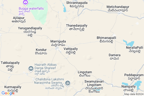
Vattipally Map
EDIT Map
Add Your House
 ..
..
Current Corona Virus Infected Patients Count in Nalgonda District
| City Name | District Name | Total Covid cases |
|---|---|---|
| Suryapet District | Suryapet | 72 |
| Nalgonda District | Nalgonda | 15 |
Locality Name :
Vattipally
( వట్టిపల్లి )
Mandal Name : Marriguda
District : Nalgonda
State : Telangana
Region : Telangana
Language : Telugu and Urdu
Current Time 10:04 AM
Date: Thursday , May 01,2025 (IST)
Time zone: IST (UTC+5:30)
Elevation / Altitude: 256 meters. Above Seal level
Telephone Code / Std Code: 08691
Assembly constituency : Munugode assembly constituency
Assembly MLA : Komatireddy Raj Gopal Reddy
Lok Sabha constituency : Bhongir parliamentary constituency
Parliament MP : Komati Reddy Venkat Reddy
Serpanch Name :
Pin Code : 508245
Post Office Name : Marriguda
Alternate Village Name : Vattipalli , Vattipalle
Commodities Prices : Venkateswarnagar(Chintapalli) Market / Mandi
Vattipally Live Weather
Temperature: 28.2 °C
clear sky
Humidity: 67%
Wind : 4.42 mt/sec towards SE
StationName : "Devarkonda"
observed on 2 Hours Back
Temperature: 28.2 °C
clear sky
Humidity: 67%
Wind : 4.42 mt/sec towards SE
StationName : "Devarkonda"
observed on 2 Hours Back
Vattipally Weather Forecast for Next 5 days
02-05-2025
27.9°C to 39.4°C
clear sky, scattered clouds
27.9°C to 39.4°C
clear sky, scattered clouds
03-05-2025
26.6°C to 39.8°C
few clouds, clear sky, scattered clouds, light rain
26.6°C to 39.8°C
few clouds, clear sky, scattered clouds, light rain
04-05-2025
27.4°C to 41.4°C
clear sky, light rain, scattered clouds, broken clouds
27.4°C to 41.4°C
clear sky, light rain, scattered clouds, broken clouds
05-05-2025
28.1°C to 40.4°C
scattered clouds, clear sky, light rain, broken clouds, overcast clouds
28.1°C to 40.4°C
scattered clouds, clear sky, light rain, broken clouds, overcast clouds
06-05-2025
28.4°C to 40.1°C
overcast clouds, scattered clouds, few clouds, clear sky, light rain
28.4°C to 40.1°C
overcast clouds, scattered clouds, few clouds, clear sky, light rain
Edit below overview about Vattipally
Edit below overview about Vattipally
OverView of Vattipally
by bus from b.n.reddy to vattipally busstop-kallu tharunit has a big historyin vattypally ramaswami temple is famous-kallu tharunEdit below overview about Vattipally
About Vattipally
Vattipally is a Village in Marriguda Mandal in Nalgonda District of Telangana State, India. It belongs to Telangana region . It is located 49 KM towards west from District head quarters Nalgonda. 4 KM from Marriguda.
Vattipally Pin code is 508245 and postal head office is Marriguda .
Ramreddypally ( 5 KM ) , Sarampeta ( 6 KM ) , Damara Bheemana Pally ( 6 KM ) , Lenkalapally ( 7 KM ) , Vaddepally ( 7 KM ) are the nearby Villages to Vattipally. Vattipally is surrounded by Nampally Mandal towards East , Chintha Pally Mandal towards South , Chandur Mandal towards East , Madgul Mandal towards west .
Devarakonda , Bhongir , Hyderabad , Farooqnagar are the near by Cities to Vattipally.
Vatti Palle 2011 Census Details
Vattipally Local Language is Telugu. Vatti Palle Village Total population is 2308 and number of houses are 533. Female Population is 47.3%. Village literacy rate is 56.6% and the Female Literacy rate is 21.3%.
Population
| Census Parameter | Census Data |
| Total Population | 2308 |
| Total No of Houses | 533 |
| Female Population % | 47.3 % ( 1092) |
| Total Literacy rate % | 56.6 % ( 1306) |
| Female Literacy rate | 21.3 % ( 491) |
| Scheduled Tribes Population % | 13.5 % ( 312) |
| Scheduled Caste Population % | 13.5 % ( 311) |
| Working Population % | 47.1 % |
| Child(0 -6) Population by 2011 | 237 |
| Girl Child(0 -6) Population % by 2011 | 40.5 % ( 96) |
Vatti Palle Census More Deatils.
Politics in Vattipally
TDP , TRS , CPI , INC are the major political parties in this area.Polling Stations /Booths near Vattipally
1)Vaillapally2)Vattipalli
3)Mankya Tanda
4)Marriguda
5)Bangarigadda
HOW TO REACH Vattipally
By Road
Nalgonda is the Nearest Town to Vattipally. Nalgonda is 60 km from Vattipally. Road connectivity is there from Nalgonda to Vattipally.By Rail
There is no railway station near to Vattipally in less than 10 km. How ever there are railway Stations from Near By town Nalgonda. are the railway Stations near to Nalgonda. You can reach from Nalgonda to Vattipally by road after .Colleges near Vattipally
Mathrusri Junior College, Suryapet
Address :
Padala Degree College
Address :
Tswrdcw,cherlapally
Address : Tswrdcw,
cherlapally,nalgonda
pon:508001
Vikas Junior College
Address :
Sphoorthy College
Address : Narkatpally
Schools near Vattipally
Kgbv Marriguda
Address : marriguda , marriguda , nalgonda , Andhra Pradesh . PIN- 508245 , Post - Marriguda
Adarsha Talant Hs
Address : marriguda , marriguda , nalgonda , Andhra Pradesh . PIN- 508245 , Post - Marriguda
St.josephs Highschool
Address : damera bheeman palle , marriguda , nalgonda , Andhra Pradesh . PIN- 508245 , Post - Marriguda
Zphs Anthampet
Address : anthampet , marriguda , nalgonda , Andhra Pradesh . PIN- 508245 , Post - Marriguda
Govt Health Centers near Vattipally
1) SubCentre, Vattipally , Government building ,SC Vattaipally , BC AREA , RCH BUILDING2) Primary Health Centre, Marriguda , Gov Building , Nampally Road , Nampally Road
3) SubCentre, Marriguda , 18-Jan , Near Post Office , Battu Venkanna
Sub Villages in Vattipally
Petrol Bunks in Vattipally,Marriguda
MALLIKARJUNA ENTERPRISES
Nalgonda - Pamangundla Rd; Marriguda; Telangana 508116; India
2.7 KM distance Detail
HP PETROL PUMP - VINOOTHNA MOTHI PETRO MART
HPC Petrol Pump Vill-vattipally Mandal Merriguda; Warangal; 508245; India
2.8 KM distance Detail
Indian Oil Petrol Bunk; Kisan Seva Kendra
Metichandapur; Telangana 508245; India
10.2 KM distance Detail
more ..
Colleges in Vattipally,Marriguda
Marriguda Degree College
Marriguda Village; Nalgonda District; Telangana 508245; India
3.5 KM distance Detail
more ..
Schools in Vattipally,Marriguda
ZPHS High school
508245; Marriguda; Ashok Nagar; Mallapur; Secunderabad; Telangana; India
2.7 KM distance Detail
About Vattipally &
History
How to reach Vattipally
Tourist Places Near By Vattipally
Schools in Vattipally
Colleges in Vattipally
Temperature & weather of Vattipally
places in Vattipally
Vattipally photos
More Information
How to reach Vattipally
Tourist Places Near By Vattipally
Schools in Vattipally
Colleges in Vattipally
Temperature & weather of Vattipally
places in Vattipally
Vattipally photos
More Information
Village Talk
Post News or Events about this Village
Near Cities
Devarakonda 31 KM near
Bhongir 70 KM near
Hyderabad 74 KM near
Farooqnagar 82 KM near
Devarakonda 31 KM near
Bhongir 70 KM near
Hyderabad 74 KM near
Farooqnagar 82 KM near
Near By Taluks
Marriguda 4 KM near
Nampally 13 KM near
Chintha Pally 13 KM near
Chandur 18 KM near
Marriguda 4 KM near
Nampally 13 KM near
Chintha Pally 13 KM near
Chandur 18 KM near
Near By Air Ports
Rajiv Gandhi International Airport 65 KM near
Vijayawada Airport 234 KM near
Nanded Airport 335 KM near
Latur Airport 339 KM near
Rajiv Gandhi International Airport 65 KM near
Vijayawada Airport 234 KM near
Nanded Airport 335 KM near
Latur Airport 339 KM near
Near By Tourist Places
Nagarjunsagar 69 KM near
Hyderabad 72 KM near
Srisailam 107 KM near
Nagarjunakonda 121 KM near
Khammam 156 KM near
Nagarjunsagar 69 KM near
Hyderabad 72 KM near
Srisailam 107 KM near
Nagarjunakonda 121 KM near
Khammam 156 KM near
Near By Districts
Nalgonda 47 KM near
Hyderabad 78 KM near
Rangareddi 101 KM near
Mahbubnagar 108 KM near
Nalgonda 47 KM near
Hyderabad 78 KM near
Rangareddi 101 KM near
Mahbubnagar 108 KM near
Near By RailWay Station
Nalgonda Rail Way Station 50 KM near
Kacheguda Rail Way Station 72 KM near
Nalgonda Rail Way Station 50 KM near
Kacheguda Rail Way Station 72 KM near