| Home | City Bus | Maps | Villages | Cities | Rail | Tourist Places | School | College | Pin Codes | Corona Cases Count |
| Distance Calculator Bus Services IFSC Codes Trace Mobile Number Weather Search Place Trace IP Available Cash ATM/Banks Locate Polling Booth Report an Error contact People |
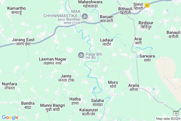
Balha
Balha Map
EDIT Map
Add Your House
 ..
..
Current Corona Virus Infected Patients Count in Muzaffarpur District
| City Name | District Name | Total Covid cases |
|---|
Locality Name :
Balha
( बलहा )
Block Name : Gaighat
District : Muzaffarpur
State : Bihar
Division : Tirhut
Language : Maithili and Hindi, Urdu, Vajjika And Bhojpuri
Current Time 10:41 AM
Date: Thursday , May 01,2025 (IST)
Time zone: IST (UTC+5:30)
Elevation / Altitude: 56 meters. Above Seal level
Telephone Code / Std Code: 0621
Assembly constituency : Gaighat assembly constituency
Assembly MLA : Niranjan Roy
Lok Sabha constituency : Muzaffarpur parliamentary constituency
Parliament MP : Ajay Nishad
Serpanch Name :
Pin Code : 847107
Post Office Name : Keotsa Baruari
Main Village Name : Balha
Balha Live Weather
Temperature: 33.3 °C
overcast clouds
Humidity: 34%
Wind : 3.51 mt/sec towards SE
StationName : "Darbhanga"
observed on Now
Temperature: 33.3 °C
overcast clouds
Humidity: 34%
Wind : 3.51 mt/sec towards SE
StationName : "Darbhanga"
observed on Now
Balha Weather Forecast for Next 5 days
02-05-2025
27.5°C to 36.6°C
overcast clouds, broken clouds, light rain, scattered clouds
27.5°C to 36.6°C
overcast clouds, broken clouds, light rain, scattered clouds
03-05-2025
26.0°C to 37.4°C
overcast clouds, light rain, scattered clouds, few clouds
26.0°C to 37.4°C
overcast clouds, light rain, scattered clouds, few clouds
04-05-2025
25.9°C to 38.0°C
light rain, overcast clouds, broken clouds, scattered clouds
25.9°C to 38.0°C
light rain, overcast clouds, broken clouds, scattered clouds
05-05-2025
25.2°C to 37.8°C
scattered clouds, light rain, few clouds, clear sky
25.2°C to 37.8°C
scattered clouds, light rain, few clouds, clear sky
06-05-2025
27.0°C to 39.8°C
light rain, clear sky, scattered clouds, broken clouds
27.0°C to 39.8°C
light rain, clear sky, scattered clouds, broken clouds
Edit below overview about Balha
Edit below overview about Balha
OverView of Balha
Balha is a tiny beautiful village surrounded by river Bagmati from three sides.It has several mango,lichi,Jackfruit and banana grooves.The village has a Govt. school and two nice temples, both near the bank of the river.All the inhabitants are hindus ,.the nearby village of Saraia and Ratanpura are populated with Muslims.The cordial relations have been continuing from centuries and that is an example for the entire country.This village is there for more than five hundred years.All the festivals are celebrated with pomp and show here.It has electricity connection and recently Govt. has started work on providing pure drinking water to everybody.The best time to visit is during mango and lichi season and in the month of October-November.The famous city of Darbhanga(The capital of Mithila) is only 22 Kms. and you can get conveyance through out the day as the Village is on the PMRY sarak yogna road from Ramauli ,which is on the East West Expressway and three kilo meter from Balha.Edit below overview about Balha
National Highways Reachable To Balha
Nationa High Way :NH27
Nationa High Way :NH527B
Nationa High Way :NH27
Nationa High Way :NH527B
Rivers Near Balha
Baya Nadi
Baya Nadi
About Balha
Balha is a small Village/hamlet in Gaighat Block in Muzaffarpur District of Bihar State, India. It comes under Balha Panchayath. It belongs to Tirhut Division . It is located 38 KM towards East from District head quarters Muzaffarpur. 16 KM from Gaighat. 93 KM from State capital Patna
Balha Pin code is 847107 and postal head office is Keotsa Baruari .
Maheshwara ( 7 KM ) , Mahamadpur Sura ( 8 KM ) , Munni Bangri ( 8 KM ) , Bandra ( 10 KM ) , Jamalpur Kodai ( 10 KM ) are the nearby Villages to Balha. Balha is surrounded by Bandra Block towards west , Singhwara Block towards North , Gaighat Block towards west , Kalyanpur Block towards South .
Darbhanga , Samastipur , Muzaffarpur , Kanti are the near by Cities to Balha.
This Place is in the border of the Muzaffarpur District and Vaishali District. Vaishali District Garaul is west towards this place .
Balha 2011 Census Details
Balha Local Language is Maithili. Balha Village Total population is 1263 and number of houses are 307. Female Population is 47.6%. Village literacy rate is 64.5% and the Female Literacy rate is 27.9%.
Population
| Census Parameter | Census Data |
| Total Population | 1263 |
| Total No of Houses | 307 |
| Female Population % | 47.6 % ( 601) |
| Total Literacy rate % | 64.5 % ( 815) |
| Female Literacy rate | 27.9 % ( 353) |
| Scheduled Tribes Population % | 0.0 % ( 0) |
| Scheduled Caste Population % | 9.0 % ( 114) |
| Working Population % | 28.2 % |
| Child(0 -6) Population by 2011 | 227 |
| Girl Child(0 -6) Population % by 2011 | 46.7 % ( 106) |
Balha Census More Deatils.
Politics in Balha
JD(U) , Bharatiya Janata Party , LJP , BJP , RJD , INC are the major political parties in this area.Polling Stations /Booths near Balha
1)Madhya Vidyalay Bagha Khal2)Prathamik Vidyalay Gayasuddinpur
3)Utkramit Madhya Vidyalay Bharatnagar
4)Utkramit Madhya Vidyalay Motnaje
5)Utkramit Madhya Vidyalay Susta Chakki
HOW TO REACH Balha
By Rail
There is no railway station near to Balha in less than 10 km. Ram Dayalu Nagar Rail Way Station (near to Muzaffarpur) , Muzaffarpur Junction Rail Way Station (near to Muzaffarpur) are the Rail way stations reachable from near by towns.By Road
Muzaffarpur are the nearby by towns to Balha having road connectivity to BalhaColleges near Balha
Ramjanki College
Address :
Alliance Industrial Training Centre
Address :
High School Undar
Address :
Laxmipur College G.k.nagar
Address : Laxmipur,g.k.nagar Muzaffarpurroad Bihar 843102
Laxmipur College G.k.nagar
Address : Laxmipur,g.k.nagar Muzaffarpurroad Bihar 843102
Schools in Balha
Ms Pura Nankar
Address : balha , gaighat , muzaffarpur , Bihar . PIN- 847107 , Post - Keotsa Baruari
Ms Balaha
Address : balha , gaighat , muzaffarpur , Bihar . PIN- 847107 , Post - Keotsa Baruari
Govt Health Centers near Balha
1) Jayantipur Dath , , ,2) Pusa , , ,
3) Kalyanpur , , ,
Hospitals in Balha,Gaighat
Narayani Sawat Seva Sadan Hospital Gaighat
Gayghat; Jarang; Bihar 843118; India
7.1 KM distance Detail
more ..
Petrol Bunks in Balha,Gaighat
GIRISH AUTOMOBILES
NH-57;BENIBAD;MUZAFFARPUR; MUZZAFARPUR; Bihar 846004; India
5.2 KM distance Detail
HP PETROL PUMP - RAJEEV SERVICE STATION
HP Petrol Pump Benibad Gaighat DT Muzaffarpur; Begusarai; Bihar 842001; India
5.3 KM distance Detail
Indian Oil Petrol Pump
Basudeopur; Darbhanga; NH-57; Darbhanga; Darbhanga; Bihar 846004; India
9.2 KM distance Detail
more ..
Electronic Shops in Balha,Gaighat
S Communication Ghoghardiha
Ramashish Chowk Rail Over Bridge; Ghoghardiha - Durgasthan Rd; Nehru Tola; India
5.0 KM distance Detail
About Balha &
History
How to reach Balha
Tourist Places Near By Balha
Schools in Balha
Colleges in Balha
Temperature & weather of Balha
places in Balha
Balha photos
More Information
How to reach Balha
Tourist Places Near By Balha
Schools in Balha
Colleges in Balha
Temperature & weather of Balha
places in Balha
Balha photos
More Information
Village Talk
Post News or Events about this Village
Near Cities
Darbhanga 22 KM near
Samastipur 32 KM near
Muzaffarpur 36 KM near
Kanti 46 KM near
Darbhanga 22 KM near
Samastipur 32 KM near
Muzaffarpur 36 KM near
Kanti 46 KM near
Near By Taluks
Hanuman Nagar 12 KM near
Bandra 13 KM near
Singhwara 13 KM near
Gaighat 15 KM near
Hanuman Nagar 12 KM near
Bandra 13 KM near
Singhwara 13 KM near
Gaighat 15 KM near
Near By Air Ports
Patna Airport 94 KM near
Gaya Airport 190 KM near
Gorakhpur Airport 264 KM near
Bagdogra Airport 300 KM near
Patna Airport 94 KM near
Gaya Airport 190 KM near
Gorakhpur Airport 264 KM near
Bagdogra Airport 300 KM near
Near By Tourist Places
Darbhanga 22 KM near
Samastipur 32 KM near
Muzaffarpur 35 KM near
Madhubani 50 KM near
Sitamarhi 66 KM near
Darbhanga 22 KM near
Samastipur 32 KM near
Muzaffarpur 35 KM near
Madhubani 50 KM near
Sitamarhi 66 KM near
Near By Districts
Darbhanga 20 KM near
Samastipur 31 KM near
Muzaffarpur 36 KM near
Madhubani 49 KM near
Darbhanga 20 KM near
Samastipur 31 KM near
Muzaffarpur 36 KM near
Madhubani 49 KM near
Near By RailWay Station
Laheria Sarai Rail Way Station 21 KM near
Haiaghat Rail Way Station 22 KM near
Laheria Sarai Rail Way Station 21 KM near
Haiaghat Rail Way Station 22 KM near