| Home | City Bus | Maps | Villages | Cities | Rail | Tourist Places | School | College | Pin Codes | Corona Cases Count |
| Distance Calculator Bus Services IFSC Codes Trace Mobile Number Weather Search Place Trace IP Available Cash ATM/Banks Locate Polling Booth Report an Error contact People |
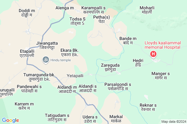
Tumargunda (s.)
Tumargunda (s.) Map
EDIT Map
Add Your House
 ..
..
Current Corona Virus Infected Patients Count in Gadchiroli District
| City Name | District Name | Total Covid cases |
|---|
Locality Name :
Tumargunda (s.)
( तुमरगुंद (s.) )
Taluka Name : Etapalli
District : Gadchiroli
State : Maharashtra
Region : Vidarbh
Division : Nagpur
Language : Marathi and Hindi,gondi,bengali, Telgu
Current Time 10:56 PM
Date: Saturday , May 03,2025 (IST)
Time zone: IST (UTC+5:30)
Elevation / Altitude: 200 meters. Above Seal level
Telephone Code / Std Code: 07136
Assembly constituency : Aheri assembly constituency
Assembly MLA : Aatram Dharamraobaba Bhagwantrao
Lok Sabha constituency : Gadchiroli-Chimur parliamentary constituency
Parliament MP : ASHOK MAHADEORAO NETE
Serpanch Name :
Pin Code : 442704
Post Office Name : Ettapalli
Alternate Village Name : Tumargunda
Commodities Prices : Chamorshi Market / Mandi
Tumargunda (s.) Live Weather
Temperature: 30.9 °C
few clouds
Humidity: 41%
Wind : 3.21 mt/sec towards SE
StationName : "AllÄ\u0081palli"
observed on 1 Hours Back
Temperature: 30.9 °C
few clouds
Humidity: 41%
Wind : 3.21 mt/sec towards SE
StationName : "AllÄ\u0081palli"
observed on 1 Hours Back
Tumargunda (s.) Weather Forecast for Next 5 days
04-05-2025
28.1°C to 31.8°C
few clouds
28.1°C to 31.8°C
few clouds
05-05-2025
26.6°C to 42.8°C
clear sky, scattered clouds, few clouds, broken clouds, overcast clouds
26.6°C to 42.8°C
clear sky, scattered clouds, few clouds, broken clouds, overcast clouds
06-05-2025
26.5°C to 43.0°C
scattered clouds, few clouds, clear sky, broken clouds
26.5°C to 43.0°C
scattered clouds, few clouds, clear sky, broken clouds
07-05-2025
26.0°C to 41.6°C
scattered clouds, broken clouds, clear sky, few clouds, light rain
26.0°C to 41.6°C
scattered clouds, broken clouds, clear sky, few clouds, light rain
08-05-2025
25.4°C to 40.6°C
scattered clouds, light rain, overcast clouds, broken clouds, few clouds
25.4°C to 40.6°C
scattered clouds, light rain, overcast clouds, broken clouds, few clouds
National Highways Reachable To Tumargunda (s.)
Nationa High Way :NH353C
Nationa High Way :NH353C
Rivers Near Tumargunda (s.)
Dongri
Por river
Dongri
Por river
About Tumargunda (s.)
Correct below Info and add more info about Tumargunda (s.)Tumargunda (s.) is a Village in Etapalli Taluka in Gadchiroli District of Maharashtra State, India. It belongs to Vidarbh region . It belongs to Nagpur Division . It is located 85 KM towards South from District head quarters Gadchiroli. 916 KM from State capital Mumbai
Tumargunda (s.) Pin code is 442704 and postal head office is Ettapalli .
Tumargunda (s.) is surrounded by Mulchera Taluka towards west , Bhamaragad Taluka towards East , Aheri Taluka towards west , Chamorshi Taluka towards west .
Gadchiroli , Mul , Kagaznagar , Bellampalle are the near by Cities to Tumargunda (s.).
Demographics of Tumargunda (s.)
Marathi is the Local Language here.Politics in Tumargunda (s.)
BJP , NCP , are the major political parties in this area.Polling Stations /Booths near Tumargunda (s.)
1)Pandewahi S2)Todsa S
3)Shantigram
4)Petha S
5)Tumnur Mal
HOW TO REACH Tumargunda (s.)
By Rail
There is no railway station near to Tumargunda (s.) in less than 10 km. are the Rail way stations reachable from near by towns.By Road
Gadchiroli are the nearby by towns to Tumargunda (s.) having road connectivity to Tumargunda (s.)Colleges near Tumargunda (s.)
Government Sec Ashramschool Jarawandi
Address :
Schools in Tumargunda (s.)
Z.p. Prm. School
Address : tumargunda , etapalli , gadchiroli , Maharashtra . PIN- 442704 , Post - Ettapalli
Govt Health Centers near Tumargunda (s.)
1) Gatta , Gatta , Gatta ,2) Gomani , GOMNI , GOMNI , GOMNI
3) Dhodraj , Dhodraj , Dhodraj , Z.P. Primary School
Colleges in Tumargunda (s.),Etapalli
Bhagwantrao Arts & Science College Etapalli
Etapalli; Maharashtra 442704; India
9.3 KM distance Detail
more ..
Schools in Tumargunda (s.),Etapalli
Sant Chavara School
Chavara Bhavan; In front of Forest Check Post; Pandevahi; Pandevahi; to Akera village.; Etapalli; Maharashtra 442704; India
9.1 KM distance Detail
Electronic Shops in Tumargunda (s.),Etapalli
Sai Digital Photo Studio And Zerox Center;Etapalli.
Etapalli; Maharashtra 442704; India
8.9 KM distance Detail
Super Markets in Tumargunda (s.),Etapalli
Local Parks in Tumargunda (s.),Etapalli
About Tumargunda (s.) &
History
How to reach Tumargunda (s.)
Tourist Places Near By Tumargunda (s.)
Schools in Tumargunda (s.)
Colleges in Tumargunda (s.)
Temperature & weather of Tumargunda (s.)
places in Tumargunda (s.)
Tumargunda (s.) photos
More Information
How to reach Tumargunda (s.)
Tourist Places Near By Tumargunda (s.)
Schools in Tumargunda (s.)
Colleges in Tumargunda (s.)
Temperature & weather of Tumargunda (s.)
places in Tumargunda (s.)
Tumargunda (s.) photos
More Information
Village Talk
Post News or Events about this Village
Near Cities
Gadchiroli 81 KM near
Mul 93 KM near
Kagaznagar 99 KM near
Bellampalle 115 KM near
Gadchiroli 81 KM near
Mul 93 KM near
Kagaznagar 99 KM near
Bellampalle 115 KM near
Near By Taluks
Etapalli 0 KM near
Mulchera 33 KM near
Bhamaragad 37 KM near
Aheri 39 KM near
Etapalli 0 KM near
Mulchera 33 KM near
Bhamaragad 37 KM near
Aheri 39 KM near
Near By Air Ports
Sonegaon Airport 236 KM near
Raipur Airport 260 KM near
Nanded Airport 354 KM near
Rajahmundry Airport 357 KM near
Sonegaon Airport 236 KM near
Raipur Airport 260 KM near
Nanded Airport 354 KM near
Rajahmundry Airport 357 KM near
Near By Tourist Places
Bhamragarh Wildlife Sanctuary 40 KM near
Sirpur 85 KM near
Chandrapur 125 KM near
Tadoba 131 KM near
Dantewada 151 KM near
Bhamragarh Wildlife Sanctuary 40 KM near
Sirpur 85 KM near
Chandrapur 125 KM near
Tadoba 131 KM near
Dantewada 151 KM near
Near By Districts
Gadchiroli 82 KM near
Narayanpur 114 KM near
Bijapur 115 KM near
Chandrapur 123 KM near
Gadchiroli 82 KM near
Narayanpur 114 KM near
Bijapur 115 KM near
Chandrapur 123 KM near
Near By RailWay Station
Sirpur Kaghaznagar Rail Way Station 99 KM near
Balharshah Junction Rail Way Station 116 KM near
Sirpur Kaghaznagar Rail Way Station 99 KM near
Balharshah Junction Rail Way Station 116 KM near