| Home | City Bus | Maps | Villages | Cities | Rail | Tourist Places | School | College | Pin Codes | Corona Cases Count |
| Distance Calculator Bus Services IFSC Codes Trace Mobile Number Weather Search Place Trace IP Available Cash ATM/Banks Locate Polling Booth Report an Error contact People |
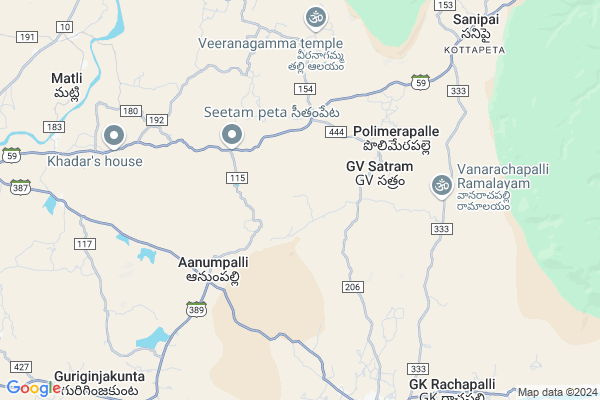
Kothakunta (h.w)
Kothakunta (h.w) Map
EDIT Map
Add Your House
 ..
..
Current Corona Virus Infected Patients Count in Cuddapah District
| City Name | District Name | Total Covid cases |
|---|
Locality Name :
Kothakunta (h.w)
( కోతకుంట (h.w) )
Mandal Name : T.sundupalle
District : Cuddapah
State : Andhra Pradesh
Region : Rayalaseema
Language : Telugu and Urdu
Current Time 01:32 AM
Date: Saturday , May 03,2025 (IST)
Time zone: IST (UTC+5:30)
Elevation / Altitude: 144 meters. Above Seal level
Telephone Code / Std Code: 08567
Assembly constituency : assembly constituency
Assembly MLA : Meda Venkata Mallikarjuna Reddy
Lok Sabha constituency : parliamentary constituency
Parliament MP : P.V.MIDHUN REDDY
Serpanch Name :
Pin Code : 516130
Post Office Name : T. Sundupalli
Main Village Name : Polimerapalle
Commodities Prices : Piler Market / Mandi
Kothakunta (h.w) Live Weather
Temperature: 27.8 °C
broken clouds
Humidity: 69%
Wind : 4.08 mt/sec towards S
StationName : "Rayachoti"
observed on Now
Temperature: 27.8 °C
broken clouds
Humidity: 69%
Wind : 4.08 mt/sec towards S
StationName : "Rayachoti"
observed on Now
Kothakunta (h.w) Weather Forecast for Next 5 days
03-05-2025
27.2°C to 27.2°C
broken clouds
27.2°C to 27.2°C
broken clouds
04-05-2025
26.4°C to 39.7°C
broken clouds, scattered clouds, clear sky, light rain, overcast clouds
26.4°C to 39.7°C
broken clouds, scattered clouds, clear sky, light rain, overcast clouds
05-05-2025
26.6°C to 38.5°C
overcast clouds, broken clouds
26.6°C to 38.5°C
overcast clouds, broken clouds
06-05-2025
26.2°C to 39.9°C
broken clouds, clear sky, few clouds, scattered clouds, overcast clouds
26.2°C to 39.9°C
broken clouds, clear sky, few clouds, scattered clouds, overcast clouds
07-05-2025
27.8°C to 39.9°C
overcast clouds, scattered clouds, broken clouds, light rain
27.8°C to 39.9°C
overcast clouds, scattered clouds, broken clouds, light rain
Rivers Near Kothakunta (h.w)
Papagni :ಪಾಪಾಗ್ನಿ :పాపాగ్ని
Chinneru River
Papagni :ಪಾಪಾಗ್ನಿ :పాపాగ్ని
Chinneru River
About Kothakunta (h.w)
Correct below Info and add more info about Kothakunta (h.w)Kothakunta (h.w) is a small Village/hamlet in T.sundupalle Mandal in Cuddapah District of Andhra Pradesh State, India. It comes under Polimerapalle Panchayath. It belongs to Rayalaseema region . It is located 53 KM towards South from District head quarters Kadapa. 12 KM from T.Sundupalli. 436 KM from State capital Hyderabad
Kothakunta (h.w) Pin code is 516130 and postal head office is T. Sundupalli .
Kothakunta (h.w) is surrounded by Veeraballi Mandal towards North , Rayachoty Mandal towards west , Sambepalle Mandal towards west , Ramapuram Mandal towards North .
Rayachoti , Kadapa , Cuddapah , Madanapalle are the near by Cities to Kothakunta (h.w).
Demographics of Kothakunta (h.w)
Telugu is the Local Language here. Total population of Kothakunta (h.w) is 4320 .Males are 2209 and Females are 2,111 living in 1022 Houses. Total area of Kothakunta (h.w) is 2837 hectares.HOW TO REACH Kothakunta (h.w)
By Road
Cuddapah is the Nearest Town to Kothakunta (h.w). Cuddapah is 61 km from Kothakunta (h.w). Road connectivity is there from Cuddapah to Kothakunta (h.w).By Rail
There is no railway station near to Kothakunta (h.w) in less than 10 km. How ever there are railway Stations from Near By town Cuddapah. are the railway Stations near to Cuddapah. You can reach from Cuddapah to Kothakunta (h.w) by road after .By Bus
Rayachoti APSRTC Bus Station , Kalakada APSRTC Bus Station , Rajampet APSRTC Bus Station are the nearby by Bus Stations to Kothakunta (h.w) .APSRTC runs Number of busses from major cities to here.Colleges near Kothakunta (h.w)
Rani Tirumala Devi College Of Science
Address : Rayavaram, Proddatur, Kadapa Dist.
Schools in Kothakunta (h.w)
Zphs Guntha Racha Pally
Address : polimerapalle , t sundupalli , cuddapah , Andhra Pradesh . PIN- 516130 , Post - T. Sundupalli
Mpups Sarreddy Gari Pally
Address : polimerapalle , t sundupalli , cuddapah , Andhra Pradesh . PIN- 516130 , Post - T. Sundupalli
Govt Health Centers near Kothakunta (h.w)
1) Rajupalem SC , D.NO:1-2 , MAIN ROAD , NEAR AWW CENTER2) Madireddypalli , , Thalamadugu Road , Opp.MPUPSchool
3) SC Chennamukkapalli , 08/1-A , Rajula colony , Near ICDS Offce
Hospitals in Kothakunta (h.w),T.sundupalle
Renukeswara Medical Shop
Rayachoti Rd; T. Sundupalli; Andhra Pradesh 516130; India
9.2 KM distance Detail
more ..
Petrol Bunks in Kothakunta (h.w),T.sundupalle
HP PETROL PUMP - SRI RAJARAJESWARI FILLING STATION
Hpcl Dealers; Rayachoty Road; Tsundupally Village & Mandal Tsundupally; Kadapa; Andhra Pradesh 516130; India
8.6 KM distance Detail
Khwaja Gareebun Nawaz Fuel Station
Rajampeta -T Sundupalli Rd; Rayachoty; Andhra Pradesh 516269; India
10.2 KM distance Detail
more ..
Colleges in Kothakunta (h.w),T.sundupalle
International Merit High School
National Highway 18; Balaji Nagar; Rayachoty; Andhra Pradesh 516269; India
15.9 KM distance Detail
more ..
Schools in Kothakunta (h.w),T.sundupalle
Mopalakunta Govt School
Mopalakunta Seethampeta; Andhra Pradesh 516130; India
2.8 KM distance Detail
Sree Kakatiya Vidhaya Nikeatan
Rajampeta Rd; Akkampalle; Andhra Pradesh 516130; India
9.1 KM distance Detail
Electronic Shops in Kothakunta (h.w),T.sundupalle
Arfath Auto Mobiles Sparparts
Pincha Rd; T. Sundupalli; Andhra Pradesh 516130; India
9.5 KM distance Detail
Local Parks in Kothakunta (h.w),T.sundupalle
Chakradhar park
Rajampeta Rd; T.sundupalli; Upparapalli; Andhra Pradesh 516130; India
7.7 KM distance Detail
RamaKrishna Gardens
Odiveedu Rd; Reddyvaripalli; Matli; Andhra Pradesh 516268; India
9.1 KM distance Detail
Governement Offices near Kothakunta (h.w),T.sundupalle
MeeSeva Center
Sanipaya;Veeraballi YSE Kadapa.; Moram; Andhra Pradesh 516269; India
8.4 KM distance Detail
MeeSeva Center
Opp: Syndicate Bank; 7/2; Pincha Rd; T. Sundupalli; Andhra Pradesh 516130; India
9.5 KM distance Detail
MeeSeva Center
15/96; Rajmoney Point; Rayavaram Road; Near State Bank of India; Maditahdu(V); T Sundupalle(M); Dr.YSR Kadapa(D);516129; Andhra Pradesh 516129; India
10.6 KM distance Detail
About Kothakunta (h.w) &
History
How to reach Kothakunta (h.w)
Tourist Places Near By Kothakunta (h.w)
Schools in Kothakunta (h.w)
Colleges in Kothakunta (h.w)
Temperature & weather of Kothakunta (h.w)
places in Kothakunta (h.w)
Kothakunta (h.w) photos
More Information
How to reach Kothakunta (h.w)
Tourist Places Near By Kothakunta (h.w)
Schools in Kothakunta (h.w)
Colleges in Kothakunta (h.w)
Temperature & weather of Kothakunta (h.w)
places in Kothakunta (h.w)
Kothakunta (h.w) photos
More Information
Village Talk
Post News or Events about this Village
Near Cities
Rayachoti 17 KM near
Kadapa 51 KM near
Cuddapah 51 KM near
Madanapalle 77 KM near
Rayachoti 17 KM near
Kadapa 51 KM near
Cuddapah 51 KM near
Madanapalle 77 KM near
Near By Taluks
T.Sundupalle 11 KM near
Veeraballi 13 KM near
Rayachoty 17 KM near
Sambepalle 19 KM near
T.Sundupalle 11 KM near
Veeraballi 13 KM near
Rayachoty 17 KM near
Sambepalle 19 KM near
Near By Air Ports
Tirupati Airport 94 KM near
Bengaluru International Airport 178 KM near
Chennai Airport 203 KM near
Salem Airport 311 KM near
Tirupati Airport 94 KM near
Bengaluru International Airport 178 KM near
Chennai Airport 203 KM near
Salem Airport 311 KM near
Near By Tourist Places
Kadapa 52 KM near
Horsley Hills 77 KM near
Tirupati 82 KM near
Srikalahasti 104 KM near
Chittoor 106 KM near
Kadapa 52 KM near
Horsley Hills 77 KM near
Tirupati 82 KM near
Srikalahasti 104 KM near
Chittoor 106 KM near
Near By Districts
Cuddapah 51 KM near
Chittoor 107 KM near
Spsr Nellore 139 KM near
Vellore 145 KM near
Cuddapah 51 KM near
Chittoor 107 KM near
Spsr Nellore 139 KM near
Vellore 145 KM near
Near By RailWay Station
Razampeta Rail Way Station 36 KM near
Nandalur Rail Way Station 37 KM near
Razampeta Rail Way Station 36 KM near
Nandalur Rail Way Station 37 KM near