| Home | City Bus | Maps | Villages | Cities | Rail | Tourist Places | School | College | Pin Codes | Corona Cases Count |
| Distance Calculator Bus Services IFSC Codes Trace Mobile Number Weather Search Place Trace IP Available Cash ATM/Banks Locate Polling Booth Report an Error contact People |
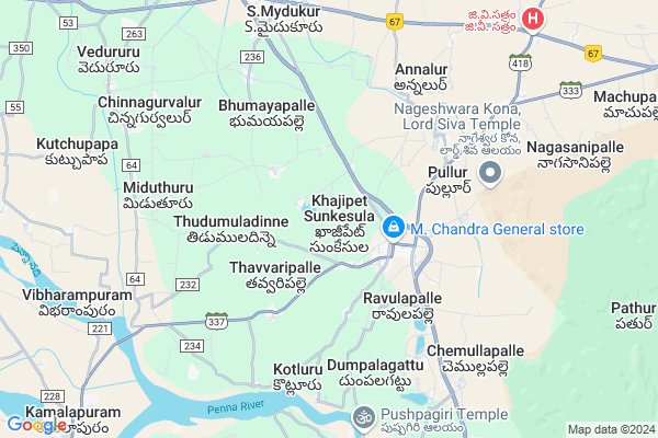
Sunkesula H.w
Sunkesula H.w Map
EDIT Map
Add Your House
 ..
..
Current Corona Virus Infected Patients Count in Cuddapah District
| City Name | District Name | Total Covid cases |
|---|
Locality Name :
Sunkesula H.w
( సుంకేసుల H.w )
Mandal Name : Khajipet
District : Cuddapah
State : Andhra Pradesh
Region : Rayalaseema
Language : Telugu and Urdu
Current Time 10:37 PM
Date: Saturday , May 03,2025 (IST)
Time zone: IST (UTC+5:30)
Elevation / Altitude: 137 meters. Above Seal level
Telephone Code / Std Code: 08563
Assembly constituency : assembly constituency
Assembly MLA : Raghurami Reddy Settipally
Lok Sabha constituency : parliamentary constituency
Parliament MP : Y.S.Avinash Reddy
Serpanch Name :
Pin Code : 516203
Post Office Name : Khajipet
Main Village Name : Khajipet
Alternate Village Name : Sunkesula Madigawada
Commodities Prices : Cuddapah Market / Mandi
National Highways Reachable To Sunkesula H.w
Nationa High Way :NH67
Nationa High Way :NH67
Rivers Near Sunkesula H.w
Sagileru
Sagileru
Sagileru
Sagileru
About Sunkesula H.w
Correct below Info and add more info about Sunkesula H.wSunkesula H.w is a small Village/hamlet in Khajipet Mandal in Cuddapah District of Andhra Pradesh State, India. It comes under Khajipet Panchayath. It belongs to Rayalaseema region . It is located 27 KM towards North from District head quarters Kadapa. 2 KM from Khajipet. 356 KM from State capital Hyderabad
Sunkesula H.w Pin code is 516203 and postal head office is Khajipet .
Sunkesula H.w is surrounded by Mydukur Mandal towards North , Vallur Mandal towards South , Chapadu Mandal towards west , Chennur Mandal towards South .
Yerraguntla , Kadapa , Cuddapah , Proddatur are the near by Cities to Sunkesula H.w.
Demographics of Sunkesula H.w
Telugu is the Local Language here. Total population of Sunkesula H.w is 10831 .Males are 5425 and Females are 5,406 living in 2437 Houses. Total area of Sunkesula H.w is 1622 hectares.HOW TO REACH Sunkesula H.w
By Road
Cuddapah is the Nearest Town to Sunkesula H.w. Cuddapah is 22 km from Sunkesula H.w. Road connectivity is there from Cuddapah to Sunkesula H.w.By Rail
There is no railway station near to Sunkesula H.w in less than 10 km. How ever there are railway Stations from Near By town Cuddapah. are the railway Stations near to Cuddapah. You can reach from Cuddapah to Sunkesula H.w by road after .By Bus
Mydukur APSRTC Bus Station , Vannipenta APSRTC Bus Station , Kadapa APSRTC Bus Station are the nearby by Bus Stations to Sunkesula H.w .APSRTC runs Number of busses from major cities to here.Colleges near Sunkesula H.w
R E S S V Jr College Khajipet
Address : R E S S V Jr College Khajipet
Sri. Yv Nagi Reddy Degree College
Address : D.no.51/107, Kothapeta Rayachoti - 516269, Kadapa
Schools in Sunkesula H.w
Sri Balaji Vidyanikethan High School
Address : MLA STREET,KHAJIPET MAIN ROAD,KADAPA DISTRICT
Govt Health Centers near Sunkesula H.w
1) Sunkesula , 6/160 , K. Sunkesula , Ramalayam Tempul2) Rangapuram , Apr-98 , Appanapalli Road , M.P.P. School
3) Khajipeta , 4/468 4th word Kajipeta , Mydukur Road , Mydukur Road
Petrol Bunks in Sunkesula H.w,Khajipet
HP PETROL PUMP - JAI GURU F/S
Hpcl Dealers Pathur Village ON Cuddapah-kurnool Road; NH 18; Kadapa; Andhra Pradesh 516203; India
4.1 KM distance Detail
more ..
Colleges in Sunkesula H.w,Khajipet
Dr. Ravindhra Reddy Junior College
NH40; Mydukur; Andhra Pradesh 516172; India
7.1 KM distance Detail
more ..
Schools in Sunkesula H.w,Khajipet
Siva Surya High School Mydukur
Khajipet Sunkesula; Andhra Pradesh 516203; India
1.6 KM distance Detail
Governement Offices near Sunkesula H.w,Khajipet
Mpdo Office
కమలాపురం- ఖాజిపేట- మైదుకూరు రహదారి; Khajipet Sunkesula; Andhra Pradesh 516203; India
1.9 KM distance Detail
Govt Ration Shop
Sarvarkhanpet; Khajipet Sunkesula; Andhra Pradesh 516203; India
3.1 KM distance Detail
MeeSeva Center
H No.1-234-C; Beside ZPH School;Gandhi Nagar;Chinnagaruvaluru(V); Chapadu(M); YSR Kadapa; Andhra Pradesh 516355; India
8.3 KM distance Detail
About Sunkesula H.w &
History
How to reach Sunkesula H.w
Tourist Places Near By Sunkesula H.w
Schools in Sunkesula H.w
Colleges in Sunkesula H.w
Temperature & weather of Sunkesula H.w
places in Sunkesula H.w
Sunkesula H.w photos
More Information
How to reach Sunkesula H.w
Tourist Places Near By Sunkesula H.w
Schools in Sunkesula H.w
Colleges in Sunkesula H.w
Temperature & weather of Sunkesula H.w
places in Sunkesula H.w
Sunkesula H.w photos
More Information
Village Talk
Post News or Events about this Village
Near Cities
Yerraguntla 25 KM near
Kadapa 26 KM near
Cuddapah 26 KM near
Proddatur 28 KM near
Yerraguntla 25 KM near
Kadapa 26 KM near
Cuddapah 26 KM near
Proddatur 28 KM near
Near By Taluks
Khajipet 3 KM near
Mydukur 8 KM near
Vallur 12 KM near
Chapadu 13 KM near
Khajipet 3 KM near
Mydukur 8 KM near
Vallur 12 KM near
Chapadu 13 KM near
Near By Air Ports
Tirupati Airport 159 KM near
Bengaluru International Airport 221 KM near
Chennai Airport 269 KM near
Rajiv Gandhi International Airport 323 KM near
Tirupati Airport 159 KM near
Bengaluru International Airport 221 KM near
Chennai Airport 269 KM near
Rajiv Gandhi International Airport 323 KM near
Near By Tourist Places
Kadapa 25 KM near
Puttaparthi 130 KM near
Horsley Hills 132 KM near
Nellore 149 KM near
Tirupati 151 KM near
Kadapa 25 KM near
Puttaparthi 130 KM near
Horsley Hills 132 KM near
Nellore 149 KM near
Tirupati 151 KM near
Near By Districts
Cuddapah 26 KM near
Anantapur 139 KM near
Spsr Nellore 149 KM near
Kurnool 166 KM near
Cuddapah 26 KM near
Anantapur 139 KM near
Spsr Nellore 149 KM near
Kurnool 166 KM near
Near By RailWay Station
Kamalapuram Rail Way Station 13 KM near
Yerraguntla Junction Rail Way Station 25 KM near
Kamalapuram Rail Way Station 13 KM near
Yerraguntla Junction Rail Way Station 25 KM near