| Home | City Bus | Maps | Villages | Cities | Rail | Tourist Places | School | College | Pin Codes | Corona Cases Count |
| Distance Calculator Bus Services IFSC Codes Trace Mobile Number Weather Search Place Trace IP Available Cash ATM/Banks Locate Polling Booth Report an Error contact People |
Division : Rohtak
Head Quarters : Rohtak
Language : Hindi and Punjabi, English
Area: 1668 sq. km
Population : 1058683
Sex Ratio : 868
Density : 607/ sq. km
Literacy : 80.4
Elevation / Altitude: 222 - 221 meters. Above Seal level
Current Time 07:19 PM
Date: Thursday , Jan 01,2026 (IST)
Time zone: IST (UTC+5:30)
District Pin code Index: 124XXX
Vehicle Registration Number: HR-12,HR-15,HR-46
RTO Office: Meham,Rohtak
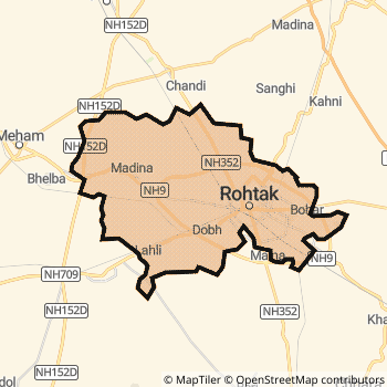
Rohtak District Map
Current Corona Virus Infected Patients Count in Rohtak District
| City Name | District Name | Total Covid cases |
|---|
Rohtak Live Weather
Temperature: 16.6 °C
scattered clouds
Humidity: 56%
Wind : 2.02 mt/sec towards SE
StationName : "Rohtak"
observed on 1 Hours Back
Temperature: 16.6 °C
scattered clouds
Humidity: 56%
Wind : 2.02 mt/sec towards SE
StationName : "Rohtak"
observed on 1 Hours Back
Rohtak Weather Forecast for Next 5 days
02-01-2026
10.8°C to 17.7°C
few clouds, clear sky
10.8°C to 17.7°C
few clouds, clear sky
03-01-2026
9.7°C to 20.9°C
clear sky
9.7°C to 20.9°C
clear sky
04-01-2026
9.5°C to 20.9°C
clear sky
9.5°C to 20.9°C
clear sky
05-01-2026
9.8°C to 21.8°C
clear sky
9.8°C to 21.8°C
clear sky
06-01-2026
9.5°C to 22.7°C
clear sky, few clouds
9.5°C to 22.7°C
clear sky, few clouds
Temples in Rohtak
Historical Daily Max Temperatures (Next 7 Days)
| Years | 01 Jan | 02 Jan | 03 Jan | 04 Jan | 05 Jan | 06 Jan | 07 Jan |
|---|---|---|---|---|---|---|---|
| 2025 | |||||||
| 2024 | |||||||
| 2023 |
About Rohtak District
Rohtak District is one among 21 Districts of Haryana State ,India. Rohtak District Administrative head quarter is Rohtak. It is is Located 235 KM North towards State capital Chandigarh . Rohtak District population is 1058683. It is 14 th Largest District in the State by population.Geography and Climate Rohtak District
It is Located at Latitude-28.9, Longitude-76.5. Rohtak District is sharing border with Bhiwani District to the west , Jhajjar District to the South , Sonipat District to the East . Rohtak District occupies an area of approximately 1668 square kilometres. . Its in the 222 meters to 221 meters elevation range.This District belongs to Hindi Belt India .DemoGraphics of Rohtak District
Hindi is the Local Language here. Also People Speaks Punjabi, English . Rohtak District is divided into 5 Tehsils , 162 Panchayats , 244 Villages. Maham Tehsil is the Smallest Tehsil by population with 181346 population. Rohtak Tehsil is the Biggest Tehsil by population with 758782 population.Census 2011 of Rohtak District
Rohtak district Total population is 1058683 according to census 2011.Males are 566747 and Females are 491936 .Literate people are 700425 among total.Its total area is 1668 sq.km. It is the 14 th largest district in the state by Population . But 14 th Largest District in the state By Area. 425 th Largest District in the Country By Population. 8 th highest District in the State By literacy rate. 163 rd highest District in the Country By literacy rate.its literacy Rate is 80.4Politics in Rohtak District
Independent , BJP , INC are the major political parties in Rohtak District.Assembly constituencies in Rohtak District
Total 4 Assembly constituencies in Rohtak District.| Constituency name | MLA name | Party |
|---|---|---|
| Meham | Balraj Kundu | Independent |
| Garhi Sampla-Kiloi | Bhupinder Singh Hooda | INC |
| Rohtak | Bharat Bhushan Batra | INC |
| Kalanaur | Shakuntala Khatak | INC |
Parliament constituencies in Rohtak District
Total 1 Parliament constituencies in Rohtak District.| Constituency name | MP name | Party |
|---|---|---|
| Rohtak | ARVIND KUMAR SHARMA | Bharatiya Janata Party |
Rohtak District Political Map
Rohtak Commerce
Total Registered Comapnies with Ministry of Corporate Affairs (MCA) in Rohtak are 860Company Name : ADVICS NORTH INDIA PRIVATE LIMITED
Type Of Business : Manufacturing (Machinery & Equipments)
Capital : 104.0 Crores
Company Name : NIPPON CARBIDE INDIA PRIVATE LIMITED
Type Of Business : Business Services
Capital : 73.1 Crores
Company Name : HINDUSTAN HERBALS LIMITED
Type Of Business : Agriculture and Allied Activities
Capital : 29.482 Crores
Company Name : LAKSHMI PRECISION SCREWS LIMITED
Type Of Business : Manufacturing (Machinery & Equipments)
Capital : 10.9417 Crores
More Rohtak Registered Companies
Rohtak District Tourism
Rohtak Transport
Road Transport
District Headquarters Rohtak is well connected by road . Rohtak is about 235 KM by road to Chandigarh( Capital of Haryana )Rail Transport
Some of the rail way stations in district are Rohtak Junction , Sampla , Asthal Bohar Junction , Ismaila Haryana , Kharawar , Asaudah , Rohed Nagar Halt , Kalanaur Kalan .... which connects most of the towns and villages in the District.Bus Transport
Haryana Roadways ( ) runs Busses from Major cities to Towns and Villages in this District.
Pin Codes in Rohtak District
124412
( Kahnaur ) ,
124111
( Madina ) ,
124513
( Nindana ) ,
124113
( Kalanaur (Rohtak)) ,
124411
( Anwal ) ,
124112
( Mehem ) ,
124022
( Mokhra ) ,
124514
( Lakhan Majra ) ,
124021
( Asthal Bohar ) ,
124001
( Rohtak ) ,
124406
( Kansala ) ,
124401
( Bhalaut ) ,
124303
( Sanghi ) ,
124524
( Chiri) ,
124416
( Baliana) ,
more PinCodes
Hotels in Rohtak
BusStops in Rohtak Lakes in Rohtak Temples in Rohtak Shops in Rohtak Rohtak Hospitals Hotel/Restaurants in Rohtak Rohtak RailwayStations Rohtak BusStops ATM in Rohtak
Near Cities
Rohtak 5 KM near
Gohana 30 KM near
Jhajjar 40 KM near
Bahadurgarh 49 KM near
Near By Air Ports
Indira Gandhi International Airport 74 KM near
Muzaffarnagar Airport 134 KM near
Chandigarh Airport 218 KM near
Dehra Dun Airport 234 KM near
Near By Districts
Rohtak 0 KM near
Jhajjar 40 KM near
Sonipat 48 KM near
Bhiwani 51 KM near