| Home | City Bus | Maps | Villages | Cities | Rail | Tourist Places | School | College | Pin Codes | Corona Cases Count |
| Distance Calculator Bus Services IFSC Codes Trace Mobile Number Weather Search Place Trace IP Available Cash ATM/Banks Locate Polling Booth Report an Error contact People |
Division : Mysore
Head Quarters : Mandya
Language : Kannada and Hindi And English
Area: 4961 sq. km
Population : 1808680
Sex Ratio : 989
Density : 365/ sq. km
Literacy : 70.14
Elevation / Altitude: 798 - 641 meters. Above Seal level
Current Time 03:31 PM
Date: Thursday , Jan 01,2026 (IST)
Time zone: IST (UTC+5:30)
District Pin code Index: 571XXX
Vehicle Registration Number: KA-11,KA-54
RTO Office: Mandya,Nagamangala
Tourist Places near Mandya
Srirangapatna (Shrirangapattana) Mysore Shivanasamundram (Shivanasamundra) Bheemeshwari Nanjangud Sravanabelagola
Srirangapatna (Shrirangapattana) Mysore Shivanasamundram (Shivanasamundra) Bheemeshwari Nanjangud Sravanabelagola
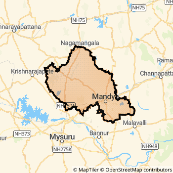
Mandya District Map
Current Corona Virus Infected Patients Count in Mandya District
| City Name | District Name | Total Covid cases |
|---|---|---|
| Mandya District | Mandya | 3 |
Mandya Live Weather
Temperature: 28.6 °C
overcast clouds
Humidity: 46%
Wind : 2.12 mt/sec towards E
StationName : "Mandya"
observed on 2 Hours Back
Temperature: 28.6 °C
overcast clouds
Humidity: 46%
Wind : 2.12 mt/sec towards E
StationName : "Mandya"
observed on 2 Hours Back
Mandya Weather Forecast for Next 5 days
02-01-2026
20.5°C to 29.1°C
overcast clouds, light rain
20.5°C to 29.1°C
overcast clouds, light rain
03-01-2026
19.7°C to 29.4°C
light rain, overcast clouds
19.7°C to 29.4°C
light rain, overcast clouds
04-01-2026
19.2°C to 29.0°C
light rain, broken clouds, few clouds, scattered clouds, overcast clouds
19.2°C to 29.0°C
light rain, broken clouds, few clouds, scattered clouds, overcast clouds
05-01-2026
17.6°C to 29.1°C
overcast clouds, scattered clouds, few clouds, clear sky
17.6°C to 29.1°C
overcast clouds, scattered clouds, few clouds, clear sky
06-01-2026
16.0°C to 27.9°C
scattered clouds, broken clouds
16.0°C to 27.9°C
scattered clouds, broken clouds
Historical Daily Max Temperatures (Next 7 Days)
| Years | 01 Jan | 02 Jan | 03 Jan | 04 Jan | 05 Jan | 06 Jan | 07 Jan |
|---|---|---|---|---|---|---|---|
| 2025 | |||||||
| 2024 | |||||||
| 2023 |
About Mandya District
Mandya District is one among 30 Districts of Karnataka State ,India. Mandya District Administrative head quarter is Mandya. It is is Located 105 KM East towards State capital Bangalore . Mandya District population is 1808680. It is 13 th Largest District in the State by population.Geography and Climate Mandya District
It is Located at Latitude-12.5, Longitude-76.8. Mandya District is sharing border with Hassan District to the west , Mysore District to the west , Ramanagara District to the East , Tumkur District to the North . Mandya District occupies an area of approximately 4961 square kilometres. . Its in the 798 meters to 641 meters elevation range.This District belongs to Southern India .DemoGraphics of Mandya District
Kannada is the Local Language here. Also People Speaks Hindi And English . Mandya District is divided into 7 Taluks , 205 Panchayats , 1964 Villages. Shrirangapattana Taluk is the Smallest Taluk by population with 162984 population. Mandya Taluk is the Biggest Taluk by population with 405612 population.Major producing Items,Crops,Industries and Exports from Mandya District
Addy, Agr.Products, Agri.Products, Banana, BatteryItems, Bricks, BuildingStone, BullockCart, Cashewnut, CayarIndrustri, Cloths, Cococnut, Coconut, CoconutCopra, CoconutOil, CoconutOit, Cocoon, Cocoons are the major producing Items and Exports from here.Census 2011 of Mandya District
Mandya district Total population is 1808680 according to census 2011.Males are 909341 and Females are 899339 .Literate people are 1196623 among total.Its total area is 4961 sq.km. It is the 13 th largest district in the state by Population . But 16 th Largest District in the state By Area. 262 nd Largest District in the Country By Population. 20 th highest District in the State By literacy rate. 388 th highest District in the Country By literacy rate.its literacy Rate is 70.14Politics in Mandya District
Independent , JD(S) , Janata Dal (Secular) (JD(S)) , INC are the major political parties in Mandya District.Assembly constituencies in Mandya District
Total 7 Assembly constituencies in Mandya District.| Constituency name | MLA name | Party |
|---|---|---|
| Malavalli | P.M.Narendraswamy | Janata Dal (Secular) (JD(S)) |
| Maddur | Udaya.K.M | Janata Dal (Secular) (JD(S)) |
| Melukote | Dharshan Puttannaiah | Janata Dal (Secular) (JD(S)) |
| Mandya | Ravikumar Gowda (GANIGA) | Janata Dal (Secular) (JD(S)) |
| Srirangapatna | A.B. Ramesha Bandisiddegowda | Janata Dal (Secular) (JD(S)) |
| Nagamangala | N. Chaluvarayaswamy | Janata Dal (Secular) (JD(S)) |
Parliament constituencies in Mandya District
Total 1 Parliament constituencies in Mandya District.| Constituency name | MP name | Party |
|---|---|---|
| Mandya | SUMALATHA AMBAREESH | Independent |
Mandya District Political Map
Mandya Commerce
Total Registered Comapnies with Ministry of Corporate Affairs (MCA) in Mandya are 152Company Name : RANGSONS SCHUSTER TECHNOLOGIES PRIVATE LIMITED
Type Of Business : Manufacturing (Machinery & Equipments)
Capital : 7.51 Crores
Company Name : MODULUS INFRA INDIA PRIVATE LIMITED
Type Of Business : Manufacturing (Metals & Chemicals, and products thereof)
Capital : 4.5 Crores
Company Name : AMBLEE HOTELS LIMITED
Type Of Business : Trading
Capital : 4.0 Crores
Company Name : SRI PANCHAMUKHI NUTRIENTS PRIVATE LIMITED
Type Of Business : Manufacturing (Food stuffs)
Capital : 3.2 Crores
More Mandya Registered Companies
Mandya District Tourism
Bheemeshwari , Shivanasamundram , Srirangapatna , Cauvery Fishing , Doddamakkali Nature Camp , Kokrebellur Pelicanry , Barachukki and Gaganachukki Falls Ranganatha Swamy Temple , Venkataramana Temple , Jumma Masjid , are the Tourist destinations to Visit.
Temples in Mandya District
Cheluvanarayana Swamy Temple, , Melkote are the famous temple in Mandya DistrictMandya Transport
Road Transport
District Headquarters Mandya is well connected by road . Maddur , Malavalli , Mandya , Shrirangapattana are the Cities in this district having road connectivity to major towns and remote villages. Mandya is about 105 KM by road to Bangalore( Capital of Karnataka )Rail Transport
Some of the rail way stations in district are Mysuru Junction , Mandya , Maddur , Pandavapura , Shrirangapattana , Chamarajapuram , Ashokapuram , Mandagere .... which connects most of the towns and villages in the District.Bus Transport
Karnataka State Road Transport Corporation ( KSRTC) runs Busses from Major cities to Towns and Villages in this District.
Pin Codes in Mandya District
571446
( Keragodu ) ,
571424
( Kiragavalu ) ,
571426
( Krishnarajapete ) ,
571437
( Sivasamudram ) ,
571455
( Chinakurali ) ,
571606
( Belagola ) ,
571423
( Kikkeri ) ,
571477
( Ganjam ) ,
571422
( Bharathinagar ) ,
571436
( Santhebachahalli ) ,
571448
( Balagangadaranathnagar ) ,
571605
( Akkihebbal ) ,
571405
( V C Farm ) ,
571403
( Guthal Colony ) ,
571478
( Kottatti ) ,
571430
( Malavalli ) ,
571402
( Sugar Town ) ,
571476
( Kestur ) ,
571450
( Keelara ) ,
571463
( Purigali ) ,
more PinCodes
Hotels in Mandya
The Cute
Bommuru Agrahara rd; Srirangapatna-KRS rd; Palahalli; Karnataka; Pin code- 571438
Mysore
Price Range : Rs. 2600 - Rs. 3600
Sandesh The Prince
No.3, Nazarabad MN RD, Nazarbad, Mysore - 570010
Mysore
Contact No: (91)-(821)-2436777, (91)-9008799999
Price Range : Rs. 5000 - Rs. 13100
Ginger Hotel
Nazarbad Police Station, Opposite To Vasant Mahal, Vasant Mahal Road, Nazarbad, Mysore - 570010
Mysore
Contact No: (91)-(821)-6633333
Price Range : Rs. 2200 - Rs. 2200
Sri Keerthi Comforts
1190/1; Opp: Mysore Zoo; Indiranagar; Mysore; Karnataka; Pin code- 570010
Mysore
Price Range : Rs. 750 - Rs. 750
BusStops in Mandya Lakes in Mandya Temples in Mandya Shops in Mandya Mandya Hospitals Hotel/Restaurants in Mandya Mandya RailwayStations Mandya BusStops ATM in Mandya
Tourist Places Around Mandya
Near Cities
Mandya 0 KM near
Maddur 19 KM near
Malavalli 28 KM near
Shrirangapattana 29 KM near
Near By Air Ports
Mysore Airport 41 KM near
Bengaluru International Airport 128 KM near
Peelamedu Airport 187 KM near
Salem Airport 189 KM near
Near By Districts
Mandya 0 KM near
Mysore 40 KM near
Ramanagara 52 KM near
Chamarajanagar 73 KM near