| Home | City Bus | Maps | Villages | Cities | Rail | Tourist Places | School | College | Pin Codes | Corona Cases Count |
| Distance Calculator Bus Services IFSC Codes Trace Mobile Number Weather Search Place Trace IP Available Cash ATM/Banks Locate Polling Booth Report an Error contact People |
Lower Subansiri District.
Currently In:
India >>
Arunachal Pradesh
Head Quarters : Ziro
Language : Apatani and Nyishi, Assamese, Hindi & English.
Area: 10135 sq. km
Population : 82839
Sex Ratio : 975
Density : 24/ sq. km
Literacy : 76.33
Elevation / Altitude: - meters. Above Seal level
Current Time 07:50 AM
Date: Friday , Jan 02,2026 (IST)
Time zone: IST (UTC+5:30)
District Pin code Index: 791XXX
Vehicle Registration Number: AR-06
RTO Office: Ziro
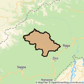
Lower Subansiri District Map
Current Corona Virus Infected Patients Count in Lower Subansiri District
| City Name | District Name | Total Covid cases |
|---|
Lower Subansiri Live Weather
Temperature: 8.2 °C
clear sky
Humidity: 69%
Wind : 1.85 mt/sec towards N
StationName : "Ziro"
observed on Now
Temperature: 8.2 °C
clear sky
Humidity: 69%
Wind : 1.85 mt/sec towards N
StationName : "Ziro"
observed on Now
Lower Subansiri Weather Forecast for Next 5 days
03-01-2026
2.3°C to 15.6°C
clear sky, broken clouds
2.3°C to 15.6°C
clear sky, broken clouds
04-01-2026
1.9°C to 14.7°C
clear sky, light rain, broken clouds, few clouds
1.9°C to 14.7°C
clear sky, light rain, broken clouds, few clouds
05-01-2026
1.4°C to 14.4°C
few clouds, clear sky, broken clouds, scattered clouds
1.4°C to 14.4°C
few clouds, clear sky, broken clouds, scattered clouds
06-01-2026
0.9°C to 14.4°C
clear sky, few clouds
0.9°C to 14.4°C
clear sky, few clouds
07-01-2026
0.9°C to 13.0°C
clear sky, few clouds, light rain, broken clouds
0.9°C to 13.0°C
clear sky, few clouds, light rain, broken clouds
Temples in Lower Subansiri
Historical Daily Max Temperatures (Next 7 Days)
| Years | 01 Jan | 02 Jan | 03 Jan | 04 Jan | 05 Jan | 06 Jan | 07 Jan |
|---|---|---|---|---|---|---|---|
| 2025 | |||||||
| 2024 | |||||||
| 2023 |
About Lower Subansiri District
Lower Subansiri District is one among 16 Districts of Arunachal Pradesh State ,India. Lower Subansiri District Administrative head quarter is Ziro. It is is Located 58 KM South towards State capital Itanagar . Lower Subansiri District population is 82839. It is 10 th Largest District in the State by population.Geography and Climate Lower Subansiri District
It is Located at Latitude-27.5, Longitude-93.8. Lower Subansiri District is sharing border with Kurung Kumey District to the west , Papum Pare District to the South , Upper Subansiri District to the North . Lower Subansiri District occupies an area of approximately 10135 square kilometres. . Its in the meters to meters elevation range.This District belongs to Eastern India .DemoGraphics of Lower Subansiri District
Apatani is the Local Language here. Also People Speaks Nyishi, Assamese, Hindi & English. . Lower Subansiri District is divided into 15 Tehsils , 58 Panchayats , 203 Villages. Dollumukh Taming Tehsil is the Smallest Tehsil by population with 1080 population. Ziro Tehsil is the Biggest Tehsil by population with 24703 population.Census 2011 of Lower Subansiri District
Lower Subansiri district Total population is 82839 according to census 2011.Males are 41944 and Females are 40895 .Literate people are 54806 among total.Its total area is 10135 sq.km. It is the 10 th largest district in the state by Population . But 1 st Largest District in the state By Area. 605 th Largest District in the Country By Population. 2 nd highest District in the State By literacy rate. 239 th highest District in the Country By literacy rate.its literacy Rate is 76.33Politics in Lower Subansiri District
N.A , Bharatiya Janata Party , National People s Party , AITC , NCP , INC are the major political parties in Lower Subansiri District.Assembly constituencies in Lower Subansiri District
Total 3 Assembly constituencies in Lower Subansiri District.| Constituency name | MLA name | Party |
|---|---|---|
| Yachuli | TABA TEDIR | Bharatiya Janata Party |
| Ziro Hapoli | TAGE TAKI | Bharatiya Janata Party |
| Raga | Tarin Dakpe | National People s Party |
Parliament constituencies in Lower Subansiri District
Lower Subansiri District Political Map
Lower Subansiri Commerce
Total Registered Comapnies with Ministry of Corporate Affairs (MCA) in Lower Subansiri are 9Company Name : NANA KOO AGRO PVT LTD
Type Of Business : Business Services
Capital : 51.6 Lakhs
Company Name : GODAK ENGINEERING & CONSTRUCTIONS PRIVATE LIMITED
Type Of Business : Construction
Capital : 2.0 Lakhs
Company Name : LEMELEN CONSTRUCTIONS PRIVATE LIMITED
Type Of Business : Construction
Capital : 2.0 Lakhs
Company Name : HENKAKO TECHNOLOGIES PRIVATE LIMITED
Type Of Business : Trading
Capital : 1.0 Lakhs
More Lower Subansiri Registered Companies
Lower Subansiri District Tourism
Ziro , are the Tourist destinations to Visit.
Lower Subansiri Transport
Road Transport
District Headquarters Ziro is well connected by road . Ziro is about 58 KM by road to Itanagar( Capital of Arunachal Pradesh )Rail Transport
Bus Transport
Arunachal pradesh state transport services ( APSTS) runs Busses from Major cities to Towns and Villages in this District.
Pin Codes in Lower Subansiri District
791120
( Ziro ) ,
791119
( Ranga Nadi Project ) ,
more PinCodes
Hotels in Lower Subansiri
Oshin, Hotel
Tezu; Arunachal Pradesh; Pin code- 791110
Arunachal Pradesh
Price Range : Rs. 400 - Rs. 500
Arunachal Hotel
Super Market, Naharlagun, Itanagar - 791110, India
Itanagar
Contact No: 0360 - 2244960
Price Range : Rs. 800 - Rs. 1100
Laxmi Hotel
C-Sector, Naharlagun, Itanagar - 791110, India
Itanagar
Contact No: 0360 - 2244111
Price Range : Rs. 400 - Rs. 600
Rajdhan Hotel
Varapani Bazaar, Naharlagun, Itanagar - 791110, India
Itanagar
Contact No: 0360 - 2244400
Price Range : Rs. 600 - Rs. 800
BusStops in Lower Subansiri Lakes in Lower Subansiri Temples in Lower Subansiri Shops in Lower Subansiri Lower Subansiri Hospitals Hotel/Restaurants in Lower Subansiri Lower Subansiri RailwayStations Lower Subansiri BusStops ATM in Lower Subansiri
Near Cities
Naharlagun 54 KM near
Itanagar 60 KM near
Silapathar 99 KM near
Jorhat 107 KM near
Near By Air Ports
Lilabari Airport 43 KM near
Rowriah Airport 108 KM near
Chabua Airport 133 KM near
Salonibari Airport 152 KM near
Near By Districts
Lower Subansiri 0 KM near
Papum Pare 31 KM near
Lakhimpur 49 KM near
Kurung Kumey 59 KM near