| Home | City Bus | Maps | Villages | Cities | Rail | Tourist Places | School | College | Pin Codes | Corona Cases Count |
| Distance Calculator Bus Services IFSC Codes Trace Mobile Number Weather Search Place Trace IP Available Cash ATM/Banks Locate Polling Booth Report an Error contact People |
Division : Munger
Head Quarters : Jamui
Language : Maithili and Hindi, Urdu
Area: 3122 sq. km
Population : 1756078
Sex Ratio : 921
Density : 567/ sq. km
Literacy : 62.16
Elevation / Altitude: 81 - 106 meters. Above Seal level
Current Time 09:27 AM
Date: Tuesday , Jan 06,2026 (IST)
Time zone: IST (UTC+5:30)
District Pin code Index: 811XXX
Vehicle Registration Number: BR-46
RTO Office: Jamui
Tourist Places near Jamui
Munger Deoghar (Baba Dham) Kakolat Bihar Sharif (Bihar Sri) Nalanda Giridh
Munger Deoghar (Baba Dham) Kakolat Bihar Sharif (Bihar Sri) Nalanda Giridh
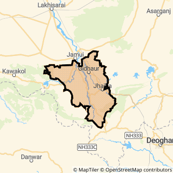
Jamui District Map
Current Corona Virus Infected Patients Count in Jamui District
| City Name | District Name | Total Covid cases |
|---|
Temples in Jamui
Historical Daily Min/Max Temperatures (Next 7 Days)
| Years | 05 Jan | 06 Jan | 07 Jan | 08 Jan | 09 Jan | 10 Jan | 11 Jan |
|---|---|---|---|---|---|---|---|
| 2025 | 22.0°C/ 13.0°C | 25.0°C/ 14.0°C | |||||
| 2024 | 24.0°C/ 12.0°C | 23.0°C/ 9.0°C | |||||
| 2023 | 23.0°C/ 9.0°C | 23.0°C/ 9.0°C |
About Jamui District
Jamui District is one among 38 Districts of Bihar State ,India. Jamui District Administrative head quarter is Jamui. It is is Located 157 KM west towards State capital Patna . Jamui District population is 1756078. It is 28 th Largest District in the State by population.Geography and Climate Jamui District
It is Located at Latitude-24.9, Longitude-86.2. Jamui District is sharing border with Lakhisarai District to the North , Nawada District to the west , Giridih District to the South . It is sharing Border with Jharkhand State to the South . Jamui District occupies an area of approximately 3122 square kilometres. . Its in the 81 meters to 106 meters elevation range.This District belongs to Hindi Belt India .DemoGraphics of Jamui District
Maithili is the Local Language here. Also People Speaks Hindi, Urdu . Jamui District is divided into 10 Blocks , 136 Panchayats , 1182 Villages. Gidhor Block is the Smallest Block by population with 60670 population. Jhajha Block is the Biggest Block by population with 215551 population.Major producing Items,Crops,Industries and Exports from Jamui District
Basket, Carpet, LeafPlate, Pottery, Rice, TobaccoLeaves, Treacle are the major producing Items and Exports from here.Census 2011 of Jamui District
Jamui district Total population is 1756078 according to census 2011.Males are 914148 and Females are 841930 .Literate people are 1161821 among total.Its total area is 3122 sq.km. It is the 28 th largest district in the state by Population . But 12 th Largest District in the state By Area. 271 st Largest District in the Country By Population. 22 nd highest District in the State By literacy rate. 537 th highest District in the Country By literacy rate.its literacy Rate is 62.16Politics in Jamui District
JD(U) , LJP , BJP , Lok Jan Shakti Party , JMM , Janata Dal (United) , RJD , INC are the major political parties in Jamui District.Assembly constituencies in Jamui District
Total 5 Assembly constituencies in Jamui District.| Constituency name | MLA name | Party |
|---|---|---|
| Belhar | Manoj Yadav | JD(U) |
| Sikandra | Prafull Kumar Manjhi | JD(U) |
| Jamui | Shreyasi Singh | JD(U) |
| Jhajha | Damodar Rawat | JD(U) |
| Chakai | Sumit Kumar Singh | JMM |
Parliament constituencies in Jamui District
Total 2 Parliament constituencies in Jamui District.| Constituency name | MP name | Party |
|---|---|---|
| Banka | GIRIDHARI YADAV | Janata Dal (United) |
| Jamui | CHIRAG KUMAR PASWAN | Lok Jan Shakti Party |
Jamui District Political Map
Jamui Commerce
Total Registered Comapnies with Ministry of Corporate Affairs (MCA) in Jamui are 111Company Name : AMRITESH AGRO PRODUCTS PRIVATE LIMITED
Type Of Business : Manufacturing (Food stuffs)
Capital : 5.0 Crores
Company Name : SAI SHIV CONSTRUCTION PRIVATE LIMITED
Type Of Business : Construction
Capital : 91.141 Lakhs
Company Name : AMRENDRA KUMAR ATRI INFRASTRUCTURE PRIVATE LIMITED
Type Of Business : Construction
Capital : 75.0 Lakhs
Company Name : KNR SUBH LAXMI PRIVATE LIMITED
Type Of Business : Trading
Capital : 50.0 Lakhs
More Jamui Registered Companies
Jamui District Tourism
Jamui Transport
Road Transport
District Headquarters Jamui is well connected by road . Jamui , Jhajha are the Cities in this district having road connectivity to major towns and remote villages. Jamui is about 157 KM by road to Patna( Capital of Bihar )Rail Transport
Some of the rail way stations in district are Jhajha , Jamui , Gidhaur , Chaura , Dadpur , Narganjo Halt .... which connects most of the towns and villages in the District.Bus Transport
Bihar State Road Transportation Corporation ( BSTDC) runs Busses from Major cities to Towns and Villages in this District.
Pin Codes in Jamui District
811314
( Sono ) ,
811313
( Mallehpur ) ,
811301
( Aliganj (Jamui)) ,
811308
( Jhajha ) ,
811307
( Jamui ) ,
811317
( Khaira (Jamui)) ,
811312
( Laxmipur (Jamui) ) ,
811305
( Gidhaur ) ,
811303
( Chakai ) ,
811315
( Sikandra (Jamui)) ,
811316
( Simultala ) ,
more PinCodes
Hotels in Jamui
BusStops in Jamui Lakes in Jamui Temples in Jamui Shops in Jamui Jamui Hospitals Hotel/Restaurants in Jamui Jamui RailwayStations Jamui BusStops ATM in Jamui
Near Cities
Jamui 0 KM near
Jhajha 24 KM near
Lakhisarai 33 KM near
Kharagpur 45 KM near
Near By Air Ports
Gaya Airport 146 KM near
Patna Airport 153 KM near
Ranchi Airport 224 KM near
Bagdogra Airport 321 KM near
Near By Districts
Jamui 0 KM near
Lakhisarai 35 KM near
Sheikhpura 50 KM near
Munger 62 KM near