| Home | City Bus | Maps | Villages | Cities | Rail | Tourist Places | School | College | Pin Codes | Corona Cases Count |
| Distance Calculator Bus Services IFSC Codes Trace Mobile Number Weather Search Place Trace IP Available Cash ATM/Banks Locate Polling Booth Report an Error contact People |
Division : Magadh
Head Quarters : Gaya
Language : Maithili and Hindi, Urdu, English
Area: 4976 sq. km
Population : 4379383
Sex Ratio : 932
Density : 880/ sq. km
Literacy : 66.35
Elevation / Altitude: 93 - 102 meters. Above Seal level
Current Time 01:21 PM
Date: Thursday , Jan 01,2026 (IST)
Time zone: IST (UTC+5:30)
District Pin code Index: 804XXX,805XXX,823XXX,824XXX
Vehicle Registration Number: BR-02
RTO Office: Gaya
Municipalities in Gaya
Bodh_Gaya
Bodh_Gaya
Tourist Places near Gaya
Bodh Gaya (Bodhgaya) Kakolat Chatra (Atavika) Koderma Jhumri telaiya Bihar Sharif (Bihar Sri)
Bodh Gaya (Bodhgaya) Kakolat Chatra (Atavika) Koderma Jhumri telaiya Bihar Sharif (Bihar Sri)
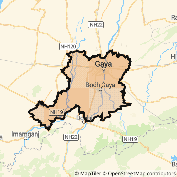
Gaya District Map
Current Corona Virus Infected Patients Count in Gaya District
| City Name | District Name | Total Covid cases |
|---|
Gaya Live Weather
Temperature: 18.0 °C
haze
Humidity: 63%
Wind : 0 mt/sec towards N
StationName : "Gaya"
observed on 1 Hours Back
Temperature: 18.0 °C
haze
Humidity: 63%
Wind : 0 mt/sec towards N
StationName : "Gaya"
observed on 1 Hours Back
Gaya Weather Forecast for Next 5 days
02-01-2026
11.9°C to 23.3°C
clear sky
11.9°C to 23.3°C
clear sky
03-01-2026
11.2°C to 24.2°C
clear sky, few clouds
11.2°C to 24.2°C
clear sky, few clouds
04-01-2026
10.7°C to 24.4°C
clear sky
10.7°C to 24.4°C
clear sky
05-01-2026
11.5°C to 24.5°C
clear sky
11.5°C to 24.5°C
clear sky
06-01-2026
10.2°C to 23.4°C
clear sky
10.2°C to 23.4°C
clear sky
Historical Daily Max Temperatures (Next 7 Days)
| Years | 01 Jan | 02 Jan | 03 Jan | 04 Jan | 05 Jan | 06 Jan | 07 Jan |
|---|---|---|---|---|---|---|---|
| 2025 | |||||||
| 2024 | |||||||
| 2023 |
About Gaya District
Gaya District is one among 38 Districts of Bihar State ,India. Gaya District Administrative head quarter is Gaya. It is is Located 107 KM North towards State capital Patna . Gaya District population is 4379383. It is 5 th Largest District in the State by population.Geography and Climate Gaya District
It is Located at Latitude-24.7, Longitude-84.9. Gaya District is sharing border with Aurangabad District to the west , Nalanda District to the East , Nawada District to the East , Chatra District to the South , Hazaribagh District to the South . It is sharing Border with Jharkhand State to the South . Gaya District occupies an area of approximately 4976 square kilometres. . Its in the 93 meters to 102 meters elevation range.This District belongs to Hindi Belt India .DemoGraphics of Gaya District
Maithili is the Local Language here. Also People Speaks Hindi, Urdu, English . Gaya District is divided into 24 Blocks , 336 Panchayats , 2068 Villages. Atri Block is the Smallest Block by population with 65360 population. Gaya Block is the Biggest Block by population with 528033 population.Major producing Items,Crops,Industries and Exports from Gaya District
Agarbatti, Basket, Bindi, Biri, Brick, Bucket, Cauldron, Crockery, Dhoop, Flour, Furture, Ghee, Gur, LeafPlate, Mawa, MunjRope, PanPatta, Popcorn, StoneGoods, StoneStatue, Tilkut are the major producing Items and Exports from here.Census 2011 of Gaya District
Gaya district Total population is 4379383 according to census 2011.Males are 2266761 and Females are 2112622 .Literate people are 2897400 among total.Its total area is 4976 sq.km. It is the 5 th largest district in the state by Population . But 3 rd Largest District in the state By Area. 42 nd Largest District in the Country By Population. 15 th highest District in the State By literacy rate. 464 th highest District in the Country By literacy rate.its literacy Rate is 66.35Politics in Gaya District
JD(U) , LJP , Bharatiya Janata Party , BJP , Janata Dal (United) , RJD , INC are the major political parties in Gaya District.Assembly constituencies in Gaya District
Total 10 Assembly constituencies in Gaya District.| Constituency name | MLA name | Party |
|---|---|---|
| Islampur | Rakesh Kumar Roushan | JD(U) |
| Gurua | Vinay Kumar | BJP |
| Sherghati | Manju Agrawal | JD(U) |
| Imamganj | Jitan Ram Manjhi | JD(U) |
| Bodh Gaya | Kumar Sarvjeet | BJP |
| Gaya Town | Prem Kumar | BJP |
Parliament constituencies in Gaya District
Total 4 Parliament constituencies in Gaya District.| Constituency name | MP name | Party |
|---|---|---|
| Aurangabad | SUSHIL KUMAR SINGH | Bharatiya Janata Party |
| Gaya | Vijay Kumar | Janata Dal (United) |
| Jahanabad | CHANDESHWAR PRASAD | Janata Dal (United) |
| Nalanda | Kaushlendra Kumar | Janata Dal (United) |
Gaya District Political Map
Gaya Commerce
Total Registered Comapnies with Ministry of Corporate Affairs (MCA) in Gaya are 745Company Name : RAMNANDI HOTEL AND RESORTS LIMITED
Type Of Business : Trading
Capital : 15.45 Crores
Company Name : PAREENA MOTORS PRIVATE LIMITED
Type Of Business : Manufacturing (Machinery & Equipments)
Capital : 10.0 Crores
Company Name : RAMNANDI AUTOMOBILES PRIVATE LIMITED
Type Of Business : Trading
Capital : 4.802 Crores
Company Name : DAYA OGDEN POWER GENERATION (INDIA) PRIVATE LIMITED
Type Of Business : Electricity, Gas & Water companies
Capital : 4.1707 Crores
More Gaya Registered Companies
Gaya District Tourism
Bodh Gaya , Great Buddha Statue , Archaeological Society of India Museum , Muchalinda Lake , Ajapala Nigrodha Tree , Animesh Lochana Chaitya , Mahabodhi temple , Dungeswari Hills , are the Tourist destinations to Visit.
Temples in Gaya District
Vishnupad Temple , Mangalagauri Temple , Bodh Gaya , The Kurkihar Temple are the famous temple in Gaya DistrictGaya Transport
Road Transport
District Headquarters Gaya is well connected by road . Gaya , Bodh Gaya , Sherghati are the Cities in this district having road connectivity to major towns and remote villages. Gaya is about 107 KM by road to Patna( Capital of Bihar )Rail Transport
Some of the rail way stations in district are Gaya Junction , Bela , Guraru , Chakand , Manpur Junction , Wazerganj , Paharpur , Karjara .... which connects most of the towns and villages in the District.Bus Transport
Bihar State Road Transportation Corporation ( BSTDC) runs Busses from Major cities to Towns and Villages in this District.
Pin Codes in Gaya District
823001
( Gaya ) ,
804402
( Baidrabad ) ,
804428
( Usari ) ,
824231
( Bodhgaya ) ,
824209
( Paraiya ) ,
804430
( K.Bhupat ) ,
805135
( Ayer ) ,
824210
( Raniganj (Gaya)) ,
805236
( Jethian ) ,
804403
( Belaganj ) ,
824201
( Barachatti ) ,
824205
( Gurua ) ,
824232
( Fatehpur (Gaya)) ,
824233
( Khizersarai ) ,
824236
( Tekari ) ,
823004
( Civil Aerodram ) ,
804423
( Nagla Kinger ) ,
824234
( Magadh University ) ,
824235
( Mow ) ,
823003
( Durga Asthan ) ,
more PinCodes
Hotels in Gaya
Lotus Nikko Hotel
Near Museum Bodh Gaya - 824231, India
Bodhgaya
Contact No: 0631 - 2200700/ 789 / 9091 / 92
Email: lotus.nikko.hotels@vsnl.net
Price Range : Rs. 3000 - Rs. 4500
BSTDC Tourist Complex
Near Maha Bodhi Temple Bodh Gaya - 824231, India
Bodhgaya
Contact No: 0631 - 2200445
Price Range : Rs. 600 - Rs. 900
Mahamaya, Hotel
Near Main Temple Bodh Gaya - 824231, India
Bodhgaya
Contact No: 0631 - 2200121
Price Range : Rs. 1800 - Rs. 1800
Tathagat International, Hotel
Near Maha Bodhi Temple Bodh Gaya - 824231, India
Bodhgaya
Contact No: 0631 2200106/3201567
Email: swagat@hoteltathagatbodhgaya.net, hoteltathagatbodhgaya@yahoo.com
Price Range : Rs. 3600 - Rs. 5600
BusStops in Gaya Lakes in Gaya Temples in Gaya Shops in Gaya Gaya Hospitals Hotel/Restaurants in Gaya Gaya RailwayStations Gaya BusStops ATM in Gaya
Near Cities
Gaya 1 KM near
Bodh Gaya 11 KM near
Makhdumpur 35 KM near
Sherghati 36 KM near
Near By Air Ports
Gaya Airport 7 KM near
Patna Airport 100 KM near
Ranchi Airport 187 KM near
Varanasi Airport 254 KM near
Near By Districts
Gaya 0 KM near
Jehanabad 51 KM near
Nawada 62 KM near
Arwal 67 KM near