| Home | City Bus | Maps | Villages | Cities | Rail | Tourist Places | School | College | Pin Codes | Corona Cases Count |
| Distance Calculator Bus Services IFSC Codes Trace Mobile Number Weather Search Place Trace IP Available Cash ATM/Banks Locate Polling Booth Report an Error contact People |
Chandauli District.
Currently In:
India >>
Uttar Pradesh
Division : Varanasi
Head Quarters : Chandauli
Language : Hindi and Urdu
Area: 2484.70 sq. km
Population : 1952713
Sex Ratio : 913
Density : 768/ sq. km
Literacy : 73.86
Elevation / Altitude: 80 - 305 meters. Above Seal level
Current Time 10:56 AM
Date: Friday , Jan 02,2026 (IST)
Time zone: IST (UTC+5:30)
District Pin code Index: 221XXX,232XXX
Vehicle Registration Number: UP-67
RTO Office: Chandauli
Tourist Places near Chandauli
Sarnath (Mrigadava) Varanasi (Benares) Vindhyachal Jaunpur Sasaram Rohtasgarh Fort
Sarnath (Mrigadava) Varanasi (Benares) Vindhyachal Jaunpur Sasaram Rohtasgarh Fort
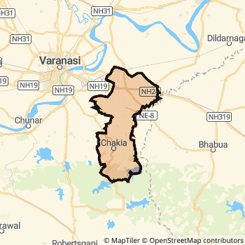
Chandauli District Map
Current Corona Virus Infected Patients Count in Chandauli District
| City Name | District Name | Total Covid cases |
|---|
Chandauli Live Weather
Temperature: 19.4 °C
clear sky
Humidity: 38%
Wind : 2.75 mt/sec towards W
StationName : "Chandauli"
observed on Now
Temperature: 19.4 °C
clear sky
Humidity: 38%
Wind : 2.75 mt/sec towards W
StationName : "Chandauli"
observed on Now
Chandauli Weather Forecast for Next 5 days
03-01-2026
12.0°C to 23.4°C
clear sky
12.0°C to 23.4°C
clear sky
04-01-2026
11.4°C to 24.1°C
clear sky
11.4°C to 24.1°C
clear sky
05-01-2026
11.0°C to 23.2°C
clear sky
11.0°C to 23.2°C
clear sky
06-01-2026
9.7°C to 22.9°C
clear sky
9.7°C to 22.9°C
clear sky
07-01-2026
9.6°C to 23.6°C
clear sky
9.6°C to 23.6°C
clear sky
Temples in Chandauli
Historical Daily Max Temperatures (Next 7 Days)
| Years | 01 Jan | 02 Jan | 03 Jan | 04 Jan | 05 Jan | 06 Jan | 07 Jan |
|---|---|---|---|---|---|---|---|
| 2025 | |||||||
| 2024 | |||||||
| 2023 |
About Chandauli District
Chandauli District is one among 71 Districts of Uttar Pradesh State ,India. Chandauli District Administrative head quarter is Chandauli. It is is Located 340 KM west towards State capital Lucknow . Chandauli District population is 1952713. It is 48 th Largest District in the State by population.Geography and Climate Chandauli District
It is Located at Latitude-25.2, Longitude-83.2. Chandauli District is sharing border with Kaimur (Bhabua) District to the East , Ghazipur District to the North , Sonbhadra District to the South , Varanasi District to the west . It is sharing Border with Bihar State to the East . Chandauli District occupies an area of approximately 2484.70 square kilometres. . Its in the 80 meters to 305 meters elevation range.This District belongs to Hindi Belt India .DemoGraphics of Chandauli District
Hindi is the Local Language here. Also People Speaks Urdu . Chandauli District is divided into 9 Blocks , Panchayats , 2015 Villages.Census 2011 of Chandauli District
Chandauli district Total population is 1952713 according to census 2011.Males are 1020760 and Females are 931953 .Literate people are 1291915 among total.Its total area is 2484.70 sq.km. It is the 48 th largest district in the state by Population . But 49 th Largest District in the state By Area. 237 th Largest District in the Country By Population. 18 th highest District in the State By literacy rate. 286 th highest District in the Country By literacy rate.its literacy Rate is 73.86Politics in Chandauli District
SP , BSP , PMSP are the major political parties in Chandauli District.Assembly constituencies in Chandauli District
Total 4 Assembly constituencies in Chandauli District.| Constituency name | MLA name | Party |
|---|---|---|
| Mughalsarai | Ramesh Jaiswal | BSP |
| Sakaldiha | Prabhu Narayan Yadav | IND |
| Saiyadraja | Sushil Singh | IND |
| Chakia | Kailash | SP |
Parliament constituencies in Chandauli District
Total 2 Parliament constituencies in Chandauli District.| Constituency name | MP name | Party |
|---|---|---|
| Chandauli | Dr. Mahendra Nath Pandey | Bharatiya Janata Party |
| Robertsganj | PAKAURI LAL KOL | Apna Dal (Soneylal) |
Chandauli District Political Map
Chandauli Commerce
Total Registered Comapnies with Ministry of Corporate Affairs (MCA) in Chandauli are 82Company Name : S.A. IRON & ALLOYS PRIVATE LIMITED
Type Of Business : Manufacturing (Metals & Chemicals, and products thereof)
Capital : 32.054 Crores
Company Name : MAAMUNDESHWARI AGRO OILS PRIVATE LIMITED
Type Of Business : Agriculture and Allied Activities
Capital : 2.0 Crores
Company Name : PRAKASH INTERCONTINENTAL PRIVATE LIMITED
Type Of Business : Business Services
Capital : 1.8432 Crores
Company Name : RAHUL COKE PRIVATE LIMITED
Type Of Business : Mining & Quarrying
Capital : 1.625 Crores
More Chandauli Registered Companies
Chandauli District Tourism
Chandauli Transport
Road Transport
District Headquarters Chandauli is well connected by road . Chandauli is about 340 KM by road to Lucknow( Capital of Uttar Pradesh )Rail Transport
Some of the rail way stations in district are Zamania , Kadipur , Rajawari , Sakaldiha , Chandauli Majhwar , Saidraja , Kuchman , Dheena .... which connects most of the towns and villages in the District.Bus Transport
Uttar Pradesh State Road Transport ( UPSRTC) runs Busses from Major cities to Towns and Villages in this District.
Pin Codes in Chandauli District
232104
( Chandauli ) ,
232107
( Ramgarh (Chandauli)) ,
232109
( Sakaldiha Bazar ) ,
232120
( Sadalpura ) ,
232102
( Baburi ) ,
232103
( Chakia ) ,
232105
( Dhanapur ) ,
232110
( Saiyadraja ) ,
221115
( Tanda Kalan ) ,
232108
( Sakaldiha ) ,
221009
( Sahupuri ) ,
232106
( Kamalpur (Chandauli)) ,
232111
( Naugarh (Chandauli)) ,
232118
( Sahabganj (Chandauli)) ,
more PinCodes
Hotels in Chandauli
Golden Buddha Hotel
Sarangnath Colony; Saranath;; Varanasi; Uttar Pradesh; Pin code- 221007
Varanasi
Price Range : Rs. 600 - Rs. 1100
Mansarovar Hotel
Railway Station, Main GT RD, Varanasi H O, Varanasi - 221001
Varanasi
Contact No: (91)-(542)-2208346
Price Range : Rs. 400 - Rs. 600
Surabhi International Hotel
Pahariya, Varanasi H O, VARANASI - 221001
Varanasi
Contact No: (91)-(542)-2587600
Price Range : Rs. 3000 - Rs. 4000
Buddha International Hotel
10/85;Baraipur; Near Sarnath Chauraha; Sarnath; Varanas; Uttar Pradesh; Pin code- 221007
Sarnath
Price Range : Rs. 800 - Rs. 1000
Near Cities
Varanasi 31 KM near
Saidpur, Ghazipur 37 KM near
Zamania 40 KM near
Mohania 41 KM near
Near By Air Ports
Varanasi Airport 51 KM near
Bamrauli Airport 172 KM near
Gorakhpur Airport 186 KM near
Gaya Airport 200 KM near
Near By Districts
Chandauli 0 KM near
Varanasi 31 KM near
Kaimur (Bhabua) 53 KM near
Ghazipur 54 KM near