| Home | City Bus | Maps | Villages | Cities | Rail | Tourist Places | School | College | Pin Codes | Corona Cases Count |
| Distance Calculator Bus Services IFSC Codes Trace Mobile Number Weather Search Place Trace IP Available Cash ATM/Banks Locate Polling Booth Report an Error contact People |
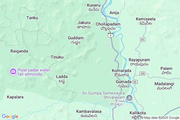
Alluvada
Alluvada Map
EDIT Map
Add Your House
 ..
..
Current Corona Virus Infected Patients Count in Vizianagaram District
| City Name | District Name | Total Covid cases |
|---|
Locality Name :
Alluvada
( అల్లుడా )
Mandal Name : Komarada
District : Vizianagaram
State : Andhra Pradesh
Region : Andhra
Language : Telugu
Current Time 07:59 AM
Date: Friday , May 02,2025 (IST)
Time zone: IST (UTC+5:30)
Elevation / Altitude: 135 meters. Above Seal level
Telephone Code / Std Code: 08963
Assembly constituency : Kamalapuram assembly constituency
Assembly MLA : POCHIMAREDDY RAVINDRANATH REDDY
Lok Sabha constituency : Kurnool parliamentary constituency
Parliament MP : AYUSHMAN DOCTOR SANJEEV KUMAR
Serpanch Name :
Main Village Name : Alluvada
Commodities Prices : Rayagada Market / Mandi
Alluvada Live Weather
Temperature: 26.0 °C
scattered clouds
Humidity: 82%
Wind : 1.71 mt/sec towards S
StationName : "PÄ\u0081rvatipuram"
observed on 10 Mins Back
Temperature: 26.0 °C
scattered clouds
Humidity: 82%
Wind : 1.71 mt/sec towards S
StationName : "PÄ\u0081rvatipuram"
observed on 10 Mins Back
Alluvada Weather Forecast for Next 5 days
03-05-2025
20.8°C to 31.1°C
scattered clouds, light rain, few clouds
20.8°C to 31.1°C
scattered clouds, light rain, few clouds
04-05-2025
20.5°C to 32.5°C
few clouds, clear sky, light rain, moderate rain, broken clouds, overcast clouds
20.5°C to 32.5°C
few clouds, clear sky, light rain, moderate rain, broken clouds, overcast clouds
05-05-2025
21.0°C to 34.8°C
broken clouds, few clouds, scattered clouds
21.0°C to 34.8°C
broken clouds, few clouds, scattered clouds
06-05-2025
24.0°C to 35.0°C
broken clouds, scattered clouds, overcast clouds
24.0°C to 35.0°C
broken clouds, scattered clouds, overcast clouds
07-05-2025
24.4°C to 36.8°C
broken clouds, overcast clouds
24.4°C to 36.8°C
broken clouds, overcast clouds
Rivers Near Alluvada
Indravati
Boduru Gedda
Indravati
Boduru Gedda
About Alluvada
Correct below Info and add more info about AlluvadaAlluvada is a small Village/hamlet in Komarada Mandal in Vizianagaram District of Andhra Pradesh State, India. It comes under Alluvada Panchayath. It belongs to Andhra region . It is located 103 KM towards North from District head quarters Vizianagaram. 642 KM from State capital Hyderabad
Alluvada is surrounded by Bandhugaon Mandal towards west , Parvathipuram Mandal towards South , Jiyyammavalasa Mandal towards East , Garugubilli Mandal towards South .
Parvathipuram , Rayagada , Bobbili , Gunupur are the near by Cities to Alluvada.
Alluwada 2011 Census Details
Alluvada Local Language is Telugu. Alluwada Village Total population is 259 and number of houses are 57. Female Population is 51.0%. Village literacy rate is 45.6% and the Female Literacy rate is 16.6%.
Population
| Census Parameter | Census Data |
| Total Population | 259 |
| Total No of Houses | 57 |
| Female Population % | 51.0 % ( 132) |
| Total Literacy rate % | 45.6 % ( 118) |
| Female Literacy rate | 16.6 % ( 43) |
| Scheduled Tribes Population % | 85.3 % ( 221) |
| Scheduled Caste Population % | 3.9 % ( 10) |
| Working Population % | 60.6 % |
| Child(0 -6) Population by 2011 | 23 |
| Girl Child(0 -6) Population % by 2011 | 43.5 % ( 10) |
Alluwada Census More Deatils.
Politics in Alluvada
TDP , YSRC , Yuvajana Sramika Rythu Congress Party , YSRCP , INC are the major political parties in this area.Polling Stations /Booths near Alluvada
1)Bayanapalli2)Narasaramaiahgari Palle
3)Balupalle
4)Diguvapalli
5)Nazeerbegpalli
HOW TO REACH Alluvada
By Road
Parvathipuram is the Nearest Town to Alluvada. Parvathipuram is 22 km from Alluvada. Road connectivity is there from Parvathipuram to Alluvada.By Rail
Gumada Rail Way Station , Kuneru Rail Way Station are the very nearby railway stations to Alluvada. Also you can consider railway Stations from Near By town Parvathipuram. Parvatipuram Town Rail Way Station , Parvatipuram Rail Way Station are the railway Stations near to Parvathipuram. You can reach from Parvathipuram to Alluvada by road after .By Bus
Parvathipuram APSRTC Bus Station , Bobbili APSRTC Bus Station , Battili APSRTC Bus Station are the nearby by Bus Stations to Alluvada .APSRTC runs Number of busses from major cities to here.Pincodes near Alluvada
535521 ( Komarada ) , 535522 ( Mrutyunjayarayanagaram ) , 535501 ( Parvatipuram )Colleges near Alluvada
Govt Junior College Komarada
Address : Govt Junior College Komarada
Schools near Alluvada
Zphs Dalaipeta
Address : dalaipeta , komarada , vizianagaram , Andhra Pradesh . PIN- 535501 , Post - Parvatipuram
Kgbv Komarada
Address : komarada , komarada , vizianagaram , Andhra Pradesh . PIN- 535521 , Post - Komarada
Zphs Vikramapuram
Address : vikrampuram , komarada , vizianagaram , Andhra Pradesh . PIN- 535501 , Post - Parvatipuram
A P S W Rs Komarada
Address : komarada , komarada , vizianagaram , Andhra Pradesh . PIN- 535521 , Post - Komarada
Govt Health Centers near Alluvada
1) Chinakerjila , , Main street ,2) KOMARADA Sub Centre , 2...171 , MAIN ROAD , WATER TANK
3) Komarada , , Main Road ,
Sub Villages in Alluvada
Hospitals in Alluvada,Komarada
Sri Sai super speciality Dental hospital
Bobbili-Parvathipuram Rd; Parvathipuram; Andhra Pradesh 535501; India
16.7 KM distance Detail
more ..
Petrol Bunks in Alluvada,Komarada
HP PETROL PUMP - BABU FILLING PARVATIPURAM
Hpcl Dealers;d.no.: 17-182/A; Rajeev Marg; Parvatipuram; ITDA PARVATHIPURAM; Parvathipuram; Andhra Pradesh 535501; India
16.4 KM distance Detail
HP PETROL PUMP - SRI SAI RAMANA FILLING STATION
HPC Dealers Survey NOS. 335/2; 335/8; 335/9; Village Parvathipuram;; Visakhapatnam; Andhra Pradesh 535501; India
16.9 KM distance Detail
LAXMI SATYANANDA AGENCIES
Bypass Rd; Parvathipuram; Andhra Pradesh 535501; India
17.1 KM distance Detail
more ..
Schools in Alluvada,Komarada
Mandal Parishad Pradhamika Patasala in Prakasam;AP
parsirampuram; Andhra Pradesh 535501; India
13.8 KM distance Detail
Electronic Shops in Alluvada,Komarada
digi world Sowndarya Enterprises
28/1/16; Main Rd; Parvathipuram; Andhra Pradesh 535501; India
16.4 KM distance Detail
Chinna Cellpoint
Gembalivari St; Parvathipuram; Andhra Pradesh 535501; India
16.7 KM distance Detail
VASU CELLPOINT
Bobbili-Parvathipuram Rd; Parvathipuram; Andhra Pradesh 535501; India
16.8 KM distance Detail
Super Markets in Alluvada,Komarada
The Mahadev Steel & General Stores
Bobbili-Parvathipuram Rd; Parvathipuram; Andhra Pradesh 535501; India
16.7 KM distance Detail
Police Stations near Alluvada,Komarada
Parvathipuram Town Police Station
15-58; Gembalivari St; Parvathipuram; Andhra Pradesh 535501; India
16.5 KM distance Detail
Sbi Atm;town Police Station Street
Parvathipuram; Andhra Pradesh 535501; India
16.5 KM distance Detail
About Alluvada &
History
How to reach Alluvada
Tourist Places Near By Alluvada
Schools in Alluvada
Colleges in Alluvada
Temperature & weather of Alluvada
places in Alluvada
Alluvada photos
More Information
How to reach Alluvada
Tourist Places Near By Alluvada
Schools in Alluvada
Colleges in Alluvada
Temperature & weather of Alluvada
places in Alluvada
Alluvada photos
More Information
Village Talk
Post News or Events about this Village
Near Cities
Parvathipuram 15 KM near
Rayagada 32 KM near
Bobbili 42 KM near
Gunupur 50 KM near
Parvathipuram 15 KM near
Rayagada 32 KM near
Bobbili 42 KM near
Gunupur 50 KM near
Near By Taluks
Komarada 0 KM near
Bandhugaon 16 KM near
Parvathipuram 19 KM near
Jiyyammavalasa 21 KM near
Komarada 0 KM near
Bandhugaon 16 KM near
Parvathipuram 19 KM near
Jiyyammavalasa 21 KM near
Near By Air Ports
Vishakhapatnam Airport 149 KM near
Rajahmundry Airport 294 KM near
Bhubaneswar Airport 326 KM near
Raipur Airport 345 KM near
Vishakhapatnam Airport 149 KM near
Rajahmundry Airport 294 KM near
Bhubaneswar Airport 326 KM near
Raipur Airport 345 KM near
Near By Tourist Places
Araku Valley 97 KM near
Ananthagiri 98 KM near
Vizayanagaram 100 KM near
Jeypore 102 KM near
Kalahandi 121 KM near
Araku Valley 97 KM near
Ananthagiri 98 KM near
Vizayanagaram 100 KM near
Jeypore 102 KM near
Kalahandi 121 KM near
Near By Districts
Rayagada 32 KM near
Koraput 85 KM near
Gajapati 89 KM near
Srikakulam 94 KM near
Rayagada 32 KM near
Koraput 85 KM near
Gajapati 89 KM near
Srikakulam 94 KM near
Near By RailWay Station
Gumada Rail Way Station 4.4 KM near
Kuneru Rail Way Station 7.4 KM near
Parvatipuram Town Rail Way Station 15 KM near
Parvatipuram Rail Way Station 17 KM near
Gumada Rail Way Station 4.4 KM near
Kuneru Rail Way Station 7.4 KM near
Parvatipuram Town Rail Way Station 15 KM near
Parvatipuram Rail Way Station 17 KM near