| Home | City Bus | Maps | Villages | Cities | Rail | Tourist Places | School | College | Pin Codes | Corona Cases Count |
| Distance Calculator Bus Services IFSC Codes Trace Mobile Number Weather Search Place Trace IP Available Cash ATM/Banks Locate Polling Booth Report an Error contact People |
Gadabavalasa
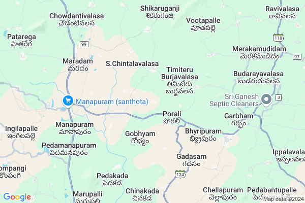
Gadabavalasa Map
EDIT Map
Add Your House
 ..
..
Current Corona Virus Infected Patients Count in Vizianagaram District
| City Name | District Name | Total Covid cases |
|---|
Locality Name :
Gadabavalasa
( గదబవలస )
Mandal Name : Dattirajeru
District : Vizianagaram
State : Andhra Pradesh
Region : Andhra
Language : Telugu
Current Time 03:07 AM
Date: Friday , May 02,2025 (IST)
Time zone: IST (UTC+5:30)
Elevation / Altitude: 95 meters. Above Seal level
Telephone Code / Std Code: 08965
Assembly constituency : Srisailam assembly constituency
Assembly MLA : APPALANARASAYYA BOTCHA
Lok Sabha constituency : Hindupur parliamentary constituency
Parliament MP : KURUVA GORANTLA MADHAV
Serpanch Name :
Pin Code : 535580
Post Office Name : Pedamanapuram
Main Village Name : Gadabavalasa
Commodities Prices : Koraput(Semilguda) Market / Mandi
National Highways Reachable To Gadabavalasa
Nationa High Way :NH16
Nationa High Way :NH16
Rivers Near Gadabavalasa
Nagavali
Pedda Eru
Nagavali
Pedda Eru
About Gadabavalasa
Correct below Info and add more info about GadabavalasaGadabavalasa is a small Village/hamlet in Dattirajeru Mandal in Vizianagaram District of Andhra Pradesh State, India. It comes under Gadabavalasa Panchayath. It belongs to Andhra region . It is located 33 KM towards North from District head quarters Vizianagaram. 620 KM from State capital Hyderabad
Gadabavalasa Pin code is 535580 and postal head office is Pedamanapuram .
Gadabavalasa is surrounded by Merakamudidam Mandal towards East , Gajapathinagaram Mandal towards South , Ramabhadrapuram Mandal towards west , Badangi Mandal towards North .
Bobbili , Salur , Rajam , Vizianagaram are the near by Cities to Gadabavalasa.
Gadabavalasa 2011 Census Details
Gadabavalasa Local Language is Telugu. Gadabavalasa Village Total population is 577 and number of houses are 161. Female Population is 52.9%. Village literacy rate is 46.3% and the Female Literacy rate is 21.0%.
Population
| Census Parameter | Census Data |
| Total Population | 577 |
| Total No of Houses | 161 |
| Female Population % | 52.9 % ( 305) |
| Total Literacy rate % | 46.3 % ( 267) |
| Female Literacy rate | 21.0 % ( 121) |
| Scheduled Tribes Population % | 0.0 % ( 0) |
| Scheduled Caste Population % | 1.9 % ( 11) |
| Working Population % | 45.2 % |
| Child(0 -6) Population by 2011 | 69 |
| Girl Child(0 -6) Population % by 2011 | 46.4 % ( 32) |
Gadabavalasa Census More Deatils.
Politics in Gadabavalasa
TDP , YSRC , Yuvajana Sramika Rythu Congress Party , YSRCP , INC are the major political parties in this area.Polling Stations /Booths near Gadabavalasa
1)Srisailam2)Srisailam
3)Sripati Rao Peta
4)Srisailam
5)Sunnipenta
HOW TO REACH Gadabavalasa
By Road
Vizianagaram is the Nearest Town to Gadabavalasa. Vizianagaram is 35 km from Gadabavalasa. Road connectivity is there from Vizianagaram to Gadabavalasa.By Rail
Komatipalli Rail Way Station is the very nearby railway stations to Gadabavalasa. Also you can consider railway Stations from Near By town Vizianagaram. Vizianagaram Junction Rail Way Station , Nellimarla Rail Way Station are the railway Stations near to Vizianagaram. You can reach from Vizianagaram to Gadabavalasa by road after .By Bus
Manapuram APSRTC Bus Station , Gajapathinagaram APSRTC Bus Station , Ramabadrapuram APSRTC Bus Station are the nearby by Bus Stations to Gadabavalasa .APSRTC runs Number of busses from major cities to here.Colleges near Gadabavalasa
Maharshi Jr College, Pedamanapuram
Address : Pedamanapuram
Maharshi Degree College
Address : Pedamana Puram, Dattirajeru (m), Vizianagaram Dis
Schools in Gadabavalasa
Mpps Gadabavalasa
Address : gadabavalasa , dathirajeru , vizianagaram , Andhra Pradesh . PIN- 535580 , Post - Pedamanapuram
Govt Health Centers near Gadabavalasa
1) Porali , , Bc .colony , Near church2) Dathi , , Beside High school , Near pantchayathioffice
3) Vangara , 1-Feb , Chinavangara , Near MPP school
Sub Villages in Gadabavalasa
Hospitals in Gadabavalasa,Dattirajeru
Suncity Homoeo Clinic
Railway Station Overpass; Railway Colony; Gajapatinagaram; Andhra Pradesh 535270; India
13.3 KM distance Detail
more ..
Petrol Bunks in Gadabavalasa,Dattirajeru
HP PETROL PUMP - SREE MAHALAKSHMI FUEL STATION
HPC Dealers Survey NO. 314/1; Village Garbham Merakamudidam Mandalam; Visakhapatnam; Andhra Pradesh 535102; India
9.2 KM distance Detail
HP Petrol Bunk
D.NO. 155/13 Madhup0adu Village Gajapathinagarm; Visakhapatnam; Andhra Pradesh 535270; India
13.5 KM distance Detail
more ..
Colleges in Gadabavalasa,Dattirajeru
Avanthi Theresa Engineering
Garbham Rd; Garbham; Andhra Pradesh 535102; India
9.0 KM distance Detail
Balajee Polytechnic College
Marupalli Village; Gajapathinagaram Mandal; Vizianagaram; Andhra Pradesh 535270; India
9.7 KM distance Detail
Balaji polytechnic college
Jeypore-Vizianagaram Rd; Andhra Pradesh 535270; India
10.9 KM distance Detail
more ..
Schools in Gadabavalasa,Dattirajeru
ZP High School; Dattirajeru
Venkatakrishnaraja Puram; Andhra Pradesh 535102; India
1.0 KM distance Detail
T.Burjavalasa
Dattirajeru(MD);dist); Timiteru Burjavalasa; Andhra Pradesh 535102; India
3.8 KM distance Detail
Electronic Shops in Gadabavalasa,Dattirajeru
Yedukondalu Engineering Works
Pedamanapram; 535580; Pedamanapuram; Andhra Pradesh; India
8.0 KM distance Detail
Vinayaka Engineering works
Jayanthi colony; Gajapatinagaram; Andhra Pradesh 535270; India
14.0 KM distance Detail
Super Markets in Gadabavalasa,Dattirajeru
Sri Kheteshwara Plywood &Hardware Gajapathinagaram
Gajapatinagaram; Andhra Pradesh 535270; India
14.4 KM distance Detail
A.V.BANGARRAGU WHOLESALE SHOP
Gajapathi Nagaram Rd; Gajapatinagaram; Andhra Pradesh 535270; India
14.5 KM distance Detail
Local Parks in Gadabavalasa,Dattirajeru
Vanamitra;Forest Office; Bondapalli
Vizianagaram; Andhra Pradesh 535260; India
17.4 KM distance Detail
Police Stations near Gadabavalasa,Dattirajeru
Police Station Gajapathingaarm
Gajapatinagaram; Andhra Pradesh 535270; India
14.3 KM distance Detail
Police Station
Jeypore-Vizianagaram Rd; Gajapatinagaram; Andhra Pradesh 535270; India
14.3 KM distance Detail
About Gadabavalasa &
History
How to reach Gadabavalasa
Tourist Places Near By Gadabavalasa
Schools in Gadabavalasa
Colleges in Gadabavalasa
Temperature & weather of Gadabavalasa
places in Gadabavalasa
Gadabavalasa photos
More Information
How to reach Gadabavalasa
Tourist Places Near By Gadabavalasa
Schools in Gadabavalasa
Colleges in Gadabavalasa
Temperature & weather of Gadabavalasa
places in Gadabavalasa
Gadabavalasa photos
More Information
Village Talk
Post News or Events about this Village
Near Cities
Bobbili 25 KM near
Salur 27 KM near
Rajam 33 KM near
Vizianagaram 34 KM near
Bobbili 25 KM near
Salur 27 KM near
Rajam 33 KM near
Vizianagaram 34 KM near
Near By Taluks
Dattirajeru 0 KM near
Merakamudidam 9 KM near
Gajapathinagaram 13 KM near
Ramabhadrapuram 14 KM near
Dattirajeru 0 KM near
Merakamudidam 9 KM near
Gajapathinagaram 13 KM near
Ramabhadrapuram 14 KM near
Near By Air Ports
Vishakhapatnam Airport 83 KM near
Rajahmundry Airport 244 KM near
Bhubaneswar Airport 368 KM near
Vijayawada Airport 384 KM near
Vishakhapatnam Airport 83 KM near
Rajahmundry Airport 244 KM near
Bhubaneswar Airport 368 KM near
Vijayawada Airport 384 KM near
Near By Tourist Places
Vizayanagaram 34 KM near
Araku Valley 62 KM near
Ananthagiri 62 KM near
Simhachalam 80 KM near
Visakhapatnam 88 KM near
Vizayanagaram 34 KM near
Araku Valley 62 KM near
Ananthagiri 62 KM near
Simhachalam 80 KM near
Visakhapatnam 88 KM near
Near By Districts
Vizianagaram 32 KM near
Srikakulam 60 KM near
Visakhapatanam 85 KM near
Koraput 96 KM near
Vizianagaram 32 KM near
Srikakulam 60 KM near
Visakhapatanam 85 KM near
Koraput 96 KM near
Near By RailWay Station
Komatipalli Rail Way Station 6.0 KM near
Chipurupalle Rail Way Station 22 KM near
Bobbili Junction Rail Way Station 24 KM near
Komatipalli Rail Way Station 6.0 KM near
Chipurupalle Rail Way Station 22 KM near
Bobbili Junction Rail Way Station 24 KM near