| Home | City Bus | Maps | Villages | Cities | Rail | Tourist Places | School | College | Pin Codes | Corona Cases Count |
| Distance Calculator Bus Services IFSC Codes Trace Mobile Number Weather Search Place Trace IP Available Cash ATM/Banks Locate Polling Booth Report an Error contact People |
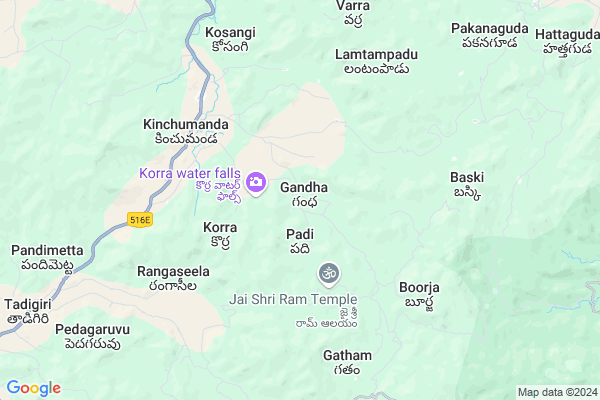
Gandha
Gandha Map
EDIT Map
Add Your House
 ..
..
Current Corona Virus Infected Patients Count in Visakhapatanam District
| City Name | District Name | Total Covid cases |
|---|---|---|
| Visakhapatnam District | Visakhapatnam | 14 |
| Narsipatnam | Visakhapatnam | 2 |
| Visakhapatnam | Visakhapatnam | 2 |
| Akkayyapelem | Visakhapatnam | 2 |
| Visakapatnam | Visakhapatnam | 1 |
| Gajuwaka | Visakhapatnam | 1 |
Locality Name :
Gandha
( గంధ )
Mandal Name : Dumbriguda
District : Visakhapatanam
State : Andhra Pradesh
Region : Andhra
Language : Telugu
Current Time 06:53 AM
Date: Saturday , May 03,2025 (IST)
Time zone: IST (UTC+5:30)
Elevation / Altitude: 910 meters. Above Seal level
Telephone Code / Std Code: 08936
Assembly constituency : Alur assembly constituency
Assembly MLA : P Jayaram
Lok Sabha constituency : Kurnool parliamentary constituency
Parliament MP : AYUSHMAN DOCTOR SANJEEV KUMAR
Serpanch Name :
Pin Code : 531149
Post Office Name : Araku Colony
Main Village Name : Gandha
Commodities Prices : Koraput(Semilguda) Market / Mandi
Gandha Live Weather
Temperature: 21.3 °C
clear sky
Humidity: 71%
Wind : 0.4 mt/sec towards W
StationName : "MÄ\u0081dugula"
observed on 51 Mins Back
Temperature: 21.3 °C
clear sky
Humidity: 71%
Wind : 0.4 mt/sec towards W
StationName : "MÄ\u0081dugula"
observed on 51 Mins Back
Gandha Weather Forecast for Next 5 days
04-05-2025
21.4°C to 32.2°C
few clouds, clear sky, broken clouds, light rain
21.4°C to 32.2°C
few clouds, clear sky, broken clouds, light rain
05-05-2025
21.4°C to 32.7°C
scattered clouds, overcast clouds, light rain
21.4°C to 32.7°C
scattered clouds, overcast clouds, light rain
06-05-2025
21.7°C to 33.0°C
broken clouds, overcast clouds, light rain
21.7°C to 33.0°C
broken clouds, overcast clouds, light rain
07-05-2025
22.2°C to 32.5°C
scattered clouds, overcast clouds, light rain
22.2°C to 32.5°C
scattered clouds, overcast clouds, light rain
08-05-2025
24.0°C to 32.7°C
overcast clouds, broken clouds, scattered clouds
24.0°C to 32.7°C
overcast clouds, broken clouds, scattered clouds
Rivers Near Gandha
Champavati
Potula Gedda
Champavati
Potula Gedda
About Gandha
Correct below Info and add more info about GandhaGandha is a small Village/hamlet in Dumbriguda Mandal in Visakhapatanam District of Andhra Pradesh State, India. It comes under Gandha Panchayath. It belongs to Andhra region . It is located 82 KM towards North from District head quarters Vishakhapatnam. 11 KM from Dumbriguda. 548 KM from State capital Hyderabad
Gandha Pin code is 531149 and postal head office is Araku Colony .
Kinchumanda ( 5 KM ) , Boorja ( 6 KM ) , Rangaseela ( 6 KM ) , Baski ( 6 KM ) , Pynampadu ( 8 KM ) are the nearby Villages to Gandha. Gandha is surrounded by Hukumpeta Mandal towards South , Araku Valley Mandal towards East , Ananthagiri Mandal towards East , Paderu Mandal towards South .
Salur , Sunabeda , Anakapalle , Narsipatnam are the near by Cities to Gandha.
Gandha 2011 Census Details
Gandha Local Language is Telugu. Gandha Village Total population is 232 and number of houses are 58. Female Population is 53.4%. Village literacy rate is 29.7% and the Female Literacy rate is 10.8%.
Population
| Census Parameter | Census Data |
| Total Population | 232 |
| Total No of Houses | 58 |
| Female Population % | 53.4 % ( 124) |
| Total Literacy rate % | 29.7 % ( 69) |
| Female Literacy rate | 10.8 % ( 25) |
| Scheduled Tribes Population % | 99.6 % ( 231) |
| Scheduled Caste Population % | 0.0 % ( 0) |
| Working Population % | 70.3 % |
| Child(0 -6) Population by 2011 | 36 |
| Girl Child(0 -6) Population % by 2011 | 58.3 % ( 21) |
Gandha Census More Deatils.
Politics in Gandha
TDP , YSRC , Yuvajana Sramika Rythu Congress Party , PRAP , YSRCP , INC are the major political parties in this area.Polling Stations /Booths near Gandha
1)M.kottala2)Nitravatti
3)P.kotakonda
4)P.kotakonda-
5)P.kotakonda-
HOW TO REACH Gandha
By Road
Vizianagaram is the Nearest Town to Gandha. Vizianagaram is 105 km from Gandha. Road connectivity is there from Vizianagaram to Gandha.By Rail
There is no railway station near to Gandha in less than 10 km. How ever there are railway Stations from Near By town Vizianagaram. are the railway Stations near to Vizianagaram. You can reach from Vizianagaram to Gandha by road after .By Bus
Arakuvalley APSRTC Bus Station , Araku APSRTC Bus Station , Paderu APSRTC Bus Station are the nearby by Bus Stations to Gandha .APSRTC runs Number of busses from major cities to here.Colleges near Gandha
A P T W R Jr College Araku Valley Vizag
Address : A P T W R Jr College Araku Valley Vizag
Shanti Niketan Degree College
Address : Ttc Buildings, Arakuvalley, Visakhapatnam Dist.,
Schools in Gandha
Govt Ps (tw) Gandha
Address : gandha , dumbriguda , visakhapatnam , Andhra Pradesh . PIN- 531151 , Post - Araku Rs
Govt Health Centers near Gandha
1) Devarapalli , Govt Sub Centre , Devarapalli , Near A.W.Centre2) BOORJA , , Kotta Veedi , Opp.Bathel Church
3) Guggudu , Govt Sub Centre , Guggudu , Near Govt School
Sub Villages in Gandha
Schools in Gandha,Dumbriguda
M.P. Elementary School; Gattaraguda
Visakapatnam; Gattaraguda; Andhra Pradesh 531149; India
17.1 KM distance Detail
Super Markets in Gandha,Dumbriguda
Local Parks in Gandha,Dumbriguda
Padmapuram Garden
Padmapuram village; Arakuvalley; ITDA Paderu; Araku; Andhra Pradesh 531151; India
17.6 KM distance Detail
Police Stations near Gandha,Dumbriguda
Police Station
Araku - Visakhapatnam Rd; Araku; Andhra Pradesh 531149; India
15.8 KM distance Detail
Governement Offices near Gandha,Dumbriguda
MeeSeva Center
Near RTC Complex; Araku - Visakhapatnam Rd; Araku; Andhra Pradesh 531149; India
15.9 KM distance Detail
About Gandha &
History
How to reach Gandha
Tourist Places Near By Gandha
Schools in Gandha
Colleges in Gandha
Temperature & weather of Gandha
places in Gandha
Gandha photos
More Information
How to reach Gandha
Tourist Places Near By Gandha
Schools in Gandha
Colleges in Gandha
Temperature & weather of Gandha
places in Gandha
Gandha photos
More Information
Village Talk
Post News or Events about this Village
Near Cities
Salur 58 KM near
Sunabeda 64 KM near
Anakapalle 69 KM near
Narsipatnam 71 KM near
Salur 58 KM near
Sunabeda 64 KM near
Anakapalle 69 KM near
Narsipatnam 71 KM near
Near By Taluks
Dumbriguda 11 KM near
Hukumpeta 11 KM near
Araku Valley 19 KM near
Ananthagiri 21 KM near
Dumbriguda 11 KM near
Hukumpeta 11 KM near
Araku Valley 19 KM near
Ananthagiri 21 KM near
Near By Air Ports
Vishakhapatnam Airport 76 KM near
Rajahmundry Airport 181 KM near
Vijayawada Airport 319 KM near
Raipur Airport 391 KM near
Vishakhapatnam Airport 76 KM near
Rajahmundry Airport 181 KM near
Vijayawada Airport 319 KM near
Raipur Airport 391 KM near
Near By Tourist Places
Ananthagiri 15 KM near
Araku Valley 15 KM near
Vizayanagaram 68 KM near
Simhachalam 74 KM near
Visakhapatnam 79 KM near
Ananthagiri 15 KM near
Araku Valley 15 KM near
Vizayanagaram 68 KM near
Simhachalam 74 KM near
Visakhapatnam 79 KM near
Near By Districts
Vizianagaram 69 KM near
Koraput 76 KM near
Visakhapatanam 78 KM near
Malkangiri 111 KM near
Vizianagaram 69 KM near
Koraput 76 KM near
Visakhapatanam 78 KM near
Malkangiri 111 KM near
Near By RailWay Station
Kottavalasa Junction Rail Way Station 57 KM near
Anakapalle Rail Way Station 67 KM near
Kottavalasa Junction Rail Way Station 57 KM near
Anakapalle Rail Way Station 67 KM near