| Home | City Bus | Maps | Villages | Cities | Rail | Tourist Places | School | College | Pin Codes | Corona Cases Count |
| Distance Calculator Bus Services IFSC Codes Trace Mobile Number Weather Search Place Trace IP Available Cash ATM/Banks Locate Polling Booth Report an Error contact People |
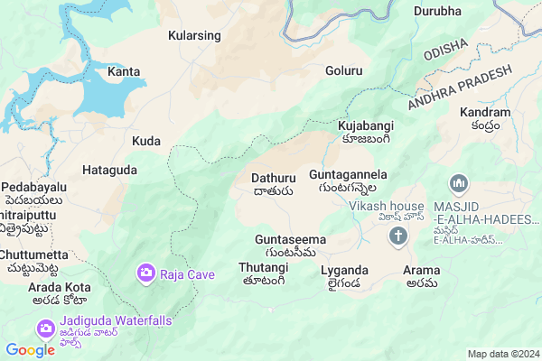
Dathuru
Dathuru Map
EDIT Map
Add Your House
 ..
..
Current Corona Virus Infected Patients Count in Visakhapatanam District
| City Name | District Name | Total Covid cases |
|---|---|---|
| Visakhapatnam District | Visakhapatnam | 14 |
| Narsipatnam | Visakhapatnam | 2 |
| Visakhapatnam | Visakhapatnam | 2 |
| Akkayyapelem | Visakhapatnam | 2 |
| Visakapatnam | Visakhapatnam | 1 |
| Gajuwaka | Visakhapatnam | 1 |
Locality Name :
Dathuru
( దాతురు )
Mandal Name : Dumbriguda
District : Visakhapatanam
State : Andhra Pradesh
Region : Andhra
Language : Telugu
Current Time 09:21 PM
Date: Friday , May 02,2025 (IST)
Time zone: IST (UTC+5:30)
Elevation / Altitude: 910 meters. Above Seal level
Telephone Code / Std Code: 08936
Assembly constituency : Alur assembly constituency
Assembly MLA : P Jayaram
Lok Sabha constituency : Kurnool parliamentary constituency
Parliament MP : AYUSHMAN DOCTOR SANJEEV KUMAR
Serpanch Name :
Pin Code : 531151
Post Office Name : Araku Rs
Main Village Name : Dathuru
Commodities Prices : Koraput(Semilguda) Market / Mandi
Rivers Near Dathuru
Champavati
Potula Gedda
Champavati
Potula Gedda
About Dathuru
Correct below Info and add more info about DathuruDathuru is a small Village/hamlet in Dumbriguda Mandal in Visakhapatanam District of Andhra Pradesh State, India. It comes under Dathuru Panchayath. It belongs to Andhra region . It is located 102 KM towards North from District head quarters Vishakhapatnam. 16 KM from Dumbriguda. 532 KM from State capital Hyderabad
Dathuru Pin code is 531151 and postal head office is Araku Rs .
Aradakota ( 11 KM ) , Pothangi ( 12 KM ) , Seethagunta ( 12 KM ) , Seekari ( 13 KM ) , Gamparai ( 14 KM ) are the nearby Villages to Dathuru. Dathuru is surrounded by Hukumpeta Mandal towards South , Nandapur Mandal towards North , Peda Bayalu Mandal towards west , Munchingi Puttu Mandal towards west .
Sunabeda , Koraput , Salur , Jeypur are the near by Cities to Dathuru.
Dathuru 2011 Census Details
Dathuru Local Language is Telugu. Dathuru Village Total population is 846 and number of houses are 203. Female Population is 51.7%. Village literacy rate is 30.1% and the Female Literacy rate is 10.0%.
Population
| Census Parameter | Census Data |
| Total Population | 846 |
| Total No of Houses | 203 |
| Female Population % | 51.7 % ( 437) |
| Total Literacy rate % | 30.1 % ( 255) |
| Female Literacy rate | 10.0 % ( 85) |
| Scheduled Tribes Population % | 97.8 % ( 827) |
| Scheduled Caste Population % | 1.2 % ( 10) |
| Working Population % | 67.8 % |
| Child(0 -6) Population by 2011 | 164 |
| Girl Child(0 -6) Population % by 2011 | 45.1 % ( 74) |
Dathuru Census More Deatils.
Politics in Dathuru
TDP , YSRC , Yuvajana Sramika Rythu Congress Party , PRAP , YSRCP , INC are the major political parties in this area.Polling Stations /Booths near Dathuru
1)M.kottala2)Nitravatti
3)P.kotakonda
4)P.kotakonda-
5)P.kotakonda-
HOW TO REACH Dathuru
By Road
Vizianagaram is the Nearest Town to Dathuru. Vizianagaram is 97 km from Dathuru. Road connectivity is there from Vizianagaram to Dathuru.By Rail
Darliput Rail Way Station is the very nearby railway stations to Dathuru. Also you can consider railway Stations from Near By town Vizianagaram. Vizianagaram Junction Rail Way Station , Nellimarla Rail Way Station are the railway Stations near to Vizianagaram. You can reach from Vizianagaram to Dathuru by road after .By Bus
Arakuvalley APSRTC Bus Station , Araku APSRTC Bus Station , Paderu APSRTC Bus Station are the nearby by Bus Stations to Dathuru .APSRTC runs Number of busses from major cities to here.Colleges near Dathuru
A P T W R Jr College Araku Valley Vizag
Address : A P T W R Jr College Araku Valley Vizag
Shanti Niketan Degree College
Address : Ttc Buildings, Arakuvalley, Visakhapatnam Dist.,
Schools in Dathuru
Govt Ps (tw) Laseru
Address : dathuru , dumbriguda , visakhapatnam , Andhra Pradesh . PIN- 531151 , Post - Araku Rs
Govt Ps (tw) Jarrai
Address : dathuru , dumbriguda , visakhapatnam , Andhra Pradesh . PIN- 491151
Mpps Dathuru
Address : dathuru , dumbriguda , visakhapatnam , Andhra Pradesh . PIN- 531151 , Post - Araku Rs
Govt Health Centers near Dathuru
1) Domangi , , NEAR GOVT SCHOOL , DOMANGI2) Laiganda , , NEAR AWW CENTRE , LAIGANDA
3) Kendrem , Govt Sub Centre , Kandrum , Beddaguda
Sub Villages in Dathuru
Petrol Bunks in Dathuru,Dumbriguda
HP PETROL PUMP - PATRO FILLING STATION
HP Petrol Pump AT Padua Post Padua; Sambalpur; Odisha 764038; India
11.3 KM distance Detail
more ..
Colleges in Dathuru,Dumbriguda
Radha Krishna Junior College Padwa
Vizag; semililguda Road; Dorasubalar; Odisha 764038; India
14.9 KM distance Detail
more ..
Local Parks in Dathuru,Dumbriguda
Governement Offices near Dathuru,Dumbriguda
MeeSeva Center
1-30; Dumbriguda (Block); Araku Santa;Araku; Araku - Visakhapatnam Rd; Andhra Pradesh 531151; India
21.5 KM distance Detail
About Dathuru &
History
How to reach Dathuru
Tourist Places Near By Dathuru
Schools in Dathuru
Colleges in Dathuru
Temperature & weather of Dathuru
places in Dathuru
Dathuru photos
More Information
How to reach Dathuru
Tourist Places Near By Dathuru
Schools in Dathuru
Colleges in Dathuru
Temperature & weather of Dathuru
places in Dathuru
Dathuru photos
More Information
Village Talk
Post News or Events about this Village
Near Cities
Sunabeda 57 KM near
Koraput 66 KM near
Salur 68 KM near
Jeypur 72 KM near
Sunabeda 57 KM near
Koraput 66 KM near
Salur 68 KM near
Jeypur 72 KM near
Near By Taluks
Dumbriguda 15 KM near
Hukumpeta 22 KM near
Nandapur 22 KM near
Peda Bayalu 23 KM near
Dumbriguda 15 KM near
Hukumpeta 22 KM near
Nandapur 22 KM near
Peda Bayalu 23 KM near
Near By Air Ports
Vishakhapatnam Airport 95 KM near
Rajahmundry Airport 178 KM near
Vijayawada Airport 313 KM near
Raipur Airport 376 KM near
Vishakhapatnam Airport 95 KM near
Rajahmundry Airport 178 KM near
Vijayawada Airport 313 KM near
Raipur Airport 376 KM near
Near By Tourist Places
Ananthagiri 22 KM near
Araku Valley 22 KM near
Jeypore 73 KM near
Vizayanagaram 87 KM near
Simhachalam 93 KM near
Ananthagiri 22 KM near
Araku Valley 22 KM near
Jeypore 73 KM near
Vizayanagaram 87 KM near
Simhachalam 93 KM near
Near By Districts
Koraput 65 KM near
Vizianagaram 89 KM near
Malkangiri 92 KM near
Visakhapatanam 97 KM near
Koraput 65 KM near
Vizianagaram 89 KM near
Malkangiri 92 KM near
Visakhapatanam 97 KM near
Near By RailWay Station
Darliput Rail Way Station 8.3 KM near
Koraput Junction Rail Way Station 62 KM near
Kottavalasa Junction Rail Way Station 77 KM near
Darliput Rail Way Station 8.3 KM near
Koraput Junction Rail Way Station 62 KM near
Kottavalasa Junction Rail Way Station 77 KM near