| Home | City Bus | Maps | Villages | Cities | Rail | Tourist Places | School | College | Pin Codes | Corona Cases Count |
| Distance Calculator Bus Services IFSC Codes Trace Mobile Number Weather Search Place Trace IP Available Cash ATM/Banks Locate Polling Booth Report an Error contact People |
Kanhekusum
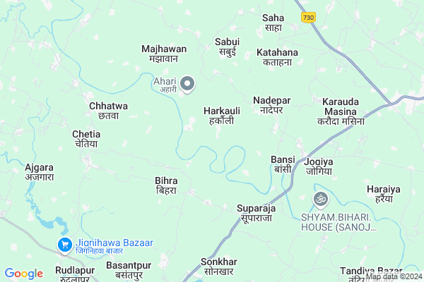
Kanhekusum Map
EDIT Map
Add Your House
 ..
..
Current Corona Virus Infected Patients Count in Siddharth Nagar District
| City Name | District Name | Total Covid cases |
|---|
Locality Name :
Kanhekusum
( काँहेकुसुम )
Block Name : Jogia
District : Siddharth Nagar
State : Uttar Pradesh
Division : Basti
Language : Hindi and Urdu
Current Time 11:51 PM
Date: Thursday , May 01,2025 (IST)
Time zone: IST (UTC+5:30)
Elevation / Altitude: 91 meters. Above Seal level
Telephone Code / Std Code: 05544
Assembly constituency : Kapilvastu assembly constituency
Assembly MLA : Shyamdhani Rahi
Lok Sabha constituency : Domariyaganj parliamentary constituency
Parliament MP : JAGDAMBIKA PAL
Serpanch Name :
Main Village Name : Kanhekusum
Commodities Prices : Wansi Market / Mandi
Kanhekusum Live Weather
Temperature: 27.9 °C
broken clouds
Humidity: 39%
Wind : 2.82 mt/sec towards NE
StationName : "ChiliÄ\u0081"
observed on 8 Mins Back
Temperature: 27.9 °C
broken clouds
Humidity: 39%
Wind : 2.82 mt/sec towards NE
StationName : "ChiliÄ\u0081"
observed on 8 Mins Back
Kanhekusum Weather Forecast for Next 5 days
02-05-2025
26.7°C to 27.6°C
scattered clouds
26.7°C to 27.6°C
scattered clouds
03-05-2025
25.8°C to 36.7°C
scattered clouds, broken clouds, overcast clouds, few clouds, clear sky
25.8°C to 36.7°C
scattered clouds, broken clouds, overcast clouds, few clouds, clear sky
04-05-2025
26.3°C to 38.5°C
few clouds, broken clouds, scattered clouds
26.3°C to 38.5°C
few clouds, broken clouds, scattered clouds
05-05-2025
26.6°C to 40.0°C
light rain, scattered clouds, clear sky, overcast clouds
26.6°C to 40.0°C
light rain, scattered clouds, clear sky, overcast clouds
06-05-2025
25.6°C to 40.3°C
overcast clouds, scattered clouds, light rain, broken clouds
25.6°C to 40.3°C
overcast clouds, scattered clouds, light rain, broken clouds
Rivers Near Kanhekusum
Rohini :Rohini
Sotwa Nala
Rohini :Rohini
Sotwa Nala
About Kanhekusum
Correct below Info and add more info about KanhekusumKanhekusum is a small Village/hamlet in Jogia Block in Siddharth Nagar District of Uttar Pradesh State, India. It comes under Kanhekusum Panchayath. It belongs to Basti Division . It is located 14 KM towards west from District head quarters Navgarh. 4 KM from Jogiya. 239 KM from State capital Lucknow
Khetawal Tiwari ( 1 KM ) , Satwari ( 1 KM ) , Nawaila ( 2 KM ) , Kodri ( 2 KM ) , Subhauli ( 3 KM ) are the nearby Villages to Kanhekusum. Kanhekusum is surrounded by Bansi Block towards South , Naugarh Block towards East , Navgarh Block towards East , Shoharatgarh Block towards North .
Tetri Bazar , Nautanwa , Utraula , Sahjanwa are the near by Cities to Kanhekusum.
Kanhekusum 2011 Census Details
Kanhekusum Local Language is Hindi. Kanhekusum Village Total population is 283 and number of houses are 57. Female Population is 50.2%. Village literacy rate is 24.0% and the Female Literacy rate is 10.2%.
Population
| Census Parameter | Census Data |
| Total Population | 283 |
| Total No of Houses | 57 |
| Female Population % | 50.2 % ( 142) |
| Total Literacy rate % | 24.0 % ( 68) |
| Female Literacy rate | 10.2 % ( 29) |
| Scheduled Tribes Population % | 0.0 % ( 0) |
| Scheduled Caste Population % | 0.0 % ( 0) |
| Working Population % | 50.9 % |
| Child(0 -6) Population by 2011 | 54 |
| Girl Child(0 -6) Population % by 2011 | 48.1 % ( 26) |
Kanhekusum Census More Deatils.
Politics in Kanhekusum
BJP , SP are the major political parties in this area.Polling Stations /Booths near Kanhekusum
1)Ghughuliya2)Tighra
3)Khaleelpur
4)Abhaypur
5)Kadjahva
HOW TO REACH Kanhekusum
By Rail
There is no railway station near to Kanhekusum in less than 10 km.Pincodes near Kanhekusum
272204 ( Udairajganj ) , 272207 ( Tetari Bazar ) , 272153 ( Bansi )Colleges near Kanhekusum
Srimati Yasoda Devi Pandey Kanya Inter Colledge Itwa Siddharth Nagar U.p.
Address :
Adarsh Inter College Gaura Garh Siddharthnagar
Address :
Shiv Pati P.g. College, Shohrat Garh, Siddharth Nagar U.p.
Address :
Rafi Memorial Inter College
Address :
Neharu Inter College Kakrahwa
Address :
Schools near Kanhekusum
J.h.s. Paharava
Address : jamhiriya , jogiya , siddharthnagar , Uttar Pradesh . PIN- 271412
J.h.s. Dohani
Address : dohani , jogiya , siddharthnagar , Uttar Pradesh . PIN- 272415
K.g.b.v. Debara Bazar
Address : debra bazar , jogiya , siddharthnagar , Uttar Pradesh . PIN- 272105
P.m.v. Bhapasi
Address : bhapasi , jogiya , siddharthnagar , Uttar Pradesh . PIN- 272205 , Post - Shoharatgarh
Govt Health Centers near Kanhekusum
1) Navaila , , ,2) Jogi Bari , , ,
3) Gulhariya Raja , , ,
Sub Villages in Kanhekusum
Hospitals in Kanhekusum,Jogia
Bansi HOSPITAL AND MATERNITY SEVAASHRAM
Bansi-Naugarh Rd; Mahua; Uttar Pradesh 272207; India
5.1 KM distance Detail
Prathmik Chikitsa Kendra; Katahna Paliya
Katahana; Uttar Pradesh 272204; India
6.2 KM distance Detail
वर्मा मेडिकल स्टोर चेतिया बाजार उत्तर प्रदेश सिद्धार्थ नगर
Chetia; Uttar Pradesh 272153; India
6.9 KM distance Detail
more ..
Petrol Bunks in Kanhekusum,Jogia
Chaudhary Hp Gas Gramin Vitrak Chetia Siddhartha Nagar
Chetia; Uttar Pradesh 272153; India
7.0 KM distance Detail
more ..
Colleges in Kanhekusum,Jogia
Maha Maya Polytechnic Of Information Technology
Bansi; Uttar Pradesh 272153; India
9.3 KM distance Detail
more ..
Electronic Shops in Kanhekusum,Jogia
Jivisha Mobile Repairing Shop
Kadjahava Bazar; Dumariya; Uttar Pradesh 272204; India
3.4 KM distance Detail
Police Stations near Kanhekusum,Jogia
Women Police Station
Telephone Exchange Colony; Naugarh; Uttar Pradesh 272207; India
12.6 KM distance Detail
Governement Offices near Kanhekusum,Jogia
Aadhaar Card Kendra
Near Jai Kisan Inter College Sanai Chauraha Aj Savitri Information Center; Uttar Pradesh 272207; India
8.9 KM distance Detail
About Kanhekusum &
History
How to reach Kanhekusum
Tourist Places Near By Kanhekusum
Schools in Kanhekusum
Colleges in Kanhekusum
Temperature & weather of Kanhekusum
places in Kanhekusum
Kanhekusum photos
More Information
How to reach Kanhekusum
Tourist Places Near By Kanhekusum
Schools in Kanhekusum
Colleges in Kanhekusum
Temperature & weather of Kanhekusum
places in Kanhekusum
Kanhekusum photos
More Information
Village Talk
Post News or Events about this Village
Near Cities
Tetri Bazar 14 KM near
Nautanwa 55 KM near
Utraula 61 KM near
Sahjanwa 63 KM near
Tetri Bazar 14 KM near
Nautanwa 55 KM near
Utraula 61 KM near
Sahjanwa 63 KM near
Near By Taluks
Jogia 3 KM near
Bansi 7 KM near
Naugarh 12 KM near
Navgarh 14 KM near
Jogia 3 KM near
Bansi 7 KM near
Naugarh 12 KM near
Navgarh 14 KM near
Near By Air Ports
Gorakhpur Airport 83 KM near
Varanasi Airport 225 KM near
Amausi Airport 238 KM near
Bamrauli Airport 264 KM near
Gorakhpur Airport 83 KM near
Varanasi Airport 225 KM near
Amausi Airport 238 KM near
Bamrauli Airport 264 KM near
Near By Tourist Places
Kapilvastu 49 KM near
Basti 59 KM near
Gorakhpur 77 KM near
Ayodhya 102 KM near
Faizabad 108 KM near
Kapilvastu 49 KM near
Basti 59 KM near
Gorakhpur 77 KM near
Ayodhya 102 KM near
Faizabad 108 KM near
Near By Districts
Siddharth Nagar 14 KM near
Sant Kabeer Nagar 61 KM near
Basti 62 KM near
Maharajganj 68 KM near
Siddharth Nagar 14 KM near
Sant Kabeer Nagar 61 KM near
Basti 62 KM near
Maharajganj 68 KM near
Near By RailWay Station
Naugarh Rail Way Station 14 KM near
Shohratgarh Rail Way Station 16 KM near
Naugarh Rail Way Station 14 KM near
Shohratgarh Rail Way Station 16 KM near