| Home | City Bus | Maps | Villages | Cities | Rail | Tourist Places | School | College | Pin Codes | Corona Cases Count |
| Distance Calculator Bus Services IFSC Codes Trace Mobile Number Weather Search Place Trace IP Available Cash ATM/Banks Locate Polling Booth Report an Error contact People |
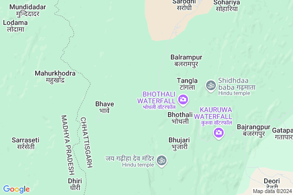
Kolambo
Kolambo Map
EDIT Map
Add Your House
 ..
..
Current Corona Virus Infected Patients Count in Rajnandgaon District
| City Name | District Name | Total Covid cases |
|---|---|---|
| Rajnandgaon | Rajnandgaon | 1 |
Locality Name :
Kolambo
( कोलम्बो )
Tehsil Name : Chhuikhadan
District : Rajnandgaon
State : Chattisgarh
Language : Chhattisgarhi and Hindi
Current Time 12:57 AM
Date: Friday , May 02,2025 (IST)
Time zone: IST (UTC+5:30)
Elevation / Altitude: 319 meters. Above Seal level
Telephone Code / Std Code: 07743
Assembly constituency : Khairagarh assembly constituency
Assembly MLA : Yashoda Nilamber Verma
Lok Sabha constituency : Rajnandgaon parliamentary constituency
Parliament MP : SANTOSH PANDEY
Serpanch Name :
Pin Code : 491881
Post Office Name : Khairagah Raj
Main Village Name : Kolambo
Commodities Prices : Kheragarh Market / Mandi
Rivers Near Kolambo
Shivnath :Seonath
Tanda
Shivnath :Seonath
Tanda
About Kolambo
Correct below Info and add more info about KolamboKolambo is a small Village/hamlet in Chhuikhadan Tehsil in Rajnandgaon District of Chattisgarh State, India. It comes under Kolambo Panchayath. It is located 64 KM towards North from District head quarters Rajnandgaon. 27 KM from Chhuikhadan. 108 KM from State capital Raipur
Kolambo Pin code is 491881 and postal head office is Khairagah Raj .
Deori ( 13 KM ) , Kumharwada ( 13 KM ) , Katangikhurd ( 13 KM ) , Baihatola ( 16 KM ) , Chichka ( 16 KM ) are the nearby Villages to Kolambo. Kolambo is surrounded by Chhuikhadan Tehsil towards East , Lanji Tehsil towards west , Dongarghar Tehsil towards South , Salekasa Tehsil towards west .
Dongargarh , Malajkhand , Rajnandgaon , Gondiya are the near by Cities to Kolambo.
Kolamba 2011 Census Details
Kolambo Local Language is Chhattisgarhi. Kolamba Village Total population is and number of houses are . Female Population is -1.0%. Village literacy rate is -1.0% and the Female Literacy rate is -1.0%.
Population
| Census Parameter | Census Data |
| Total Population | |
| Total No of Houses | |
| Female Population % | -1.0 % ( ) |
| Total Literacy rate % | -1.0 % ( ) |
| Female Literacy rate | -1.0 % ( ) |
| Scheduled Tribes Population % | -1.0 % ( ) |
| Scheduled Caste Population % | -1.0 % ( ) |
| Working Population % | -1.0 % |
| Child(0 -6) Population by 2011 | |
| Girl Child(0 -6) Population % by 2011 | -1.0 % ( ) |
Kolamba Census More Deatils.
Politics in Kolambo
Bharatiya Janata Party , BJP , INC are the major political parties in this area.Polling Stations /Booths near Kolambo
1)Bhothi2)Bhardakala
3)Saraipatera
4)Bajguda
5)Bakarkatta
HOW TO REACH Kolambo
By Rail
There is no railway station near to Kolambo in less than 10 km.Colleges near Kolambo
Veerangana Avanti Bai Govt. College
Address : Chhuikhadan, Raipur
Schools near Kolambo
M.s. (new) Jagmadva
Address : jagmadava , chuikhadan , rajnandgaon , Chattisgarh . PIN- 491888 , Post - Gandai Pandaria
M.s. (new) Bhajidongri
Address : bhaji dongri , chuikhadan , rajnandgaon , Chattisgarh . PIN- 491888 , Post - Gandai Pandaria
M.s. (new) Suradabari
Address : suradabari , chuikhadan , rajnandgaon , Chattisgarh . PIN- 491888 , Post - Gandai Pandaria
Avanti Vidya Mandir Tendubhatha
Address : tendubhatha , chuikhadan , rajnandgaon , Chattisgarh . PIN- 491888 , Post - Gandai Pandaria
Govt Health Centers near Kolambo
1) SHC Bothal , Sub Health Center Bothal , ,2) SHC Tendubhata , Sub Health Center Tendubhata , ,
3) SHC Bakarkatta , Sub Health Center Bakarkatta , ,
Sub Villages in Kolambo
Super Markets in Kolambo,Chhuikhadan
Local Parks in Kolambo,Chhuikhadan
Police Stations near Kolambo,Chhuikhadan
Governement Offices near Kolambo,Chhuikhadan
About Kolambo &
History
How to reach Kolambo
Tourist Places Near By Kolambo
Schools in Kolambo
Colleges in Kolambo
Temperature & weather of Kolambo
places in Kolambo
Kolambo photos
More Information
How to reach Kolambo
Tourist Places Near By Kolambo
Schools in Kolambo
Colleges in Kolambo
Temperature & weather of Kolambo
places in Kolambo
Kolambo photos
More Information
Village Talk
Post News or Events about this Village
Near Cities
Dongargarh 42 KM near
Malajkhand 59 KM near
Rajnandgaon 60 KM near
Gondiya 68 KM near
Dongargarh 42 KM near
Malajkhand 59 KM near
Rajnandgaon 60 KM near
Gondiya 68 KM near
Near By Taluks
Khairagarh 26 KM near
Chhuikhadan 27 KM near
Lanji 31 KM near
Salekasa 44 KM near
Khairagarh 26 KM near
Chhuikhadan 27 KM near
Lanji 31 KM near
Salekasa 44 KM near
Near By Air Ports
Raipur Airport 119 KM near
Jabalpur Airport 172 KM near
Sonegaon Airport 207 KM near
Khajuraho Airport 421 KM near
Raipur Airport 119 KM near
Jabalpur Airport 172 KM near
Sonegaon Airport 207 KM near
Khajuraho Airport 421 KM near
Near By Tourist Places
Rajnandgaon 61 KM near
Durg 72 KM near
Kawardha 79 KM near
Bhilai 80 KM near
Kanha National park 95 KM near
Rajnandgaon 61 KM near
Durg 72 KM near
Kawardha 79 KM near
Bhilai 80 KM near
Kanha National park 95 KM near
Near By Districts
Rajnandgaon 61 KM near
Gondia 67 KM near
Durg 72 KM near
Balaghat 77 KM near
Rajnandgaon 61 KM near
Gondia 67 KM near
Durg 72 KM near
Balaghat 77 KM near
Near By RailWay Station
Dongargarh Rail Way Station 42 KM near
Amgaon Rail Way Station 51 KM near
Dongargarh Rail Way Station 42 KM near
Amgaon Rail Way Station 51 KM near