| Home | City Bus | Maps | Villages | Cities | Rail | Tourist Places | School | College | Pin Codes | Corona Cases Count |
| Distance Calculator Bus Services IFSC Codes Trace Mobile Number Weather Search Place Trace IP Available Cash ATM/Banks Locate Polling Booth Report an Error contact People |
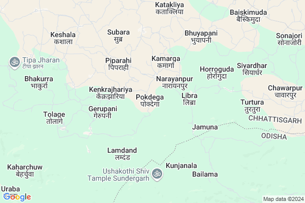
Pokdega
Pokdega Map
EDIT Map
Add Your House
 ..
..
Current Corona Virus Infected Patients Count in Raigarh District
| City Name | District Name | Total Covid cases |
|---|
Locality Name :
Pokdega
( पकडेगा )
Tehsil Name : Lailunga
District : Raigarh
State : Chattisgarh
Language : Chhattisgarhi and Hindi, Oriya
Current Time 12:17 AM
Date: Sunday , May 04,2025 (IST)
Time zone: IST (UTC+5:30)
Elevation / Altitude: 243 meters. Above Seal level
Telephone Code / Std Code: 07765
Assembly constituency : Lailunga assembly constituency
Assembly MLA : Vidyawati Sidar
Lok Sabha constituency : Raigarh parliamentary constituency
Parliament MP : GOMATI SAI
Serpanch Name :
Pin Code : 496113
Post Office Name : Lailunga
Main Village Name : Pokdega
Commodities Prices : Kotba Market / Mandi
Pokdega Live Weather
Temperature: 24.8 °C
scattered clouds
Humidity: 63%
Wind : 1.5 mt/sec towards SE
StationName : "Gharghoda"
observed on 2 Hours Back
Temperature: 24.8 °C
scattered clouds
Humidity: 63%
Wind : 1.5 mt/sec towards SE
StationName : "Gharghoda"
observed on 2 Hours Back
Pokdega Weather Forecast for Next 5 days
04-05-2025
23.3°C to 24.7°C
scattered clouds, few clouds
23.3°C to 24.7°C
scattered clouds, few clouds
05-05-2025
22.3°C to 38.7°C
clear sky, few clouds, light rain, scattered clouds
22.3°C to 38.7°C
clear sky, few clouds, light rain, scattered clouds
06-05-2025
23.4°C to 40.0°C
few clouds, broken clouds, scattered clouds, clear sky
23.4°C to 40.0°C
few clouds, broken clouds, scattered clouds, clear sky
07-05-2025
25.6°C to 40.2°C
few clouds, clear sky, scattered clouds, broken clouds
25.6°C to 40.2°C
few clouds, clear sky, scattered clouds, broken clouds
08-05-2025
27.0°C to 41.3°C
broken clouds, few clouds, scattered clouds, overcast clouds
27.0°C to 41.3°C
broken clouds, few clouds, scattered clouds, overcast clouds
Rivers Near Pokdega
Sonajori
Sanbandajor
Sonajori
Sanbandajor
About Pokdega
Correct below Info and add more info about PokdegaPokdega is a small Village/hamlet in Lailunga Tehsil in Raigarh District of Chattisgarh State, India. It comes under Pokdega Panchayath. It is located 56 KM towards North from District head quarters Raigarh. 11 KM from Lailunga. 276 KM from State capital Raipur
Pokdega Pin code is 496113 and postal head office is Lailunga .
Gerupani ( 3 KM ) , Bhuyapani ( 6 KM ) , Kupakani ( 8 KM ) , Khar ( 8 KM ) , Turtura ( 8 KM ) are the nearby Villages to Pokdega. Pokdega is surrounded by Tamnar Tehsil towards South , Lephripara Tehsil towards East , Hemgir Tehsil towards South , Gharghoda Tehsil towards west .
Sundargarh , Raigarh , Belpahar , Brajrajnagar are the near by Cities to Pokdega.
This Place is in the border of the Raigarh District and Jashpur District. Jashpur District Patthalgaon is North towards this place .
Pokdega 2011 Census Details
Pokdega Local Language is Chhattisgarhi. Pokdega Village Total population is 613 and number of houses are 165. Female Population is 46.8%. Village literacy rate is 53.3% and the Female Literacy rate is 21.2%.
Population
| Census Parameter | Census Data |
| Total Population | 613 |
| Total No of Houses | 165 |
| Female Population % | 46.8 % ( 287) |
| Total Literacy rate % | 53.3 % ( 327) |
| Female Literacy rate | 21.2 % ( 130) |
| Scheduled Tribes Population % | 9.8 % ( 60) |
| Scheduled Caste Population % | 1.5 % ( 9) |
| Working Population % | 60.4 % |
| Child(0 -6) Population by 2011 | 72 |
| Girl Child(0 -6) Population % by 2011 | 43.1 % ( 31) |
Pokdega Census More Deatils.
Politics in Pokdega
Bharatiya Janata Party , BJP , INC are the major political parties in this area.Polling Stations /Booths near Pokdega
1)Naharkela2)Narayanpur-1
3)Laripani
4)Piprahi(su
5)Kilkila (handipani Mohhalla)
HOW TO REACH Pokdega
By Rail
There is no railway station near to Pokdega in less than 10 km.Colleges near Pokdega
Shri Rameshwar Gahira Guru Sanskrit Purva Madhyamik Vidyalaya
Address : Lailunga, Raipur
Schools in Pokdega
Ums Pokdega
Address : pokdega , lailunga , raigarh (chhattisgarh) , Chattisgarh . PIN- 496113 , Post - Lailunga
Govt Health Centers near Pokdega
1) LIBRA , , ,2) SARAMDEGA , , ,
3) PIPRAHI , , ,
Sub Villages in Pokdega
Hospitals in Pokdega,Lailunga
Priyanka Medical & Health Care
Kotba Rd; Rudukela; Chhattisgarh 496113; India
18.5 KM distance Detail
Govt. Hospital & Helth Care;Surangpani
Surangpani; Chhattisgarh 496220; India
19.6 KM distance Detail
more ..
About Pokdega &
History
How to reach Pokdega
Tourist Places Near By Pokdega
Schools in Pokdega
Colleges in Pokdega
Temperature & weather of Pokdega
places in Pokdega
Pokdega photos
More Information
How to reach Pokdega
Tourist Places Near By Pokdega
Schools in Pokdega
Colleges in Pokdega
Temperature & weather of Pokdega
places in Pokdega
Pokdega photos
More Information
Village Talk
Post News or Events about this Village
Near Cities
Sundargarh 47 KM near
Raigarh 54 KM near
Belpahar 62 KM near
Brajrajnagar 63 KM near
Sundargarh 47 KM near
Raigarh 54 KM near
Belpahar 62 KM near
Brajrajnagar 63 KM near
Near By Taluks
Lailunga 11 KM near
Tamnar 29 KM near
Lephripara 31 KM near
Hemgir 32 KM near
Lailunga 11 KM near
Tamnar 29 KM near
Lephripara 31 KM near
Hemgir 32 KM near
Near By Air Ports
Ranchi Airport 232 KM near
Raipur Airport 258 KM near
Gaya Airport 343 KM near
Bhubaneswar Airport 354 KM near
Ranchi Airport 232 KM near
Raipur Airport 258 KM near
Gaya Airport 343 KM near
Bhubaneswar Airport 354 KM near
Near By Tourist Places
Raigarh 53 KM near
Hirakud 94 KM near
Jashpur 96 KM near
Sambalpur 105 KM near
Simdega 107 KM near
Raigarh 53 KM near
Hirakud 94 KM near
Jashpur 96 KM near
Sambalpur 105 KM near
Simdega 107 KM near
Near By Districts
Sundargarh 47 KM near
Raigarh 53 KM near
Jharsuguda 65 KM near
Jashpur 95 KM near
Sundargarh 47 KM near
Raigarh 53 KM near
Jharsuguda 65 KM near
Jashpur 95 KM near
Near By RailWay Station
Raigarh Rail Way Station 54 KM near
Brajrajnagar Rail Way Station 62 KM near
Raigarh Rail Way Station 54 KM near
Brajrajnagar Rail Way Station 62 KM near