| Home | City Bus | Maps | Villages | Cities | Rail | Tourist Places | School | College | Pin Codes | Corona Cases Count |
| Distance Calculator Bus Services IFSC Codes Trace Mobile Number Weather Search Place Trace IP Available Cash ATM/Banks Locate Polling Booth Report an Error contact People |
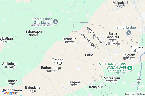
Bhaga Bandh Map
EDIT Map
Add Your House
 ..
..
Current Corona Virus Infected Patients Count in Pakur District
| City Name | District Name | Total Covid cases |
|---|
Locality Name :
Bhaga Bandh
( भगा बांध )
Block Name : Maheshpur
District : Pakur
State : Jharkhand
Language : Hindi and Santali
Current Time 02:57 AM
Date: Sunday , May 04,2025 (IST)
Time zone: IST (UTC+5:30)
Telephone Code / Std Code: 06435
Assembly constituency : Maheshpur assembly constituency
Assembly MLA : STEPHEN MARANDI
Lok Sabha constituency : Rajmahal parliamentary constituency
Parliament MP : VIJAY KUMAR HANSDAK
Serpanch Name :
Pin Code : 816107
Post Office Name : Pakur
Main Village Name : Bhaga Bandh
Alternate Village Name : Bhagabandh
Commodities Prices : Birbhum Market / Mandi
Bhaga Bandh Live Weather
Temperature: 30.2 °C
few clouds
Humidity: 47%
Wind : 4.48 mt/sec towards S
StationName : "Pakur"
observed on 2 Hours Back
Temperature: 30.2 °C
few clouds
Humidity: 47%
Wind : 4.48 mt/sec towards S
StationName : "Pakur"
observed on 2 Hours Back
Bhaga Bandh Weather Forecast for Next 5 days
04-05-2025
28.8°C to 31.0°C
scattered clouds
28.8°C to 31.0°C
scattered clouds
05-05-2025
27.4°C to 36.5°C
scattered clouds, broken clouds, light rain, moderate rain, clear sky
27.4°C to 36.5°C
scattered clouds, broken clouds, light rain, moderate rain, clear sky
06-05-2025
26.9°C to 39.3°C
clear sky, scattered clouds, few clouds, light rain
26.9°C to 39.3°C
clear sky, scattered clouds, few clouds, light rain
07-05-2025
26.8°C to 40.1°C
light rain, clear sky, few clouds, scattered clouds, broken clouds
26.8°C to 40.1°C
light rain, clear sky, few clouds, scattered clouds, broken clouds
08-05-2025
28.5°C to 40.9°C
scattered clouds, few clouds, broken clouds, overcast clouds
28.5°C to 40.9°C
scattered clouds, few clouds, broken clouds, overcast clouds
Rivers Near Bhaga Bandh
Mayurakshi
Hooghly :হুগলী :Hugli :Hooghly :Hugli
Mayurakshi
Hooghly :হুগলী :Hugli :Hooghly :Hugli
About Bhaga Bandh
Correct below Info and add more info about Bhaga BandhBhaga Bandh is a small Village/hamlet in Maheshpur Block in Pakur District of Jharkhand State, India. It comes under Bhaga Bandh Panchayath. It is located 14 KM towards South from District head quarters Pakur. 9 KM from Maheshpur. 332 KM from State capital Ranchi
Bhaga Bandh Pin code is 816107 and postal head office is Pakur .
Rampur ( 8 KM ) , Maheshpur ( 9 KM ) , Babudaha ( 10 KM ) , Malpahari ( 10 KM ) , Saharkol ( 12 KM ) are the nearby Villages to Bhaga Bandh. Bhaga Bandh is surrounded by Pakur Block towards North , Murarai-I Block towards South , Hiranpur Block towards North , Murarai-Ii Block towards East .
Pakaur , Dhulian , Paschim Punropara , Rampurhat are the near by Cities to Bhaga Bandh.
This Place is in the border of the Pakur District and Birbhum District. Birbhum District Murarai-i is South towards this place . It is near to the West Bengal State Border.
Bhagabandh 2011 Census Details
Bhaga Bandh Local Language is Hindi. Bhagabandh Village Total population is 750 and number of houses are 146. Female Population is 48.9%. Village literacy rate is 21.1% and the Female Literacy rate is 8.5%.
Population
| Census Parameter | Census Data |
| Total Population | 750 |
| Total No of Houses | 146 |
| Female Population % | 48.9 % ( 367) |
| Total Literacy rate % | 21.1 % ( 158) |
| Female Literacy rate | 8.5 % ( 64) |
| Scheduled Tribes Population % | 100.0 % ( 750) |
| Scheduled Caste Population % | 0.0 % ( 0) |
| Working Population % | 56.3 % |
| Child(0 -6) Population by 2011 | 173 |
| Girl Child(0 -6) Population % by 2011 | 48.0 % ( 83) |
Bhagabandh Census More Deatils.
Politics in Bhaga Bandh
JVM , Jharkhand Mukti Morcha , BJP , JMM are the major political parties in this area.Polling Stations /Booths near Bhaga Bandh
1)Primary School Benakura2)Upgraded Middle School Tetulia
3)Primary School Bishanpur
4)Upgraded Middle School Jaynagra
5)Middle School Ramdeokundi
HOW TO REACH Bhaga Bandh
By Rail
Rajgram Rail Way Station is the very nearby railway stations to Bhaga Bandh.Schools near Bhaga Bandh
Jawahar Navodaya Vidyalaya
Address :
Uttkramit Middle School Nurai
Address : Nurai, Maheshpur, Pakur, Pin 816106
Govt Health Centers near Bhaga Bandh
1) HSC BHAGABANDH , HSC BHAGABANDH , BHAGABANDH ,2) HSC BORIO , HSC BORIO , BORIO ,
3) HSC TARAPUR , HSC TARAPUR , TARAPUR ,
Sub Villages in Bhaga Bandh
Hospitals in Bhaga Bandh,Maheshpur
gourangomedical hall
ambedkar chowk West Bengal; Amrapara - Maheshpur - Murarai Rd; Maheshpur; 816106; India
9.9 KM distance Detail
sarkar Automobuiles
Rajgram-Kasilla-Bahutali Rd; Ambhua; West Bengal 731222; India
10.2 KM distance Detail
more ..
Petrol Bunks in Bhaga Bandh,Maheshpur
M/s Shree Jin Mata Auto Fuel Centre - Petrol Pump
Near Police Station; Murarai Road; Mahespur;; Pakur; Jharkhand 816106; India
9.7 KM distance Detail
HP PETROL PUMP - SARITA SERVICE STATION
HP Petrol Pump PO Maheshpur PS Maheshpur; Ranchi; Jharkhand 816106; India
9.9 KM distance Detail
more ..
Colleges in Bhaga Bandh,Maheshpur
Ursuline Primary Teachers' Education College; Chandrapura
Chandrapura; Maheshpur; Jharkhand; India
6.9 KM distance Detail
CSC ACADEMY; NDLM; MAHESHPUR
MAHESHPUR; HATPARA ROAD; Amrapara - Maheshpur - Murarai Rd; Maheshpur; Jharkhand 816106; India
9.2 KM distance Detail
Pakur Polytechnic; Pakur
National Highway 114A; Beside New DC(Combined Building) Office; Pakur; Kalajora; Jharkhand 816107; India
10.2 KM distance Detail
more ..
Super Markets in Bhaga Bandh,Maheshpur
Annapurna Super Market
Rajgram-Kasilla-Bahutali Rd; Ambhua; West Bengal 731222; India
11.7 KM distance Detail
Police Stations near Bhaga Bandh,Maheshpur
New Police Line
Police Ln; Police Line; Beliadanga; Pakur; Jharkhand 816107; India
14.9 KM distance Detail
About Bhaga Bandh &
History
How to reach Bhaga Bandh
Tourist Places Near By Bhaga Bandh
Schools in Bhaga Bandh
Colleges in Bhaga Bandh
Temperature & weather of Bhaga Bandh
places in Bhaga Bandh
Bhaga Bandh photos
More Information
How to reach Bhaga Bandh
Tourist Places Near By Bhaga Bandh
Schools in Bhaga Bandh
Colleges in Bhaga Bandh
Temperature & weather of Bhaga Bandh
places in Bhaga Bandh
Bhaga Bandh photos
More Information
Village Talk
Post News or Events about this Village
Near Cities
Pakaur 13 KM near
Dhulian 27 KM near
Paschim Punropara 33 KM near
Rampurhat 47 KM near
Pakaur 13 KM near
Dhulian 27 KM near
Paschim Punropara 33 KM near
Rampurhat 47 KM near
Near By Taluks
Maheshpur 9 KM near
Murarai-I 13 KM near
Pakur 13 KM near
Hiranpur 15 KM near
Maheshpur 9 KM near
Murarai-I 13 KM near
Pakur 13 KM near
Hiranpur 15 KM near
Near By Air Ports
Netaji Subhas Chandra Bose Airport 249 KM near
Bagdogra Airport 273 KM near
Rupsi Airport 313 KM near
Ranchi Airport 317 KM near
Netaji Subhas Chandra Bose Airport 249 KM near
Bagdogra Airport 273 KM near
Rupsi Airport 313 KM near
Ranchi Airport 317 KM near
Near By Tourist Places
Pakur 13 KM near
Dumka 69 KM near
English-Bazar 70 KM near
Malda 71 KM near
Murshidabad 74 KM near
Pakur 13 KM near
Dumka 69 KM near
English-Bazar 70 KM near
Malda 71 KM near
Murshidabad 74 KM near
Near By Districts
Pakur 14 KM near
Dumka 69 KM near
Maldah 71 KM near
Godda 72 KM near
Pakur 14 KM near
Dumka 69 KM near
Maldah 71 KM near
Godda 72 KM near
Near By RailWay Station
Pakur Rail Way Station 14 KM near
Murarai Rail Way Station 16 KM near
Pakur Rail Way Station 14 KM near
Murarai Rail Way Station 16 KM near