| Home | City Bus | Maps | Villages | Cities | Rail | Tourist Places | School | College | Pin Codes | Corona Cases Count |
| Distance Calculator Bus Services IFSC Codes Trace Mobile Number Weather Search Place Trace IP Available Cash ATM/Banks Locate Polling Booth Report an Error contact People |
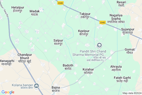
Inayatpur
Inayatpur Map
EDIT Map
Add Your House
 ..
..
Current Corona Virus Infected Patients Count in Mathura District
| City Name | District Name | Total Covid cases |
|---|---|---|
| Mathura District | Mathura | 10 |
Locality Name :
Inayatpur
( इनायतपुर )
Block Name : Nohjhil
District : Mathura
State : Uttar Pradesh
Division : Agra
Language : Hindi and Urdu
Current Time 11:17 PM
Date: Friday , May 02,2025 (IST)
Time zone: IST (UTC+5:30)
Elevation / Altitude: 189 meters. Above Seal level
Telephone Code / Std Code: 05662
Assembly constituency : Khair assembly constituency
Assembly MLA : Anoop Singh Urf Anoop Pradhan Valmeeki
Lok Sabha constituency : Aligarh parliamentary constituency
Parliament MP : SATISH KUMAR GAUTAM
Serpanch Name :
Main Village Name : Inayatpur
Commodities Prices : Khair Market / Mandi
National Highways Reachable To Inayatpur
Nationa High Way :NH509
Nationa High Way :NH509
Rivers Near Inayatpur
Karwan Nadi
यमुना (Yamuna) :যমুনা :Yamuna :યમુના :यमुना :ಯಮುನಾ :यमुना :யமுனை :Ямуна :https://1drv.ms/b/s!Ar-WXIFaX7UdgQuO6WpVrTr6YYsQ
Karwan Nadi
यमुना (Yamuna) :যমুনা :Yamuna :યમુના :यमुना :ಯಮುನಾ :यमुना :யமுனை :Ямуна :https://1drv.ms/b/s!Ar-WXIFaX7UdgQuO6WpVrTr6YYsQ
About Inayatpur
Correct below Info and add more info about InayatpurInayatpur is a small Village/hamlet in Nohjhil Block in Mathura District of Uttar Pradesh State, India. It comes under Inayatpur Panchayath. It belongs to Agra Division . It is located 58 KM towards North from District head quarters Mathura. 8 KM from Nohjhil. 401 KM from State capital Lucknow
Sakatpur ( 3 KM ) , Shankar Garhi ( 3 KM ) , Dilu Patti ( 4 KM ) , Kolahar ( 4 KM ) , Bajna ( 5 KM ) are the nearby Villages to Inayatpur. Inayatpur is surrounded by Tappal Block towards North , Khair Block towards East , Chandaus Block towards East , Gonda Block towards East .
Hodal , Aligarh , Vrindavan , Palwal are the near by Cities to Inayatpur.
Inayatpur 2011 Census Details
Inayatpur Local Language is Hindi. Inayatpur Village Total population is 167 and number of houses are 25. Female Population is 47.9%. Village literacy rate is 65.9% and the Female Literacy rate is 25.1%.
Population
| Census Parameter | Census Data |
| Total Population | 167 |
| Total No of Houses | 25 |
| Female Population % | 47.9 % ( 80) |
| Total Literacy rate % | 65.9 % ( 110) |
| Female Literacy rate | 25.1 % ( 42) |
| Scheduled Tribes Population % | 0.0 % ( 0) |
| Scheduled Caste Population % | 0.0 % ( 0) |
| Working Population % | 39.5 % |
| Child(0 -6) Population by 2011 | 29 |
| Girl Child(0 -6) Population % by 2011 | 51.7 % ( 15) |
Inayatpur Census More Deatils.
Politics in Inayatpur
BJP , RLD , BSP , INC are the major political parties in this area.Polling Stations /Booths near Inayatpur
1)Primary School Plaveeran2)Jamuna Khand Higher Secodry School Tappal R.n. 5
3)Janta Vikas Inter College Mathna R.n. 1
4)Primary School Bajhera
5)Junior High School Khediya Kurd R.n. 2
HOW TO REACH Inayatpur
By Rail
There is no railway station near to Inayatpur in less than 10 km.Pincodes near Inayatpur
281201 ( Bajna (Mathura) ) , 202135 ( Gomat ) , 202141 ( Dayal Nagar )Colleges near Inayatpur
Sri Mohar Singh Mahavidyalaya, Nanakpur Mathura
Address : Nanakpur, Nohjheel
Skv Inter College
Address :
Shri Radha Krishna Inter Collage, Tilkagarhi
Address :
Sarswati Siksha Niketan Suhagpur (mathura) 28 1201
Address :
G.s.tiwari Public School Chandpur Kalan
Address :
Schools near Inayatpur
Neh.smarak Kri. Int. Coll. Re
Address : chandapur kalan , nohjheel , mathura , Uttar Pradesh . PIN- 281201 , Post - Bajna (Mathura)
Sri R.krishan Int.coll. H.pur.
Address : hasan pur (nau.) , nohjheel , mathura , Uttar Pradesh . PIN- 281201 , Post - Bajna (Mathura)
Sri G.ashram Int. Coll.bera
Address : bera , nohjheel , mathura , Uttar Pradesh . PIN- 281205 , Post - Surir
J.h.s.asafabad
Address : asafabad , nohjheel , mathura , Uttar Pradesh . PIN- 281011
Govt Health Centers near Inayatpur
1) Badauth , Sub Centre , Badauth ,2) Kolahar , Sub Centre , Kolahar , Bajna kher Rod
3) Bharatia , Sub Centre , Bharatia , Kaneka
Sub Villages in Inayatpur
Schools in Inayatpur,Nohjhil
Electronic Shops in Inayatpur,Nohjhil
Super Markets in Inayatpur,Nohjhil
Local Parks in Inayatpur,Nohjhil
Police Stations near Inayatpur,Nohjhil
Governement Offices near Inayatpur,Nohjhil
About Inayatpur &
History
How to reach Inayatpur
Tourist Places Near By Inayatpur
Schools in Inayatpur
Colleges in Inayatpur
Temperature & weather of Inayatpur
places in Inayatpur
Inayatpur photos
More Information
How to reach Inayatpur
Tourist Places Near By Inayatpur
Schools in Inayatpur
Colleges in Inayatpur
Temperature & weather of Inayatpur
places in Inayatpur
Inayatpur photos
More Information
Village Talk
Post News or Events about this Village
Near Cities
Hodal 36 KM near
Aligarh 41 KM near
Vrindavan 46 KM near
Palwal 49 KM near
Hodal 36 KM near
Aligarh 41 KM near
Vrindavan 46 KM near
Palwal 49 KM near
Near By Taluks
Nohjhil 8 KM near
Tappal 11 KM near
Khair 14 KM near
Chandaus 24 KM near
Nohjhil 8 KM near
Tappal 11 KM near
Khair 14 KM near
Chandaus 24 KM near
Near By Air Ports
Indira Gandhi International Airport 100 KM near
Kheria Airport 102 KM near
Muzaffarnagar Airport 184 KM near
Gwalior Airport 214 KM near
Indira Gandhi International Airport 100 KM near
Kheria Airport 102 KM near
Muzaffarnagar Airport 184 KM near
Gwalior Airport 214 KM near
Near By Tourist Places
Dabchick 36 KM near
Aligarh 42 KM near
Vrindavan 45 KM near
Mathura 57 KM near
Bulandshahr 58 KM near
Dabchick 36 KM near
Aligarh 42 KM near
Vrindavan 45 KM near
Mathura 57 KM near
Bulandshahr 58 KM near
Near By Districts
Aligarh 41 KM near
Palwal 49 KM near
Gautam Buddha Nagar 55 KM near
Mathura 56 KM near
Aligarh 41 KM near
Palwal 49 KM near
Gautam Buddha Nagar 55 KM near
Mathura 56 KM near
Near By RailWay Station
Kosi Kalan Rail Way Station 34 KM near
Khurja Junction Rail Way Station 34 KM near
Kosi Kalan Rail Way Station 34 KM near
Khurja Junction Rail Way Station 34 KM near