| Home | City Bus | Maps | Villages | Cities | Rail | Tourist Places | School | College | Pin Codes | Corona Cases Count |
| Distance Calculator Bus Services IFSC Codes Trace Mobile Number Weather Search Place Trace IP Available Cash ATM/Banks Locate Polling Booth Report an Error contact People |
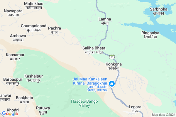
Sarpata
Sarpata Map
EDIT Map
Add Your House
 ..
..
Current Corona Virus Infected Patients Count in Korba District
| City Name | District Name | Total Covid cases |
|---|---|---|
| Korba District | Korba | 25 |
| Katghora | Korba | 3 |
Locality Name :
Sarpata
( सरपट )
Tehsil Name : Podi Uparoda
District : Korba
State : Chattisgarh
Language : Chhattisgarhi and Hindi
Current Time 12:39 AM
Date: Sunday , May 04,2025 (IST)
Time zone: IST (UTC+5:30)
Elevation / Altitude: 293 meters. Above Seal level
Telephone Code / Std Code: 07815
Assembly constituency : Pali-Tanakhar assembly constituency
Assembly MLA : Tuleshwar Hira Singh Markam
Lok Sabha constituency : Korba parliamentary constituency
Parliament MP : JYOTSNA CHARANDAS MAHANT
Serpanch Name :
Pin Code : 495445
Post Office Name : Katghora
Main Village Name : Sarpata
Commodities Prices : Katghora Market / Mandi
Sarpata Live Weather
Temperature: 25.3 °C
clear sky
Humidity: 50%
Wind : 1.25 mt/sec towards SE
StationName : "Katghora"
observed on 2 Hours Back
Temperature: 25.3 °C
clear sky
Humidity: 50%
Wind : 1.25 mt/sec towards SE
StationName : "Katghora"
observed on 2 Hours Back
Sarpata Weather Forecast for Next 5 days
04-05-2025
23.6°C to 24.5°C
few clouds, clear sky
23.6°C to 24.5°C
few clouds, clear sky
05-05-2025
22.6°C to 38.3°C
clear sky, few clouds, moderate rain, light rain, broken clouds
22.6°C to 38.3°C
clear sky, few clouds, moderate rain, light rain, broken clouds
06-05-2025
23.6°C to 40.2°C
broken clouds, clear sky, few clouds
23.6°C to 40.2°C
broken clouds, clear sky, few clouds
07-05-2025
25.8°C to 41.2°C
scattered clouds, clear sky, few clouds, broken clouds
25.8°C to 41.2°C
scattered clouds, clear sky, few clouds, broken clouds
08-05-2025
26.1°C to 41.9°C
scattered clouds, overcast clouds
26.1°C to 41.9°C
scattered clouds, overcast clouds
Rivers Near Sarpata
Samarsuta
Chornai
Samarsuta
Chornai
About Sarpata
Correct below Info and add more info about SarpataSarpata is a small Village/hamlet in Podi Uparoda Tehsil in Korba District of Chattisgarh State, India. It comes under Sarpata Panchayath. It is located 48 KM towards North from District head quarters Korba. 212 KM from State capital Raipur
Sarpata Pin code is 495445 and postal head office is Katghora .
Sarpata is surrounded by Katghora Tehsil towards South , Pali Tehsil towards South , Korba Tehsil towards South , Premnagar Tehsil towards North .
Dipka , Korba , Chirmiri , Akaltara are the near by Cities to Sarpata.
Sarpata 2011 Census Details
Sarpata Local Language is Chhattisgarhi. Sarpata Village Total population is 422 and number of houses are 116. Female Population is 49.8%. Village literacy rate is 60.4% and the Female Literacy rate is 23.9%.
Population
| Census Parameter | Census Data |
| Total Population | 422 |
| Total No of Houses | 116 |
| Female Population % | 49.8 % ( 210) |
| Total Literacy rate % | 60.4 % ( 255) |
| Female Literacy rate | 23.9 % ( 101) |
| Scheduled Tribes Population % | 19.0 % ( 80) |
| Scheduled Caste Population % | 14.0 % ( 59) |
| Working Population % | 64.5 % |
| Child(0 -6) Population by 2011 | 66 |
| Girl Child(0 -6) Population % by 2011 | 43.9 % ( 29) |
Sarpata Census More Deatils.
Politics in Sarpata
Indian National Congress , BJP , INC are the major political parties in this area.Polling Stations /Booths near Sarpata
1)Sakho(bagbudapara)2)Tulbul
3)Bapaputi
4)Madanpur
5)Kutelamuda
HOW TO REACH Sarpata
By Rail
There is no railway station near to Sarpata in less than 10 km.Colleges near Sarpata
Govt. College Kartala
Address :
P G Collage Korba
Address : Gorhi
gorhi
gorhi
Jifsa Pvt. Iti - Industrial Training Institute
Address : Jifsa Pvt. Iti Industrial Training Institute,
residential & Training Practical Ground,
gevra Bypass Road, Kuchaina, Kusmunda
korba, Chhattisgarh India
Institute Of Technology (it)
Address : Korba, Vill-rumgara, P.o. – Balco Nagar, Korba (c
Modern Institute Of Managment And Technology
Address : Behind Icici Bank,t P Nagar
Schools in Sarpata
Ps Sarpata
Address : sarpata , pondi-uproda , korba , Chattisgarh . PIN- 495445 , Post - Katghora
Govt Health Centers near Sarpata
1) MADAI , SHC-MADAI , NEAR MARKET MADAI , NEAR MARKET MADAI2) PACHRA , SHC-PACHRA , NEAR MARKET , NERA HIGH SCHOOL-PACHRA
3) Sarbhoka , SHC-SARBHOKA , NEAR GOVT. SCHOOL-SARBHOKA , BEHIND PANCHYAT BHAVAN SARBHOKA
Sub Villages in Sarpata
Petrol Bunks in Sarpata,Podi Uparoda
Shree Mahamaya Fuels Petrol Pump
NH111; Amakhokhara; Chhattisgarh 495445; India
20.5 KM distance Detail
Bharat Petroleum
Korba; NH-130; Ambikapur Highway; Kothaghora; Kothaghora; Chhattisgarh 497116; India
20.5 KM distance Detail
more ..
Schools in Sarpata,Podi Uparoda
Saraswati Shishu Mandir Gursiya
Ambikapur Road; Gursia; Chhattisgarh 495445; India
4.8 KM distance Detail
Police Stations near Sarpata,Podi Uparoda
Katghora Police Station
Tahsil Collony; Katghora; Chhattisgarh 495445; India
22.7 KM distance Detail
About Sarpata &
History
How to reach Sarpata
Tourist Places Near By Sarpata
Schools in Sarpata
Colleges in Sarpata
Temperature & weather of Sarpata
places in Sarpata
Sarpata photos
More Information
How to reach Sarpata
Tourist Places Near By Sarpata
Schools in Sarpata
Colleges in Sarpata
Temperature & weather of Sarpata
places in Sarpata
Sarpata photos
More Information
Village Talk
Post News or Events about this Village
Near Cities
Dipka 40 KM near
Korba 53 KM near
Chirmiri 67 KM near
Akaltara 80 KM near
Dipka 40 KM near
Korba 53 KM near
Chirmiri 67 KM near
Akaltara 80 KM near
Near By Taluks
Podi Uparoda 0 KM near
Katghora 32 KM near
Pali 39 KM near
Korba 48 KM near
Podi Uparoda 0 KM near
Katghora 32 KM near
Pali 39 KM near
Korba 48 KM near
Near By Air Ports
Raipur Airport 204 KM near
Jabalpur Airport 294 KM near
Ranchi Airport 334 KM near
Varanasi Airport 348 KM near
Raipur Airport 204 KM near
Jabalpur Airport 294 KM near
Ranchi Airport 334 KM near
Varanasi Airport 348 KM near
Near By Tourist Places
Korba 45 KM near
Janjgir-Champa 66 KM near
Baikunthpur 72 KM near
Amarkantak 83 KM near
Janjgir 83 KM near
Korba 45 KM near
Janjgir-Champa 66 KM near
Baikunthpur 72 KM near
Amarkantak 83 KM near
Janjgir 83 KM near
Near By Districts
Korba 46 KM near
Korea 74 KM near
Bilaspur 84 KM near
Janjgir-Champa 94 KM near
Korba 46 KM near
Korea 74 KM near
Bilaspur 84 KM near
Janjgir-Champa 94 KM near
Near By RailWay Station
Belgahna Rail Way Station 60 KM near
Pendra Road Rail Way Station 68 KM near
Belgahna Rail Way Station 60 KM near
Pendra Road Rail Way Station 68 KM near