| Home | City Bus | Maps | Villages | Cities | Rail | Tourist Places | School | College | Pin Codes | Corona Cases Count |
| Distance Calculator Bus Services IFSC Codes Trace Mobile Number Weather Search Place Trace IP Available Cash ATM/Banks Locate Polling Booth Report an Error contact People |
Hathmar
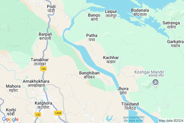
Hathmar Map
EDIT Map
Add Your House
 ..
..
Current Corona Virus Infected Patients Count in Korba District
| City Name | District Name | Total Covid cases |
|---|---|---|
| Korba District | Korba | 25 |
| Katghora | Korba | 3 |
Locality Name :
Hathmar
( हाथमार )
Tehsil Name : Podi Uparoda
District : Korba
State : Chattisgarh
Language : Chhattisgarhi and Hindi
Current Time 10:45 PM
Date: Saturday , May 03,2025 (IST)
Time zone: IST (UTC+5:30)
Elevation / Altitude: 293 meters. Above Seal level
Telephone Code / Std Code: 07815
Assembly constituency : Rampur assembly constituency
Assembly MLA : Phoolsingh Rathiya
Lok Sabha constituency : Korba parliamentary constituency
Parliament MP : JYOTSNA CHARANDAS MAHANT
Serpanch Name :
Pin Code : 495445
Post Office Name : Katghora
Main Village Name : Hathmar
Commodities Prices : Katghora Market / Mandi
Rivers Near Hathmar
Samarsuta
Chornai
Samarsuta
Chornai
About Hathmar
Correct below Info and add more info about HathmarHathmar is a small Village/hamlet in Podi Uparoda Tehsil in Korba District of Chattisgarh State, India. It comes under Hathmar Panchayath. It is located 28 KM towards North from District head quarters Korba. 20 KM from Podi Uparoda. 205 KM from State capital Raipur
Hathmar Pin code is 495445 and postal head office is Katghora .
Ghuchapur ( 3 KM ) , Bango ( 6 KM ) , Lalpur ( 7 KM ) , Chhurikhurd ( 7 KM ) , Tanakhar ( 7 KM ) are the nearby Villages to Hathmar. Hathmar is surrounded by Podi Uparoda Tehsil towards North , Korba Tehsil towards South , Pali Tehsil towards west , Kartala Tehsil towards South .
Dipka , Korba , Champa , Naila Janjgir are the near by Cities to Hathmar.
Hathmar 2011 Census Details
Hathmar Local Language is Chhattisgarhi. Hathmar Village Total population is 170 and number of houses are 36. Female Population is 50.0%. Village literacy rate is 55.9% and the Female Literacy rate is 23.5%.
Population
| Census Parameter | Census Data |
| Total Population | 170 |
| Total No of Houses | 36 |
| Female Population % | 50.0 % ( 85) |
| Total Literacy rate % | 55.9 % ( 95) |
| Female Literacy rate | 23.5 % ( 40) |
| Scheduled Tribes Population % | 94.7 % ( 161) |
| Scheduled Caste Population % | 0.0 % ( 0) |
| Working Population % | 61.8 % |
| Child(0 -6) Population by 2011 | 21 |
| Girl Child(0 -6) Population % by 2011 | 52.4 % ( 11) |
Hathmar Census More Deatils.
Politics in Hathmar
Indian National Congress , BJP , INC are the major political parties in this area.Polling Stations /Booths near Hathmar
1)Kachhar2)Tharakpur
3)Khuntakunda
4)Pidiya
5)Barpali
HOW TO REACH Hathmar
By Rail
There is no railway station near to Hathmar in less than 10 km.Colleges near Hathmar
Govt. College Kartala
Address :
P G Collage Korba
Address : Gorhi
gorhi
gorhi
Jifsa Pvt. Iti - Industrial Training Institute
Address : Jifsa Pvt. Iti Industrial Training Institute,
residential & Training Practical Ground,
gevra Bypass Road, Kuchaina, Kusmunda
korba, Chhattisgarh India
Institute Of Technology (it)
Address : Korba, Vill-rumgara, P.o. – Balco Nagar, Korba (c
Modern Institute Of Managment And Technology
Address : Behind Icici Bank,t P Nagar
Schools in Hathmar
Ps. Hathmar
Address : hathmar , pondi-uproda , korba , Chattisgarh . PIN- 495445 , Post - Katghora
Govt Health Centers near Hathmar
1) Kachar , SHC Kachar , Manjhi Para kachar , Near Aanganbadi2) SHC BANJIBAN , SHC-BANJHIBAN , NEAR AWC-BANJHIBAN , NEAR AWC-BANJHIBAN
3) Gharipakhna , SHC-GHARIPAKHNA , NEAR GRAM PANCHYAT GHARIPAKHNA , NEAR GOVT. SCHOOL-GHARIPAKHNA
Sub Villages in Hathmar
Petrol Bunks in Hathmar,Podi Uparoda
Bharat Petroleum
Korba; NH-130; Ambikapur Highway; Kothaghora; Kothaghora; Chhattisgarh 497116; India
7.5 KM distance Detail
Shree Mahamaya Fuels Petrol Pump
NH111; Amakhokhara; Chhattisgarh 495445; India
7.5 KM distance Detail
HP Petrol Pump - Gomti Fuel
Hpcl Petrol Pump Near NEW BUS Stand Katghora; Raipur; Chhattisgarh 495445; India
7.7 KM distance Detail
Hindustan Petroleum
Mohline Bhata; Korba; NH-130; Ambikapur Highway; Kothaghora; Kothaghora; Chhattisgarh 497116; India
7.8 KM distance Detail
more ..
Colleges in Hathmar,Podi Uparoda
Government Mukut Dhar Pandey Mahavidyalaya
Dudga; Korba; SH-4; Korba Road; Katghora; Katghora; Chhattisgarh 495675; India
8.5 KM distance Detail
more ..
Schools in Hathmar,Podi Uparoda
Kings Public School Katghora Korba Chattisgarh
Katghora; Chhattisgarh 495445; India
7.5 KM distance Detail
Electronic Shops in Hathmar,Podi Uparoda
Agarwal Agencies
Infront Of High School; Katghora; Chhattisgarh 495445; India
8.0 KM distance Detail
About Hathmar &
History
How to reach Hathmar
Tourist Places Near By Hathmar
Schools in Hathmar
Colleges in Hathmar
Temperature & weather of Hathmar
places in Hathmar
Hathmar photos
More Information
How to reach Hathmar
Tourist Places Near By Hathmar
Schools in Hathmar
Colleges in Hathmar
Temperature & weather of Hathmar
places in Hathmar
Hathmar photos
More Information
Village Talk
Post News or Events about this Village
Near Cities
Dipka 25 KM near
Korba 33 KM near
Champa 64 KM near
Naila Janjgir 66 KM near
Dipka 25 KM near
Korba 33 KM near
Champa 64 KM near
Naila Janjgir 66 KM near
Near By Taluks
Katghora 15 KM near
Podi Uparoda 19 KM near
Korba 28 KM near
Pali 34 KM near
Katghora 15 KM near
Podi Uparoda 19 KM near
Korba 28 KM near
Pali 34 KM near
Near By Air Ports
Raipur Airport 196 KM near
Jabalpur Airport 307 KM near
Ranchi Airport 326 KM near
Varanasi Airport 362 KM near
Raipur Airport 196 KM near
Jabalpur Airport 307 KM near
Ranchi Airport 326 KM near
Varanasi Airport 362 KM near
Near By Tourist Places
Korba 26 KM near
Janjgir-Champa 53 KM near
Janjgir 67 KM near
Bilaspur 79 KM near
Baikunthpur 87 KM near
Korba 26 KM near
Janjgir-Champa 53 KM near
Janjgir 67 KM near
Bilaspur 79 KM near
Baikunthpur 87 KM near
Near By Districts
Korba 27 KM near
Janjgir-Champa 75 KM near
Bilaspur 78 KM near
Korea 88 KM near
Korba 27 KM near
Janjgir-Champa 75 KM near
Bilaspur 78 KM near
Korea 88 KM near
Near By RailWay Station
Champa Junction Rail Way Station 64 KM near
Janjgir Naila Rail Way Station 65 KM near
Champa Junction Rail Way Station 64 KM near
Janjgir Naila Rail Way Station 65 KM near