| Home | City Bus | Maps | Villages | Cities | Rail | Tourist Places | School | College | Pin Codes | Corona Cases Count |
| Distance Calculator Bus Services IFSC Codes Trace Mobile Number Weather Search Place Trace IP Available Cash ATM/Banks Locate Polling Booth Report an Error contact People |
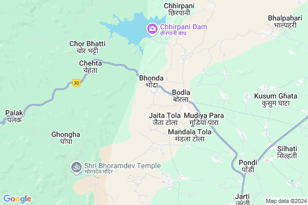
Kotnapani
Kotnapani Map
EDIT Map
Add Your House
 ..
..
Current Corona Virus Infected Patients Count in Kabirdham District
| City Name | District Name | Total Covid cases |
|---|
Locality Name :
Kotnapani
( कोटनपानी )
Tehsil Name : Bodla
District : Kabirdham
State : Chattisgarh
Language : Chhattisgarhi and Hindi, Agariya
Current Time 12:23 PM
Date: Thursday , May 01,2025 (IST)
Time zone: IST (UTC+5:30)
Elevation / Altitude: 325 meters. Above Seal level
Telephone Code / Std Code: 07740
Assembly constituency : Kawardha assembly constituency
Assembly MLA : Vijay Sharma
Lok Sabha constituency : Rajnandgaon parliamentary constituency
Parliament MP : SANTOSH PANDEY
Serpanch Name :
Pin Code : 491995
Post Office Name : Kawardha
Main Village Name : Kotnapani
Commodities Prices : Kawardha Market / Mandi
Kotnapani Live Weather
Temperature: 36.9 °C
clear sky
Humidity: 22%
Wind : 3.12 mt/sec towards SE
StationName : "Kawardha"
observed on 1 Hours Back
Temperature: 36.9 °C
clear sky
Humidity: 22%
Wind : 3.12 mt/sec towards SE
StationName : "Kawardha"
observed on 1 Hours Back
Kotnapani Weather Forecast for Next 5 days
02-05-2025
24.7°C to 38.3°C
clear sky, few clouds, light rain
24.7°C to 38.3°C
clear sky, few clouds, light rain
03-05-2025
23.3°C to 39.8°C
clear sky, scattered clouds, broken clouds, few clouds
23.3°C to 39.8°C
clear sky, scattered clouds, broken clouds, few clouds
04-05-2025
24.7°C to 40.8°C
scattered clouds, clear sky, broken clouds
24.7°C to 40.8°C
scattered clouds, clear sky, broken clouds
05-05-2025
26.4°C to 41.1°C
scattered clouds, clear sky, few clouds, overcast clouds, light rain, broken clouds
26.4°C to 41.1°C
scattered clouds, clear sky, few clouds, overcast clouds, light rain, broken clouds
06-05-2025
25.7°C to 40.5°C
light rain, overcast clouds, broken clouds, scattered clouds
25.7°C to 40.5°C
light rain, overcast clouds, broken clouds, scattered clouds
Rivers Near Kotnapani
Baniar
Tannor
Baniar
Tannor
About Kotnapani
Correct below Info and add more info about KotnapaniKotnapani is a small Village/hamlet in Bodla Tehsil in Kabirdham District of Chattisgarh State, India. It comes under Kotnapani Panchayath. It is located 20 KM towards North from District head quarters Kawardha. 129 KM from State capital Raipur
Kotnapani Pin code is 491995 and postal head office is Kawardha .
Kotnapani is surrounded by Kabirdham Tehsil towards South , Kawardha Tehsil towards South , Pandariya Tehsil towards East , S.Lohara Tehsil towards South .
Kawardha , Mungeli , Malajkhand , Bemetra are the near by Cities to Kotnapani.
Kotnapani 2011 Census Details
Kotnapani Local Language is Chhattisgarhi. Kotnapani Village Total population is 176 and number of houses are 36. Female Population is 50.0%. Village literacy rate is 44.9% and the Female Literacy rate is 20.5%.
Population
| Census Parameter | Census Data |
| Total Population | 176 |
| Total No of Houses | 36 |
| Female Population % | 50.0 % ( 88) |
| Total Literacy rate % | 44.9 % ( 79) |
| Female Literacy rate | 20.5 % ( 36) |
| Scheduled Tribes Population % | 93.2 % ( 164) |
| Scheduled Caste Population % | 0.0 % ( 0) |
| Working Population % | 53.4 % |
| Child(0 -6) Population by 2011 | 43 |
| Girl Child(0 -6) Population % by 2011 | 44.2 % ( 19) |
Kotnapani Census More Deatils.
Politics in Kotnapani
Bharatiya Janata Party , BJP , INC are the major political parties in this area.Polling Stations /Booths near Kotnapani
1)Bodla2)Bodla
3)Bodla
4)Bodhikunda
5)Harmo
HOW TO REACH Kotnapani
By Rail
There is no railway station near to Kotnapani in less than 10 km.Colleges near Kotnapani
Government Swami Vivekanand Collage Bodla
Address :
Schools in Kotnapani
U.n.p.s.kotnapani
Address : kotnapani , bodla , kawardha , Chattisgarh . PIN- 491995 , Post - Kawardha
Govt Health Centers near Kotnapani
1) SHC Mandlatola , , ,2) SHC Khairbanakhurd , , ,
3) CHC Bodla , , ,
Sub Villages in Kotnapani
Hospitals in Kotnapani,Bodla
Primary Health Center
Bodla; Kabirdham; NH-12A; Chillip Highway; Kawardha; Kawardha; Chhattisgarh 491995; India
1.9 KM distance Detail
Govt. Hospital Bodla
Bodla; Kabirdham NH-12A; Chillip Highway; Kawardha; Chhattisgarh 491995; India
1.9 KM distance Detail
more ..
Petrol Bunks in Kotnapani,Bodla
Hindustan Petroleum
Bodla; Mudiya Para; Kabirdham; NH-12A; Chillip Highway; Kawardha; Kawardha; Chhattisgarh 491995; India
3.3 KM distance Detail
Asha Fuels Indian Oil Petrol Pump
Bodla; Mudiya Para; Kabirdham; NH-12A; Chillip Highway; Kawardha; Kawardha; Chhattisgarh 491995; India
5.0 KM distance Detail
more ..
Police Stations near Kotnapani,Bodla
Police Thana
police thana post pandatarai; Pandatarai; Chhattisgarh 491559; India
15.4 KM distance Detail
About Kotnapani &
History
How to reach Kotnapani
Tourist Places Near By Kotnapani
Schools in Kotnapani
Colleges in Kotnapani
Temperature & weather of Kotnapani
places in Kotnapani
Kotnapani photos
More Information
How to reach Kotnapani
Tourist Places Near By Kotnapani
Schools in Kotnapani
Colleges in Kotnapani
Temperature & weather of Kotnapani
places in Kotnapani
Kotnapani photos
More Information
Village Talk
Post News or Events about this Village
Near Cities
Kawardha 20 KM near
Mungeli 57 KM near
Malajkhand 59 KM near
Bemetra 68 KM near
Kawardha 20 KM near
Mungeli 57 KM near
Malajkhand 59 KM near
Bemetra 68 KM near
Near By Taluks
Bodla 0 KM near
Kabirdham 20 KM near
Kawardha 26 KM near
Pandariya 28 KM near
Bodla 0 KM near
Kabirdham 20 KM near
Kawardha 26 KM near
Pandariya 28 KM near
Near By Air Ports
Raipur Airport 136 KM near
Jabalpur Airport 159 KM near
Sonegaon Airport 281 KM near
Khajuraho Airport 362 KM near
Raipur Airport 136 KM near
Jabalpur Airport 159 KM near
Sonegaon Airport 281 KM near
Khajuraho Airport 362 KM near
Near By Tourist Places
Kawardha 19 KM near
Kanha National park 68 KM near
Amarkantak 91 KM near
Bilaspur 108 KM near
Bhilai 120 KM near
Kawardha 19 KM near
Kanha National park 68 KM near
Amarkantak 91 KM near
Bilaspur 108 KM near
Bhilai 120 KM near
Near By Districts
Kabirdham 19 KM near
Dindori 98 KM near
Mandla 109 KM near
Bilaspur 111 KM near
Kabirdham 19 KM near
Dindori 98 KM near
Mandla 109 KM near
Bilaspur 111 KM near
Near By RailWay Station
Kargi Road Rail Way Station 96 KM near
Bhatapara Rail Way Station 101 KM near
Kargi Road Rail Way Station 96 KM near
Bhatapara Rail Way Station 101 KM near