| Home | City Bus | Maps | Villages | Cities | Rail | Tourist Places | School | College | Pin Codes | Corona Cases Count |
| Distance Calculator Bus Services IFSC Codes Trace Mobile Number Weather Search Place Trace IP Available Cash ATM/Banks Locate Polling Booth Report an Error contact People |
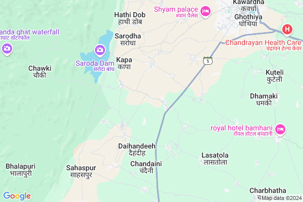
Jitatola
Jitatola Map
EDIT Map
Add Your House
 ..
..
Current Corona Virus Infected Patients Count in Kabirdham District
| City Name | District Name | Total Covid cases |
|---|
Locality Name :
Jitatola
( जीटाटोला )
Tehsil Name : Bodla
District : Kabirdham
State : Chattisgarh
Language : Chhattisgarhi and Hindi, Agariya
Current Time 12:50 PM
Date: Thursday , May 01,2025 (IST)
Time zone: IST (UTC+5:30)
Elevation / Altitude: 325 meters. Above Seal level
Telephone Code / Std Code: 07740
Assembly constituency : Kawardha assembly constituency
Assembly MLA : Vijay Sharma
Lok Sabha constituency : Rajnandgaon parliamentary constituency
Parliament MP : SANTOSH PANDEY
Serpanch Name :
Pin Code : 491995
Post Office Name : Kawardha
Main Village Name : Jitatola
Commodities Prices : Kawardha Market / Mandi
Jitatola Live Weather
Temperature: 38.7 °C
clear sky
Humidity: 21%
Wind : 3.36 mt/sec towards S
StationName : "Kawardha"
observed on 40 Mins Back
Temperature: 38.7 °C
clear sky
Humidity: 21%
Wind : 3.36 mt/sec towards S
StationName : "Kawardha"
observed on 40 Mins Back
Jitatola Weather Forecast for Next 5 days
02-05-2025
25.6°C to 39.1°C
few clouds, moderate rain, scattered clouds, clear sky
25.6°C to 39.1°C
few clouds, moderate rain, scattered clouds, clear sky
03-05-2025
24.3°C to 40.1°C
clear sky, scattered clouds, light rain, broken clouds
24.3°C to 40.1°C
clear sky, scattered clouds, light rain, broken clouds
04-05-2025
26.0°C to 40.1°C
few clouds, scattered clouds, broken clouds, light rain
26.0°C to 40.1°C
few clouds, scattered clouds, broken clouds, light rain
05-05-2025
27.5°C to 42.1°C
scattered clouds, clear sky, few clouds, light rain
27.5°C to 42.1°C
scattered clouds, clear sky, few clouds, light rain
06-05-2025
27.3°C to 42.2°C
light rain, overcast clouds, broken clouds, few clouds, scattered clouds, clear sky
27.3°C to 42.2°C
light rain, overcast clouds, broken clouds, few clouds, scattered clouds, clear sky
Rivers Near Jitatola
Baniar
Tannor
Baniar
Tannor
About Jitatola
Correct below Info and add more info about JitatolaJitatola is a small Village/hamlet in Bodla Tehsil in Kabirdham District of Chattisgarh State, India. It comes under Jitatola Panchayath. It is located 10 KM towards South from District head quarters Kawardha. 28 KM from Bodla. 106 KM from State capital Raipur
Jitatola Pin code is 491995 and postal head office is Kawardha .
Bhagutola ( 6 KM ) , Lasatola ( 7 KM ) , Kisungarh ( 7 KM ) , Bachedi ( 7 KM ) , Chhantajha ( 7 KM ) are the nearby Villages to Jitatola. Jitatola is surrounded by S.Lohara Tehsil towards South , Kawardha Tehsil towards East , Bodla Tehsil towards North , Saja Tehsil towards South .
Kawardha , Bemetra , Malajkhand , Mungeli are the near by Cities to Jitatola.
Jitatola 2011 Census Details
Jitatola Local Language is Chhattisgarhi. Jitatola Village Total population is 475 and number of houses are 90. Female Population is 51.6%. Village literacy rate is 47.8% and the Female Literacy rate is 16.6%.
Population
| Census Parameter | Census Data |
| Total Population | 475 |
| Total No of Houses | 90 |
| Female Population % | 51.6 % ( 245) |
| Total Literacy rate % | 47.8 % ( 227) |
| Female Literacy rate | 16.6 % ( 79) |
| Scheduled Tribes Population % | 85.5 % ( 406) |
| Scheduled Caste Population % | 4.2 % ( 20) |
| Working Population % | 52.6 % |
| Child(0 -6) Population by 2011 | 98 |
| Girl Child(0 -6) Population % by 2011 | 57.1 % ( 56) |
Jitatola Census More Deatils.
Politics in Jitatola
Bharatiya Janata Party , BJP , INC are the major political parties in this area.Polling Stations /Booths near Jitatola
1)Maharaj Pur2)Mahli
3)Magarwada
4)Gangpur
5)Bhaisbod
HOW TO REACH Jitatola
By Rail
There is no railway station near to Jitatola in less than 10 km.Colleges near Jitatola
Government Swami Vivekanand Collage Bodla
Address :
Schools in Jitatola
U.n.p.s.jitatola
Address : jitatola , bodla , kawardha , Chattisgarh . PIN- 491995 , Post - Kawardha
Govt Health Centers near Jitatola
1) SHC Mahrajpur , , ,2) SHC Barondakala , , ,
3) SHC Mainpuri , , ,
Sub Villages in Jitatola
Petrol Bunks in Jitatola,Bodla
Hindustan Petroleum
Kailash Nagar; Kawardha; SH-5; Rajnadgaon Dalli Rajhra Road; Kawardha; Kawardha; Chhattisgarh 491995; India
9.6 KM distance Detail
more ..
Colleges in Jitatola,Bodla
Sant Kabir College of Agriculture and Research Station
Ghotiya; Kawardha; Chhattisgarh 491995; India
9.2 KM distance Detail
Bhoramdev College of Agriculture
Ghughari Kawardha; Kawardha; Kabeerdham; Chhattisgarh 492006; India
9.3 KM distance Detail
Acharya Panth Shri Grindh Muni Naam Saheb Government PG college
Kabirdham; Kawardha; Chhattisgarh 491995; India
9.7 KM distance Detail
more ..
Schools in Jitatola,Bodla
Abhyuday School
Sarodha Canal Road; S.H. 9; Ghothiya Village; Kawardha; Ghothiya; Chhattisgarh 491995; India
8.2 KM distance Detail
Ashoka public school; college and ITI
Sikshak Colony; Kawardha; Chhattisgarh 491995; India
8.8 KM distance Detail
Bhramha Kumari Senter Kawardha
Collector Colony; Kawardha; Chhattisgarh 491995; India
9.3 KM distance Detail
Super Markets in Jitatola,Bodla
Ashu New Look Hair Cut
near ssm school; Ramnagar; Kawardha; Chhattisgarh; India
8.7 KM distance Detail
Police Stations near Jitatola,Bodla
Office Of Superintendent Of Police; Kawardha
Link Road Number 3; Bhopal; India
9.3 KM distance Detail
Governement Offices near Jitatola,Bodla
Amin Office
Vindhyavasini Ward; Dani Tola; Dhamtari; Chhattisgarh 491995; India
10.1 KM distance Detail
About Jitatola &
History
How to reach Jitatola
Tourist Places Near By Jitatola
Schools in Jitatola
Colleges in Jitatola
Temperature & weather of Jitatola
places in Jitatola
Jitatola photos
More Information
How to reach Jitatola
Tourist Places Near By Jitatola
Schools in Jitatola
Colleges in Jitatola
Temperature & weather of Jitatola
places in Jitatola
Jitatola photos
More Information
Village Talk
Post News or Events about this Village
Near Cities
Kawardha 12 KM near
Bemetra 51 KM near
Malajkhand 53 KM near
Mungeli 61 KM near
Kawardha 12 KM near
Bemetra 51 KM near
Malajkhand 53 KM near
Mungeli 61 KM near
Near By Taluks
Kabirdham 12 KM near
S.Lohara 17 KM near
Kawardha 18 KM near
Bodla 26 KM near
Kabirdham 12 KM near
S.Lohara 17 KM near
Kawardha 18 KM near
Bodla 26 KM near
Near By Air Ports
Raipur Airport 115 KM near
Jabalpur Airport 168 KM near
Sonegaon Airport 267 KM near
Khajuraho Airport 384 KM near
Raipur Airport 115 KM near
Jabalpur Airport 168 KM near
Sonegaon Airport 267 KM near
Khajuraho Airport 384 KM near
Near By Tourist Places
Kawardha 10 KM near
Kanha National park 76 KM near
Bhilai 95 KM near
Durg 95 KM near
Raipur 101 KM near
Kawardha 10 KM near
Kanha National park 76 KM near
Bhilai 95 KM near
Durg 95 KM near
Raipur 101 KM near
Near By Districts
Kabirdham 9 KM near
Durg 95 KM near
Raipur 103 KM near
Rajnandgaon 107 KM near
Kabirdham 9 KM near
Durg 95 KM near
Raipur 103 KM near
Rajnandgaon 107 KM near
Near By RailWay Station
Tilda Rail Way Station 87 KM near
Bhatapara Rail Way Station 93 KM near
Tilda Rail Way Station 87 KM near
Bhatapara Rail Way Station 93 KM near