| Home | City Bus | Maps | Villages | Cities | Rail | Tourist Places | School | College | Pin Codes | Corona Cases Count |
| Distance Calculator Bus Services IFSC Codes Trace Mobile Number Weather Search Place Trace IP Available Cash ATM/Banks Locate Polling Booth Report an Error contact People |
Sahilata
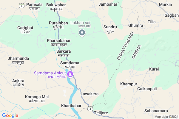
Sahilata Map
EDIT Map
Add Your House
 ..
..
Current Corona Virus Infected Patients Count in Jashpur District
| City Name | District Name | Total Covid cases |
|---|
Locality Name :
Sahilata
( साहिलाता )
Tehsil Name : Pharsabahar
District : Jashpur
State : Chattisgarh
Language : Chhattisgarhi and Hindi
Current Time 12:17 AM
Date: Sunday , May 04,2025 (IST)
Time zone: IST (UTC+5:30)
Elevation / Altitude: 229 meters. Above Seal level
Telephone Code / Std Code: 07761
Assembly constituency : Kunkuri assembly constituency
Assembly MLA : Vishnu Deo Sai
Lok Sabha constituency : Raigarh parliamentary constituency
Parliament MP : GOMATI SAI
Serpanch Name :
Pin Code : 496245
Post Office Name : Lawakera
Main Village Name : Sahilata
Alternate Village Name : SAHILATA
Commodities Prices : Kotba Market / Mandi
Sahilata Live Weather
Temperature: 26.2 °C
few clouds
Humidity: 61%
Wind : 2.41 mt/sec towards S
StationName : "Sundargarh"
observed on 1 Hours Back
Temperature: 26.2 °C
few clouds
Humidity: 61%
Wind : 2.41 mt/sec towards S
StationName : "Sundargarh"
observed on 1 Hours Back
Sahilata Weather Forecast for Next 5 days
04-05-2025
24.4°C to 25.4°C
few clouds, clear sky
24.4°C to 25.4°C
few clouds, clear sky
05-05-2025
23.7°C to 39.9°C
clear sky, scattered clouds, light rain, broken clouds
23.7°C to 39.9°C
clear sky, scattered clouds, light rain, broken clouds
06-05-2025
25.3°C to 41.1°C
scattered clouds, few clouds, broken clouds
25.3°C to 41.1°C
scattered clouds, few clouds, broken clouds
07-05-2025
27.4°C to 41.4°C
scattered clouds, clear sky, broken clouds
27.4°C to 41.4°C
scattered clouds, clear sky, broken clouds
08-05-2025
29.0°C to 42.0°C
broken clouds, scattered clouds, overcast clouds
29.0°C to 42.0°C
broken clouds, scattered clouds, overcast clouds
Rivers Near Sahilata
Gahira
Drongjor
Gahira
Drongjor
About Sahilata
Correct below Info and add more info about SahilataSahilata is a small Village/hamlet in Pharsabahar Tehsil in Jashpur District of Chattisgarh State, India. It comes under Sahilata Panchayath. It is located 62 KM towards South from District head quarters Jashpur Nagar. 9 KM from Pharsabahar. 322 KM from State capital Raipur
Sahilata Pin code is 496245 and postal head office is Lawakera .
Purain Bandh ( 4 KM ) , Lawakera ( 5 KM ) , Sundru ( 5 KM ) , Babusajbahar ( 6 KM ) , Kharibahar ( 7 KM ) are the nearby Villages to Sahilata. Sahilata is surrounded by Balisankara Tehsil towards South , Subdega Tehsil towards South , Kurdeg Tehsil towards East , Kersai Tehsil towards East .
Sundargarh , Bamra , Jashpurnagar , Simdega are the near by Cities to Sahilata.
Sahilata 2011 Census Details
Sahilata Local Language is Chhattisgarhi. Sahilata Village Total population is 194 and number of houses are 46. Female Population is 50.5%. Village literacy rate is 57.7% and the Female Literacy rate is 24.2%.
Population
| Census Parameter | Census Data |
| Total Population | 194 |
| Total No of Houses | 46 |
| Female Population % | 50.5 % ( 98) |
| Total Literacy rate % | 57.7 % ( 112) |
| Female Literacy rate | 24.2 % ( 47) |
| Scheduled Tribes Population % | 79.4 % ( 154) |
| Scheduled Caste Population % | 0.0 % ( 0) |
| Working Population % | 25.8 % |
| Child(0 -6) Population by 2011 | 28 |
| Girl Child(0 -6) Population % by 2011 | 50.0 % ( 14) |
Sahilata Census More Deatils.
Politics in Sahilata
Bharatiya Janata Party , BJP , INC are the major political parties in this area.Polling Stations /Booths near Sahilata
1)Bankombo2)Salihatoli
3)Mendarbahar
4)Pumshala
5)Samadma
HOW TO REACH Sahilata
By Rail
There is no railway station near to Sahilata in less than 10 km.Colleges near Sahilata
Government Girls College, Kansabel
Address : Church Road, Near High School
New Government College Kansabel
Address :
Govt. Vbsd Girls College Jashpur Nagar
Address : Major-priti Road, Basant Vihar, Jashpur
Schools in Sahilata
Govt Jan. Ps Sahilata
Address : sahilata , farsabahar , jashpur , Chattisgarh . PIN- 496245 , Post - Lawakera
Govt Health Centers near Sahilata
1) SHC BansaJhal , BansaJhal , BansaJhal , BansaJhal2) SHC Purainbandh , Purainbandh , Purainbandh , Purainbandh
3) SHC Lawakera , Lawakera , Lawakera , Lawakera
Sub Villages in Sahilata
Hospitals in Sahilata,Pharsabahar
N.K. ELECTROTECH;Subdega Road
Hospital Chowk; Balisankara; Odisha 770015; India
11.5 KM distance Detail
more ..
Schools in Sahilata,Pharsabahar
Anganwadi;Jun Wain;Kharibahar;Jashpur;Chhatishgarh
Panchayat-Kharibahar; Jun Wain; Chhattisgarh 496245; India
8.3 KM distance Detail
Local Parks in Sahilata,Pharsabahar
Police Stations near Sahilata,Pharsabahar
Police Station Pathalgaon
Pharsabahal; Jashpur; SH-22; Pathalgaon Road; Pathalgaon; Pathalgaon; Chhattisgarh 496223; India
21.2 KM distance Detail
About Sahilata &
History
How to reach Sahilata
Tourist Places Near By Sahilata
Schools in Sahilata
Colleges in Sahilata
Temperature & weather of Sahilata
places in Sahilata
Sahilata photos
More Information
How to reach Sahilata
Tourist Places Near By Sahilata
Schools in Sahilata
Colleges in Sahilata
Temperature & weather of Sahilata
places in Sahilata
Sahilata photos
More Information
Village Talk
Post News or Events about this Village
Near Cities
Sundargarh 37 KM near
Bamra 58 KM near
Jashpurnagar 62 KM near
Simdega 62 KM near
Sundargarh 37 KM near
Bamra 58 KM near
Jashpurnagar 62 KM near
Simdega 62 KM near
Near By Taluks
Pharsabahar 9 KM near
Balisankara 11 KM near
Subdega 23 KM near
Kurdeg 24 KM near
Pharsabahar 9 KM near
Balisankara 11 KM near
Subdega 23 KM near
Kurdeg 24 KM near
Near By Air Ports
Ranchi Airport 189 KM near
Raipur Airport 302 KM near
Gaya Airport 309 KM near
Bhubaneswar Airport 343 KM near
Ranchi Airport 189 KM near
Raipur Airport 302 KM near
Gaya Airport 309 KM near
Bhubaneswar Airport 343 KM near
Near By Tourist Places
Jashpur 60 KM near
Simdega 63 KM near
Raigarh 93 KM near
Gumla 100 KM near
Rourkela 105 KM near
Jashpur 60 KM near
Simdega 63 KM near
Raigarh 93 KM near
Gumla 100 KM near
Rourkela 105 KM near
Near By Districts
Sundargarh 38 KM near
Jashpur 59 KM near
Simdega 61 KM near
Jharsuguda 68 KM near
Sundargarh 38 KM near
Jashpur 59 KM near
Simdega 61 KM near
Jharsuguda 68 KM near
Near By RailWay Station
Bamra Rail Way Station 57 KM near
Jharsuguda Junction Rail Way Station 69 KM near
Bamra Rail Way Station 57 KM near
Jharsuguda Junction Rail Way Station 69 KM near