| Home | City Bus | Maps | Villages | Cities | Rail | Tourist Places | School | College | Pin Codes | Corona Cases Count |
| Distance Calculator Bus Services IFSC Codes Trace Mobile Number Weather Search Place Trace IP Available Cash ATM/Banks Locate Polling Booth Report an Error contact People |
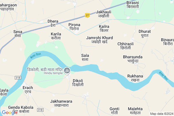
Sala
Sala Map
EDIT Map
Add Your House
 ..
..
Current Corona Virus Infected Patients Count in Jalaun District
| City Name | District Name | Total Covid cases |
|---|---|---|
| Jalaun District | Jalaun | 1 |
Locality Name :
Sala
( साला )
Block Name : Konch
District : Jalaun
State : Uttar Pradesh
Division : Jhansi
Language : Hindi and Urdu
Current Time 04:50 AM
Date: Friday , May 02,2025 (IST)
Time zone: IST (UTC+5:30)
Elevation / Altitude: 158 meters. Above Seal level
Telephone Code / Std Code: 05165
Assembly constituency : Orai assembly constituency
Assembly MLA : Gauri Shankar
Lok Sabha constituency : Jalaun parliamentary constituency
Parliament MP : BHANU PRATAP SINGH VERMA
Serpanch Name :
Pin Code : 285201
Post Office Name : Ait
Main Village Name : Sala
Commodities Prices : Gurusarai Market / Mandi
Sala Live Weather
Temperature: 30.0 °C
clear sky
Humidity: 35%
Wind : 5.1 mt/sec towards E
StationName : "Kotra"
observed on Now
Temperature: 30.0 °C
clear sky
Humidity: 35%
Wind : 5.1 mt/sec towards E
StationName : "Kotra"
observed on Now
Sala Weather Forecast for Next 5 days
03-05-2025
29.8°C to 40.4°C
clear sky, scattered clouds, overcast clouds
29.8°C to 40.4°C
clear sky, scattered clouds, overcast clouds
04-05-2025
30.3°C to 41.6°C
overcast clouds, broken clouds, scattered clouds, clear sky, few clouds
30.3°C to 41.6°C
overcast clouds, broken clouds, scattered clouds, clear sky, few clouds
05-05-2025
31.1°C to 40.3°C
overcast clouds, light rain
31.1°C to 40.3°C
overcast clouds, light rain
06-05-2025
26.9°C to 42.1°C
broken clouds, clear sky, scattered clouds, overcast clouds
26.9°C to 42.1°C
broken clouds, clear sky, scattered clouds, overcast clouds
Rivers Near Sala
Parwar Nadi
Sindh
Parwar Nadi
Sindh
About Sala
Correct below Info and add more info about SalaSala is a small Village/hamlet in Konch Block in Jalaun District of Uttar Pradesh State, India. It comes under Sala Panchayath. It belongs to Jhansi Division . It is located 47 KM towards South from District head quarters Orai. 18 KM from Konch. 247 KM from State capital Lucknow
Sala Pin code is 285201 and postal head office is Ait .
Chhiraoli ( 5 KM ) , Ingui Khurd ( 6 KM ) , Dhamseni ( 6 KM ) , Jakhauli ( 6 KM ) , Bharsunda ( 6 KM ) are the nearby Villages to Sala. Sala is surrounded by Konch Block towards North , Moth Block towards west , Dakore Block towards East , Nadigaon Block towards North .
Samthar , Orai , Lahar , Rath are the near by Cities to Sala.
Sala 2011 Census Details
Sala Local Language is Hindi. Sala Village Total population is 212 and number of houses are 34. Female Population is 45.8%. Village literacy rate is 53.3% and the Female Literacy rate is 16.0%.
Population
| Census Parameter | Census Data |
| Total Population | 212 |
| Total No of Houses | 34 |
| Female Population % | 45.8 % ( 97) |
| Total Literacy rate % | 53.3 % ( 113) |
| Female Literacy rate | 16.0 % ( 34) |
| Scheduled Tribes Population % | 0.0 % ( 0) |
| Scheduled Caste Population % | 0.0 % ( 0) |
| Working Population % | 48.6 % |
| Child(0 -6) Population by 2011 | 38 |
| Girl Child(0 -6) Population % by 2011 | 65.8 % ( 25) |
Sala Census More Deatils.
Politics in Sala
BJP , SP , BSP , INC are the major political parties in this area.Polling Stations /Booths near Sala
1)Pirauna2)Pirauna
3)Pirauna
4)Pathakpura
5)Pirauna
HOW TO REACH Sala
By Rail
Parauna Rail Way Station is the very nearby railway stations to Sala.Colleges near Sala
St. Shri Gafoor Khan Mahavidyalaya
Address :
Adarsh Vidya Peeth Inter College
Address :
Shree Veer Singh Inter College Babina
Address :
Samar Singh Intar College Rampura Jalaun U.p.
Address :
Janta Inter College Sirsa Kalar
Address :
Schools in Sala
Primary School
Address : sala , konch , jalaun , Uttar Pradesh . PIN- 285201 , Post - Ait
Govt Health Centers near Sala
1) NPHC Erach , , ,2) Erach , , ,
3) NPHC Poonchh , , ,
Sub Villages in Sala
Petrol Bunks in Sala,Konch
VISHAL HIGHWAY FUELS
ORAI; ORAI-JHANSI ROAD; JALAUN; Uttar Pradesh 285001; India
5.7 KM distance Detail
more ..
Colleges in Sala,Konch
Shaheed Singh Ran Degree College
National Highway 25; Ingui Khurd; Uttar Pradesh 285201; India
6.2 KM distance Detail
Seth Bhagwati Prasad Saraswati vidya mandir
National Highway 25; Uttar Pradesh 285201; India
12.1 KM distance Detail
more ..
Schools in Sala,Konch
जय माँ काली का मन्दिर अम्बेडकर नगर पिरौना
Pirauna Village Rd; Pirona; Uttar Pradesh 285201; India
5.0 KM distance Detail
Electronic Shops in Sala,Konch
Jai Ma Ratan Gad Bali Electrical Shop
Birguwan khurd; Pirona; Uttar Pradesh 285201; India
5.7 KM distance Detail
Police Stations near Sala,Konch
Pirona Police Station
National Highway 25; Pirona; Uttar Pradesh 285201; India
5.6 KM distance Detail
Sagar Talaab Police Station
Konch; Jawahar Nagar; Konch; Uttar Pradesh 285205; India
22.6 KM distance Detail
About Sala &
History
How to reach Sala
Tourist Places Near By Sala
Schools in Sala
Colleges in Sala
Temperature & weather of Sala
places in Sala
Sala photos
More Information
How to reach Sala
Tourist Places Near By Sala
Schools in Sala
Colleges in Sala
Temperature & weather of Sala
places in Sala
Sala photos
More Information
Village Talk
Post News or Events about this Village
Near Cities
Samthar 27 KM near
Orai 38 KM near
Lahar 53 KM near
Rath 53 KM near
Samthar 27 KM near
Orai 38 KM near
Lahar 53 KM near
Rath 53 KM near
Near By Taluks
Bamaur 16 KM near
Konch 17 KM near
Moth 21 KM near
Dakore 32 KM near
Bamaur 16 KM near
Konch 17 KM near
Moth 21 KM near
Dakore 32 KM near
Near By Air Ports
Gwalior Airport 119 KM near
Khajuraho Airport 150 KM near
Kanpur Airport 157 KM near
Kheria Airport 213 KM near
Gwalior Airport 119 KM near
Khajuraho Airport 150 KM near
Kanpur Airport 157 KM near
Kheria Airport 213 KM near
Near By Tourist Places
Datia 79 KM near
Jhansi 80 KM near
Orchha 83 KM near
Sonagir 88 KM near
Gwalior 120 KM near
Datia 79 KM near
Jhansi 80 KM near
Orchha 83 KM near
Sonagir 88 KM near
Gwalior 120 KM near
Near By Districts
Jalaun 45 KM near
Jhansi 80 KM near
Datia 80 KM near
Auraiya 89 KM near
Jalaun 45 KM near
Jhansi 80 KM near
Datia 80 KM near
Auraiya 89 KM near
Near By RailWay Station
Parauna Rail Way Station 7.3 KM near
Ait Junction Rail Way Station 12 KM near
Moth Rail Way Station 25 KM near
Parauna Rail Way Station 7.3 KM near
Ait Junction Rail Way Station 12 KM near
Moth Rail Way Station 25 KM near