| Home | City Bus | Maps | Villages | Cities | Rail | Tourist Places | School | College | Pin Codes | Corona Cases Count |
| Distance Calculator Bus Services IFSC Codes Trace Mobile Number Weather Search Place Trace IP Available Cash ATM/Banks Locate Polling Booth Report an Error contact People |
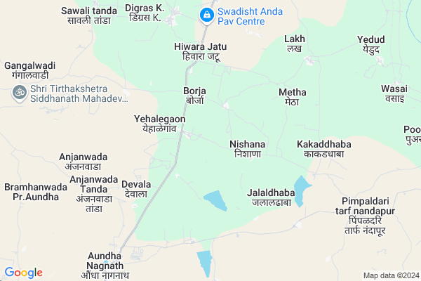
Dharkheda
Dharkheda Map
EDIT Map
Add Your House
 ..
..
Current Corona Virus Infected Patients Count in Hingoli District
| City Name | District Name | Total Covid cases |
|---|---|---|
| Hingoli District | Hingoli | 8 |
Locality Name :
Dharkheda
( धरखेडा )
Taluka Name : Aundha Nagnath
District : Hingoli
State : Maharashtra
Region : Marathwada
Division : Aurangabad
Language : Marathi and Hindi
Current Time 03:43 PM
Date: Saturday , May 03,2025 (IST)
Time zone: IST (UTC+5:30)
Elevation / Altitude: 434 meters. Above Seal level
Telephone Code / Std Code: 02456
Assembly constituency : Basmath assembly constituency
Assembly MLA : Chandrakant Alias Rajubhaiyya Ramakant Nawghare
Lok Sabha constituency : Hingoli parliamentary constituency
Parliament MP : Hemant Patil
Serpanch Name :
Pin Code : 431705
Post Office Name : Aundha Nagnath
Main Village Name : Dharkheda
Commodities Prices : Hingoli Market / Mandi
National Highways Reachable To Dharkheda
Nationa High Way :NH53
Nationa High Way :NH752K
Nationa High Way :NH53
Nationa High Way :NH752K
Rivers Near Dharkheda
Saraswati Nadi
Kowlas nala
Saraswati Nadi
Kowlas nala
About Dharkheda
Correct below Info and add more info about DharkhedaDharkheda is a small Village/hamlet in Aundha Nagnath Taluka in Hingoli District of Maharashtra State, India. It comes under Dharkheda Panchayath. It belongs to Marathwada region . It belongs to Aurangabad Division . It is located 18 KM towards South from District head quarters Hingoli. 9 KM from Aundha Nagnath. 525 KM from State capital Mumbai
Dharkheda Pin code is 431705 and postal head office is Aundha Nagnath .
Jadgaon ( 2 KM ) , Suregaon ( 3 KM ) , Devala ( 4 KM ) , Jalaldhaba ( 4 KM ) , Walki ( 5 KM ) are the nearby Villages to Dharkheda. Dharkheda is surrounded by Hingoli Taluka towards North , Basmat Taluka towards South , Kalamnuri Taluka towards East , Sengaon Taluka towards North .
Purna , Parbhani , Risod , Washim are the near by Cities to Dharkheda.
Dharkheda 2011 Census Details
Dharkheda Local Language is Marathi. Dharkheda Village Total population is 263 and number of houses are 56. Female Population is 46.4%. Village literacy rate is 68.8% and the Female Literacy rate is 25.9%.
Population
| Census Parameter | Census Data |
| Total Population | 263 |
| Total No of Houses | 56 |
| Female Population % | 46.4 % ( 122) |
| Total Literacy rate % | 68.8 % ( 181) |
| Female Literacy rate | 25.9 % ( 68) |
| Scheduled Tribes Population % | 0.0 % ( 0) |
| Scheduled Caste Population % | 7.2 % ( 19) |
| Working Population % | 66.9 % |
| Child(0 -6) Population by 2011 | 41 |
| Girl Child(0 -6) Population % by 2011 | 48.8 % ( 20) |
Dharkheda Census More Deatils.
Politics in Dharkheda
NCP , Shivsena , INC , SHS are the major political parties in this area.Polling Stations /Booths near Dharkheda
1)Z. P. P. S Asola T. Lakh Room No. 12)Z. P. P. S Annjanavadi Room No 1
3)Z. P. P. S Daregaon
4)Z. P. P. S Chimeganv Room No 1
5)Z. P. C. P. School Jawla Bazar North Side Room No. 2
HOW TO REACH Dharkheda
By Rail
There is no railway station near to Dharkheda in less than 10 km. Pimpla Chaure Halt Rail Way Station (near to Basmath) , Dhamni Rail Way Station (near to Hingoli) , Basmat Rail Way Station (near to Basmath) , Nawalgohan Rail Way Station (near to Hingoli) are the Rail way stations reachable from near by towns.By Road
Hingoli , Basmath , Jintur are the nearby by towns to Dharkheda having road connectivity to DharkhedaColleges near Dharkheda
Madhomati Sec And Higher Sec School Lakh
Address :
Schools in Dharkheda
Zpps.dharkheda
Address : dharkheda , aundha nagnath , hingoli , Maharashtra . PIN- 431705 , Post - Aundha Nagnath
Govt Health Centers near Dharkheda
1) Nishana , , , Anganwadi2) Jalaldhaba , sc jalaldhaba , Near the road , z.p shcoool
3) Goregaon , SC bulding , near police station ,
Sub Villages in Dharkheda
Hospitals in Dharkheda,Aundha Nagnath
PRESTIGE LOGISTICS PaČЌers And MỖϋers
99; Atmaram Nagar Road; Lok Gram; Lokgram; Kalyan; Maharashtra 421306; India
6.5 KM distance Detail
more ..
Petrol Bunks in Dharkheda,Aundha Nagnath
Auto LPG Gas
Hivra; Hingoli; Parbhani Hingoli Road; Nanded Anudha Road; Hingoli; Hingoli; Maharashtra 431513; India
5.6 KM distance Detail
HP PETROL PUMP - OM PETROLEUM
GUT NO. 89 (P) AT Golegaon; Aundha Jintur Road Near Aundha (nagnath); Sholapur; Maharashtra 431705; India
13.8 KM distance Detail
more ..
Colleges in Dharkheda,Aundha Nagnath
Swami Vivekananda Gurukul; Late Radhatai Musale Kanishth Mahavidyalaya ; Vivekanada Gyanpeeth English school
Behinde to MIDC area; Limbaala Makta; Santuk pimpari; Maharashtra; India
9.9 KM distance Detail
more ..
Local Parks in Dharkheda,Aundha Nagnath
Nagar Palika Garden
Devda Nagar; Mohalla Paltan; Siddharth Nagar; Hingoli; Maharashtra 431513; India
16.1 KM distance Detail
Police Stations near Dharkheda,Aundha Nagnath
police superintendent office
Ashta Vinayak Nagar; Hingoli; Maharashtra 431513; India
16.1 KM distance Detail
Police station gramin
Mohalla Paltan; Siddharth Nagar; Hingoli; Maharashtra 431513; India
16.1 KM distance Detail
Governement Offices near Dharkheda,Aundha Nagnath
Forest Department Office
Aundha Nagnath; Hingoli; Nanded Jintur Road; Nanded Anudha Road; Hingoli; Hingoli; Maharashtra 431705; India
10.2 KM distance Detail
About Dharkheda &
History
How to reach Dharkheda
Tourist Places Near By Dharkheda
Schools in Dharkheda
Colleges in Dharkheda
Temperature & weather of Dharkheda
places in Dharkheda
Dharkheda photos
More Information
How to reach Dharkheda
Tourist Places Near By Dharkheda
Schools in Dharkheda
Colleges in Dharkheda
Temperature & weather of Dharkheda
places in Dharkheda
Dharkheda photos
More Information
Village Talk
Post News or Events about this Village
Near Cities
Purna 51 KM near
Parbhani 54 KM near
Risod 58 KM near
Washim 63 KM near
Purna 51 KM near
Parbhani 54 KM near
Risod 58 KM near
Washim 63 KM near
Near By Taluks
Aundha Nagnath 9 KM near
Hingoli 26 KM near
Basmat 30 KM near
Kalamnuri 30 KM near
Aundha Nagnath 9 KM near
Hingoli 26 KM near
Basmat 30 KM near
Kalamnuri 30 KM near
Near By Air Ports
Nanded Airport 58 KM near
Latur Airport 165 KM near
Chikkalthana Airport 201 KM near
Sholapur Airport 280 KM near
Nanded Airport 58 KM near
Latur Airport 165 KM near
Chikkalthana Airport 201 KM near
Sholapur Airport 280 KM near
Near By Tourist Places
Hingoli 16 KM near
Washim 62 KM near
Amravati 182 KM near
Aurangabad 210 KM near
Bidar 218 KM near
Hingoli 16 KM near
Washim 62 KM near
Amravati 182 KM near
Aurangabad 210 KM near
Bidar 218 KM near
Near By Districts
Hingoli 17 KM near
Parbhani 55 KM near
Nanded 60 KM near
Washim 62 KM near
Hingoli 17 KM near
Parbhani 55 KM near
Nanded 60 KM near
Washim 62 KM near
Near By RailWay Station
Hingoli Deccan Rail Way Station 17 KM near
Basmat Rail Way Station 33 KM near
Hingoli Deccan Rail Way Station 17 KM near
Basmat Rail Way Station 33 KM near