| Home | City Bus | Maps | Villages | Cities | Rail | Tourist Places | School | College | Pin Codes | Corona Cases Count |
| Distance Calculator Bus Services IFSC Codes Trace Mobile Number Weather Search Place Trace IP Available Cash ATM/Banks Locate Polling Booth Report an Error contact People |
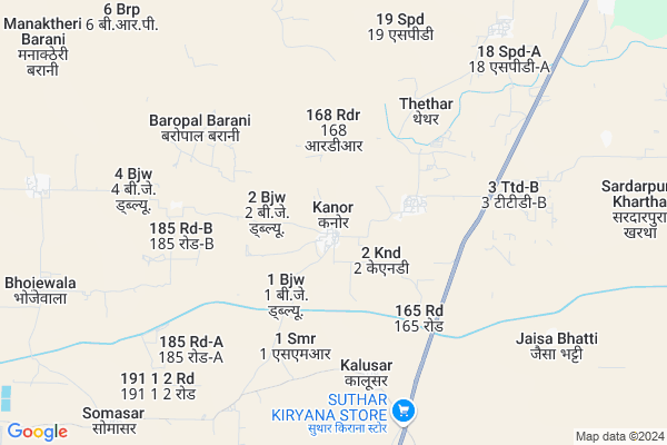
Kanor
Kanor Map
EDIT Map
Add Your House
 ..
..
Current Corona Virus Infected Patients Count in Ganganagar District
| City Name | District Name | Total Covid cases |
|---|
Locality Name :
Kanor
( कनोर )
Tehsil Name : Suratgarh
District : Ganganagar
State : Rajasthan
Division : Bikaner
Language : Rajasthani and Hindi, Seraiki, Sindhi,punjabi
Current Time 01:12 AM
Date: Saturday , May 03,2025 (IST)
Time zone: IST (UTC+5:30)
Elevation / Altitude: 170 meters. Above Seal level
Telephone Code / Std Code: 01509
Assembly constituency : Suratgarh assembly constituency
Assembly MLA : Dungarram Gedar
Lok Sabha constituency : Ganganagar parliamentary constituency
Parliament MP : NIHAL CHAND
Serpanch Name :
Pin Code : 335804
Post Office Name : Suratgarh
Main Village Name : Kanor
Commodities Prices : Suratgarh Market / Mandi
Kanor Live Weather
Temperature: 29.4 °C
clear sky
Humidity: 37%
Wind : 3.74 mt/sec towards SE
StationName : "Pilibangan"
observed on Now
Temperature: 29.4 °C
clear sky
Humidity: 37%
Wind : 3.74 mt/sec towards SE
StationName : "Pilibangan"
observed on Now
Kanor Weather Forecast for Next 5 days
03-05-2025
28.5°C to 28.5°C
few clouds
28.5°C to 28.5°C
few clouds
04-05-2025
27.0°C to 39.9°C
clear sky, few clouds, light rain, overcast clouds
27.0°C to 39.9°C
clear sky, few clouds, light rain, overcast clouds
05-05-2025
25.9°C to 37.2°C
light rain, overcast clouds, clear sky
25.9°C to 37.2°C
light rain, overcast clouds, clear sky
06-05-2025
28.4°C to 39.7°C
broken clouds, overcast clouds, light rain
28.4°C to 39.7°C
broken clouds, overcast clouds, light rain
07-05-2025
27.8°C to 38.7°C
overcast clouds, few clouds, clear sky
27.8°C to 38.7°C
overcast clouds, few clouds, clear sky
National Highways Reachable To Kanor
Nationa High Way :NH58
Nationa High Way :NH48
Nationa High Way :NH58
Nationa High Way :NH48
Rivers Near Kanor
Mangla
Sukar
Mangla
Sukar
About Kanor
Correct below Info and add more info about KanorKanor is a small Village/hamlet in Suratgarh Tehsil in Ganganagar District of Rajasthan State, India. It comes under Kanor Panchayath. It belongs to Bikaner Division . It is located 90 KM towards South from District head quarters Ganganagar. 35 KM from Suratgarh. 360 KM from State capital Jaipur
Kanor Pin code is 335804 and postal head office is Suratgarh .
Bhoje Wala ( 10 KM ) are the nearby Villages to Kanor. Kanor is surrounded by Pilibanga Tehsil towards North , Suratgarh Tehsil towards west , Hanumangarh Tehsil towards North , Tibbi Tehsil towards North .
Suratgarh , Pilibanga , Rawatsar , Hanumangarh are the near by Cities to Kanor.
Kanor 2011 Census Details
Kanor Local Language is Rajasthani. Kanor Village Total population is 940 and number of houses are 153. Female Population is 48.6%. Village literacy rate is 51.2% and the Female Literacy rate is 21.0%.
Population
| Census Parameter | Census Data |
| Total Population | 940 |
| Total No of Houses | 153 |
| Female Population % | 48.6 % ( 457) |
| Total Literacy rate % | 51.2 % ( 481) |
| Female Literacy rate | 21.0 % ( 197) |
| Scheduled Tribes Population % | 0.0 % ( 0) |
| Scheduled Caste Population % | 58.5 % ( 550) |
| Working Population % | 77.8 % |
| Child(0 -6) Population by 2011 | 139 |
| Girl Child(0 -6) Population % by 2011 | 46.8 % ( 65) |
Kanor Census More Deatils.
Politics in Kanor
BJP , INC are the major political parties in this area.Polling Stations /Booths near Kanor
1)Govt. Upper Primary School Right Side 1 Ppm (mohammadabad)2)Govt. Upper Primary School Jaisabhatti ( 2 Jbd)
3)Govt. Upper Primary School Hinjarasar (2 Do)
4)Gaushala (left Side) Suratgarh
5)Govt. Sen. Sec. School Right Side Maler
HOW TO REACH Kanor
By Rail
There is no railway station near to Kanor in less than 10 km.Colleges near Kanor
Mata Jeetoji Girls College
Address : Mata Jeetoji Girls College Suratgarh
Suratgarh P.g. College
Address : Suratgarh P.g. College Suratgarh --
Tagore Mahila T.t. College
Address : Tagore Mahila T.t. College Suratgarh --
Tagore P.g. College
Address : Tagore P.g. College Suratgarh --
Bansal College Of Physiotherapy & Occupational Therapy
Address : Bansal College Ofphysiotherapy & Occupational Ther
Schools in Kanor
Vishavkarma Shikshan
Address : kanor , suratgarh , ganganagar , Rajasthan . PIN- 335804 , Post - Suratgarh
Gups Kalusar
Address : kanor , suratgarh , ganganagar , Rajasthan . PIN- 335804 , Post - Suratgarh
Govt Health Centers near Kanor
1) Badopal , Village Badopal , ,2) Jhakhrawali , village jhakhrawali , ,
3) Ariayanwali , village ariayanwali , ,
Sub Villages in Kanor
Electronic Shops in Kanor,Suratgarh
Super Markets in Kanor,Suratgarh
Local Parks in Kanor,Suratgarh
Police Stations near Kanor,Suratgarh
Governement Offices near Kanor,Suratgarh
About Kanor &
History
How to reach Kanor
Tourist Places Near By Kanor
Schools in Kanor
Colleges in Kanor
Temperature & weather of Kanor
places in Kanor
Kanor photos
More Information
How to reach Kanor
Tourist Places Near By Kanor
Schools in Kanor
Colleges in Kanor
Temperature & weather of Kanor
places in Kanor
Kanor photos
More Information
Village Talk
Post News or Events about this Village
Near Cities
Suratgarh 26 KM near
Pilibanga 29 KM near
Rawatsar 29 KM near
Hanumangarh 49 KM near
Suratgarh 26 KM near
Pilibanga 29 KM near
Rawatsar 29 KM near
Hanumangarh 49 KM near
Near By Taluks
Rawatsar 29 KM near
Pilibanga 33 KM near
Suratgarh 34 KM near
Hanumangarh 47 KM near
Rawatsar 29 KM near
Pilibanga 33 KM near
Suratgarh 34 KM near
Hanumangarh 47 KM near
Near By Air Ports
Surat Gujarat Airport 23 KM near
Ludhiana Airport 276 KM near
Raja Sansi Airport 314 KM near
Indira Gandhi International Airport 335 KM near
Surat Gujarat Airport 23 KM near
Ludhiana Airport 276 KM near
Raja Sansi Airport 314 KM near
Indira Gandhi International Airport 335 KM near
Near By Tourist Places
Shri Ganganagar 87 KM near
Muktsar 137 KM near
Churu 150 KM near
Bathinda 150 KM near
Mansa 165 KM near
Shri Ganganagar 87 KM near
Muktsar 137 KM near
Churu 150 KM near
Bathinda 150 KM near
Mansa 165 KM near
Near By Districts
Hanumangarh 48 KM near
Ganganagar 86 KM near
Sirsa 105 KM near
Bathinda 148 KM near
Hanumangarh 48 KM near
Ganganagar 86 KM near
Sirsa 105 KM near
Bathinda 148 KM near
Near By RailWay Station
Suratgarh Junction Rail Way Station 25 KM near
Pilibanga Rail Way Station 29 KM near
Suratgarh Junction Rail Way Station 25 KM near
Pilibanga Rail Way Station 29 KM near