| Home | City Bus | Maps | Villages | Cities | Rail | Tourist Places | School | College | Pin Codes | Corona Cases Count |
| Distance Calculator Bus Services IFSC Codes Trace Mobile Number Weather Search Place Trace IP Available Cash ATM/Banks Locate Polling Booth Report an Error contact People |
Atarjhola
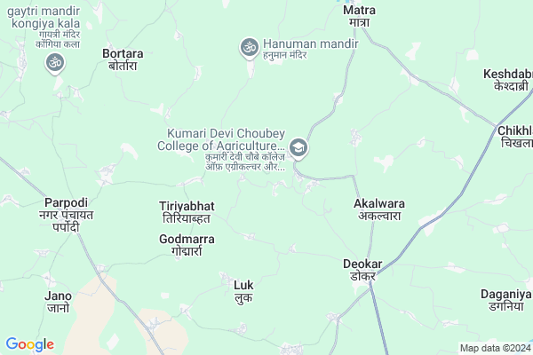
Atarjhola Map
EDIT Map
Add Your House
 ..
..
Current Corona Virus Infected Patients Count in Durg District
| City Name | District Name | Total Covid cases |
|---|---|---|
| Bhilai | Durg | 1 |
Locality Name :
Atarjhola
( अतरझोला )
Tehsil Name : Saja
District : Durg
State : Chattisgarh
Language : Chhattisgarhi and Hindi, Urdu
Current Time 10:53 PM
Date: Saturday , May 03,2025 (IST)
Time zone: IST (UTC+5:30)
Elevation / Altitude: 291 meters. Above Seal level
Telephone Code / Std Code: 07821
Assembly constituency : Saja assembly constituency
Assembly MLA : Ishwar Sahu
Lok Sabha constituency : Durg parliamentary constituency
Parliament MP : VIJAY BAGHEL
Serpanch Name :
Pin Code : 491993
Post Office Name : Saja
Main Village Name : Atarjhola
Commodities Prices : Gandai Market / Mandi
Rivers Near Atarjhola
Shivnath :Seonath
Kharun River
Shivnath :Seonath
Kharun River
About Atarjhola
Correct below Info and add more info about AtarjholaAtarjhola is a small Village/hamlet in Saja Tehsil in Durg District of Chattisgarh State, India. It comes under Atarjhola Panchayath. It is located 53 KM towards North from District head quarters Durg. 4 KM from Saja. 62 KM from State capital Raipur
Atarjhola Pin code is 491993 and postal head office is Saja .
Khurus Bod ( 4 KM ) , Tiriyabhat ( 4 KM ) , Tendubhata ( 4 KM ) , Godmarra ( 5 KM ) , Harduwa ( 5 KM ) are the nearby Villages to Atarjhola. Atarjhola is surrounded by Dhamdha Tehsil towards South , Berla Tehsil towards East , S.Lohara Tehsil towards North , Chhuikhadan Tehsil towards west .
Bemetra , Bhilai , Durg-Bhilai Nagar , Kawardha are the near by Cities to Atarjhola.
Atarjhola 2011 Census Details
Atarjhola Local Language is Chhattisgarhi. Atarjhola Village Total population is 423 and number of houses are 78. Female Population is 47.8%. Village literacy rate is 64.5% and the Female Literacy rate is 23.6%.
Population
| Census Parameter | Census Data |
| Total Population | 423 |
| Total No of Houses | 78 |
| Female Population % | 47.8 % ( 202) |
| Total Literacy rate % | 64.5 % ( 273) |
| Female Literacy rate | 23.6 % ( 100) |
| Scheduled Tribes Population % | 3.1 % ( 13) |
| Scheduled Caste Population % | 14.9 % ( 63) |
| Working Population % | 51.8 % |
| Child(0 -6) Population by 2011 | 66 |
| Girl Child(0 -6) Population % by 2011 | 51.5 % ( 34) |
Atarjhola Census More Deatils.
Politics in Atarjhola
Bharatiya Janata Party , BJP , INC are the major political parties in this area.Polling Stations /Booths near Atarjhola
1)Bortara2)Silli
3)Madiyapar
4)Matra
5)Darri
HOW TO REACH Atarjhola
By Rail
There is no railway station near to Atarjhola in less than 10 km.Colleges near Atarjhola
Govt College Armarikala
Address :
Demo Mobile Colllege
Address :
Chhattisgarh Institute Of Management And Technology Bhilai
Address :
Gov.collage Of Art,commerce & Seince Jamgaon R
Address : Jamgaon R , Patan ,durg ,chattisgarh
Govt. College Bori Bujurg
Address : Vill & Post-bori
thana- Bori
dist- Durg
chattisgarh
pin-491001
Schools near Atarjhola
Govt Navin Ms Pendrikala (ssa)
Address : pendrikala , saja , durg , Chattisgarh . PIN- 491338 , Post - Khamaria (Durg)
Govt Navin Ms Semariya (ssa)
Address : semariya , saja , durg , Chattisgarh . PIN- 491993 , Post - Saja
Govt Navin Ms Hathidob (ssa)
Address : hathidob , saja , durg , Chattisgarh . PIN- 491331 , Post - Dhamdha
Indian Public School
Address : than khamariya , saja , durg , Chattisgarh . PIN- 491338 , Post - Khamaria (Durg)
Govt Health Centers near Atarjhola
1) SHC Mohgown , , Near Bazar Chouk , Saja Road2) SHC Mohatara , , Near Grampanchayat Mohtara , Saja Road & Deuargaon road
3) SHC Harduwa , , School Mohalla , Akalwara Road
Sub Villages in Atarjhola
Petrol Bunks in Atarjhola,Saja
Maa Gadhimahsar Fuels ; IOCL Petrol pump
Parpodi Rd; Pathari Kalan; Chhattisgarh 491331; India
10.7 KM distance Detail
more ..
Colleges in Atarjhola,Saja
Pt. Devi Prasad Chaubey Govt College Saja
Amlidih; Chhattisgarh 491993; India
9.3 KM distance Detail
Government Chandulal Chandrakar Art and Science College; Dhamdha
Sirnabhatha; Chhattisgarh 491331; India
16.3 KM distance Detail
more ..
Schools in Atarjhola,Saja
Bachpan Play School; Saja
Mahamaya Ward No. 14; Dewkar Road; Near Bijali Office; Saja; Chhattisgarh 491993; India
7.7 KM distance Detail
Electronic Shops in Atarjhola,Saja
Pappu Electronics Parpodi
3; Parpodi Rd; Bhatgaon; Chhattisgarh 491331; India
6.3 KM distance Detail
About Atarjhola &
History
How to reach Atarjhola
Tourist Places Near By Atarjhola
Schools in Atarjhola
Colleges in Atarjhola
Temperature & weather of Atarjhola
places in Atarjhola
Atarjhola photos
More Information
How to reach Atarjhola
Tourist Places Near By Atarjhola
Schools in Atarjhola
Colleges in Atarjhola
Temperature & weather of Atarjhola
places in Atarjhola
Atarjhola photos
More Information
Village Talk
Post News or Events about this Village
Near Cities
Bemetra 31 KM near
Bhilai 50 KM near
Durg-Bhilai Nagar 50 KM near
Kawardha 50 KM near
Bemetra 31 KM near
Bhilai 50 KM near
Durg-Bhilai Nagar 50 KM near
Kawardha 50 KM near
Near By Taluks
Saja 4 KM near
Dhamdha 25 KM near
Berla 26 KM near
S.Lohara 29 KM near
Saja 4 KM near
Dhamdha 25 KM near
Berla 26 KM near
S.Lohara 29 KM near
Near By Air Ports
Raipur Airport 74 KM near
Jabalpur Airport 205 KM near
Sonegaon Airport 265 KM near
Khajuraho Airport 430 KM near
Raipur Airport 74 KM near
Jabalpur Airport 205 KM near
Sonegaon Airport 265 KM near
Khajuraho Airport 430 KM near
Near By Tourist Places
Bhilai 50 KM near
Durg 51 KM near
Kawardha 51 KM near
Raipur 59 KM near
Rajnandgaon 69 KM near
Bhilai 50 KM near
Durg 51 KM near
Kawardha 51 KM near
Raipur 59 KM near
Rajnandgaon 69 KM near
Near By Districts
Kabirdham 50 KM near
Durg 51 KM near
Raipur 60 KM near
Rajnandgaon 69 KM near
Kabirdham 50 KM near
Durg 51 KM near
Raipur 60 KM near
Rajnandgaon 69 KM near
Near By RailWay Station
Durg Junction Rail Way Station 49 KM near
Bhilai Power House Rail Way Station 50 KM near
Durg Junction Rail Way Station 49 KM near
Bhilai Power House Rail Way Station 50 KM near