| Home | City Bus | Maps | Villages | Cities | Rail | Tourist Places | School | College | Pin Codes | Corona Cases Count |
| Distance Calculator Bus Services IFSC Codes Trace Mobile Number Weather Search Place Trace IP Available Cash ATM/Banks Locate Polling Booth Report an Error contact People |
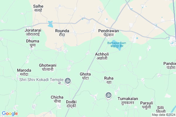
Hiretara
Hiretara Map
EDIT Map
Add Your House
 ..
..
Current Corona Virus Infected Patients Count in Durg District
| City Name | District Name | Total Covid cases |
|---|---|---|
| Bhilai | Durg | 1 |
Locality Name :
Hiretara
( हिरेटर )
Tehsil Name : Dhamdha
District : Durg
State : Chattisgarh
Language : Chhattisgarhi and Hindi, Urdu
Current Time 04:44 PM
Date: Friday , May 02,2025 (IST)
Time zone: IST (UTC+5:30)
Elevation / Altitude: 312 meters. Above Seal level
Telephone Code / Std Code: 07821
Assembly constituency : Saja assembly constituency
Assembly MLA : Ishwar Sahu
Lok Sabha constituency : Durg parliamentary constituency
Parliament MP : VIJAY BAGHEL
Serpanch Name :
Pin Code : 491331
Post Office Name : Dhamdha
Main Village Name : Hiretara
Commodities Prices : Bazar Atriya Market / Mandi
Hiretara Live Weather
Temperature: 39.8 °C
clear sky
Humidity: 16%
Wind : 1.78 mt/sec towards SW
StationName : "KhairÄ\u0081garh"
observed on 1 Hours Back
Temperature: 39.8 °C
clear sky
Humidity: 16%
Wind : 1.78 mt/sec towards SW
StationName : "KhairÄ\u0081garh"
observed on 1 Hours Back
Hiretara Weather Forecast for Next 5 days
03-05-2025
24.8°C to 37.2°C
clear sky, broken clouds, scattered clouds
24.8°C to 37.2°C
clear sky, broken clouds, scattered clouds
04-05-2025
29.1°C to 40.7°C
scattered clouds, clear sky, light rain, broken clouds
29.1°C to 40.7°C
scattered clouds, clear sky, light rain, broken clouds
05-05-2025
28.2°C to 41.9°C
clear sky, few clouds, overcast clouds, scattered clouds, light rain
28.2°C to 41.9°C
clear sky, few clouds, overcast clouds, scattered clouds, light rain
06-05-2025
29.0°C to 42.2°C
overcast clouds, few clouds, scattered clouds, clear sky
29.0°C to 42.2°C
overcast clouds, few clouds, scattered clouds, clear sky
07-05-2025
28.9°C to 42.2°C
few clouds, clear sky
28.9°C to 42.2°C
few clouds, clear sky
Rivers Near Hiretara
Kulhan
Kharun River
Kulhan
Kharun River
About Hiretara
Correct below Info and add more info about HiretaraHiretara is a small Village/hamlet in Dhamdha Tehsil in Durg District of Chattisgarh State, India. It comes under Hiretara Panchayath. It is located 33 KM towards North from District head quarters Durg. 16 KM from Dhamdha. 54 KM from State capital Raipur
Hiretara Pin code is 491331 and postal head office is Dhamdha .
Gorpa ( 5 KM ) , Khilorakala ( 7 KM ) , Barhapur ( 7 KM ) , Dodki ( 7 KM ) , Parasbod ( 9 KM ) are the nearby Villages to Hiretara. Hiretara is surrounded by Saja Tehsil towards North , Khairagarh Tehsil towards west , Berla Tehsil towards East , Bhilai Tehsil towards South .
Bhilai , Durg-Bhilai Nagar , Bemetra , Rajnandgaon are the near by Cities to Hiretara.
Hiretara 2011 Census Details
Hiretara Local Language is Chhattisgarhi. Hiretara Village Total population is 957 and number of houses are 169. Female Population is 52.5%. Village literacy rate is 60.5% and the Female Literacy rate is 26.6%.
Population
| Census Parameter | Census Data |
| Total Population | 957 |
| Total No of Houses | 169 |
| Female Population % | 52.5 % ( 502) |
| Total Literacy rate % | 60.5 % ( 579) |
| Female Literacy rate | 26.6 % ( 255) |
| Scheduled Tribes Population % | 5.3 % ( 51) |
| Scheduled Caste Population % | 0.0 % ( 0) |
| Working Population % | 48.1 % |
| Child(0 -6) Population by 2011 | 154 |
| Girl Child(0 -6) Population % by 2011 | 56.5 % ( 87) |
Hiretara Census More Deatils.
Politics in Hiretara
Bharatiya Janata Party , BJP , INC are the major political parties in this area.Polling Stations /Booths near Hiretara
1)Hedaspur2)Kachri
3)Achholi
4)Uslapur
5)Ghivri
HOW TO REACH Hiretara
By Rail
There is no railway station near to Hiretara in less than 10 km.Colleges near Hiretara
Govt. College Bori Bujurg
Address : Vill & Post-bori
thana- Bori
dist- Durg
chattisgarh
pin-491001
Sri Sai Polytechnic Nandini Road Durg 490036 (c.g)
Address : Ward-14 Banbarad-ahiwara
Schools in Hiretara
Govt Ms
Address : hiretara , dhamdha , durg , Chattisgarh . PIN- 491331 , Post - Dhamdha
Govt Health Centers near Hiretara
1) SHC Ghotha , SHC Ghotha , ,2) SHC Bhata kokdi , Bhata kokdi , ,
3) PHC Pendravan , Pendravan , ,
Sub Villages in Hiretara
Hospitals in Hiretara,Dhamdha
शा.प्रा. उपस्वास्थ्य केंद्र ग्राम चीचा
near gram panchayat chicha; Chicha; Chhattisgarh 491001; India
7.9 KM distance Detail
more ..
Petrol Bunks in Hiretara,Dhamdha
Indian oil SUSHIL FUELS KSK
Khairagarh; MAIN ROAD; THELKA TEHSIL; Dhamdha; Chhattisgarh; India
5.1 KM distance Detail
more ..
Colleges in Hiretara,Dhamdha
CHANDU LAL CHANDRAKAR COM. AND ARTS COLLEGE
Sirnabhatha; Chhattisgarh 491331; India
13.0 KM distance Detail
Government Chandulal Chandrakar Art and Science College; Dhamdha
Sirnabhatha; Chhattisgarh 491331; India
13.0 KM distance Detail
more ..
About Hiretara &
History
How to reach Hiretara
Tourist Places Near By Hiretara
Schools in Hiretara
Colleges in Hiretara
Temperature & weather of Hiretara
places in Hiretara
Hiretara photos
More Information
How to reach Hiretara
Tourist Places Near By Hiretara
Schools in Hiretara
Colleges in Hiretara
Temperature & weather of Hiretara
places in Hiretara
Hiretara photos
More Information
Village Talk
Post News or Events about this Village
Near Cities
Bhilai 32 KM near
Durg-Bhilai Nagar 35 KM near
Bemetra 47 KM near
Rajnandgaon 48 KM near
Bhilai 32 KM near
Durg-Bhilai Nagar 35 KM near
Bemetra 47 KM near
Rajnandgaon 48 KM near
Near By Taluks
Dhamdha 14 KM near
Saja 23 KM near
Khairagarh 30 KM near
Bhilai 33 KM near
Dhamdha 14 KM near
Saja 23 KM near
Khairagarh 30 KM near
Bhilai 33 KM near
Near By Air Ports
Raipur Airport 67 KM near
Jabalpur Airport 214 KM near
Sonegaon Airport 255 KM near
Khajuraho Airport 446 KM near
Raipur Airport 67 KM near
Jabalpur Airport 214 KM near
Sonegaon Airport 255 KM near
Khajuraho Airport 446 KM near
Near By Tourist Places
Durg 31 KM near
Bhilai 33 KM near
Rajnandgaon 48 KM near
Raipur 51 KM near
Kawardha 71 KM near
Durg 31 KM near
Bhilai 33 KM near
Rajnandgaon 48 KM near
Raipur 51 KM near
Kawardha 71 KM near
Near By Districts
Durg 31 KM near
Rajnandgaon 48 KM near
Raipur 52 KM near
Kabirdham 70 KM near
Durg 31 KM near
Rajnandgaon 48 KM near
Raipur 52 KM near
Kabirdham 70 KM near
Near By RailWay Station
Durg Junction Rail Way Station 30 KM near
Bhilai Power House Rail Way Station 33 KM near
Durg Junction Rail Way Station 30 KM near
Bhilai Power House Rail Way Station 33 KM near