| Home | City Bus | Maps | Villages | Cities | Rail | Tourist Places | School | College | Pin Codes | Corona Cases Count |
| Distance Calculator Bus Services IFSC Codes Trace Mobile Number Weather Search Place Trace IP Available Cash ATM/Banks Locate Polling Booth Report an Error contact People |
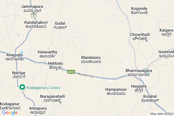
Mandaluru
Mandaluru Map
EDIT Map
Add Your House
 ..
..
Current Corona Virus Infected Patients Count in Davangere District
| City Name | District Name | Total Covid cases |
|---|---|---|
| Davangere | Davanagere | 2 |
Locality Name :
Mandaluru
( ಮಂಡಲೂರು )
Taluk Name : Davanagere
District : Davangere
State : Karnataka
Division : Bangalore
Language : Kannada and English, Hindi
Current Time 04:00 AM
Date: Saturday , May 03,2025 (IST)
Time zone: IST (UTC+5:30)
Elevation / Altitude: 598 meters. Above Seal level
Telephone Code / Std Code: 08192
Assembly constituency : Mayakonda assembly constituency
Assembly MLA : K. S. Basavanthappa
Lok Sabha constituency : Davanagere parliamentary constituency
Parliament MP : G M SIDDESHWAR
Serpanch Name :
Pin Code : 577556
Post Office Name : Anagodu
Main Village Name : Mandaluru
Commodities Prices : Davangere Market / Mandi
Mandaluru Live Weather
Temperature: 23.7 °C
broken clouds
Humidity: 79%
Wind : 4.39 mt/sec towards SW
StationName : "MÄ\u0081yakonda"
observed on 45 Mins Back
Temperature: 23.7 °C
broken clouds
Humidity: 79%
Wind : 4.39 mt/sec towards SW
StationName : "MÄ\u0081yakonda"
observed on 45 Mins Back
Mandaluru Weather Forecast for Next 5 days
04-05-2025
22.9°C to 37.1°C
broken clouds, scattered clouds, clear sky, light rain
22.9°C to 37.1°C
broken clouds, scattered clouds, clear sky, light rain
05-05-2025
22.8°C to 36.2°C
scattered clouds, few clouds, clear sky
22.8°C to 36.2°C
scattered clouds, few clouds, clear sky
06-05-2025
21.7°C to 37.7°C
scattered clouds, few clouds, clear sky, broken clouds
21.7°C to 37.7°C
scattered clouds, few clouds, clear sky, broken clouds
07-05-2025
22.5°C to 36.7°C
broken clouds, clear sky, few clouds, scattered clouds
22.5°C to 36.7°C
broken clouds, clear sky, few clouds, scattered clouds
National Highways Reachable To Mandaluru
Nationa High Way :NH50
Nationa High Way :NH48
Nationa High Way :NH50
Nationa High Way :NH48
Rivers Near Mandaluru
Kumadvati :Kumadvati :ಕುಮದ್ವತಿ
Shyagale :ಶ್ಯಾಗಲೆ ಹಳ್ಳ
Kumadvati :Kumadvati :ಕುಮದ್ವತಿ
Shyagale :ಶ್ಯಾಗಲೆ ಹಳ್ಳ
About Mandaluru
Correct below Info and add more info about MandaluruMandaluru is a small Village/hamlet in Davanagere Taluk in Davangere District of Karnataka State, India. It comes under Mandaluru Panchayath. It belongs to Bangalore Division . It is located 29 KM towards East from District head quarters Davanagere. 21 KM from Davanagere. 260 KM from State capital Bangalore
Mandaluru Pin code is 577556 and postal head office is Anagodu .
Naraganahalli ( 8 KM ) , Hulikatte ( 10 KM ) , Nerlige ( 11 KM ) , Anagodu ( 11 KM ) , Anaji ( 13 KM ) are the nearby Villages to Mandaluru. Mandaluru is surrounded by Jagalur Taluk towards North , Chitradurga Taluk towards East , Holalkere Taluk towards South , Harihara Taluk towards west .
Davanagere , Chitradurga , Ranibennur , Shimoga are the near by Cities to Mandaluru.
Mandaluru 2011 Census Details
Mandaluru Local Language is Kannada. Mandaluru Village Total population is 1299 and number of houses are 285. Female Population is 48.7%. Village literacy rate is 82.9% and the Female Literacy rate is 38.2%.
Population
| Census Parameter | Census Data |
| Total Population | 1299 |
| Total No of Houses | 285 |
| Female Population % | 48.7 % ( 632) |
| Total Literacy rate % | 82.9 % ( 1077) |
| Female Literacy rate | 38.2 % ( 496) |
| Scheduled Tribes Population % | 20.2 % ( 262) |
| Scheduled Caste Population % | 5.2 % ( 67) |
| Working Population % | 39.3 % |
| Child(0 -6) Population by 2011 | 125 |
| Girl Child(0 -6) Population % by 2011 | 52.0 % ( 65) |
Mandaluru Census More Deatils.
Politics in Mandaluru
Bharatiya Janata Party , BJP , Bharatiya Janata Party (BJP) , INC are the major political parties in this area.Polling Stations /Booths near Mandaluru
1)Govt Lower Primary School Katihalli2)Govt Lower Primary School Kashettihalli
3)Govt Lower Primary School Hosahalli
4)Govt Lower Primary School Kereyagalahalli
5)Govt Lower Primary School Guddadakumaranahalli
HOW TO REACH Mandaluru
By Road
Davangere is the Nearest Town to Mandaluru. Davangere is 30 km from Mandaluru. Road connectivity is there from Davangere to Mandaluru.By Rail
There is no railway station near to Mandaluru in less than 10 km. How ever there are railway Stations from Near By town Davangere. are the railway Stations near to Davangere. You can reach from Davangere to Mandaluru by road after .Colleges near Mandaluru
Jain Institute Of Technology ,davangere
Address :
Nutana Independent Pu Science College
Address :
Sri Channappa Junior College
Address :
R L Law College
Address :
Sri Maruti Pre Univercity College
Address :
Schools near Mandaluru
M.desai Girls Resi Sch Ward 39
Address : ward no 39 , davanagere(s) , davanagere , Karnataka . PIN- 577002 , Post - Kasturaba Extension
Anmol Public School Shiramagonda
Address : ward no 33 , davanagere(s) , davanagere , Karnataka . PIN- 577005 , Post - Sks Nagar-Davanagere
Morarji Vasathi Shale-avaragere
Address : ward no 23 , davanagere(n) , davanagere , Karnataka . PIN- 577003 , Post - Rm Yard- Davanagere
S.o.c.t. Res. H.s Hosabullapura
Address : bullapura , davanagere(n) , davanagere , Karnataka . PIN- 577556 , Post - Anagodu
Govt Health Centers near Mandaluru
1) VENKATESHWARA BADAVANE , VENKATESHWARA BADAVANE , VENKATESHWARA BADAVANE , CHITRADURGA2) Hallihal , Halihal SC , ,
3) KAMADODA , At Post:Kamadod Tq: Ranebennur Dist: Haveri Pin Code: 581145 , panchayat road , AWW Centre
Sub Villages in Mandaluru
Petrol Bunks in Mandaluru,Davanagere
B V GANGAPPA SETTY & SONS
Chithradurga Rd; Bharamasagara; Karnataka 577519; India
18.6 KM distance Detail
more ..
Schools in Mandaluru,Davanagere
Smt.Kallamma High School;Bahaddurghatta Village
BAHADDURGHATTA;CHITRADURGA TQ; AND DIST; Chitradurga; Karnataka; India
8.5 KM distance Detail
Shree Morarji Desai Model Residentioal School ;Kodi Rangavvanahalli
Rangavvanahalli; Karnataka 577519; India
9.8 KM distance Detail
Morarji Desai Govt Residential School
Rangavvanahalli; Karnataka 577519; India
9.9 KM distance Detail
Electronic Shops in Mandaluru,Davanagere
Suresh Digital Photo Studio
Railway Colony; Tholahunase; Karnataka 577514; India
21.1 KM distance Detail
Super Markets in Mandaluru,Davanagere
Duggesh Doddamane Provision Store
opp. Govt School; Hindisakatte; Karnataka 577534; India
18.3 KM distance Detail
Local Parks in Mandaluru,Davanagere
Governement Offices near Mandaluru,Davanagere
About Mandaluru &
History
How to reach Mandaluru
Tourist Places Near By Mandaluru
Schools in Mandaluru
Colleges in Mandaluru
Temperature & weather of Mandaluru
places in Mandaluru
Mandaluru photos
More Information
How to reach Mandaluru
Tourist Places Near By Mandaluru
Schools in Mandaluru
Colleges in Mandaluru
Temperature & weather of Mandaluru
places in Mandaluru
Mandaluru photos
More Information
Village Talk
Post News or Events about this Village
Near Cities
Davanagere 26 KM near
Chitradurga 38 KM near
Ranibennur 68 KM near
Shimoga 89 KM near
Davanagere 26 KM near
Chitradurga 38 KM near
Ranibennur 68 KM near
Shimoga 89 KM near
Near By Taluks
Davanagere 19 KM near
Jagalur 26 KM near
Chitradurga 28 KM near
Holalkere 43 KM near
Davanagere 19 KM near
Jagalur 26 KM near
Chitradurga 28 KM near
Holalkere 43 KM near
Near By Air Ports
Hubli Airport 174 KM near
Bajpe Airport 232 KM near
Bengaluru International Airport 241 KM near
Sambre Airport 257 KM near
Hubli Airport 174 KM near
Bajpe Airport 232 KM near
Bengaluru International Airport 241 KM near
Sambre Airport 257 KM near
Near By Tourist Places
Chitradurga 38 KM near
Shimoga 90 KM near
Shivgiri 105 KM near
Hospet 113 KM near
Kemmanagundi 114 KM near
Chitradurga 38 KM near
Shimoga 90 KM near
Shivgiri 105 KM near
Hospet 113 KM near
Kemmanagundi 114 KM near
Near By Districts
Davangere 28 KM near
Chitradurga 38 KM near
Shimoga 88 KM near
Haveri 100 KM near
Davangere 28 KM near
Chitradurga 38 KM near
Shimoga 88 KM near
Haveri 100 KM near
Near By RailWay Station
Davangere Rail Way Station 27 KM near
Chikjajur Junction Rail Way Station 32 KM near
Davangere Rail Way Station 27 KM near
Chikjajur Junction Rail Way Station 32 KM near