| Home | City Bus | Maps | Villages | Cities | Rail | Tourist Places | School | College | Pin Codes | Corona Cases Count |
| Distance Calculator Bus Services IFSC Codes Trace Mobile Number Weather Search Place Trace IP Available Cash ATM/Banks Locate Polling Booth Report an Error contact People |
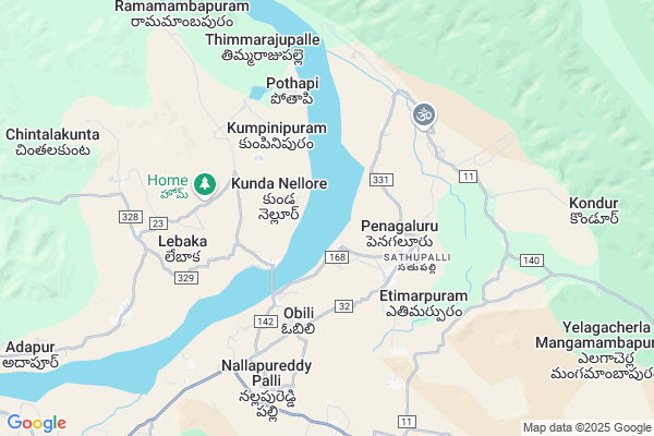
Komarunipalle
Komarunipalle Map
EDIT Map
Add Your House
 ..
..
Current Corona Virus Infected Patients Count in Cuddapah District
| City Name | District Name | Total Covid cases |
|---|
Locality Name :
Komarunipalle
( కోమారునిపల్లె )
Mandal Name : Nandalur
District : Cuddapah
State : Andhra Pradesh
Region : Rayalaseema
Language : Telugu and Urdu
Current Time 08:50 PM
Date: Friday , May 02,2025 (IST)
Time zone: IST (UTC+5:30)
Elevation / Altitude: 143 meters. Above Seal level
Telephone Code / Std Code: 08589
Assembly constituency : assembly constituency
Assembly MLA :
Lok Sabha constituency : parliamentary constituency
Parliament MP : P.V.MIDHUN REDDY
Serpanch Name :
Main Village Name : Komarunipalle
Commodities Prices : Cuddapah Market / Mandi
Komarunipalle Live Weather
Temperature: 30.7 °C
overcast clouds
Humidity: 60%
Wind : 2.99 mt/sec towards E
StationName : "NÄ\u0081gireddipalli"
observed on Now
Temperature: 30.7 °C
overcast clouds
Humidity: 60%
Wind : 2.99 mt/sec towards E
StationName : "NÄ\u0081gireddipalli"
observed on Now
Komarunipalle Weather Forecast for Next 5 days
03-05-2025
29.3°C to 30.5°C
light rain, broken clouds
29.3°C to 30.5°C
light rain, broken clouds
04-05-2025
28.5°C to 41.1°C
broken clouds, scattered clouds, clear sky
28.5°C to 41.1°C
broken clouds, scattered clouds, clear sky
05-05-2025
29.3°C to 39.5°C
light rain, overcast clouds, broken clouds
29.3°C to 39.5°C
light rain, overcast clouds, broken clouds
06-05-2025
28.8°C to 42.0°C
broken clouds, clear sky, scattered clouds
28.8°C to 42.0°C
broken clouds, clear sky, scattered clouds
07-05-2025
29.9°C to 42.1°C
light rain, overcast clouds, scattered clouds, few clouds, clear sky, broken clouds
29.9°C to 42.1°C
light rain, overcast clouds, scattered clouds, few clouds, clear sky, broken clouds
National Highways Reachable To Komarunipalle
Nationa High Way :NH716
Nationa High Way :NH716
Rivers Near Komarunipalle
Cheyyeru
Pullageru River
Cheyyeru
Pullageru River
About Komarunipalle
Correct below Info and add more info about KomarunipalleKomarunipalle is a small Village/hamlet in Nandalur Mandal in Cuddapah District of Andhra Pradesh State, India. It comes under Komarunipalle Panchayath. It belongs to Rayalaseema region . It is located 55 KM towards East from District head quarters Kadapa. 8 KM from Nandalur. 410 KM from State capital Hyderabad
Narasingaraju Puram ( 3 KM ) , Pothapi ( 5 KM ) , Singanamala ( 6 KM ) , Penagalur ( 6 KM ) , Narayana Nellore ( 7 KM ) are the nearby Villages to Komarunipalle. Komarunipalle is surrounded by Nandalur Mandal towards west , Rajampet Mandal towards South , Chitvel Mandal towards South , Pullampeta Mandal towards South .
Kadapa , Cuddapah , Venkatagiri , Rayachoti are the near by Cities to Komarunipalle.
Komarunipalle 2011 Census Details
Komarunipalle Local Language is Telugu. Komarunipalle Village Total population is 105 and number of houses are 28. Female Population is 55.2%. Village literacy rate is 43.8% and the Female Literacy rate is 19.0%.
Population
| Census Parameter | Census Data |
| Total Population | 105 |
| Total No of Houses | 28 |
| Female Population % | 55.2 % ( 58) |
| Total Literacy rate % | 43.8 % ( 46) |
| Female Literacy rate | 19.0 % ( 20) |
| Scheduled Tribes Population % | 0.0 % ( 0) |
| Scheduled Caste Population % | 35.2 % ( 37) |
| Working Population % | 38.1 % |
| Child(0 -6) Population by 2011 | 16 |
| Girl Child(0 -6) Population % by 2011 | 43.8 % ( 7) |
Komarunipalle Census More Deatils.
HOW TO REACH Komarunipalle
By Road
Cuddapah is the Nearest Town to Komarunipalle. Cuddapah is 60 km from Komarunipalle. Road connectivity is there from Cuddapah to Komarunipalle.By Rail
There is no railway station near to Komarunipalle in less than 10 km. How ever there are railway Stations from Near By town Cuddapah. are the railway Stations near to Cuddapah. You can reach from Cuddapah to Komarunipalle by road after .By Bus
Rajampet Bypass APSRTC Bus Station , Rajampet APSRTC Bus Station , Rapur APSRTC Bus Station are the nearby by Bus Stations to Komarunipalle .APSRTC runs Number of busses from major cities to here.Pincodes near Komarunipalle
516151 ( Tangatur ) , 516127 ( Penagalur ) , 516128 ( Chakrapunayanipet )Colleges near Komarunipalle
Govt Junior College? Nandalur
Address : Govt Junior College? Nandalur
Schools near Komarunipalle
Svb Hs Nagireddy Palle
Address : nagireddipalle , nandalur , cuddapah , Andhra Pradesh . PIN- 516150 , Post - Nandalur
Aprs Hs Nandalug(b)
Address : nandalur , nandalur , cuddapah , Andhra Pradesh . PIN- 516150 , Post - Nandalur
Prathibha Hs Aravapalli
Address : nagireddipalle , nandalur , cuddapah , Andhra Pradesh . PIN- 516150 , Post - Nandalur
Ssg Hs Arava Palle
Address : nandalur , nandalur , cuddapah , Andhra Pradesh . PIN- 516150 , Post - Nandalur
Govt Health Centers near Komarunipalle
1) Penagalur , 0 , PENAGALUR MAIN ROAD , NEAR PENAGALUR POLICE STATION2) Tangutur , , tangutur , tangutur main
3) Penagalur , 0 , PENAGALUR MAIN ROAD , Oop Police Staiton
Sub Villages in Komarunipalle
Hospitals in Komarunipalle,Nandalur
Mandal Primary Health Centre; Nandalur
Nandalur; Andhra Pradesh 516150; India
16.7 KM distance Detail
more ..
Petrol Bunks in Komarunipalle,Nandalur
HP PETROL PUMP - SOWMYANATHA FILLING STATION
Sy.no. 591 ; Near SAI Baba Temple; Tank Bund; Nandalur(p & M) Nandalur; Kadapa; Andhra Pradesh 516150; India
15.6 KM distance Detail
Reliance Oil Filling Station
Kadapa - Tirupati Rd; Rajampet; Andhra Pradesh 516115; India
17.3 KM distance Detail
HP PETROL PUMP - SRI SAI TIRUMALA FUELS
Renigunta Road Rajampeta Rajampeta Mandal; State Highway 31; Kadapa; 516152; India
17.3 KM distance Detail
more ..
Schools in Komarunipalle,Nandalur
Govt Urdu primary School
Tangutur; nandalur mandal; Andhra Pradesh 516151; India
2.9 KM distance Detail
High School;N R Puram
Pothapi Rd; Narasingarajupuram; Andhra Pradesh 516127; India
2.9 KM distance Detail
Super Markets in Komarunipalle,Nandalur
Sri Lakshmi Sweets and Bakery
Sathupalli; Etimarpuram; Andhra Pradesh 516127; India
3.6 KM distance Detail
Soka Venkatesh general stores
; Sathupalli; Etimarpuram; Andhra Pradesh 516127; India
4.1 KM distance Detail
Police Stations near Komarunipalle,Nandalur
Nandalur Police Station
Railway Station Rd; Nandalur; Andhra Pradesh 516150; India
17.1 KM distance Detail
About Komarunipalle &
History
How to reach Komarunipalle
Tourist Places Near By Komarunipalle
Schools in Komarunipalle
Colleges in Komarunipalle
Temperature & weather of Komarunipalle
places in Komarunipalle
Komarunipalle photos
More Information
How to reach Komarunipalle
Tourist Places Near By Komarunipalle
Schools in Komarunipalle
Colleges in Komarunipalle
Temperature & weather of Komarunipalle
places in Komarunipalle
Komarunipalle photos
More Information
Village Talk
Post News or Events about this Village
Near Cities
Kadapa 52 KM near
Cuddapah 52 KM near
Venkatagiri 59 KM near
Rayachoti 67 KM near
Kadapa 52 KM near
Cuddapah 52 KM near
Venkatagiri 59 KM near
Rayachoti 67 KM near
Near By Taluks
Penagalur 4 KM near
Nandalur 7 KM near
Rajampet 17 KM near
Chitvel 21 KM near
Penagalur 4 KM near
Nandalur 7 KM near
Rajampet 17 KM near
Chitvel 21 KM near
Near By Air Ports
Tirupati Airport 91 KM near
Chennai Airport 199 KM near
Bengaluru International Airport 231 KM near
Vijayawada Airport 333 KM near
Tirupati Airport 91 KM near
Chennai Airport 199 KM near
Bengaluru International Airport 231 KM near
Vijayawada Airport 333 KM near
Near By Tourist Places
Kadapa 53 KM near
Tirupati 87 KM near
Srikalahasti 88 KM near
Nellore 89 KM near
Horsley Hills 130 KM near
Kadapa 53 KM near
Tirupati 87 KM near
Srikalahasti 88 KM near
Nellore 89 KM near
Horsley Hills 130 KM near
Near By Districts
Cuddapah 52 KM near
Spsr Nellore 89 KM near
Chittoor 138 KM near
Thiruvallur 165 KM near
Cuddapah 52 KM near
Spsr Nellore 89 KM near
Chittoor 138 KM near
Thiruvallur 165 KM near
Near By RailWay Station
Nandalur Rail Way Station 17 KM near
Razampeta Rail Way Station 18 KM near
Nandalur Rail Way Station 17 KM near
Razampeta Rail Way Station 18 KM near