| Home | City Bus | Maps | Villages | Cities | Rail | Tourist Places | School | College | Pin Codes | Corona Cases Count |
| Distance Calculator Bus Services IFSC Codes Trace Mobile Number Weather Search Place Trace IP Available Cash ATM/Banks Locate Polling Booth Report an Error contact People |
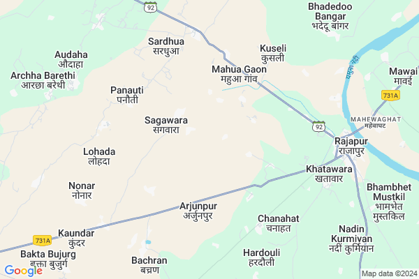
Tera Khurd
Tera Khurd Map
EDIT Map
Add Your House
 ..
..
Current Corona Virus Infected Patients Count in Chitrakoot District
| City Name | District Name | Total Covid cases |
|---|
Locality Name :
Tera Khurd
( तेरा खुर्द )
Block Name : Pahari
District : Chitrakoot
State : Uttar Pradesh
Division : Chitrakoot
Language : Hindi and Urdu
Current Time 11:36 PM
Date: Friday , May 02,2025 (IST)
Time zone: IST (UTC+5:30)
Elevation / Altitude: 134 meters. Above Seal level
Telephone Code / Std Code: 05198
Assembly constituency : Chitrakoot assembly constituency
Assembly MLA : Anil Kumar Anil Pradhan
Lok Sabha constituency : Banda parliamentary constituency
Parliament MP : R.K. SINGH PATEL
Serpanch Name :
Pin Code : 210207
Post Office Name : Rajapur (Chitrakoot)
Main Village Name : Tera Khurd
Commodities Prices : Karvi Market / Mandi
Tera Khurd Live Weather
Temperature: 33.8 °C
few clouds
Humidity: 23%
Wind : 3.88 mt/sec towards E
StationName : "RÄ\u0081jÄ\u0081pur"
observed on 1 Hours Back
Temperature: 33.8 °C
few clouds
Humidity: 23%
Wind : 3.88 mt/sec towards E
StationName : "RÄ\u0081jÄ\u0081pur"
observed on 1 Hours Back
Tera Khurd Weather Forecast for Next 5 days
03-05-2025
30.6°C to 33.0°C
few clouds
30.6°C to 33.0°C
few clouds
04-05-2025
29.2°C to 40.5°C
clear sky, light rain
29.2°C to 40.5°C
clear sky, light rain
05-05-2025
30.7°C to 42.5°C
overcast clouds, broken clouds, scattered clouds
30.7°C to 42.5°C
overcast clouds, broken clouds, scattered clouds
06-05-2025
30.2°C to 42.8°C
scattered clouds, clear sky, few clouds, light rain
30.2°C to 42.8°C
scattered clouds, clear sky, few clouds, light rain
07-05-2025
29.0°C to 40.4°C
few clouds, scattered clouds, broken clouds, light rain
29.0°C to 40.4°C
few clouds, scattered clouds, broken clouds, light rain
National Highways Reachable To Tera Khurd
Nationa High Way :NH731AG
Nationa High Way :NH731AG
Rivers Near Tera Khurd
Paisuni
Yamuna River :যমুনা :यमुना :ಯಮುನಾ :Ямуна :https://1drv.ms/b/s!Ar-WXIFaX7UdgQuO6WpVrTr6YYsQ
Paisuni
Yamuna River :যমুনা :यमुना :ಯಮುನಾ :Ямуна :https://1drv.ms/b/s!Ar-WXIFaX7UdgQuO6WpVrTr6YYsQ
About Tera Khurd
Correct below Info and add more info about Tera KhurdTera Khurd is a small Village/hamlet in Pahari Block in Chitrakoot District of Uttar Pradesh State, India. It comes under Tera Khurd Panchayath. It belongs to Chitrakoot Division . It is located 22 KM towards North from District head quarters Chitrakoot Dham. 2 KM from Pahari Bujurg. 190 KM from State capital Lucknow
Tera Khurd Pin code is 210207 and postal head office is Rajapur (Chitrakoot).
Sagawara ( 2 KM ) , Moharwan ( 3 KM ) , Arjunpur ( 4 KM ) , Mahua Gaon ( 4 KM ) , Ram Puriya Awwal ( 4 KM ) are the nearby Villages to Tera Khurd. Tera Khurd is surrounded by Ramnagar Block towards East , Sarsawan Block towards East , Dhata Block towards North , Kamasin Block towards west .
Chitrakoot , Lal Gopalganj Nindaura , Fatehpur , Banda are the near by Cities to Tera Khurd.
Tera Khurd 2011 Census Details
Tera Khurd Local Language is Hindi. Tera Khurd Village Total population is 447 and number of houses are 61. Female Population is 45.9%. Village literacy rate is 47.0% and the Female Literacy rate is 15.7%.
Population
| Census Parameter | Census Data |
| Total Population | 447 |
| Total No of Houses | 61 |
| Female Population % | 45.9 % ( 205) |
| Total Literacy rate % | 47.0 % ( 210) |
| Female Literacy rate | 15.7 % ( 70) |
| Scheduled Tribes Population % | 0.0 % ( 0) |
| Scheduled Caste Population % | 21.0 % ( 94) |
| Working Population % | 44.5 % |
| Child(0 -6) Population by 2011 | 77 |
| Girl Child(0 -6) Population % by 2011 | 54.5 % ( 42) |
Tera Khurd Census More Deatils.
Politics in Tera Khurd
SP , BSP are the major political parties in this area.Polling Stations /Booths near Tera Khurd
1)Prathmik Vidyalay Kaloopur - Central Part2)Prathmik Vidyalay Teerghumai
3)Prathmik Vidyalay Sudinpur - Central Part
4)Prathmik Vidyalay Bharatpur Taranva- West Part
5)Girls Upper Prathmik Vidyalay Arjunpur-east Part
HOW TO REACH Tera Khurd
By Rail
There is no railway station near to Tera Khurd in less than 10 km.Colleges near Tera Khurd
Lalsinghpgcollege Laxmepur Khandeha
Address :
Pandit Shree Vishnu Pandey Inter Collage Deora Mau Chitrakoot
Address :
Adarsh Inter College Manikpur Chitrakoot Up -210208
Address :
Schools near Tera Khurd
Pmv Tera Khurd
Address : rampuriya awwal , pahadi , chitrakoot , Uttar Pradesh . PIN- 210207 , Post - Rajapur (Chitrakoot)
Pmv Raipurawa
Address : audaha , pahadi , chitrakoot , Uttar Pradesh . PIN- 210207 , Post - Rajapur (Chitrakoot)
Pmv Bhanpur
Address : bhanpur , pahadi , chitrakoot , Uttar Pradesh . PIN- 210208 , Post - Manikpur (Chitrakoot)
Pmv Rampuriya Awwal
Address : rampuriya awwal , pahadi , chitrakoot , Uttar Pradesh . PIN- 210207 , Post - Rajapur (Chitrakoot)
Govt Health Centers near Tera Khurd
1) Beraur , SC Beraur , ,2) Sandila , Gaura , Gaura , Gaura
3) Pachokhar , Pachokhar , ,
Sub Villages in Tera Khurd
Hospitals in Tera Khurd,Pahari
Gayatri Pathology Lab
Near-Nagar Panchayat; Thana Rd; Rajapur; Uttar Pradesh 210207; India
7.8 KM distance Detail
more ..
Colleges in Tera Khurd,Pahari
KEDAR NATH RAM SWAROOP MAHAVIDYALAYA KHATWARA CHITRAKOOT
Pahari Marg; Khatawara; Rajapur; Uttar Pradesh 210207; India
5.6 KM distance Detail
Kedarnath Jagannath College
Khatwara Post Rajapur; Thasil Mau ;Chitrakoot; Rajapur; Uttar Pradesh 210207; India
6.5 KM distance Detail
Dherend Inter College
Loopline Chowraha; Rajapur; Chhilli Rakas Khade; Uttar Pradesh 210207; India
7.1 KM distance Detail
more ..
Electronic Shops in Tera Khurd,Pahari
Jitendra Mobile & Electronics
Kamsin; road; Tulsi chauk; Rajapur; Uttar Pradesh; India
7.3 KM distance Detail
Super Markets in Tera Khurd,Pahari
Balram General Store
Paikaura Devkali Road Paikaura; Karwi Mafi Road; Chitrakoot Dham; Uttar Pradesh 210205; India
16.7 KM distance Detail
Police Stations near Tera Khurd,Pahari
Mahewa Ghat Police Station
Mahewa ghat; Kausambi; Manjhanpur; Uttar Pradesh; India
9.3 KM distance Detail
Governement Offices near Tera Khurd,Pahari
Sameer Computer's Rajapur
Nandin Road Rajapur; Rajapur; Uttar Pradesh 210207; India
8.2 KM distance Detail
About Tera Khurd &
History
How to reach Tera Khurd
Tourist Places Near By Tera Khurd
Schools in Tera Khurd
Colleges in Tera Khurd
Temperature & weather of Tera Khurd
places in Tera Khurd
Tera Khurd photos
More Information
How to reach Tera Khurd
Tourist Places Near By Tera Khurd
Schools in Tera Khurd
Colleges in Tera Khurd
Temperature & weather of Tera Khurd
places in Tera Khurd
Tera Khurd photos
More Information
Village Talk
Post News or Events about this Village
Near Cities
Chitrakoot 35 KM near
Lal Gopalganj Nindaura 68 KM near
Fatehpur 72 KM near
Banda 85 KM near
Chitrakoot 35 KM near
Lal Gopalganj Nindaura 68 KM near
Fatehpur 72 KM near
Banda 85 KM near
Near By Taluks
Pahari 2 KM near
Ramnagar 19 KM near
Sarsawan 22 KM near
Dhata 26 KM near
Pahari 2 KM near
Ramnagar 19 KM near
Sarsawan 22 KM near
Dhata 26 KM near
Near By Air Ports
Bamrauli Airport 74 KM near
Kanpur Airport 146 KM near
Khajuraho Airport 149 KM near
Amausi Airport 172 KM near
Bamrauli Airport 74 KM near
Kanpur Airport 146 KM near
Khajuraho Airport 149 KM near
Amausi Airport 172 KM near
Near By Tourist Places
Kaushambi 36 KM near
Kalinjar 82 KM near
Allahabad 84 KM near
Shringverpur 101 KM near
Satna 104 KM near
Kaushambi 36 KM near
Kalinjar 82 KM near
Allahabad 84 KM near
Shringverpur 101 KM near
Satna 104 KM near
Near By Districts
Chitrakoot 22 KM near
Kaushambi 43 KM near
Fatehpur 74 KM near
Banda 85 KM near
Chitrakoot 22 KM near
Kaushambi 43 KM near
Fatehpur 74 KM near
Banda 85 KM near
Near By RailWay Station
Chitrakutdham Karwi Rail Way Station 27 KM near
Manikpur Junction Rail Way Station 40 KM near
Chitrakutdham Karwi Rail Way Station 27 KM near
Manikpur Junction Rail Way Station 40 KM near