| Home | City Bus | Maps | Villages | Cities | Rail | Tourist Places | School | College | Pin Codes | Corona Cases Count |
| Distance Calculator Bus Services IFSC Codes Trace Mobile Number Weather Search Place Trace IP Available Cash ATM/Banks Locate Polling Booth Report an Error contact People |
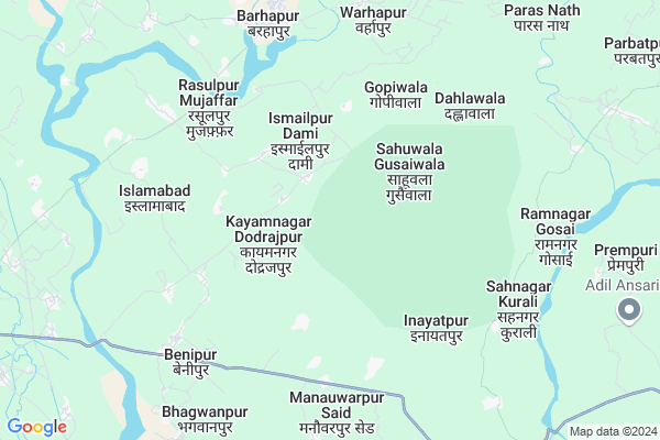
Naiwala
Naiwala Map
EDIT Map
Add Your House
 ..
..
Current Corona Virus Infected Patients Count in Bijnor District
| City Name | District Name | Total Covid cases |
|---|---|---|
| Bijnor District | Bijnor | 28 |
Locality Name :
Naiwala
( नेवला )
Block Name : Kotwali
District : Bijnor
State : Uttar Pradesh
Division : Moradabad
Language : Hindi and Urdu
Current Time 08:59 AM
Date: Saturday , May 03,2025 (IST)
Time zone: IST (UTC+5:30)
Elevation / Altitude: 247 meters. Above Seal level
Telephone Code / Std Code: 01341
Assembly constituency : Barhapur assembly constituency
Assembly MLA : Kunwar Sushant Singh
Lok Sabha constituency : Moradabad parliamentary constituency
Parliament MP : Dr. S.T. HASAN
Serpanch Name :
Pin Code : 246724
Post Office Name : Badhapur
Main Village Name : Naiwala
Commodities Prices : Nagina Market / Mandi
Naiwala Live Weather
Temperature: 30.9 °C
overcast clouds
Humidity: 29%
Wind : 2.24 mt/sec towards SE
StationName : "Nagīna"
observed on 14 Mins Back
Temperature: 30.9 °C
overcast clouds
Humidity: 29%
Wind : 2.24 mt/sec towards SE
StationName : "Nagīna"
observed on 14 Mins Back
Naiwala Weather Forecast for Next 5 days
04-05-2025
24.5°C to 37.9°C
overcast clouds, broken clouds, light rain
24.5°C to 37.9°C
overcast clouds, broken clouds, light rain
05-05-2025
24.2°C to 39.4°C
broken clouds, overcast clouds, scattered clouds, few clouds, light rain
24.2°C to 39.4°C
broken clouds, overcast clouds, scattered clouds, few clouds, light rain
06-05-2025
23.0°C to 38.1°C
light rain, overcast clouds, scattered clouds, few clouds
23.0°C to 38.1°C
light rain, overcast clouds, scattered clouds, few clouds
07-05-2025
26.9°C to 40.2°C
light rain, broken clouds, clear sky, overcast clouds
26.9°C to 40.2°C
light rain, broken clouds, clear sky, overcast clouds
08-05-2025
26.7°C to 40.2°C
scattered clouds, broken clouds, light rain, overcast clouds
26.7°C to 40.2°C
scattered clouds, broken clouds, light rain, overcast clouds
National Highways Reachable To Naiwala
Nationa High Way :NH34
Nationa High Way :NH709AD
Nationa High Way :NH34
Nationa High Way :NH709AD
Rivers Near Naiwala
Ramganga
Ramganga
Ramganga
Ramganga
About Naiwala
Correct below Info and add more info about NaiwalaNaiwala is a small Village/hamlet in Kotwali Block in Bijnor District of Uttar Pradesh State, India. It comes under Naiwala Panchayath. It belongs to Moradabad Division . It is located 49 KM towards East from District head quarters Bijnor. 13 KM from Kotwaali. 438 KM from State capital Lucknow
Naiwala Pin code is 246724 and postal head office is Badhapur .
Inayatpur ( 6 KM ) , Benipur ( 7 KM ) , Bhagwanpur ( 9 KM ) , Kishanpurkunda ( 9 KM ) , Shahjahanpur ( 9 KM ) are the nearby Villages to Naiwala. Naiwala is surrounded by Afzalgarh Block towards East , Dhampur Block towards South , Nehtaur Block towards South , Kiratpur Block towards west .
Nagina , Sherkot , Nehtaur , Najibabad are the near by Cities to Naiwala.
Naiwala 2011 Census Details
Naiwala Local Language is Hindi. Naiwala Village Total population is 751 and number of houses are 127. Female Population is 47.1%. Village literacy rate is 57.4% and the Female Literacy rate is 20.1%.
Population
| Census Parameter | Census Data |
| Total Population | 751 |
| Total No of Houses | 127 |
| Female Population % | 47.1 % ( 354) |
| Total Literacy rate % | 57.4 % ( 431) |
| Female Literacy rate | 20.1 % ( 151) |
| Scheduled Tribes Population % | 0.0 % ( 0) |
| Scheduled Caste Population % | 91.7 % ( 689) |
| Working Population % | 42.1 % |
| Child(0 -6) Population by 2011 | 137 |
| Girl Child(0 -6) Population % by 2011 | 53.3 % ( 73) |
Naiwala Census More Deatils.
Politics in Naiwala
BJP , BSP are the major political parties in this area.Polling Stations /Booths near Naiwala
1)P.v Saharawala2)P.v Sahuwala Gosaiwala Room No 1
3)P.v. Jhilmila Room No 2
4)P.m.v Jamanwala Majra Islamnagar Room No 3
5)P.v Milak Qudduspur
HOW TO REACH Naiwala
By Rail
There is no railway station near to Naiwala in less than 10 km.Colleges near Naiwala
Haffiz Mohammad Ibrahim Inter College
Address :
Rajkiya Balika Inter College
Address :
Balram Kunwar Saraswati Vidya Mandir
Address :
Government Inter College
Address :
Syam Narayan Singh Smarak Inter College
Address :
Schools in Naiwala
Dr. B.r.ambedkar J.h.s
Address : naiwala , kotwali , bijnor , Uttar Pradesh . PIN- 246762 , Post - Nagina (Bijnor)
Govt Health Centers near Naiwala
1) Ismailpur Domi , Health Sub Centre Building , Village Ismailpur Domi ,2) Muzaffar Nagar , Health Sub Centre Building , Village Muzaffar Nagar ,
3) APHC Islamabad , Primary Health Centre Building , Village & Post Islamabad Block Kotwali ,
Sub Villages in Naiwala
Schools in Naiwala,Kotwali
Electronic Shops in Naiwala,Kotwali
Super Markets in Naiwala,Kotwali
Local Parks in Naiwala,Kotwali
Police Stations near Naiwala,Kotwali
Governement Offices near Naiwala,Kotwali
About Naiwala &
History
How to reach Naiwala
Tourist Places Near By Naiwala
Schools in Naiwala
Colleges in Naiwala
Temperature & weather of Naiwala
places in Naiwala
Naiwala photos
More Information
How to reach Naiwala
Tourist Places Near By Naiwala
Schools in Naiwala
Colleges in Naiwala
Temperature & weather of Naiwala
places in Naiwala
Naiwala photos
More Information
Village Talk
Post News or Events about this Village
Near Cities
Nagina 14 KM near
Sherkot 15 KM near
Nehtaur 25 KM near
Najibabad 28 KM near
Nagina 14 KM near
Sherkot 15 KM near
Nehtaur 25 KM near
Najibabad 28 KM near
Near By Taluks
Kotwali 13 KM near
Afzalgarh 18 KM near
Dhampur 21 KM near
Nehtaur 27 KM near
Kotwali 13 KM near
Afzalgarh 18 KM near
Dhampur 21 KM near
Nehtaur 27 KM near
Near By Air Ports
Muzaffarnagar Airport 95 KM near
Pantnagar Airport 114 KM near
Dehra Dun Airport 119 KM near
Indira Gandhi International Airport 194 KM near
Muzaffarnagar Airport 95 KM near
Pantnagar Airport 114 KM near
Dehra Dun Airport 119 KM near
Indira Gandhi International Airport 194 KM near
Near By Tourist Places
Corbett National Park 42 KM near
Lansdowne 48 KM near
Kashipur 53 KM near
Ramnagar 62 KM near
Hastinapur 71 KM near
Corbett National Park 42 KM near
Lansdowne 48 KM near
Kashipur 53 KM near
Ramnagar 62 KM near
Hastinapur 71 KM near
Near By Districts
Bijnor 47 KM near
Jyotiba Phule Nagar 71 KM near
Haridwar 72 KM near
Moradabad 83 KM near
Bijnor 47 KM near
Jyotiba Phule Nagar 71 KM near
Haridwar 72 KM near
Moradabad 83 KM near
Near By RailWay Station
Nagina Rail Way Station 14 KM near
Dhampur Rail Way Station 21 KM near
Nagina Rail Way Station 14 KM near
Dhampur Rail Way Station 21 KM near