| Home | City Bus | Maps | Villages | Cities | Rail | Tourist Places | School | College | Pin Codes | Corona Cases Count |
| Distance Calculator Bus Services IFSC Codes Trace Mobile Number Weather Search Place Trace IP Available Cash ATM/Banks Locate Polling Booth Report an Error contact People |
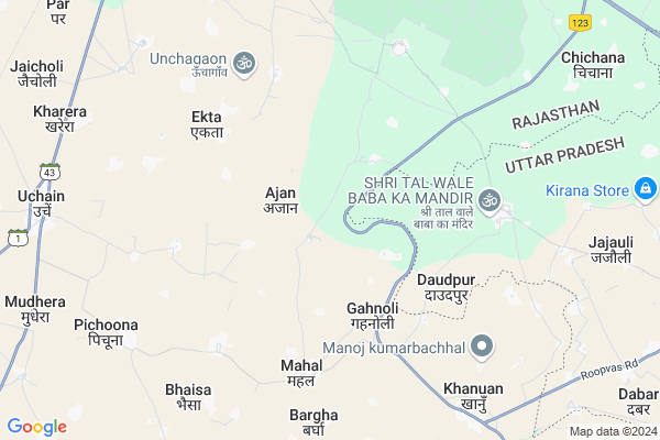
Daulatgarh Map
EDIT Map
Add Your House
 ..
..
Current Corona Virus Infected Patients Count in Bharatpur District
| City Name | District Name | Total Covid cases |
|---|---|---|
| Bharatpur District | Bharatpur | 110 |
Locality Name :
Daulatgarh
( दौलतगढ़ )
Tehsil Name : Rupbas
District : Bharatpur
State : Rajasthan
Division : Bharatpur
Language : Hindi and Rajasthani, Bharatpur
Current Time 01:07 AM
Date: Sunday , May 04,2025 (IST)
Time zone: IST (UTC+5:30)
Elevation / Altitude: 178 meters. Above Seal level
Telephone Code / Std Code: 05645
Assembly constituency : Nadbai assembly constituency
Assembly MLA : Jagat Singh
Lok Sabha constituency : Bharatpur parliamentary constituency
Parliament MP : RANJEETA KOLI
Serpanch Name :
Pin Code : 321404
Post Office Name : Roopbas Town
Main Village Name : Daulatgarh
Commodities Prices : Bharatpur(Kumer) Market / Mandi
Daulatgarh Live Weather
Temperature: 29.5 °C
broken clouds
Humidity: 36%
Wind : 3.93 mt/sec towards SE
StationName : "AghÄ\u0081pur"
observed on 1 Hours Back
Temperature: 29.5 °C
broken clouds
Humidity: 36%
Wind : 3.93 mt/sec towards SE
StationName : "AghÄ\u0081pur"
observed on 1 Hours Back
Daulatgarh Weather Forecast for Next 5 days
04-05-2025
28.4°C to 29.2°C
broken clouds
28.4°C to 29.2°C
broken clouds
05-05-2025
28.0°C to 39.4°C
broken clouds, light rain, overcast clouds
28.0°C to 39.4°C
broken clouds, light rain, overcast clouds
06-05-2025
27.1°C to 36.4°C
broken clouds, overcast clouds, light rain, few clouds
27.1°C to 36.4°C
broken clouds, overcast clouds, light rain, few clouds
07-05-2025
27.4°C to 39.2°C
broken clouds, few clouds, scattered clouds
27.4°C to 39.2°C
broken clouds, few clouds, scattered clouds
08-05-2025
27.0°C to 36.7°C
scattered clouds, broken clouds, overcast clouds
27.0°C to 36.7°C
scattered clouds, broken clouds, overcast clouds
National Highways Reachable To Daulatgarh
Nationa High Way :NH21
Nationa High Way :NH44
Nationa High Way :NH21
Nationa High Way :NH44
Rivers Near Daulatgarh
Gambhir
Khari
Gambhir
Khari
About Daulatgarh
Correct below Info and add more info about DaulatgarhDaulatgarh is a small Village/hamlet in Rupbas Tehsil in Bharatpur District of Rajasthan State, India. It comes under Daulatgarh Panchayath. It belongs to Bharatpur Division . It is located 16 KM towards South from District head quarters Bharatpur. 9 KM from Rupbas. 196 KM from State capital Jaipur
Daulatgarh Pin code is 321404 and postal head office is Roopbas Town .
Aghapur ( 6 KM ) , Barigha ( 6 KM ) , Pichuna ( 7 KM ) , Khanua ( 7 KM ) , Bhainsa ( 8 KM ) are the nearby Villages to Daulatgarh. Daulatgarh is surrounded by Sewar Tehsil towards North , Bharatpur Tehsil towards North , Fatehpur Sikri Tehsil towards East , Jagner Tehsil towards South .
Bharatpur , Fatehpur Sikri , Achhnera , Nadbai are the near by Cities to Daulatgarh.
This Place is in the border of the Bharatpur District and Agra District. Agra District Fatehpur Sikri is East towards this place . It is near to the Uttar Pradesh State Border.
Daulatgarh 2011 Census Details
Daulatgarh Local Language is Hindi. Daulatgarh Village Total population is 1753 and number of houses are 303. Female Population is 44.4%. Village literacy rate is 61.2% and the Female Literacy rate is 19.3%.
Population
| Census Parameter | Census Data |
| Total Population | 1753 |
| Total No of Houses | 303 |
| Female Population % | 44.4 % ( 779) |
| Total Literacy rate % | 61.2 % ( 1072) |
| Female Literacy rate | 19.3 % ( 339) |
| Scheduled Tribes Population % | 0.9 % ( 16) |
| Scheduled Caste Population % | 35.7 % ( 626) |
| Working Population % | 47.9 % |
| Child(0 -6) Population by 2011 | 278 |
| Girl Child(0 -6) Population % by 2011 | 42.8 % ( 119) |
Daulatgarh Census More Deatils.
Politics in Daulatgarh
Bharatiya Janata Party , BJP , BSP , INC are the major political parties in this area.Polling Stations /Booths near Daulatgarh
1)Govt Sec School Darapur Kala2)Govt Primary School Churari Gurjar
3)Govt Upper Primary School Kailuri
4)Govt Sec.school Bahra Rekhpura
5)Govt Upper Primary School Raina
HOW TO REACH Daulatgarh
By Rail
There is no railway station near to Daulatgarh in less than 10 km.Colleges near Daulatgarh
Bsm Brij Gorav Collage
Address :
Guru Madhvanand Pratima College
Address :
Shree Bhavarlal Shastri Sanskrit College
Address :
Rajesh Pilot College Rudawal
Address :
Schools near Daulatgarh
Chayana Academi Ups Jatmasi
Address : jatmasi , roopwas , bharatpur , Rajasthan . PIN- 321404 , Post - Roopbas Town
Sh. Pooran Singh S.s. Kharka
Address : kharka , roopwas , bharatpur , Rajasthan . PIN- 321302 , Post - Uchain
Global Pub.sch. Saidpura
Address : saidpura , roopwas , bharatpur , Rajasthan . PIN- 321301 , Post - Pichuna
Kausal Ups Chaicora
Address : cekora , roopwas , bharatpur , Rajasthan . PIN- 321404 , Post - Roopbas Town
Govt Health Centers near Daulatgarh
1) Seadpura , Seadpura , Seadpura , Seadpura2) Kharera , Kharera , Kharera , Kharera
3) Kharika , Kharika , Kharika , Kharika
Sub Villages in Daulatgarh
Petrol Bunks in Daulatgarh,Rupbas
Ishwar Dhakad Filling Station
Bharatpur; SH-1; Bharatpur Road; Bayana; Bayana; Rajasthan 321401; India
19.4 KM distance Detail
HP Petrol Pump
Vill Bansi Khurd Jaipur Agra Road NH 11 Dist Bharatpur; Kota; Rajasthan 321001; India
21.2 KM distance Detail
more ..
Schools in Daulatgarh,Rupbas
Government Upper Primary School Beerampura
Nagla Sewa Kurwariy; Rajasthan 321302; India
20.1 KM distance Detail
Police Stations near Daulatgarh,Rupbas
About Daulatgarh &
History
How to reach Daulatgarh
Tourist Places Near By Daulatgarh
Schools in Daulatgarh
Colleges in Daulatgarh
Temperature & weather of Daulatgarh
places in Daulatgarh
Daulatgarh photos
More Information
How to reach Daulatgarh
Tourist Places Near By Daulatgarh
Schools in Daulatgarh
Colleges in Daulatgarh
Temperature & weather of Daulatgarh
places in Daulatgarh
Daulatgarh photos
More Information
Village Talk
Post News or Events about this Village
Near Cities
Bharatpur 15 KM near
Fatehpur Sikri 18 KM near
Achhnera 30 KM near
Nadbai 37 KM near
Bharatpur 15 KM near
Fatehpur Sikri 18 KM near
Achhnera 30 KM near
Nadbai 37 KM near
Near By Taluks
Rupbas 8 KM near
Sewar 12 KM near
Bharatpur 16 KM near
Fatehpur Sikri 18 KM near
Rupbas 8 KM near
Sewar 12 KM near
Bharatpur 16 KM near
Fatehpur Sikri 18 KM near
Near By Air Ports
Kheria Airport 51 KM near
Gwalior Airport 128 KM near
Indira Gandhi International Airport 187 KM near
Sanganeer Airport 191 KM near
Kheria Airport 51 KM near
Gwalior Airport 128 KM near
Indira Gandhi International Airport 187 KM near
Sanganeer Airport 191 KM near
Near By Tourist Places
Bharatpur 15 KM near
Fatehpur Sikri 18 KM near
Govardhan 51 KM near
Mathura 53 KM near
Agra 57 KM near
Bharatpur 15 KM near
Fatehpur Sikri 18 KM near
Govardhan 51 KM near
Mathura 53 KM near
Agra 57 KM near
Near By Districts
Bharatpur 16 KM near
Mathura 54 KM near
Agra 56 KM near
Dholpur 65 KM near
Bharatpur 16 KM near
Mathura 54 KM near
Agra 56 KM near
Dholpur 65 KM near
Near By RailWay Station
Bharatpur Junction Rail Way Station 18 KM near
Achhnera Junction Rail Way Station 30 KM near
Bharatpur Junction Rail Way Station 18 KM near
Achhnera Junction Rail Way Station 30 KM near