| Home | City Bus | Maps | Villages | Cities | Rail | Tourist Places | School | College | Pin Codes | Corona Cases Count |
| Distance Calculator Bus Services IFSC Codes Trace Mobile Number Weather Search Place Trace IP Available Cash ATM/Banks Locate Polling Booth Report an Error contact People |
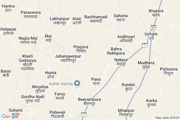
Chak Nihal Map
EDIT Map
Add Your House
 ..
..
Current Corona Virus Infected Patients Count in Bharatpur District
| City Name | District Name | Total Covid cases |
|---|---|---|
| Bharatpur District | Bharatpur | 110 |
Locality Name :
Chak Nihal
( चक निहाल )
Tehsil Name : Nadbai
District : Bharatpur
State : Rajasthan
Division : Bharatpur
Language : Hindi and Rajasthani, Bharatpur
Current Time 07:53 AM
Date: Saturday , May 03,2025 (IST)
Time zone: IST (UTC+5:30)
Elevation / Altitude: 201 meters. Above Seal level
Telephone Code / Std Code: 05643
Assembly constituency : Nadbai assembly constituency
Assembly MLA : Jagat Singh
Lok Sabha constituency : Bharatpur parliamentary constituency
Parliament MP : RANJEETA KOLI
Serpanch Name :
Pin Code : 321302
Post Office Name : Uchain
Main Village Name : Chak Nihal
Commodities Prices : Bayana Market / Mandi
National Highways Reachable To Chak Nihal
Nationa High Way :NH21
Nationa High Way :NH21
Rivers Near Chak Nihal
Gambhir
Mathura Escape
Gambhir
Mathura Escape
About Chak Nihal
Correct below Info and add more info about Chak NihalChak Nihal is a small Village/hamlet in Nadbai Tehsil in Bharatpur District of Rajasthan State, India. It comes under Chak Nihal Panchayath. It belongs to Bharatpur Division . It is located 26 KM towards South from District head quarters Bharatpur. 20 KM from Nadbai. 177 KM from State capital Jaipur
Chak Nihal Pin code is 321302 and postal head office is Uchain .
Nagla Tehriyan Mafi ( 2 KM ) , Jahangeerpur ( 3 KM ) , Kharera ( 4 KM ) , Atari ( 4 KM ) , Bachhamadi ( 5 KM ) are the nearby Villages to Chak Nihal. Chak Nihal is surrounded by Nadbai Tehsil towards North , Bayana Tehsil towards South , Sewar Tehsil towards East , Weir Tehsil towards west .
Nadbai , Bharatpur , Fatehpur Sikri , Mahwa are the near by Cities to Chak Nihal.
This Place is in the border of the Bharatpur District and Alwar District. Alwar District Kathumar is west towards this place .
Chak Nihal 2011 Census Details
Chak Nihal Local Language is Hindi. Chak Nihal Village Total population is and number of houses are . Female Population is -1.0%. Village literacy rate is -1.0% and the Female Literacy rate is -1.0%.
Population
| Census Parameter | Census Data |
| Total Population | |
| Total No of Houses | |
| Female Population % | -1.0 % ( ) |
| Total Literacy rate % | -1.0 % ( ) |
| Female Literacy rate | -1.0 % ( ) |
| Scheduled Tribes Population % | -1.0 % ( ) |
| Scheduled Caste Population % | -1.0 % ( ) |
| Working Population % | -1.0 % |
| Child(0 -6) Population by 2011 | |
| Girl Child(0 -6) Population % by 2011 | -1.0 % ( ) |
Chak Nihal Census More Deatils.
Politics in Chak Nihal
Bharatiya Janata Party , BJP , BSP , INC are the major political parties in this area.Polling Stations /Booths near Chak Nihal
1)Govt Upper Primary School Alipur2)Govt Sec School Pichuna(right Side)
3)Govt Sec School Mudhera
4)Govt Sec School Nagla Bija
5)Govt Upper Primery School Dyopura
HOW TO REACH Chak Nihal
By Rail
Pingora Rail Way Station , Kela Devi Rail Way Station are the very nearby railway stations to Chak Nihal.Colleges near Chak Nihal
Sanskar College Nadbai
Address :
Rd Group Of Management Training Academy
Address : Halena Road Near Sarde Girls Hostel Nadbai Bharatpur Rajasthan
Choudhary Kanya College Hantra
Address : Hantra Nadbai Bharatpur
Sankalp College Kawai (nadbai) Bharatpur
Address : Village+ Post Kawai Tehseel- Nadbai Dist- Bharatpur Pincode No. 321602
Sankalp Classes & College Campus Kawai
Address : Village+ Post Kawai
choudhary
Schools near Chak Nihal
Adarsh Shiv Shicha Samiti Astal
Address : astal , nadwai , bharatpur , Rajasthan . PIN- 321602 , Post - Nadbai Town
Sarasvati Shila Khediyajaga
Address : khedia jaga , nadwai , bharatpur , Rajasthan . PIN- 311602 , Post - Bijolian
Shri Siyaram Ninetan Vailara
Address : khedi devi singh , nadwai , bharatpur , Rajasthan . PIN- 321602 , Post - Nadbai Town
Akhandjyoti Ups Bchamdi
Address : bachhamdi , nadwai , bharatpur , Rajasthan . PIN- 311302 , Post - Badnore
Govt Health Centers near Chak Nihal
1) Nangla Beeja , Nangla Beeja , Nangla Beeja , Nangla Beeja2) Gangarsoli , Gangarsoli , Gangarsoli ,
3) Rahimpur , Rahimpur , Rahimpur ,
Sub Villages in Chak Nihal
Hospitals in Chak Nihal,Nadbai
Primary Health Center; SUB TEHSIL LAKHANPUR; BHARATPUR
Lakhanpur; Rajasthan 321028; India
7.2 KM distance Detail
more ..
Petrol Bunks in Chak Nihal,Nadbai
Ishwar Dhakad Filling Station
Bharatpur; SH-1; Bharatpur Road; Bayana; Bayana; Rajasthan 321401; India
4.9 KM distance Detail
HP PETROL PUMP - RANDHIR FILLING STATION
Vill- Lakhanpur Bansi TO Khedli Ghadasiya Road; Tehsil- Nadbai;; Kota; Rajasthan 321028; India
6.8 KM distance Detail
more ..
Colleges in Chak Nihal,Nadbai
Madho Singh Accommodate
Jheel - Weir Road; Pidawali; Rajasthan 321401; India
10.0 KM distance Detail
more ..
About Chak Nihal &
History
How to reach Chak Nihal
Tourist Places Near By Chak Nihal
Schools in Chak Nihal
Colleges in Chak Nihal
Temperature & weather of Chak Nihal
places in Chak Nihal
Chak Nihal photos
More Information
How to reach Chak Nihal
Tourist Places Near By Chak Nihal
Schools in Chak Nihal
Colleges in Chak Nihal
Temperature & weather of Chak Nihal
places in Chak Nihal
Chak Nihal photos
More Information
Village Talk
Post News or Events about this Village
Near Cities
Nadbai 24 KM near
Bharatpur 24 KM near
Fatehpur Sikri 36 KM near
Mahwa 45 KM near
Nadbai 24 KM near
Bharatpur 24 KM near
Fatehpur Sikri 36 KM near
Mahwa 45 KM near
Near By Taluks
Rupbas 17 KM near
Bayana 19 KM near
Nadbai 20 KM near
Sewar 24 KM near
Rupbas 17 KM near
Bayana 19 KM near
Nadbai 20 KM near
Sewar 24 KM near
Near By Air Ports
Kheria Airport 69 KM near
Gwalior Airport 138 KM near
Sanganeer Airport 173 KM near
Indira Gandhi International Airport 186 KM near
Kheria Airport 69 KM near
Gwalior Airport 138 KM near
Sanganeer Airport 173 KM near
Indira Gandhi International Airport 186 KM near
Near By Tourist Places
Bharatpur 24 KM near
Fatehpur Sikri 35 KM near
Govardhan 55 KM near
Mathura 64 KM near
Vrindavan 74 KM near
Bharatpur 24 KM near
Fatehpur Sikri 35 KM near
Govardhan 55 KM near
Mathura 64 KM near
Vrindavan 74 KM near
Near By Districts
Bharatpur 25 KM near
Mathura 64 KM near
Agra 74 KM near
Dholpur 77 KM near
Bharatpur 25 KM near
Mathura 64 KM near
Agra 74 KM near
Dholpur 77 KM near
Near By RailWay Station
Pingora Rail Way Station 4.3 KM near
Kela Devi Rail Way Station 7.2 KM near
Bayana Junction Rail Way Station 19 KM near
Nadbai Rail Way Station 23 KM near
Pingora Rail Way Station 4.3 KM near
Kela Devi Rail Way Station 7.2 KM near
Bayana Junction Rail Way Station 19 KM near
Nadbai Rail Way Station 23 KM near