| Home | City Bus | Maps | Villages | Cities | Rail | Tourist Places | School | College | Pin Codes | Corona Cases Count |
| Distance Calculator Bus Services IFSC Codes Trace Mobile Number Weather Search Place Trace IP Available Cash ATM/Banks Locate Polling Booth Report an Error contact People |
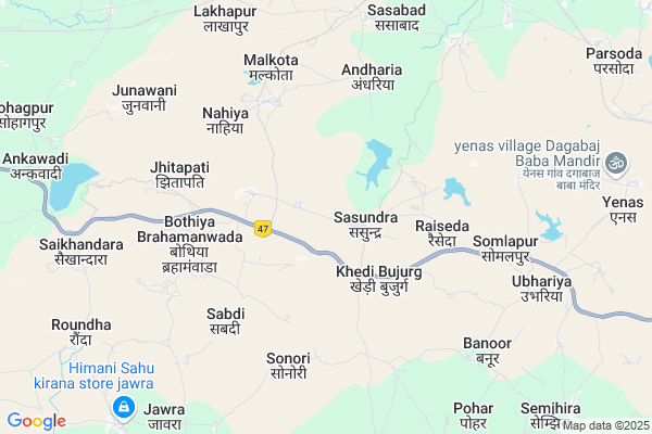
Belmandai
Belmandai Map
EDIT Map
Add Your House
 ..
..
Current Corona Virus Infected Patients Count in Betul District
| City Name | District Name | Total Covid cases |
|---|---|---|
| Betul District | Betul | 1 |
Locality Name :
Belmandai
( बेलमंडै )
Tehsil Name : Amla
District : Betul
State : Madhya Pradesh
Division : Narmadapuram
Language : Hindi
Current Time 10:47 PM
Date: Thursday , May 01,2025 (IST)
Time zone: IST (UTC+5:30)
Elevation / Altitude: 733 meters. Above Seal level
Telephone Code / Std Code: 07147
Assembly constituency : Amla assembly constituency
Assembly MLA : Dr. Yogesh Pandagre
Lok Sabha constituency : Betul parliamentary constituency
Parliament MP : DURGA DAS (D.D.) UIKEY
Serpanch Name :
Pin Code : 460557
Post Office Name : Sainkheda (Betul)
Main Village Name : Belmandai
Commodities Prices : Betul Market / Mandi
National Highways Reachable To Belmandai
Nationa High Way :NH46
Nationa High Way :NH46
Rivers Near Belmandai
Salidhana Nadi
Kanhan
Salidhana Nadi
Kanhan
About Belmandai
Correct below Info and add more info about BelmandaiBelmandai is a small Village/hamlet in Amla Tehsil in Betul District of Madhya Pradesh State, India. It comes under Belmandai Panchayath. It belongs to Narmadapuram Division . It is located 23 KM towards East from District head quarters Betul. 22 KM from Amla. 199 KM from State capital Bhopal
Belmandai Pin code is 460557 and postal head office is Sainkheda (Betul).
Nahiya ( 4 KM ) , Andhariya ( 5 KM ) , Sasabad ( 7 KM ) , Nandapur ( 8 KM ) , Kanhakhapa ( 8 KM ) are the nearby Villages to Belmandai. Belmandai is surrounded by Multai Tehsil towards East , Amla Tehsil towards East , Prabhat Pattan Tehsil towards South , Ghoradongri Tehsil towards North .
Betul , Multai , Sarni , Shendurjana are the near by Cities to Belmandai.
Belmandai 2011 Census Details
Belmandai Local Language is Hindi. Belmandai Village Total population is 615 and number of houses are 127. Female Population is 46.7%. Village literacy rate is 82.0% and the Female Literacy rate is 34.6%.
Population
| Census Parameter | Census Data |
| Total Population | 615 |
| Total No of Houses | 127 |
| Female Population % | 46.7 % ( 287) |
| Total Literacy rate % | 82.0 % ( 504) |
| Female Literacy rate | 34.6 % ( 213) |
| Scheduled Tribes Population % | 0.8 % ( 5) |
| Scheduled Caste Population % | 7.3 % ( 45) |
| Working Population % | 55.4 % |
| Child(0 -6) Population by 2011 | 52 |
| Girl Child(0 -6) Population % by 2011 | 51.9 % ( 27) |
Belmandai Census More Deatils.
Politics in Belmandai
Bharatiya Janata Party , BJP , INC are the major political parties in this area.Polling Stations /Booths near Belmandai
1)Behdi2)Narera
3)Sasabad-3
4)Sasundara-1
5)Adhariyan-1
HOW TO REACH Belmandai
By Rail
Barsali Rail Way Station , Amla Junction Rail Way Station are the very nearby railway stations to Belmandai.Colleges near Belmandai
V V M College Betul
Address :
Jayawanti Haxar Government College
Address :
J H College Betul
Address :
Bhimrao Ramrao Ambedkar College Of Education
Address : Bhimrao Ramrao Ambedkar College Of Educationchakka
The Law College
Address : The Law Collegebehind Police Stationbetulmadhya Pr
Schools in Belmandai
P.s.belmandai
Address : belmandai , amla , betul , Madhya Pradesh . PIN- 460553 , Post - Amla Depot
Govt Health Centers near Belmandai
1) SHC Sasundra , SHC Sasundra , Main Road , high school Near by sasundra2) SHC Nayegaon , SHC Nayegaon , , Opp. Of Arogya Kendra
3) SHC Ambada , SHC Ambada , aganwadi kendra , aww center ambada
Sub Villages in Belmandai
Petrol Bunks in Belmandai,Amla
Indian Oil Petrol Pump
Jhitapati; Betul; NH-69; Multai Road; Betul; Betul; Madhya Pradesh 460004; India
1.5 KM distance Detail
more ..
Colleges in Belmandai,Amla
Late Nand Kishore Smriti College
Aero Drum Bodkhi; Amla; Betul; Madhya Pradesh 460551; India
11.3 KM distance Detail
PT.JAWAHARLAL NEHRU COLLEGE (J.N.M)
DESMUKH COLONY RATEDA ROAD; 07; Gali 1; Amla; Madhya Pradesh 460551; India
11.3 KM distance Detail
Hariom Tour & Travels.
Near Hamlapur Depot; Hamlapur; Betul; Madhya Pradesh 460001; India
21.1 KM distance Detail
more ..
Schools in Belmandai,Amla
govt. higher secondary school andhariya
Andharia; Madhya Pradesh 460551; India
5.4 KM distance Detail
Ravindranath Taigore Higher Secondary School Andhariya
Andharia; Madhya Pradesh 460551; India
5.5 KM distance Detail
Electronic Shops in Belmandai,Amla
Shail Electronics Shop
Main Bus Stand; Sainkheda; Madhya Pradesh 460557; India
9.3 KM distance Detail
Harode Trading Co Sarvice Work Shop
Hasalpur; Mhow; Madhya Pradesh 460551; India
10.1 KM distance Detail
About Belmandai &
History
How to reach Belmandai
Tourist Places Near By Belmandai
Schools in Belmandai
Colleges in Belmandai
Temperature & weather of Belmandai
places in Belmandai
Belmandai photos
More Information
How to reach Belmandai
Tourist Places Near By Belmandai
Schools in Belmandai
Colleges in Belmandai
Temperature & weather of Belmandai
places in Belmandai
Belmandai photos
More Information
Village Talk
Post News or Events about this Village
Near Cities
Betul 22 KM near
Multai 22 KM near
Sarni 26 KM near
Shendurjana 46 KM near
Betul 22 KM near
Multai 22 KM near
Sarni 26 KM near
Shendurjana 46 KM near
Near By Taluks
Betul 20 KM near
Multai 21 KM near
Amla 21 KM near
Prabhat Pattan 29 KM near
Betul 20 KM near
Multai 21 KM near
Amla 21 KM near
Prabhat Pattan 29 KM near
Near By Air Ports
Sonegaon Airport 147 KM near
Bhopal Airport 197 KM near
Jabalpur Airport 235 KM near
Indore Airport 283 KM near
Sonegaon Airport 147 KM near
Bhopal Airport 197 KM near
Jabalpur Airport 235 KM near
Indore Airport 283 KM near
Near By Tourist Places
Pachmarhi 87 KM near
Itarsi 103 KM near
Chikhaldara Wildlife Sanctuary 103 KM near
Amravati 120 KM near
Melghat Tiger Reserve 121 KM near
Pachmarhi 87 KM near
Itarsi 103 KM near
Chikhaldara Wildlife Sanctuary 103 KM near
Amravati 120 KM near
Melghat Tiger Reserve 121 KM near
Near By Districts
Betul 22 KM near
Chhindwara 103 KM near
Hoshangabad 120 KM near
Amravati 121 KM near
Betul 22 KM near
Chhindwara 103 KM near
Hoshangabad 120 KM near
Amravati 121 KM near
Near By RailWay Station
Amla Junction Rail Way Station 9 KM near
Betul Rail Way Station 20 KM near
Amla Junction Rail Way Station 9 KM near
Betul Rail Way Station 20 KM near