| Home | City Bus | Maps | Villages | Cities | Rail | Tourist Places | School | College | Pin Codes | Corona Cases Count |
| Distance Calculator Bus Services IFSC Codes Trace Mobile Number Weather Search Place Trace IP Available Cash ATM/Banks Locate Polling Booth Report an Error contact People |
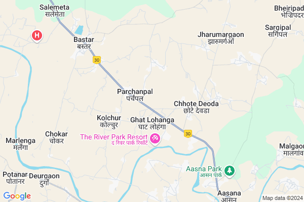
Bhirlinga
Bhirlinga Map
EDIT Map
Add Your House
 ..
..
Current Corona Virus Infected Patients Count in Bastar District
| City Name | District Name | Total Covid cases |
|---|
Locality Name :
Bhirlinga
( बहिर्लिंगा )
Tehsil Name : Bakawand
District : Bastar
State : Chattisgarh
Language : Oriya and Hindi
Current Time 12:23 AM
Date: Saturday , May 03,2025 (IST)
Time zone: IST (UTC+5:30)
Elevation / Altitude: 562 meters. Above Seal level
Telephone Code / Std Code: 07782
Assembly constituency : Bastar assembly constituency
Assembly MLA : Baghel Lakheshwar
Lok Sabha constituency : Bastar parliamentary constituency
Parliament MP : DEEPAK BAIJ
Serpanch Name :
Pin Code : 494221
Post Office Name : Asna
Main Village Name : Bhirlinga
Commodities Prices : Bastar Market / Mandi
Bhirlinga Live Weather
Temperature: 26.1 °C
clear sky
Humidity: 53%
Wind : 3.2 mt/sec towards S
StationName : "Jagdalpur"
observed on Now
Temperature: 26.1 °C
clear sky
Humidity: 53%
Wind : 3.2 mt/sec towards S
StationName : "Jagdalpur"
observed on Now
Bhirlinga Weather Forecast for Next 5 days
03-05-2025
24.8°C to 26.2°C
few clouds
24.8°C to 26.2°C
few clouds
04-05-2025
24.0°C to 35.9°C
clear sky, light rain, scattered clouds
24.0°C to 35.9°C
clear sky, light rain, scattered clouds
05-05-2025
25.3°C to 36.9°C
broken clouds, scattered clouds, few clouds, light rain, overcast clouds
25.3°C to 36.9°C
broken clouds, scattered clouds, few clouds, light rain, overcast clouds
06-05-2025
24.8°C to 38.7°C
broken clouds, clear sky, scattered clouds, overcast clouds, few clouds
24.8°C to 38.7°C
broken clouds, clear sky, scattered clouds, overcast clouds, few clouds
07-05-2025
25.4°C to 38.7°C
scattered clouds, overcast clouds, broken clouds, light rain
25.4°C to 38.7°C
scattered clouds, overcast clouds, broken clouds, light rain
Rivers Near Bhirlinga
Indravati :Indravati River
Turi
Indravati :Indravati River
Turi
About Bhirlinga
Correct below Info and add more info about BhirlingaBhirlinga is a small Village/hamlet in Bakawand Tehsil in Bastar District of Chattisgarh State, India. It comes under Bhirlinga Panchayath. It is located 7 KM towards East from District head quarters Jagdalpur. 16 KM from Bakawand. 274 KM from State capital Raipur
Bhirlinga Pin code is 494221 and postal head office is Asna .
Kudalgaon ( 3 KM ) , Tikralohanga ( 3 KM ) , Bedaumargaon ( 4 KM ) , Kolchur ( 4 KM ) , Cholnar ( 5 KM ) are the nearby Villages to Bhirlinga. Bhirlinga is surrounded by Jagdalpur Tehsil towards South , Bakawand Tehsil towards East , Tokapal Tehsil towards South , Darbha Tehsil towards South .
Jagdalpur , Kondagaon , Umarkote , Nabarangapur are the near by Cities to Bhirlinga.
Bhirlinga 2011 Census Details
Bhirlinga Local Language is Oriya. Bhirlinga Village Total population is 773 and number of houses are 175. Female Population is 50.6%. Village literacy rate is 40.2% and the Female Literacy rate is 15.8%.
Population
| Census Parameter | Census Data |
| Total Population | 773 |
| Total No of Houses | 175 |
| Female Population % | 50.6 % ( 391) |
| Total Literacy rate % | 40.2 % ( 311) |
| Female Literacy rate | 15.8 % ( 122) |
| Scheduled Tribes Population % | 83.1 % ( 642) |
| Scheduled Caste Population % | 0.0 % ( 0) |
| Working Population % | 45.4 % |
| Child(0 -6) Population by 2011 | 150 |
| Girl Child(0 -6) Population % by 2011 | 48.7 % ( 73) |
Bhirlinga Census More Deatils.
Politics in Bhirlinga
Indian National Congress , BJP , INC are the major political parties in this area.Polling Stations /Booths near Bhirlinga
1)Madhauta 22)Bhiranda
3)Junavani
4)Kachnar 1
5)Ghartrai
HOW TO REACH Bhirlinga
By Rail
There is no railway station near to Bhirlinga in less than 10 km.Colleges near Bhirlinga
Govt College Bhanpuri Besoli
Address :
Bastar Medical College Of Alternative Medicines (bmcam)
Address :
Bastar College
Address :
Late Shri Baliram Kashyap Memorial Govt.medical College Jagdalpur
Address : Dimrapal Campus Jagdalpur Pin -494001
Higher Secondary School Gamhari
Address : Gamhari .kondagaon Road
Schools in Bhirlinga
Govt. Primary School
Address : bhirlinga , bakawand , baster , Chattisgarh . PIN- 494221 , Post - Asna
Govt Health Centers near Bhirlinga
1) SHC Kachnar , SUB HEALTH CENTRE Kachnar , VILLAGE Kachnar PANCHAYAT- Kachnar ,2) PHC Kachnar , PHC KACHNAR , VILLAGE KACHNAR ,
3) PHC Kolchur , PRIMARY HEALTH CENTER KOLCHUR , VILLAGE KOLCHUR ,
Sub Villages in Bhirlinga
Petrol Bunks in Bhirlinga,Bakawand
Bharat Petroleum
Aasana; Bastar; NH-43; Jagdalpur; Jagdalpur; Chhattisgarh 494224; India
10.2 KM distance Detail
Tirath Singh Manmohan Singh Petrol Pump
NH43; Aasana; Chhattisgarh 494221; India
10.2 KM distance Detail
Petrol pump
Housing Board Colony; Dharampura-01; Jagdalpur; Chhattisgarh 494001; India
10.7 KM distance Detail
more ..
Colleges in Bhirlinga,Bakawand
Electrical Dept.
GEC Jagdalpur; Darampura; Jagdalpur; Chhattisgarh 494001; India
8.9 KM distance Detail
more ..
Schools in Bhirlinga,Bakawand
Sanskar The Gurukul Residential School
Chidaipadar; Chhattisgarh 494223; India
1.3 KM distance Detail
Dav Mukhyamantri Public School
Karmari; Po Bastar; Dist Bastar; Chhattisgarh; Bastar; Chhattisgarh; India
2.3 KM distance Detail
Prayas Residential School For Meritorious Student; Parchanpal
Mohapalbarai; Chhattisgarh 494223; India
2.3 KM distance Detail
Girls Residential School Parchanpal Bastar
Mohapalbarai; Chhattisgarh 494223; India
2.3 KM distance Detail
Electronic Shops in Bhirlinga,Bakawand
PARITOSH SUTRADHAR REPAIRING CENTER
No. 1; Kalipur Rd; Darampura; Jagdalpur; Chhattisgarh 494001; India
9.7 KM distance Detail
Super Markets in Bhirlinga,Bakawand
Shree Traders
Sanjay Market; Motitalab Para; Jagdalpur; Chhattisgarh 494001; India
11.6 KM distance Detail
Governement Offices near Bhirlinga,Bakawand
Chetana RTE Office
Unnamed Rd;; Darampura; Jagdalpur; Chhattisgarh 494005; India
9.5 KM distance Detail
District Malaria Office; Jagdalpur
Darampura; Jagdalpur; Chhattisgarh 494001; India
9.7 KM distance Detail
About Bhirlinga &
History
How to reach Bhirlinga
Tourist Places Near By Bhirlinga
Schools in Bhirlinga
Colleges in Bhirlinga
Temperature & weather of Bhirlinga
places in Bhirlinga
Bhirlinga photos
More Information
How to reach Bhirlinga
Tourist Places Near By Bhirlinga
Schools in Bhirlinga
Colleges in Bhirlinga
Temperature & weather of Bhirlinga
places in Bhirlinga
Bhirlinga photos
More Information
Village Talk
Post News or Events about this Village
Near Cities
Jagdalpur 12 KM near
Kondagaon 63 KM near
Umarkote 67 KM near
Nabarangapur 67 KM near
Jagdalpur 12 KM near
Kondagaon 63 KM near
Umarkote 67 KM near
Nabarangapur 67 KM near
Near By Taluks
Bastar 14 KM near
Jagdalpur 14 KM near
Bakawand 15 KM near
Tokapal 19 KM near
Bastar 14 KM near
Jagdalpur 14 KM near
Bakawand 15 KM near
Tokapal 19 KM near
Near By Air Ports
Vishakhapatnam Airport 232 KM near
Raipur Airport 252 KM near
Rajahmundry Airport 257 KM near
Vijayawada Airport 357 KM near
Vishakhapatnam Airport 232 KM near
Raipur Airport 252 KM near
Rajahmundry Airport 257 KM near
Vijayawada Airport 357 KM near
Near By Tourist Places
Bastar 9 KM near
Jagdalpur 12 KM near
Jeypore 78 KM near
Dantewada 82 KM near
Araku Valley 147 KM near
Bastar 9 KM near
Jagdalpur 12 KM near
Jeypore 78 KM near
Dantewada 82 KM near
Araku Valley 147 KM near
Near By Districts
Bastar 7 KM near
Nabarangpur 68 KM near
Dantewada 79 KM near
Koraput 97 KM near
Bastar 7 KM near
Nabarangpur 68 KM near
Dantewada 79 KM near
Koraput 97 KM near
Near By RailWay Station
Koraput Junction Rail Way Station 98 KM near
Singapur Road Rail Way Station 167 KM near
Koraput Junction Rail Way Station 98 KM near
Singapur Road Rail Way Station 167 KM near